Author Topic: NSW/QLD Storms 4 - 7 Dec 2009  (Read 16512 times)

0 Members and 1 Guest are viewing this topic.

Offline Michael Bath

  • storm chaser
  • Administrator
  • Wedge tornado F5
  • *
  • Posts: 1,602
  • Gender: Male
    • Australian Severe Weather
Re: NSW/QLD Storms 4 - 6 Dec 2009
« Reply #15 on: 06 December 2009, 03:25:51 PM »
A very enjoyable day at Rodney's place near Casino for the ASWA Christmas BBQ. The day was topped off nicely with some great storm action in the Northern Rivers.

By early to mid afternoon there was enough convection for a few chasers to head out. James Chambers and I headed south along the Summerland Way to Whiporie. During the trip a storm developed to our west. This was to be the main storm of the day which headed NE towards Coraki and Lismore.


Bases were very high but that allowed the CGs to be visible. We moved back north a bit to be in a better position. At Myrtle Creek (about 30ks south of Casino) the storm really gathered strength. From just a rain free base and small rain shaft it quickly evolved into a severe storm with large precip core with damaging winds (about 80-90ks) and small (about 1cm) slushy hail.


We continued north as the storm passed to our NE. At Shannonbrook (10ks S of Casino) we stopped again after 20ks of trees. The structure was impressive though still high based. The updraft area appeared to be on the west and NW flank - a bit weird. This facing southeast.


We kept with the storm driving up to Casino then east along the Coraki Road. The structure had improved again with beautiful anvil structure, rain free base, scuds and hail shafts.   The outflow winds towards the NW were full on - gusting to about 80ks. These pics generally facing E to SE:


We made a dash towards Coraki but found no hail - so it was either small or not much hail fell there. The storm appeared to weaken after this but new updrafts from the outflow meant the cell tracked almost NNE. This was a new downpour that appears to have gone over my place at McLeans Ridges.


More storms were moving into the Casino-Kyogle areas from the west so we headed back to Casino. Quite a lot of CGs were pumping out but the line was probably 2 hours too early - so a bit bright for lightning pics while dodging rain.


Was a great few hours after the earlier activities.

cheers, Michael


EDIT - lovely isolated storm there Shauno
« Last Edit: 06 December 2009, 03:35:12 PM by Michael Bath »
Location: Mcleans Ridges, NSW Northern Rivers
Australian Severe Weather:   http://australiasevereweather.com/
Lightning Photography:   http://www.lightningphotography.com/
Early Warning Network: http://www.ewn.com.au
Contact: Michael Bath

Offline Richary

  • Barrel tornado F4
  • *
  • Posts: 680
  • Gender: Male
Re: NSW/QLD Storms 4 - 6 Dec 2009
« Reply #16 on: 06 December 2009, 05:13:56 PM »
Some beautiful shots there Shaun. Very nice lightning indeed.

I am currently at Woolgoolga and most of the action has missed here so far. We had a very nice storm off Nambucca Heads last night really late that I tried using the remote lightning trigger I just got for. That worked well but unluckily didn't have the infinity focus right on the camera so all a bit blurred. Even from 50km or so away had some nice bolts to look at. Today we had storms pass a bit away from us with some structure but not much visible lightning, until about 7pm where there was quite a nice light show off the coast with some very good bolts - but we were at the pub having dinner with my parents rather than being on the headland with the camera.

Michael - I saw that storm near Coraki on the radar how it suddenly dumped a load (nice big black core) then fell apart in the next image. Had wondered if you would have been on that one, just lucky the BBQ was in the right spot! Nice rain core in the other shot as well.

Offline Clayton

  • Multi-vortex F1
  • *
  • Posts: 48
  • Gender: Male
Re: NSW/QLD Storms 4 - 6 Dec 2009
« Reply #17 on: 06 December 2009, 05:39:17 PM »
Hey

Nice storm Michael wish I was there. I ended up going to my Aunt's place who lives at Tenterfield and as I was driving there I saw your storm pop up and then there was some nice CGs to the south of my aunts so I got my video camera out and recorded them and got the stills.

Hope the storm season gets better soon (its very addictive)


Cya Clayton

Offline Jason(pato)

  • Elephant Trunk F2
  • *
  • Posts: 136
  • Gender: Male
Re: NSW/QLD Storms 4 - 6 Dec 2009
« Reply #18 on: 06 December 2009, 06:00:19 PM »
Great pics guys. I managed to sneak a few pics in before heading to my wifes Xmas party. The missus alerted me to a dark looking sky so I poked my head out the door and was greeted with a rather impressive rain free base. I shot around the corner near the Lismore airport and grabbed a few pics. A nice hailshaft was visible and there was numerous stacatto bolts within the precip core. There was a nice anvil stretching away to the NE. It was all fairly high based but very photogenic all the same! Anyway heres a few shots I'd thought I'd add to compliment the others here.


Cheers Jason
South Lismore, Northern Rivers NSW.....Supercells are us!!

Offline Mike

  • Australian Severe Weather Moderators
  • Wedge tornado F5
  • *
  • Posts: 1,348
  • Gender: Male
  • Dry season here...boring!
    • http://StormscapesDarwin.com
Re: NSW/QLD Storms 4 - 6 Dec 2009
« Reply #19 on: 06 December 2009, 06:12:58 PM »
Fabulous reports by all and the images are just splendid!  Enak, were those strikes all in one exposure?  The last image of those multiple bolts is simply outstanding!  It would be a sin not to have that blown up and framed!

The mammatus is 'bulbous!', Jimmy - beautiful and to Shauno and the other guys a great set of stills and photos also...I read the reports and tidbits with enthusiasm and def read like everyone got something somewhere.  Everytime I jump on the forum - the images/info are just brilliant.
Darwin, Northern Territory.
StormscapesDarwin.com
Lightning Research 2010/14

Offline Mathew Townsend

  • Elephant Trunk F2
  • *
  • Posts: 151
  • Gender: Male
  • Watching storms since 1998
Re: NSW/QLD Storms 4 - 6 Dec 2009
« Reply #20 on: 07 December 2009, 04:31:45 AM »
Hey guys here report from Ballina yesterday. One nasty storm cell with v hook echo was heading towards us but it shifted again to Lismore/Alstonville area. However we did get some nice photo views at the end!


I will be at Lismore this afternoon until Tuesday so i will able to see more stormies!

Offline Shaun Galman

  • Stove pipe F3
  • *
  • Posts: 441
  • Gender: Male
    • ridgelightning.com
Re: NSW/QLD Storms 4 - 6 Dec 2009
« Reply #21 on: 07 December 2009, 07:03:15 AM »
Hi guys,

Thanks so much for all the kind comments on the pics!  ;D

MB and Pato: Boy that is one serious RFB on that storm! It's a shame to see them form a little early on? It would have been nice to get a 1 or 2 second exposure to pick up a few CG on that MB! I understand your woes. Happens to us most times out here.

Gotta be pretty happy with that structure though!

Kindest regards,
Shauno  
Chasing Region: Lightning Ridge. N.S.W.
Website: www.ridgelightning.com

Offline Colin Maitland

  • Barrel tornado F4
  • *
  • Posts: 614
  • Gender: Male
Re: NSW/QLD Storms 4 - 6 Dec 2009
« Reply #22 on: 07 December 2009, 11:58:59 AM »
The cell west of Kilcoy is heading Northeast towards Maleny and Sunshine coast. I can see some cloud build up to the North of here.

Bom have issued a warning for the storm

For people in parts of the MORETON BAY, SUNSHINE COAST, SOMERSET, SOUTH BURNETT and TOOWOOMBA Council Areas.

Issued at 4:21 pm Sunday, 6 December 2009.

The Bureau of Meteorology warns that, at 4:25 pm, severe thunderstorms were detected on weather radar near Moore and Linville. These thunderstorms are moving towards the east. They are forecast to affect Mount Kilcoy by 4:55 pm and the area north of Woodford and the ranges south of Jimna by 5:25 pm.

Damaging winds, very heavy rainfall, flash flooding and large hailstones are likely.


Offline Paul D

  • Multi-vortex F1
  • *
  • Posts: 90
  • Gender: Male
Re: NSW/QLD Storms 4 - 6 Dec 2009
« Reply #23 on: 07 December 2009, 07:08:12 PM »
Kilcoy to Jimna had a couple of storms move through Sunday afternoon -6th Dec, they were both high based and well on they way into decay by the time they got nearer the coast.

Remains of 1st storm app 6pm

2nd line of storms building in distance behind rain curtain of 1st storm 6-30pm

2nd line of storms from app Yarraman to Kilcoy 7pm

Cheers,
Paul
« Last Edit: 08 December 2009, 04:57:20 AM by Paul D »

Offline Jimmy Deguara

  • Australian and Tornado Alley storm chaser
  • Administrator
  • Wedge tornado F5
  • *
  • Posts: 2,218
  • Gender: Male
  • Storm Chaser since 1993, Tornado Alley 2001
    • Australia Severe Weather
Re: NSW/QLD Storms 4 - 6 Dec 2009
« Reply #24 on: 08 December 2009, 04:12:12 AM »
Storm Chase Northern Rivers December 5th 2009

Hi,

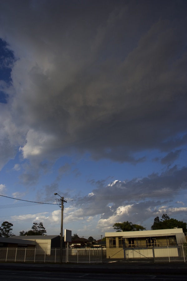
Taree during the morning
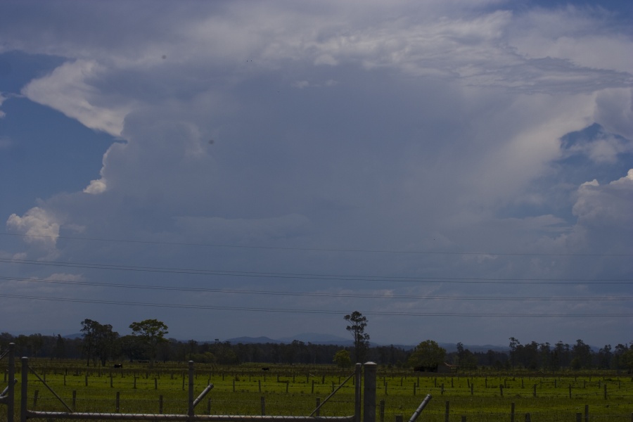
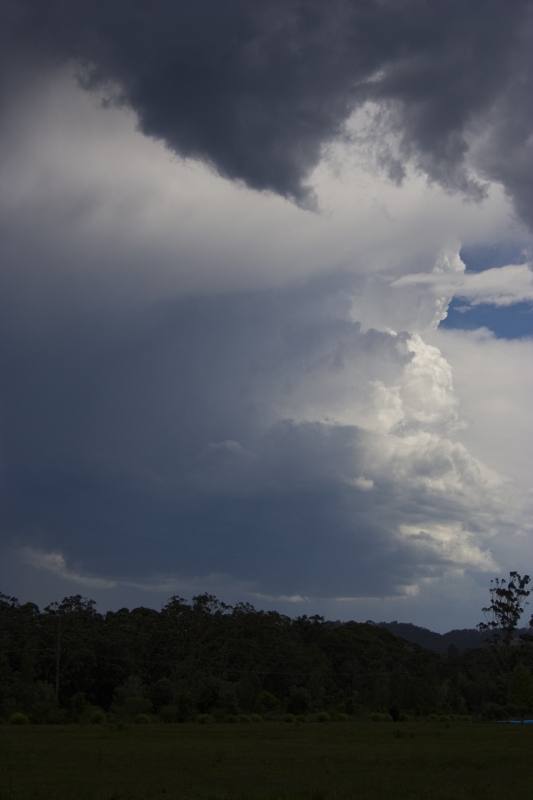

Kempsey

After an overnight stay in Taree, this was obviously going to be another high base ordeal. After a brief stop near Kempsey, we headed up to play storms near Coffs Harbour.

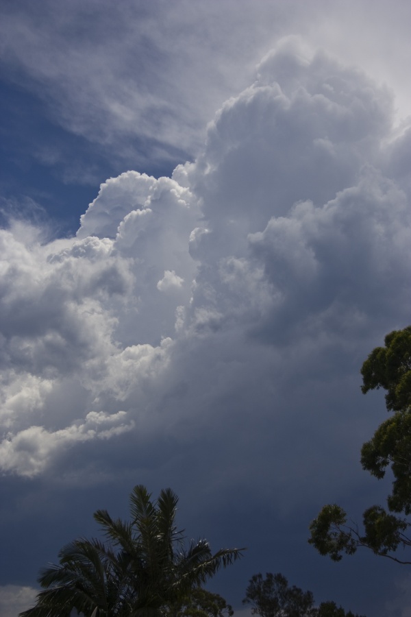
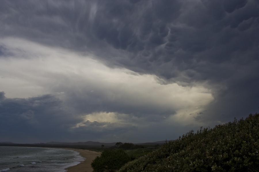
The cell developing near Coffs Harbour had briefly tapped some of the moist boundary layer but eventually collapsed. Updrafts were quite strong due to the steep mid-level lapse rates but could not be maintained due to the dry air entrainment at base level. A storm developed near Urunga though seemed to quickly disspipate so we made our way north in pursuit of the cell in the western North Rivers (Michael Bath and co were onto).

Urunga cell


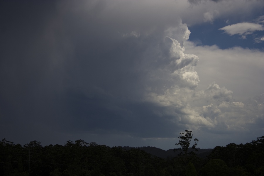
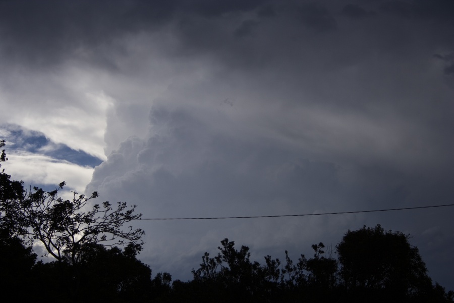
A couple of glimpses of the rear vision mirror indicated I had to at least stop and check a developing base behind me. Low and behold, an interesting base and associated updraftgot some excitement. The storm seemed to want to rotate so timelapse was organised.

Possible rotating cell
14km North of Coffs Harbour


14km North of Coffs Harbour


However, after about 5 to 10 minutes the base began to fall apart due to the dry entrainment. Another storm was developing to the west so we headed for Corindi Beach.


Even within 5 minutes a storm would go through rapid decline! The storm near Coffs Harbour was off the coast and you could still make out the reasonable updraft.

This storm near Coffs Harbour had an interesting base with with organised scud earlier - again rapid decline


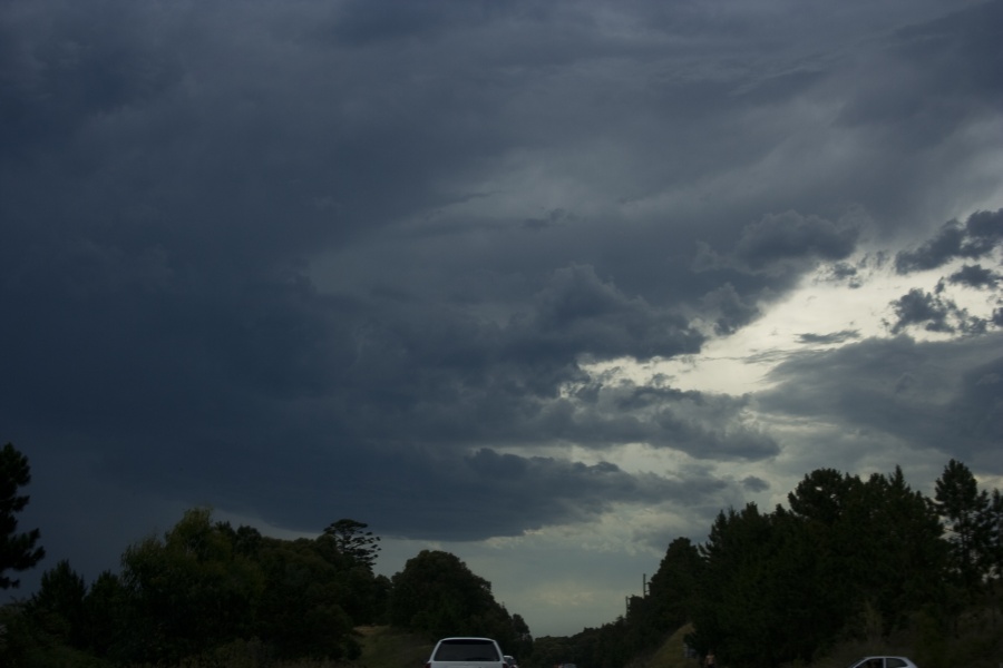
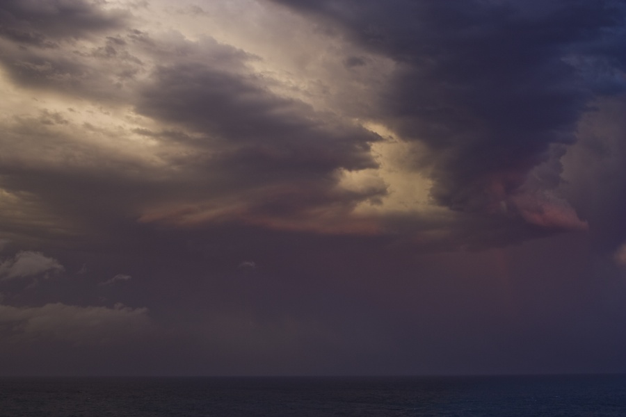
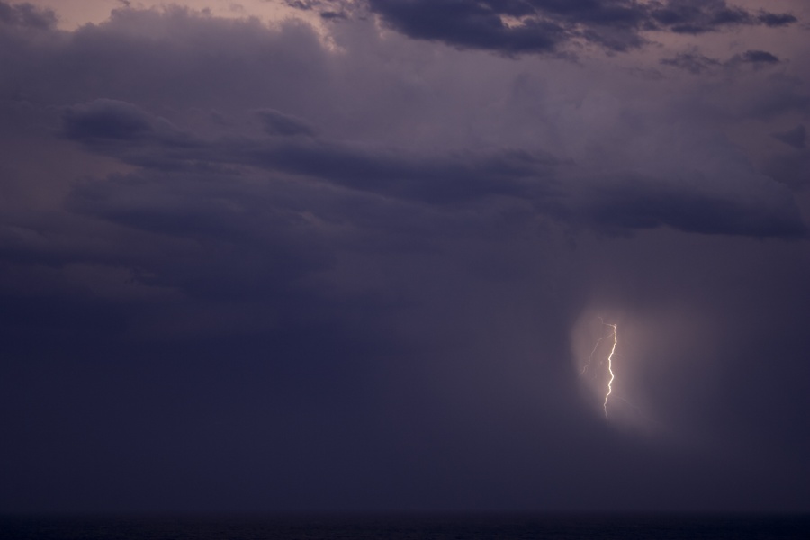
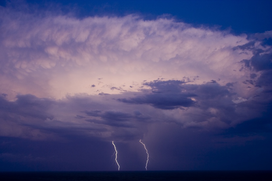
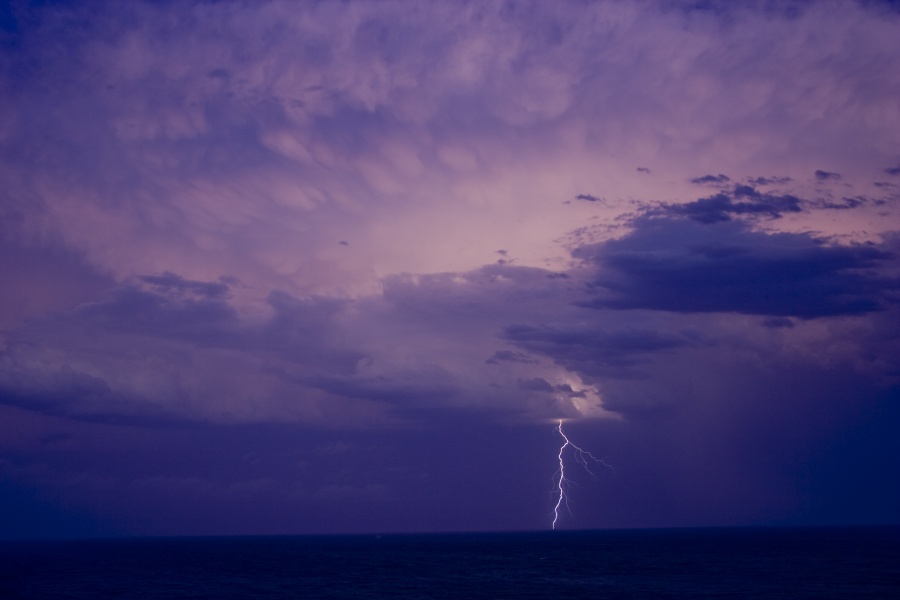
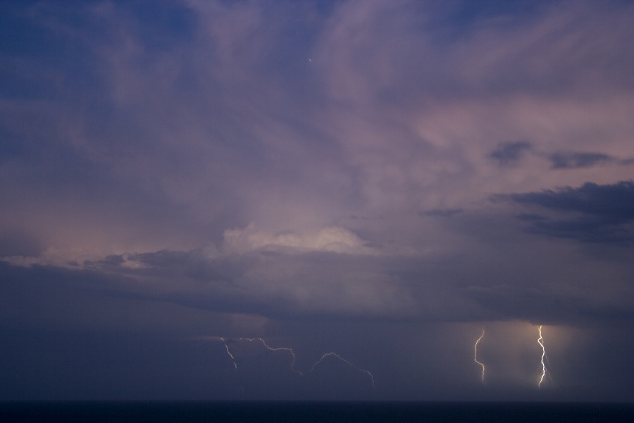
Another storm had organised in the Coffs Harbour region so we made our way south and eventually these storms weakened. Some nice staccato lightning was observed.


Another cell and associated strong upraft was intercepted 14km north of Coffs Harbour but this went into rapid decline. Another cell behind it also began to weaken. This was back in the same location where the rotating cell was timelapsed.

A strange humourous situation occurred here that I had never witnessed. We were tracking a lone kangaroo we saw opn the way and photgraphed before it entered a grassy field. Whilst photographing the weakening cell a massive bolt hit the grassy field. To our amazement, there was a scattering of movement which I thought was small herd animals. It was a herd of a hundred or so kangaroos! We could not believe it! Yes 5pm feeding time - but we had never anticipated a scene like this so close to the coast! Prior tot he bolt, we had not noticed them feeding.

FInally, we decided to head to the Woolgoolga area for a feed. We ended up booking a cabin and also grabbing some fish and chips and headed for the headland. We enjoyed the frequent lightning display (in low contrast) with a couple of cells that intensified once off the coast. Some video and photographs were obtained of this activity though nothing too spectacular. I missed some decent staccato bolts but it seemed the timing was not the best.


Regards,

Jimmy Deguara
« Last Edit: 08 December 2009, 10:29:04 AM by Jimmy Deguara »
-------------------------------------
Australian Severe Weather
www.australiasevereweather.com

Australian Thunderbolt Tours
www.thunderbolttours.com

Phone  0408 020468  (International :  61  2  408 020468)

Offline Jimmy Deguara

  • Australian and Tornado Alley storm chaser
  • Administrator
  • Wedge tornado F5
  • *
  • Posts: 2,218
  • Gender: Male
  • Storm Chaser since 1993, Tornado Alley 2001
    • Australia Severe Weather
Re: NSW/QLD Storms 4 - 6 Dec 2009
« Reply #25 on: 08 December 2009, 04:15:39 AM »
Storm Chase Northern Rivers December 6th 2009

Time allocated: 11am to 5pm

Storms intercepted: One lousy cell over the ranges

Model accuracy: pathetic!

New hobby: Pretend storm chasing!

Nana Glen - rapidly developing updraft


NW of Glenreagh - storm clearly weakening and not daring to come off the ranges - time to head home! Pretend chase over.


Regards,

Jimmy Deguara
« Last Edit: 08 December 2009, 05:01:02 AM by Jimmy Deguara »
-------------------------------------
Australian Severe Weather
www.australiasevereweather.com

Australian Thunderbolt Tours
www.thunderbolttours.com

Phone  0408 020468  (International :  61  2  408 020468)

Offline Mathew Townsend

  • Elephant Trunk F2
  • *
  • Posts: 151
  • Gender: Male
  • Watching storms since 1998
Re: NSW/QLD Storms 4 - 6 Dec 2009
« Reply #26 on: 08 December 2009, 04:37:56 AM »
What with the models yesterday!? I waited and waited then it went so wrong. Could be on again today? Forecasts have copied and pasted from yesterday.

Observations are different today than yesterday whereas its more hotter and humid with more northerly winds. Convective outlook going for severe storms today as it explained yesterday. We are being fooled again?

Offline Michael Bath

  • storm chaser
  • Administrator
  • Wedge tornado F5
  • *
  • Posts: 1,602
  • Gender: Male
    • Australian Severe Weather
Re: NSW/QLD Storms 4 - 6 Dec 2009
« Reply #27 on: 08 December 2009, 06:02:32 AM »
Yeah the models stuffed up yesterday. There was a weak low off the North Coast at the SE end of a trough that appears to have mucked things up - bringing the very dry air into the Northern Tablelands and preventing much happening where it should of.

Two cells rapidly formed in the far NW of the Northern Rivers late afternoon but they didn't last.


A few more here: http://australiasevereweather.com/photography/photos/2009/mb20091206.html

Storm activity developed NW of Brisbane that persisted into the evening.

MB
Location: Mcleans Ridges, NSW Northern Rivers
Australian Severe Weather:   http://australiasevereweather.com/
Lightning Photography:   http://www.lightningphotography.com/
Early Warning Network: http://www.ewn.com.au
Contact: Michael Bath

Offline Antonio (stormboy)

  • Stove pipe F3
  • *
  • Posts: 481
  • Gender: Male
Re: NSW/QLD Storms 4 - 6 Dec 2009
« Reply #28 on: 08 December 2009, 11:47:13 AM »
Well yesterday was a complete disappointment as I observed the cells structure in the northwest but it all feathered out within 20 minutes or so. Today there may be some thunderstorms in the western areas near Armidale but that’s all. Going to Sydney on Wednesday and Thursday forecasts a late storm possible so hope to get some chasing down south.

Antonio.

Offline enak_12

  • Elephant Trunk F2
  • *
  • Posts: 153
  • Gender: Male
Re: NSW/QLD Storms 4 - 6 Dec 2009
« Reply #29 on: 08 December 2009, 12:22:59 PM »
December 5 2009

Hey nice to see you chasing in my backyard Jimmy, to bad about the dry air it was so close to being a great day for chasing. I also noted the cells would look nice for a few miniutes but couldnt keep the moisture flowing in despite having breif RFB's. I was out doing a photoshoot with a model that had already be3en organised, but kept an eye on development and took some photos while I was there. I deliberately made it a beach shoot so I could do this haha.


I spoted this strong storm to north of Coffs probably the one you were on Jimmy that may have had some rotation.


This cell was on the south side of coffs harbour, it looked briefly interesting with a strong updraft, rfb and a small inflow band to the left of the pic out of shot. It onbly maintained this appaerance breifly however, maybe 10 mins then the dry air  came in.


10 miniutes later it was reduced to this.


I moved to a lookout later in the afternoon hoping for another dry light show looking over the city but I couldn't catch them in burst mode. The cells were to far away by night fall.


Jimmy seems you found the massive plague of Kangaroos who live north of coffs, bet it was near a big new housing estate.
« Last Edit: 08 December 2009, 12:31:01 PM by enak_12 »