Author Topic: Storms: Central Eastern NSW 20 - 22 March 2007  (Read 6729 times)

0 Members and 2 Guests are viewing this topic.

Offline Jimmy Deguara

  • Australian and Tornado Alley storm chaser
  • Administrator
  • Wedge tornado F5
  • *
  • Posts: 2,218
  • Gender: Male
  • Storm Chaser since 1993, Tornado Alley 2001
    • Australia Severe Weather
Storms: Central Eastern NSW 20 - 22 March 2007
« on: 21 March 2007, 04:58:17 PM »
Hi,

Apparently some interesting storms developed and moved through the northern suburbs and also Central Coast to Newcastle areas this evening. Very heavy rainfall was the main threat although hail was also reported in various suburbs.

I was at a meeting when these storms became quite activeand severe.

Here are a couple of the back end lightning pictures:


Rune Petersein posing for a lightning picture!


 All pics here:
http://australiansevereweather.com.au/photography/photos/2007/jd20070320.html

Some recent pics from other days:

http://australiansevereweather.com.au/photography/photos/2007/jd20070317.html

Sunrise lovers


Regards,

Jimmy Deguara
-------------------------------------
Australian Severe Weather
www.australiasevereweather.com

Australian Thunderbolt Tours
www.thunderbolttours.com

Phone  0408 020468  (International :  61  2  408 020468)

Offline Michael Bath

  • storm chaser
  • Administrator
  • Wedge tornado F5
  • *
  • Posts: 1,602
  • Gender: Male
    • Australian Severe Weather
Re: Storms: Central Eastern NSW 20 - 22 March 2007
« Reply #1 on: 22 March 2007, 08:26:06 AM »
Radar / lightning tracker chasing at present shows some interesting cells west of Singleton and near Murrurundi.


Severe thunderstorm warning has been issued:

For people in the
  Hunter and parts of the
  Northwest Slopes,
  Northern Tablelands,
  Mid North Coast and
  Central Tablelands Forecast Districts.

  Issued at 2:02 PM Wednesday, 21 March 2007.

  Severe thunderstorms are likely to produce large hailstones, damaging winds, very heavy rainfall and flash flooding in the warning area over the next several hours.

  Major locations within the warning area include Scone, Cessnock, Mudgee, Tamworth and Gunnedah.


Location: Mcleans Ridges, NSW Northern Rivers
Australian Severe Weather:   http://australiasevereweather.com/
Lightning Photography:   http://www.lightningphotography.com/
Early Warning Network: http://www.ewn.com.au
Contact: Michael Bath

Offline Michael Bath

  • storm chaser
  • Administrator
  • Wedge tornado F5
  • *
  • Posts: 1,602
  • Gender: Male
    • Australian Severe Weather
Re: Storms: Central Eastern NSW 20 - 22 March 2007
« Reply #2 on: 23 March 2007, 08:50:22 AM »
Another day of storms for central east NSW though shear is pretty terrible today.  The latest severe weather warning is a reflection of that

For people in the
  Central West Slopes and
  Central Tablelands Forecast Districts.

  Issued at 2:16 PM Thursday, 22 March 2007.

  Severe thunderstorms are likely to produce very heavy rainfall and flash flooding in the warning area over the next several hours.

  Major locations within the warning area include Dubbo, Parkes, Orange, Mudgee, Bathurst and Katoomba.
Location: Mcleans Ridges, NSW Northern Rivers
Australian Severe Weather:   http://australiasevereweather.com/
Lightning Photography:   http://www.lightningphotography.com/
Early Warning Network: http://www.ewn.com.au
Contact: Michael Bath

Offline Dave Nelson

  • Elephant Trunk F2
  • *
  • Posts: 172
  • Gender: Male
    • Stormy Sydney
Re: Storms: Central Eastern NSW 20 - 22 March 2007
« Reply #3 on: 23 March 2007, 03:36:29 PM »
Hi gang,
 
    been that busy with work and stuff, I havent had a chance to post before now.
 
  2 chases to report over the last couple of days.

  1) ... Tues. 20th ... could see the towers building up in the west during the mid afternoon
  my last job took me to Blacktown. Where once finished I headed up onto the roof level
  carpark of the westfield s/c (western end)  a fav spot for that part of the city.
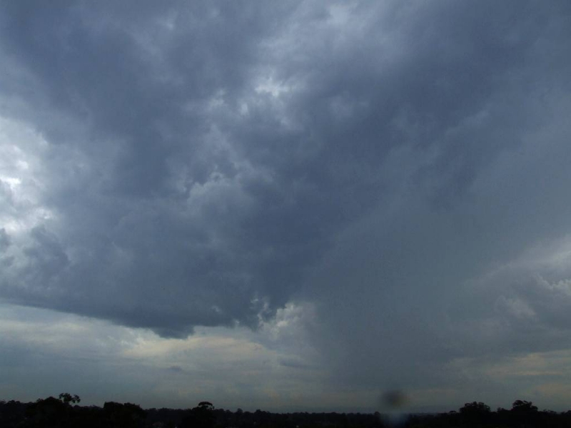
  Watched one cell coming off the mountains and another one forming between Blacktown
  and Penrith area.

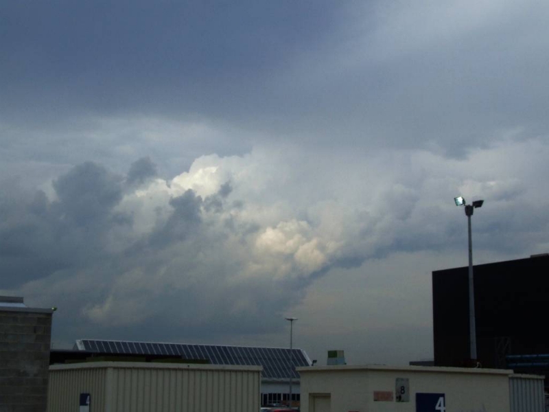
the closer cell  ( the one on the left) really tried to get organised and the base even started
to look good at times, but it failed to get its act together.  The right hand one was still producing
lightning as it came off the mountains


another cell was forming to the nth of Blacktown. and I decided to head in that direction.


heading up Old Windsor Rd, it was getting black and mean looking....


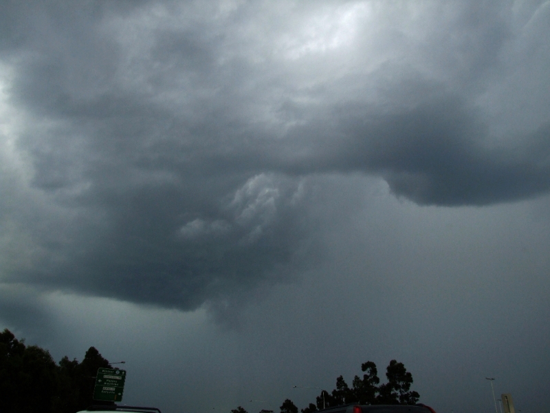
and right onto Burns Rd, I found a good open field with a clear view.
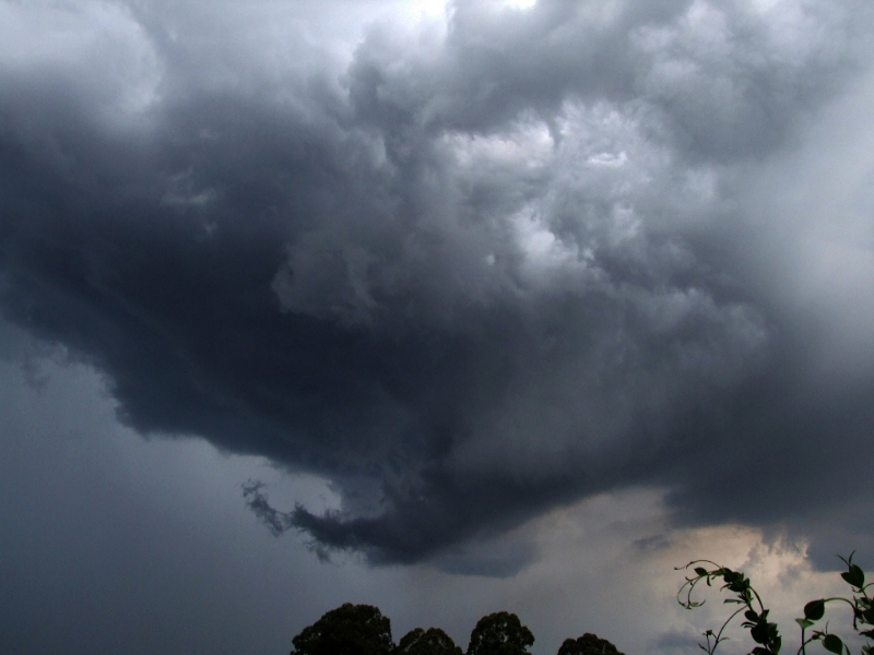
this thing was forming right over head and it was amazing to watch.


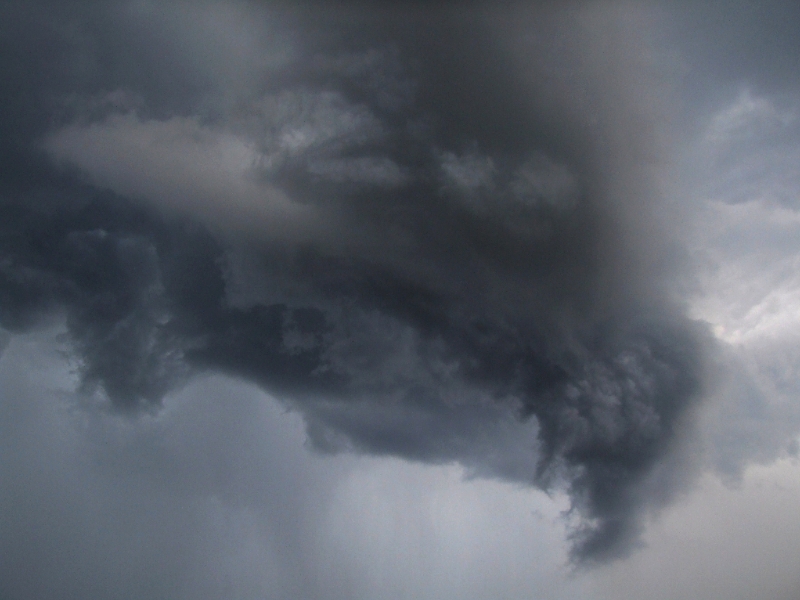
that leading edge just dipped down and curled right around and back up into the base of
the cell.


following in the heels of this cell was another one .... also reasonably lightning active.


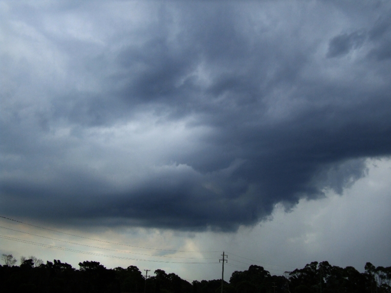
I watched and photo'ed these cells for a while before heading home.
they were very active with intra-cloud lightning and only occassional CG's

An hour after getting home (~ 7:30pm) Cindy and I headed up towards Pennant Hills to
 intercept another cell coming in from the west. We ended up in the Cherrybrook area and
watched a good display of cloud crawlers.

 all in all a good day.

Dave N
« Last Edit: 23 March 2007, 03:56:06 PM by Dave Nelson »

Offline Dave Nelson

  • Elephant Trunk F2
  • *
  • Posts: 172
  • Gender: Male
    • Stormy Sydney
Re: Storms: Central Eastern NSW 20 - 22 March 2007
« Reply #4 on: 23 March 2007, 05:20:31 PM »
reports continued....

 chase 2)
   Was today, Thurs, 22nd.  Again my last jobs for the day were out west (Mt Druitt)  and I could see
 the towers going up, some were starting to anvil. But over time, some of the anvils became detached as the
inflow dried up. I headed up the hill and past Katoomba.


First stop was Mt Piddington, just before Mt Victoria, it gives a wonderful 180 deg view out towards the west.
Today the sun was right beside the cell and it made photography rather difficult. some CG's and many rumbles
seen and heard


after 30 mins there watching and taking pix, I continued on towards Lithgow ... Stopping on the flat area
just before the dip down to the speed camera.
From here the sun was behind the clouds and I could get better contrast.

and


the cell was producing some reasonable CG's.  I didnt have the time to go all the way to Lithgow
as I had to get back to the city so left the area ~ 6pm.

Not a stunning day .... but definately NOT a bust  :)   some nice cells and a few zaps to see

cheers
Dave N


Offline Brad Hannon

  • Thunderbolt Tours Group
  • Stove pipe F3
  • ******
  • Posts: 427
  • Gender: Male
  • Colorado Beast - 2nd June 2005
Re: Storms: Central Eastern NSW 20 - 22 March 2007
« Reply #5 on: 23 March 2007, 05:30:25 PM »
Hi David, good to see some more action up there.  Pity I didn't time my trip up North that well :(.  I particularly like the curling leading edge in your pics.  You were certainly in great position to capture those shots.  Did you get any decent hail from that cell?
hmmm June 2nd......

Offline Dave Nelson

  • Elephant Trunk F2
  • *
  • Posts: 172
  • Gender: Male
    • Stormy Sydney
Re: Storms: Central Eastern NSW 20 - 22 March 2007
« Reply #6 on: 24 March 2007, 04:59:04 PM »
Hi Brad

the storms of the 20th ...  where I was, no just rain,   the ones of the 22nd I was too far away from (~10km )
I could see the rain bands, couldnt tell if there was hail involved.

cheers
Dave N

Offline Jimmy Deguara

  • Australian and Tornado Alley storm chaser
  • Administrator
  • Wedge tornado F5
  • *
  • Posts: 2,218
  • Gender: Male
  • Storm Chaser since 1993, Tornado Alley 2001
    • Australia Severe Weather
Re: Storms: Central Eastern NSW 20 - 22 March 2007
« Reply #7 on: 25 March 2007, 02:18:08 AM »
I just heard from a school teacher that on the 20th, very heavy rain and hail fell near Grenfell/Cowra region. I would not be surprised that hail fell in higher elevations but you have to be in the area at the time. I suspect that hail was small.

Regards,

Jimmy Deguara
-------------------------------------
Australian Severe Weather
www.australiasevereweather.com

Australian Thunderbolt Tours
www.thunderbolttours.com

Phone  0408 020468  (International :  61  2  408 020468)