Author Topic: NE NSW / SE QLD Severe Storms : 17 April 2009  (Read 10068 times)

0 Members and 1 Guest are viewing this topic.

Offline Michael Bath

  • storm chaser
  • Administrator
  • Wedge tornado F5
  • *
  • Posts: 1,602
  • Gender: Male
    • Australian Severe Weather
NE NSW / SE QLD Severe Storms : 17 April 2009
« on: 19 April 2009, 04:30:36 AM »
Scattered weak thunderstorms developed on the Northern Tablelands from early afternoon on 17th April in response to a quite marked upper trough system.

Some of the cells spread into the Northern Rivers but only the western parts. Storms were low topped and remained fairly weak. As the activity spread over the border one cell did manage to become severe through the southwest suburbs of Brisbane and a warning was issued.


All this initial activity pretty much died off by sunset - apart from SW of Grafton.

On dusk significant storms developed along the Clarence Coast and up to about Evans Head. They encroached onto land in a general N-NNW steering flow. Warnings were issued for flash flooding and damaging winds after reports of around 40mm and some gusty winds at Yamba and Evans Head.

This very-much coastal activity managed to spread inland to the Alstonville and Lismore areas. The first cell began to pass over my place from 8.30pm. A number of extremely close staccatos hit nearby. This was surprising as lightning was fairly unimpressive otherwise. The brightness of these compared to other lightning made it impossible to capture on the camera.

7mm of rain fell in quick time before the activity moved to the Tweed Coast. There was a report of hail at Pottsville but no mention of size.

A couple of pics:


All photos for 17 April 2009


See : 128km Radar Loop for Grafton, 02:00 17/04/2009 to 14:00 17/04/2009 UTC


See : 128km Radar Loop for Brisbane, 07:00 17/04/2009 to 14:00 17/04/2009 UTC

Location: Mcleans Ridges, NSW Northern Rivers
Australian Severe Weather:   http://australiasevereweather.com/
Lightning Photography:   http://www.lightningphotography.com/
Early Warning Network: http://www.ewn.com.au
Contact: Michael Bath

Offline Jason(pato)

  • Elephant Trunk F2
  • *
  • Posts: 136
  • Gender: Male
Re: NE NSW / SE QLD Severe Storms : 17 April 2009
« Reply #1 on: 19 April 2009, 12:53:38 PM »
Gday All,

With some activity firing in the region I decided to head out for a look.

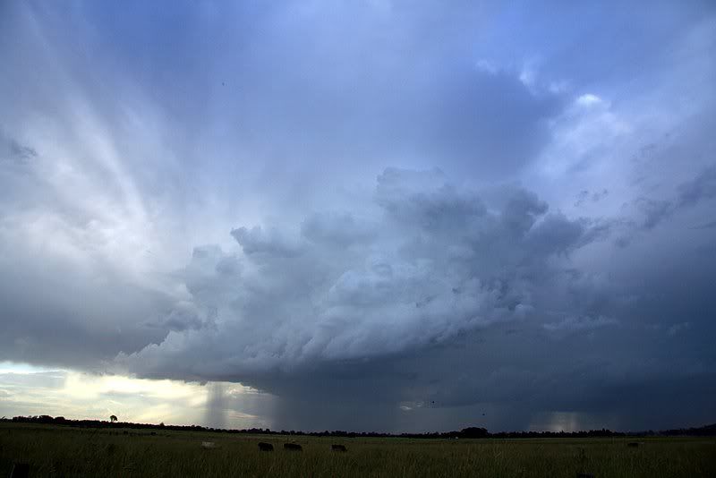
Late arvo cell from McKees Hill.


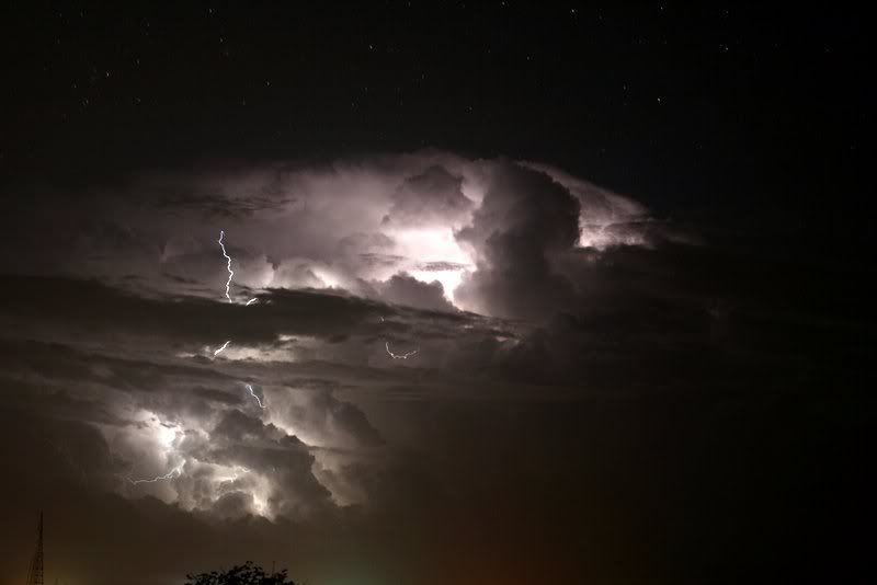
After noticing a cell near Evans Head on the radar, I ventured round the corner from home at the end of the airport runway to try and capture some CA's. Most were obscured by cloud but managed to bag a couple.


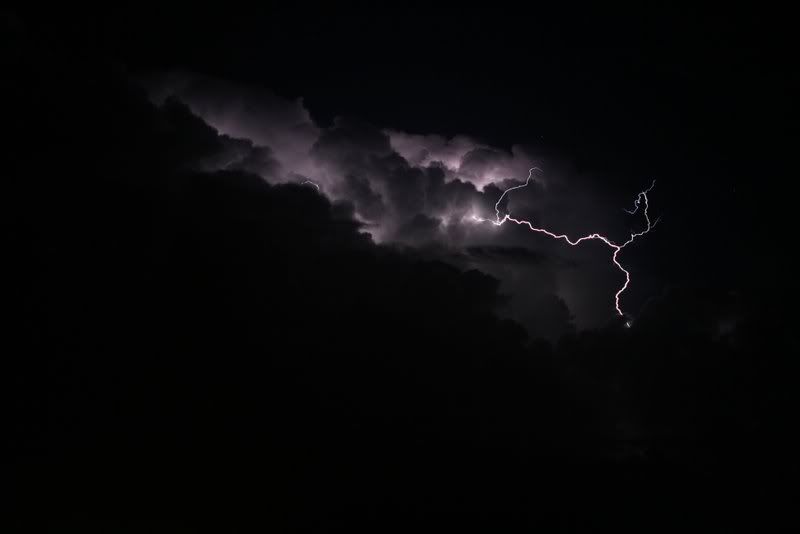
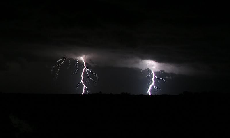
Decided to move closer to the action to a location just off the Bruxner Hwy (near Tatham) and was rewarded with a few nice stacatto's.
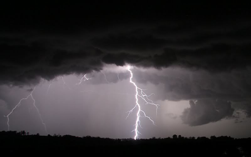


.

I left shortly after this last shot and tryed my luck back in Lismore, but everything was mostly incloud with any CGs blowing out the photo due to rain falling. Headed home to check the radar and noticed some activity coming up from the south so I thought I'd try my luck closer to the coast at Ballina. But after waiting for around 45mins it was apparent that most of it was going to stay offshore so I headed home. I figured it wasn't worth filling my memory card full of 2 pixel big CGs.
Anyway was good to get out and about again and be treated to a late season lightning show.

Hope you enjoy,

Cheers Jason
South Lismore, Northern Rivers NSW.....Supercells are us!!

Offline Chris.

  • Multi-vortex F1
  • *
  • Posts: 52
  • Gender: Male
Re: NE NSW / SE QLD Severe Storms : 17 April 2009
« Reply #2 on: 20 April 2009, 04:28:14 AM »
Warwick Qld 17th April.


Hi Every one. A few small isolated cells for us here in Warwick on the 17th. Friends managed some images of the light show in Brisbane and also a cell that had formed near Byron Bay moving North to Point Lookout A friend photographed it out to sea from the Gold Coast. Very impressive light show.

Here are a couple over the Sunflower fields from the 17th Here in Warwick.

Regards,
Chris.


Offline Shaun Galman

  • Stove pipe F3
  • *
  • Posts: 441
  • Gender: Male
    • ridgelightning.com
Re: NE NSW / SE QLD Severe Storms : 17 April 2009
« Reply #3 on: 20 April 2009, 07:02:53 AM »
Hi guys,
Great to see a final flurry of action, however weak it maybe :)

Great storms MB and Jason(Pato)! Nice to see some decent lightning as it's been a while!

Nothing to report out here? Weathers mostly fine due to the large high pressure system. It's good to have temps BELOW the 30's for a change lol.

Chris: Stunning landscapes you managed there! Been some time since I've seen a decent crop of sunflowers in a photo (other than the chasers in the USA) Well done!

Take care,
Shauno.
« Last Edit: 20 April 2009, 01:16:03 PM by Jimmy Deguara »
Chasing Region: Lightning Ridge. N.S.W.
Website: www.ridgelightning.com

Offline Colin Maitland

  • Barrel tornado F4
  • *
  • Posts: 614
  • Gender: Male
Re: NE NSW / SE QLD Severe Storms : 17 April 2009
« Reply #4 on: 20 April 2009, 12:04:33 PM »
The warning for the severe storm in Brisbane didn't eventuate into much hence the cancellation was issued shortly there after. It moved out to sea rather quickly and what had the potential to be a spectacular light show fizzled. I was looking forward to the opportunity to learn/ practice capturing lightning shots with my new camera, but to no avail. It looks like I will have to wait till next season unless there is some further storm activity.

At least I managed two and can see there is massive room for improvement.