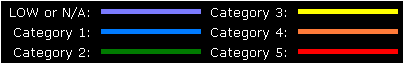
 Markers:
Show
Hide
Markers:
Show
Hide
Mouse-over the markers to view the TC name, click the marker to load the individual map.
| Tropical Cyclones
[Index] | South Pacific Ocean Tropical Cyclone Season 1981-1982 | ||
| Season 1981-1982 Summaries: [BoM-AU] [JTWC-AU] [JTWC-SIO] [JTWC-SPAC] [JTWC-SH] | |||
|
Mouse-over the markers to view the TC name, click the marker to load the individual map.
Markers:
Show
Hide
|
Joint Typhoon Warning Centre (JTWC) Tropical Cyclone Data
South Pacific Ocean: All or some of the track must occur east of 135 E to be included. |
| Cyclone Name | Map ID |
Cyclone Number |
Basin | Date Range (UTC) | Min CP |
Max Winds |
Tracking Map and data |
|---|---|---|---|---|---|---|---|
| GYAN | 1 | 1078 / 8206 | SPAC | 19 Dec 1981 - 27 Dec 1981 | Tropical Cyclone GYAN | ||
| ABIGAIL | 2 | 1086 / 8214 | SPAC | 25 Jan 1982 - 06 Feb 1982 | 65 | Tropical Cyclone ABIGAIL | |
| HETTIE | 3 | 1087 / 8215 | SPAC | 25 Jan 1982 - 01 Feb 1982 | 70 | Tropical Cyclone HETTIE | |
| CORAL | 4 | 1090 / 8218 | SPAC | 05 Feb 1982 - 05 Feb 1982 | Tropical Cyclone CORAL | ||
| ISAAC | 5 | 1094 / 8222 | SPAC | 28 Feb 1982 - 03 Mar 1982 | Tropical Cyclone ISAAC | ||
| BERNIE | 6 | 1097 / 8225 | SPAC | 31 Mar 1982 - 09 Apr 1982 | 95 | Tropical Cyclone BERNIE | |
| DOMINIC | 7 | 1098 / 8226 | SPAC | 04 Apr 1982 - 13 Apr 1982 | 70 | Tropical Cyclone DOMINIC | |
| CLAUDIA | 8 | 1100 / 8228 | SPAC | 11 May 1982 - 18 May 1982 | 40 | Tropical Cyclone CLAUDIA |
Minimum central pressure (CP) in hPa. Maximum winds are 1-min average in knots.
Tropical cyclone tracks developed by Michael Bath using data from the Joint Typhoon Warning Centre Best Tracks and Google Maps.
|
Document: jtwc_1981_1982_south_pacific_ocean_tropical_cyclones.htm
Updated: 7 February 2024 [Australian Severe Weather index] [Copyright Notice] [Email Contacts] [Search This Site] [Privacy Policy] |