Mike,
Thanks for your curiosity. Actually, in my opinion, the derecho preceeded the development of what is likely a major MCS or MCC. The complex covered almost the entire two states of Oklahoma and Kansas - check the satellite imagery:
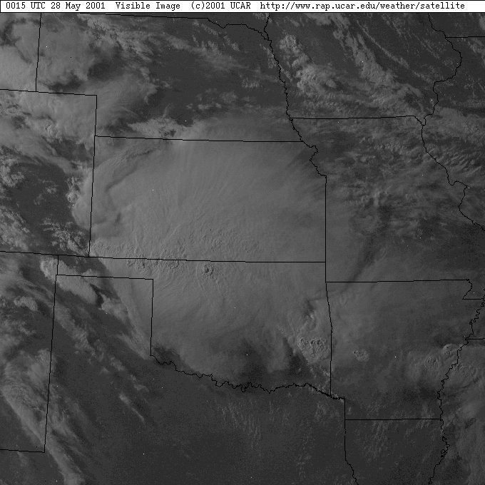
7:15pm CDT
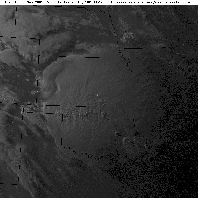
8:02pm CDT
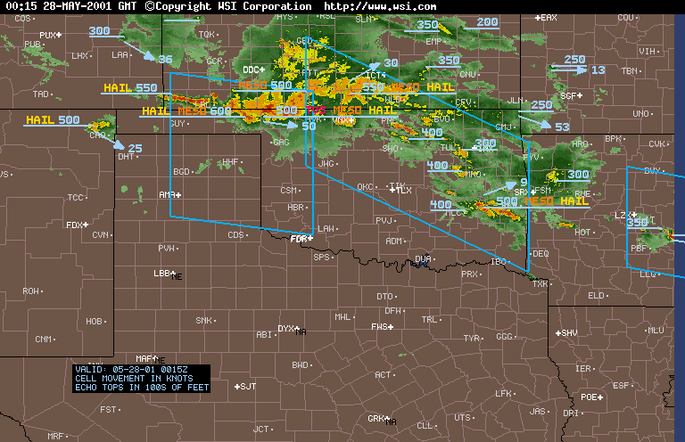
radar image at 7:15pm CDT
You can see the line clearly in the radar imagery and the TVS signatures indicating tornadic circulations.
Now to attend to your queries, the system began its career in southern Kansas, traversed Oklahoma and entered into Texas and would have travelled with damaging winds overnight throughout parts of Texas. This is typical of violent Derecho events in upper level north westerly airflow and high cape situations (>5000 J/kg) with good moisture source and good inflow - they are long lived.
The derecho develops as part of a merged cluster of supercells that can form a squall line or may also have a supercell developing on one end. They attain different characeristics throughout their life cycle and severe straight line winds eventually dominate in the system as they merge into a squall line structure. Tornadic spin ups can also form in some regions within the system. There have been some good documented case studies of derecho events including this event and also an event that occurred in the last couple of years. Well worth looking up.
Regards,
Jimmy Deguara
Regards,
Jimmy Deguara


