and Chasing
[Index][Archives]
Chase in Tornado Alley 2001 - Special Report: Episode 2 - Now includes video - White Deer tornado
report compiled by Jimmy Deguara
| Storm News and Chasing [Index][Archives] |
Chase in Tornado Alley 2001 - Special Report: Episode 2 - Now includes video - White Deer tornado report compiled by Jimmy Deguara |
Perhaps the only opportunity to chase with Ted Best our host for the trip, we headed out to our target in western Texas - southwest of Childress. I preferred the area to the north of Childress if it fired simply based on the windshear. When towers did go up, it did in both areas. We headed out of town to make our decision. Well, let's say the ones to the southwest won out, and so did David and Ted.
I suppose my reasoning was that we could catch the ones to the southwest. But as we neared, we noted the storm we had been watching had weakened. Lack of contrast and haze had hidden a second cell to the south. The anvil was facing southeast and it soon became evident that this was a right mover. Damn!! It would now become more difficult to catch.
 We
eventually did catch up. Decision time. Ted did not want to punch through this
supercell which had large hail to golf ball size reported. Understandably so.
At this point we parted and headed south and gradually south-southwest towards
the core. We then realised it was an LP supercell and we were on the wrong side.
Unfortunately, the more we headed south, cell development was shifting south-southwest.
We were not able to get onto the southern side of the storms. The anvil was extensive,
not surprising considering the relatively weaker upper level winds.
We
eventually did catch up. Decision time. Ted did not want to punch through this
supercell which had large hail to golf ball size reported. Understandably so.
At this point we parted and headed south and gradually south-southwest towards
the core. We then realised it was an LP supercell and we were on the wrong side.
Unfortunately, the more we headed south, cell development was shifting south-southwest.
We were not able to get onto the southern side of the storms. The anvil was extensive,
not surprising considering the relatively weaker upper level winds.
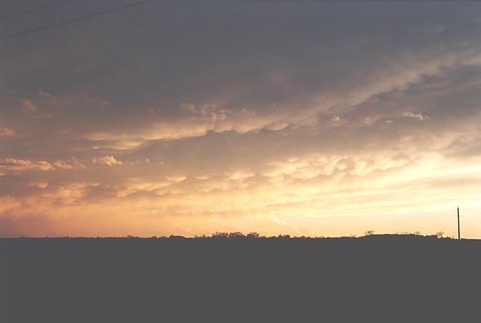
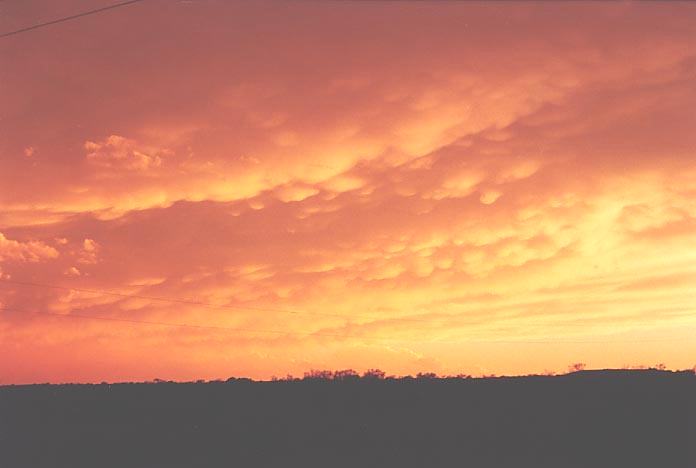
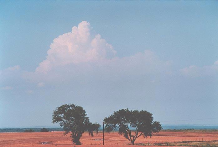
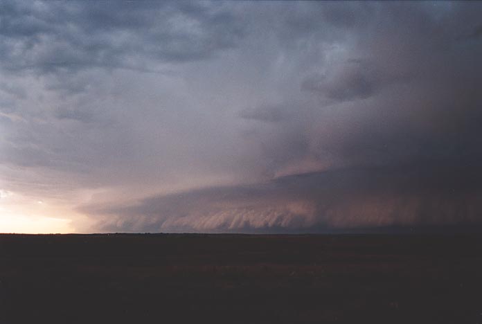
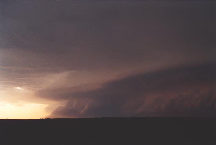
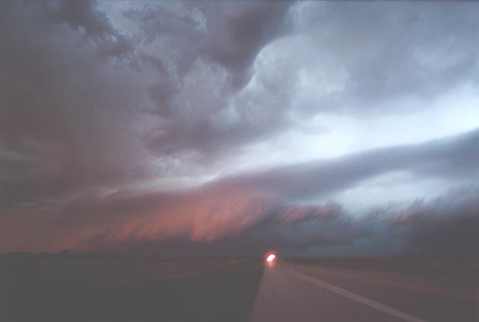
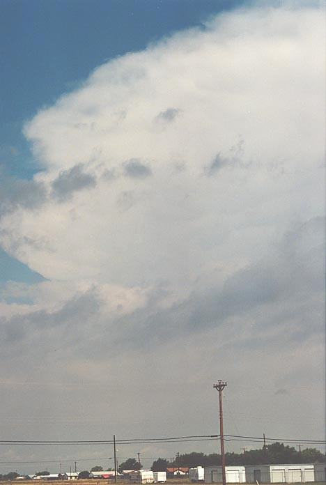
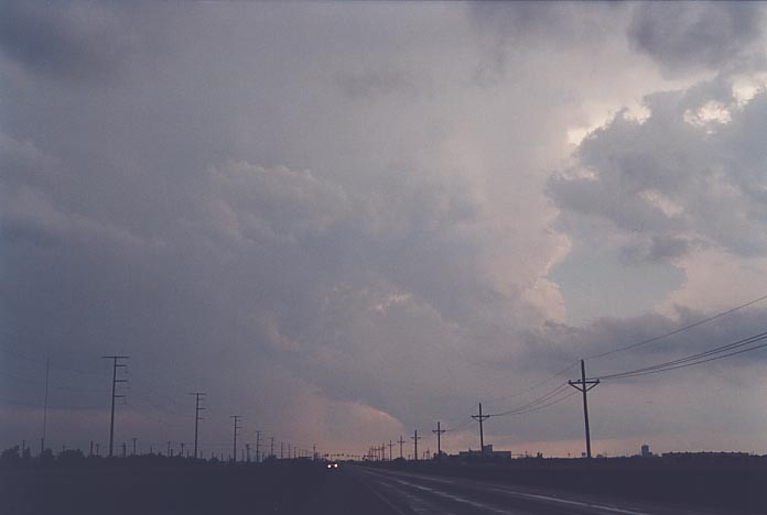
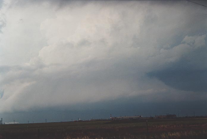
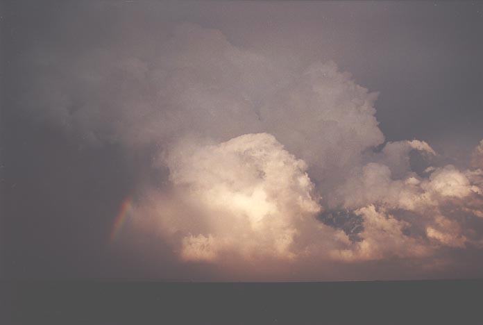
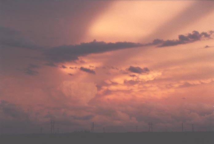
So we settled for a spectacular sunset reflection display on the thunderstorm, massive back-sheared anvil shield and mammatus near Lubbock. We eventually headed east to some spectacular lightning activity including anvil crawlers. We stayed the night at Abilene. This system developed into an meso convective system
Another Sunday, with no models until 1pm. Worse still, this was the Memorial Day Weekend so libraries in most towns will close over the weekend except major towns and Universities. So again, a rough target area was used as a guide and we headed for Lawton, Oklahoma. What a mistake, we both had forgotten the library did not open Sundays anyway. Damn!! We were on our own.
The Weather Channel had indicated this area, and the NOAA radio had also placed a moderate risk in this area. However, as we neared the region to the northwest of Lawton, we noticed that the wind had turned southwesterly and the cumulus field had decreased. We were absolutely disgusted as we had high hopes of this day. Even the cumulus field further east was not firing. We could see storms in Kansas but that was simply too far.
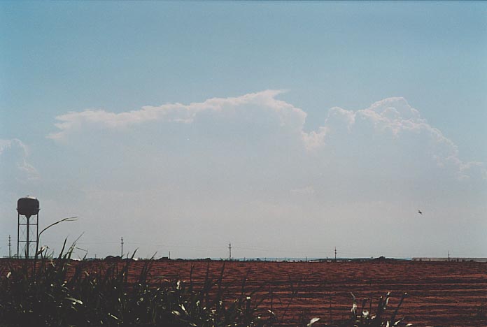
Finally, we decided to stick to our original plan and head northwest until we hit some development. And this payed dividends!!! As we neared the turnoff to Woodward in northwestern Oklahoma, we could see cirrus, which I felt at least partly was from a developing or distant anvil. The cumulus field to the north was more encouraging as well.
 As
we neared Woodward, it became obvious that a thunderstorm was in progress. The
anvil quickly increased to an altostratus layer, and after some shopping, we headed
west. We did not even get a chance to talk to the TV reporter whom we had parked
near.
As
we neared Woodward, it became obvious that a thunderstorm was in progress. The
anvil quickly increased to an altostratus layer, and after some shopping, we headed
west. We did not even get a chance to talk to the TV reporter whom we had parked
near.
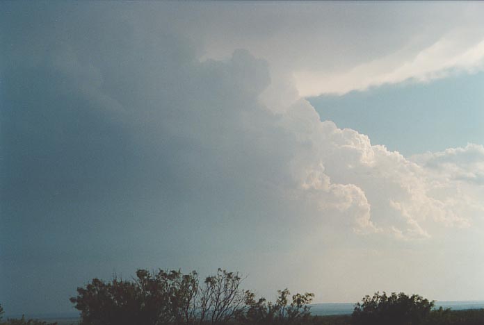
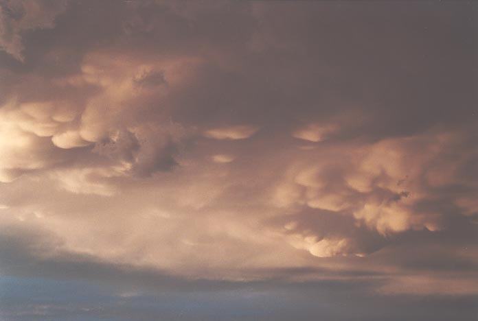
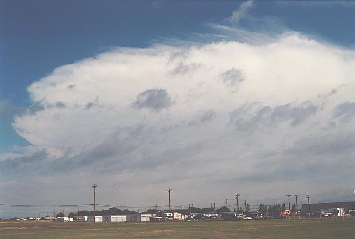
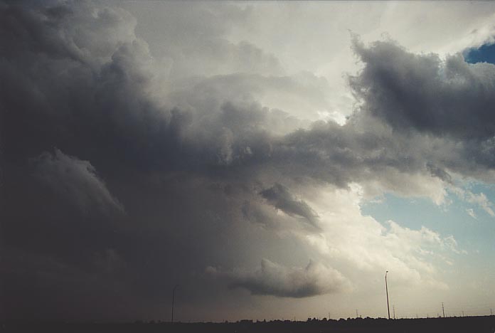
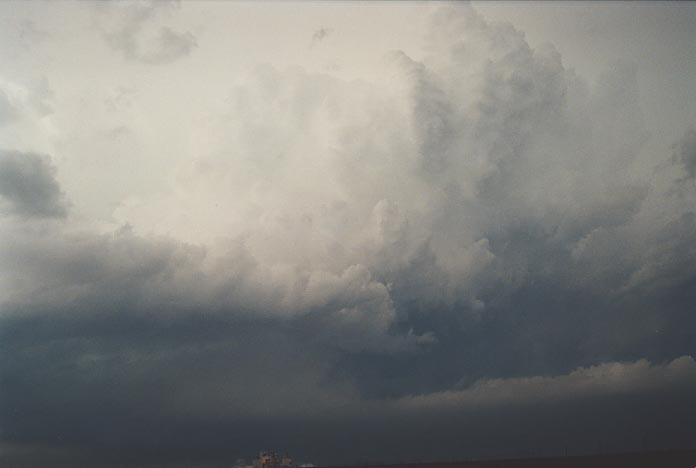
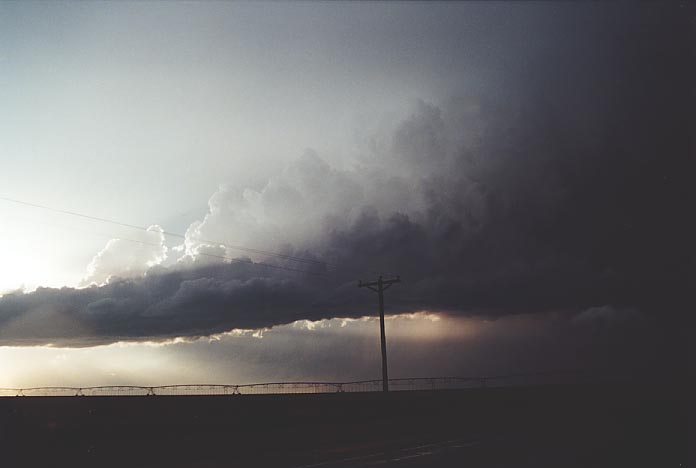
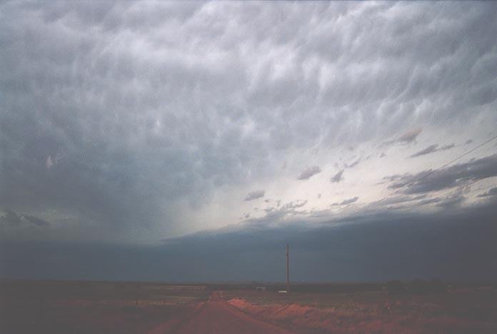 Further
west, and the storm complex took shape with a clear thick anvil overhead. There
was no shortage of mammatus from the severe hailstorm now affecting nearby counties.
A warning was announced for the storm to the north basically for hail the size
of dimes and heavy rain. At this stage, there was nothing fancy about this system.
Further
west, and the storm complex took shape with a clear thick anvil overhead. There
was no shortage of mammatus from the severe hailstorm now affecting nearby counties.
A warning was announced for the storm to the north basically for hail the size
of dimes and heavy rain. At this stage, there was nothing fancy about this system.
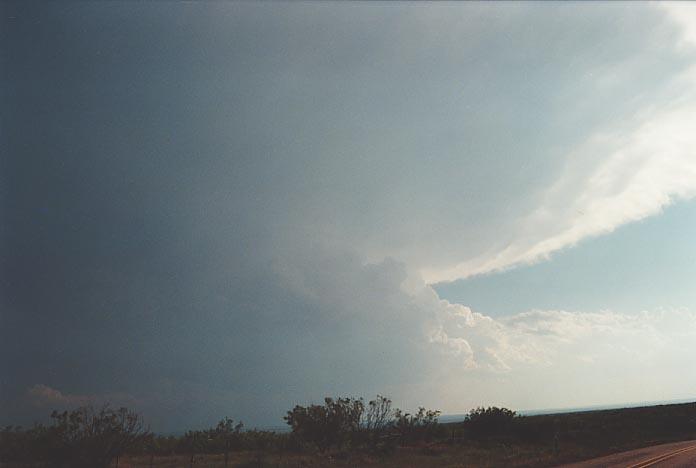
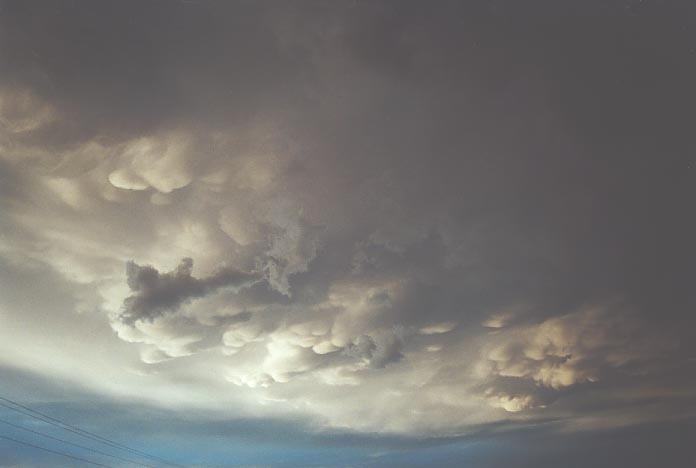
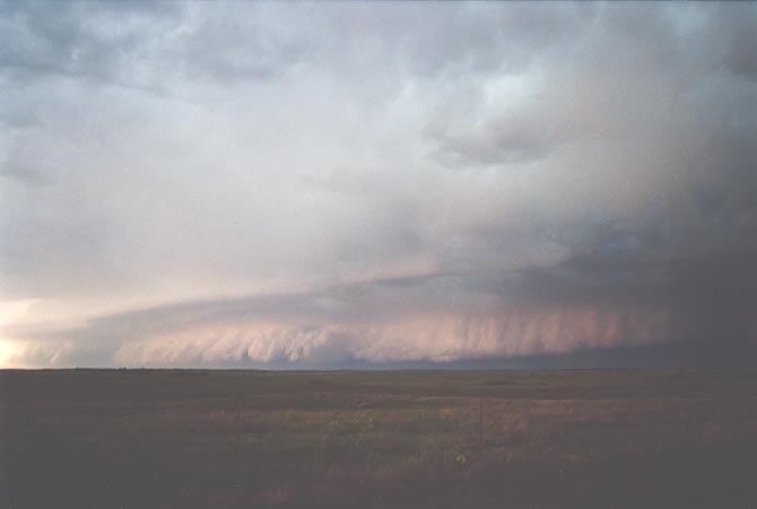
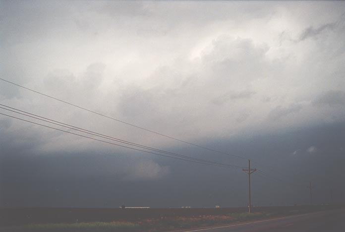
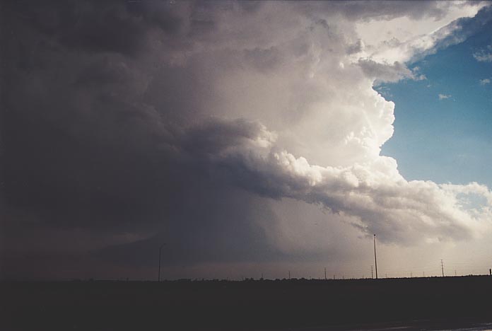
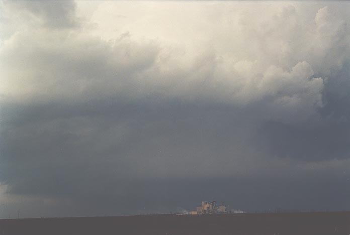
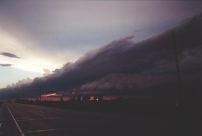
However, the storm
to our northwest had begun to drag fresh to strong inflow. Slowly but surely,
on the horizon, a gust front formation began to emerge. 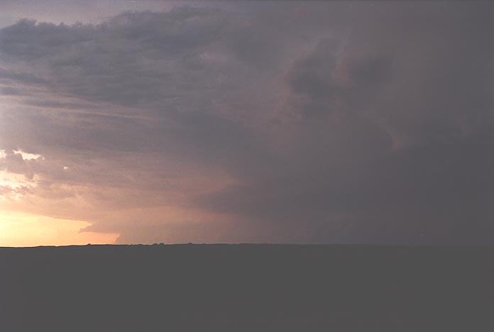 We
headed up the dirt road for a better view. The more it approached, the meaner
it looked. At times we stood in awe at the shear size of the whole system. The
contrast and formation improved dramatically about 7pm and you could now clearly
make out two storms including the storm with the warning. David and I thought
it was close for comfort so we headed off east.
We
headed up the dirt road for a better view. The more it approached, the meaner
it looked. At times we stood in awe at the shear size of the whole system. The
contrast and formation improved dramatically about 7pm and you could now clearly
make out two storms including the storm with the warning. David and I thought
it was close for comfort so we headed off east.
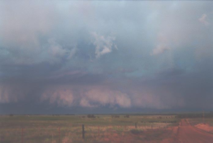
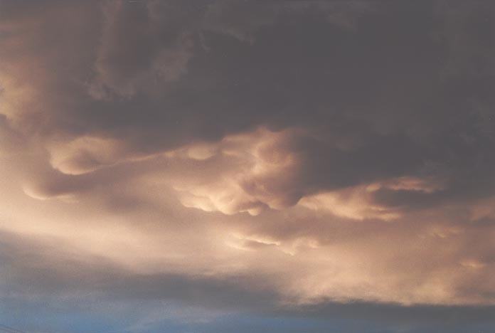
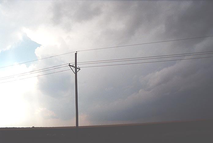
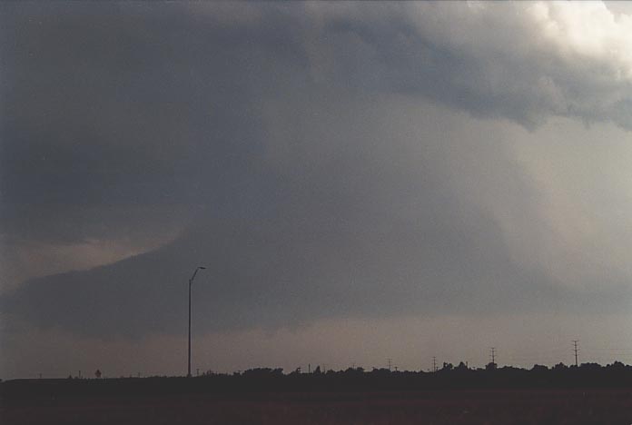
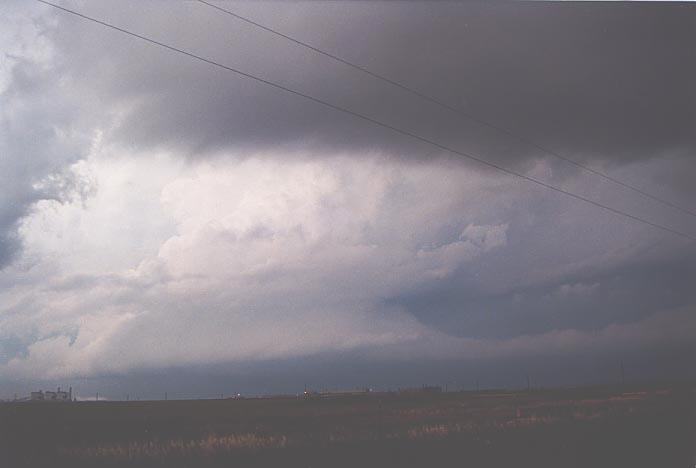
The storms were
heading east-southeast and we knew there were limited roads south as well as our
main road that headed southeast past Woodward. The further east we travelled,
the more spectacular the storm became. We stopped twice; before and after Woodward
to take stills and video of this incredible cloud structure.
Click to view the following videos
Yes lightning flashes
were frequent but of more interest were the impressive lightning bolts consistently
striking the ground and pulsing several times to the southwest. Now what also
made this incredible was that it came out of the thicker part of the anvil section
just ahead of the gust front structure, almost all from the same region.
We made it past
Woodward and then headed south. The relative position of this lightning got closer
and closer to our vehicle. I must have been out of this world as I went "nuts"
every time a bolt would drop and pulse. In fact, at one stage I went ballistic:
"That one pulsed 9 times - whoa -hohh - ha". And I was the one driving. So much
enthusiasm and a storm chasing you down is an excellent way to shield the distance.
Suddenly, flash boom followed by another pulsing bolt all within half a kilometre.
You could even hear the static on FM radio. I have included some of the highlights
of this part of the trip.
Now it was decision
time. We seemed to barely gain position ahead of this storm chasing us down. Could
we make it to Lawton in time? It was a close call but we decided to give it a
go. Bad move - as 5km from Lawton, we had to pull under an overpass. Winds were
simply too strong and had accelerated ahead of the main gust front. Steering was
difficult as wind gusts of about 130km/h or so hit the vehicle. Even under the
bridge, the car was rocking!! Then David and I noticed a glow on the horizon and
the small city went dark. This glow persisted for 10 seconds and I zoomed on it.
There seemed to be no lightning around? Unfortunately, this turned out to be a
tragic part of the chase: a power pole had been toppled over by the severe winds
falling on a woman killing her. This storm had taken its toll with extensive damage
reports from Woodward to across the border into northern Texas. We stayed the
night in Lawton and viewed video footage on our viewfinders discussing what had
happened. Certainly a breathtaking storm.
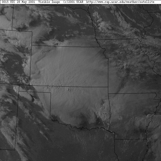
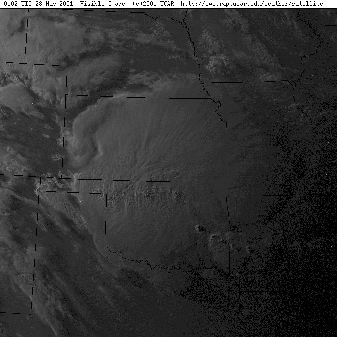
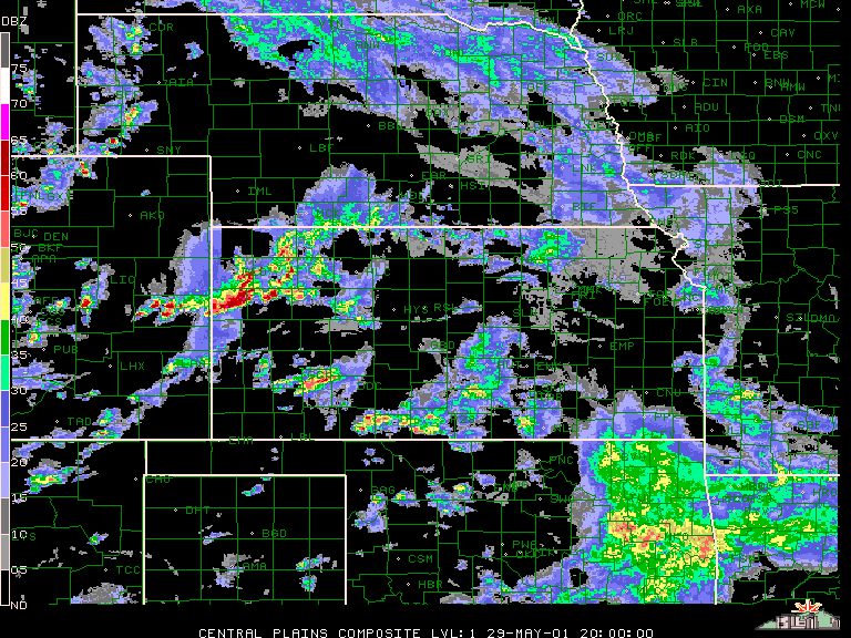
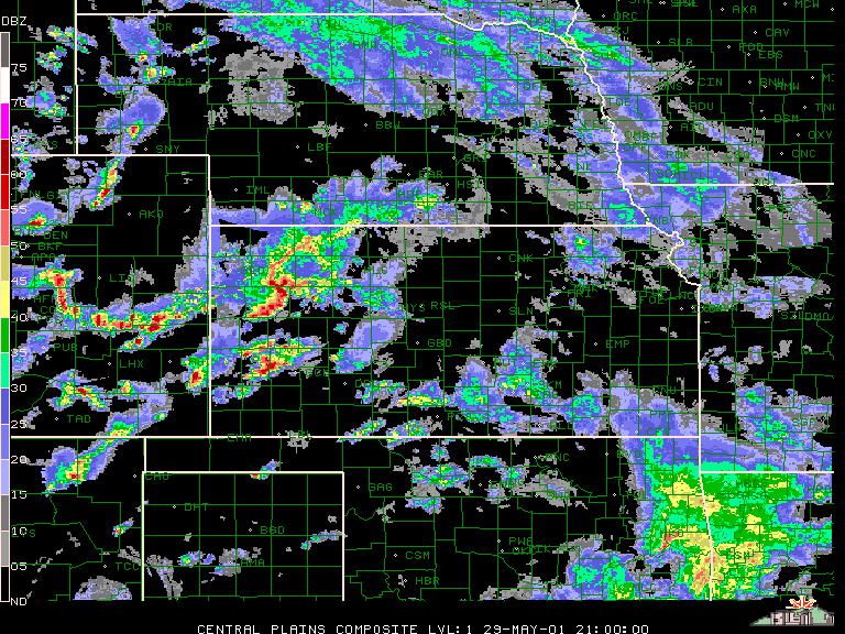
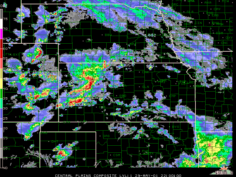
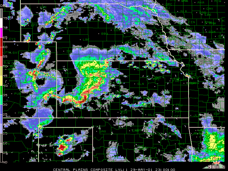
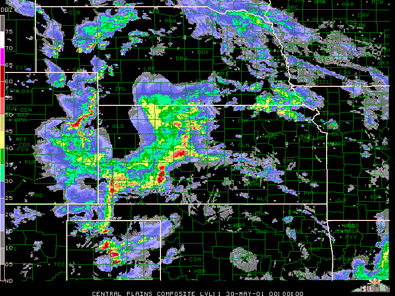
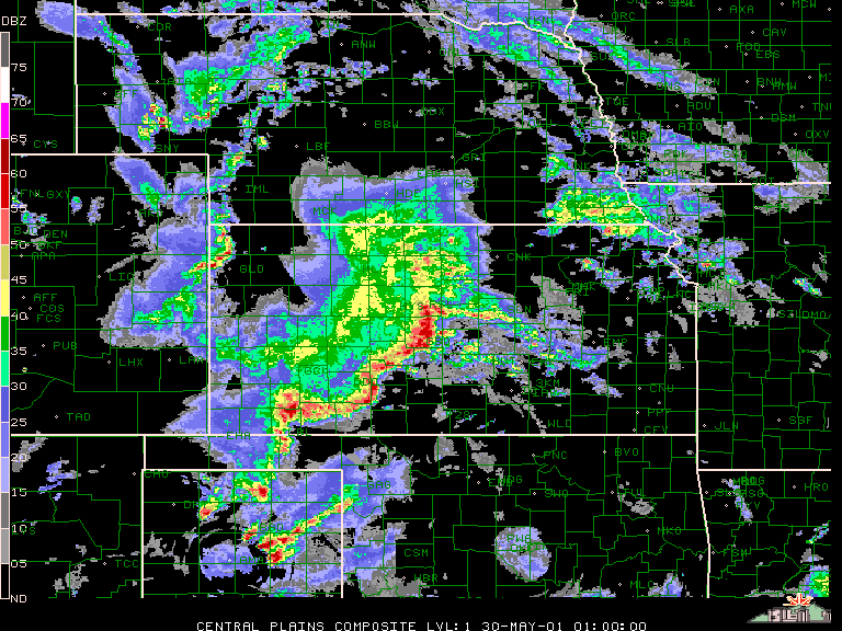
Here are some radar and satellite images for 27th May 2001 event.
Satellite images showing the massive complex extending into Oklahoma
Courtesy of UCAR - http://www.rap.ucar.edu/weather/satellite
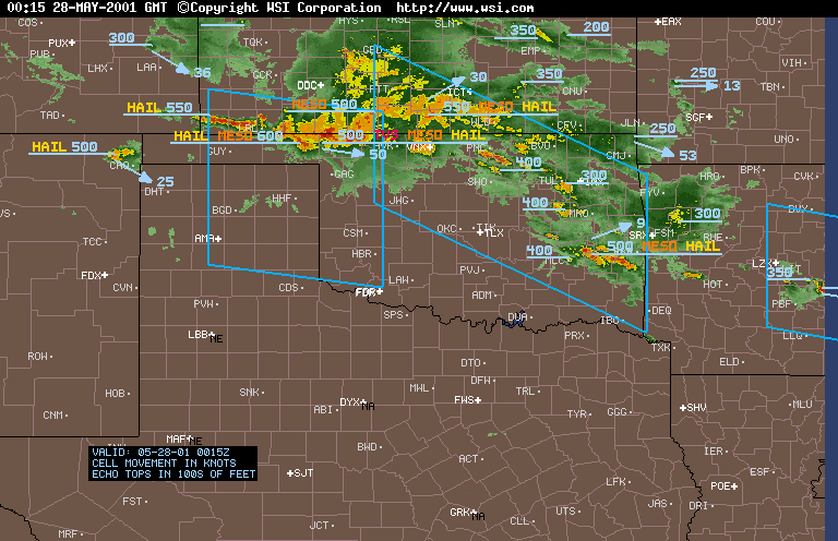
Radar Image showing the various mesocyclone, hail and even a TVS signature
Courtesy of WSI Corporation - http://www.wsi.com
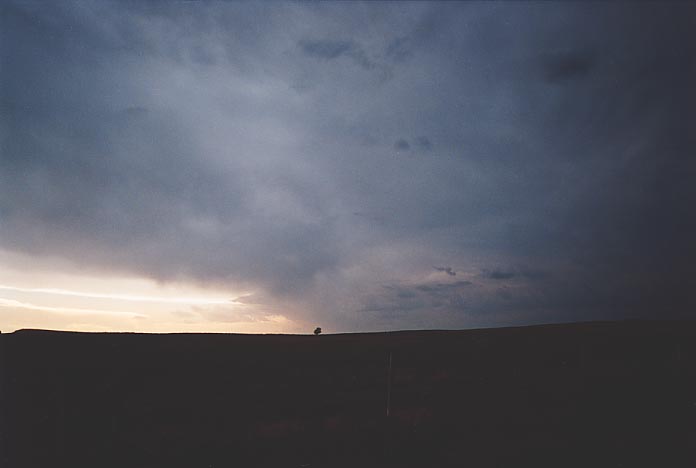
A mesoconvective
complex again stablised the air and introduced low cloud. We observed breaks in
the cloud and watch as middle level cloud also moved through. Another bust. We
were a few hours short of the tornadic weather that hit parts of Colorado. Oh
well. Anyway, in a hope to be closer to the border and any storms that may come
through, we headed for Dumas and stayed there the night.
There were no problems
with libraries being open on this day. Our aim was to quickly observe the conditions
and then possibly chase this storm to the north. Target area was basically where
we were in the northern Panhandle. We decided the storm could be caught so we
headed after it. Bad move. Not only did the storm beat us east, we were slowly
but surely getting ourselves distracted by other storms near Kansas. It is easy
to observe nice looking updraughts only to find they are too far away. Just over
the border of Kansas, we stopped to observe.
It was an interesting
stop as we could see the winds had changed somewhat and freshened from the southeast.
Cumulus clouds were now developing to the south and southwest including some possible
cumulonimbus. The distracting storms to the north had basically fired into too
many thunderstorms meaning only heavy rain could be expected from them. We went
to the local library. What a shock to the system: the national weather service
had issued a tornado watch for our 'target' area. There was even mention of chance
of F2 - F5 tornadoes! A dry line was setting up on the Texas/New Mexico border.
A surface boundary flow was expected to hit the target area during the afternoon.
Our job was to hunt down the location where these storms would eventually fire.
Was this going to be a repeat of the southeast Oklahoma case?
We quickly took
off and made the trek down through the Oklahoma Panhandle and into Texas again.
We had observed the persistent region of cumulus to our south the whole way. We
decided to take the route slightly to the west to make sure we did not miss any
development. And then we saw it: a strong cumulonimbus developed into a supercell
to our east. We were shattered as we knew we had missed the opportunity to get
it - too late to turn back. We had to commit to our original target.
We headed further
south after observing more towers and of course glimpses of the massive supercell
to the east. Then a line of weak cumulonimbus towers came into view to the south.
All storms were aligned to the northeast. My thoughts were that this was more
likely to be near the area that may take off. It was further back from the other
cells and we were entering a field of more moisture. It was also a region where
the left exit of the jet maximum was going to pass over. My interest though focused
on what could be on the other side of those cells. The thought running through
my mind was that we had to be in position on the southern side of the storm. We
were playing catch up yet again after having the best opportunity to be in position
earlier. David and I were furious that we may have again missed such an open opportunity.
There was no excuse this time.
We headed east
for about 30 miles to cut across these weaker cells and then further south towards
Amarillo. We drooled over the most perfect cook-screw updraught to our east indicative
of the windshear environment. I liked what I saw to our west as well: a cluster
of cells that were beginning to organise and seemed to maintain position. These
seemed to have the potential to turn right if they became severe and nothing blocked
their flow. There was a nice easterly flow into these storms and they were backed
up along or near the dry line. They indicated good rear flank downdraughts and
certainly were producing precipitation. Other than this, there was really nothing
special about these cells. They were barely severe and certainly not photogenic.
We finally arrived
in Amarillo. Damn we missed the turnoff but to me it was a relief that we had
made it on the southern side of these storms. We fuelled at a service station
in Amarillo in preparation for any chase that lay ahead. I got out to pay whilst
David fuelled. I could hear a screeching sound and looked around to find two cars
had had an accident and were entering the service station. I was asked to be a
witness but I had not seen anything. (Imagine if I had and was kept back whilst
a supercell took off��.hmmmm).
We headed just
outside of Amarillo and stopped to observe developments including the NOAA radio
reports. Well, it turned out that we were observing everything before the warnings
were put out. We had earlier observed a dark base develop before a severe warning
was put out for possible giant hail. That storm had taken off northeast. But it
was the persisting cells to the west that demanded our interest - watching for
signs of rotation. Well, finally we were rewarded with the first organised scud
rising into the base a few minutes after inflow freshened from the east. Video
and photographs were taken as this persisted for several minutes. We could hear
the siren go off in Amarillo and then 10 minutes or so later, a tornado warning
was issued for the storm. David also noticed a tornado warning was issued for
another storm. This turned out to be a county to the south. A storm was also in
progress south of this storm that we had been watching.
As time went on,
this southern storm developed a beaver tail and David took a liking to it. We
were at this stage parked on a side road. I had no idea about the inflow band
until David commented on it. I suppose I was so focused on 'our' storm to the
west.
I have got to get
another shot - I simply was in awe of the rotation and the incredible contrast
of this developing beast. Another chaser vehicle stopped behind us. Well you know
me, I could not let an opportunity go without talking to other chasers. So we
introduced ourselves and discussed the storm situation. They were trying to pick
which storm to go after. Well David and I had no doubt that this storm was the
one to chase. After all, if we needed to, we were within travelling distance of
the southern cell. Looking in the rear vision mirror, the other guys had decided
to follow us!!
This storm was
showing good inflow with now a lot of moisture condensing in the form of low cloud.
This was very turbulent. We headed further northeast and could now make out the
dark menacing base as well as the exploding tower. The contrast was excellent.
We waited near an easterly route that could take us to White Deer.
Rotation was still
evident. We were looking around for more funnel possibilities. And then as we
headed a little further north, David indicated another funnel and tornado to the
north from a separate wall cloud. I grabbed the video camera and taped the last
bit but I was not able to get it into view in time after stopping. David got it
- great stuff.
We were parked
on the entrance of a gravel road when we saw an upside-down dome shaped funnel
cloud developing in a similar region where the first tornado developed. I was
sure that it had the inflow to develop into another tornado. And apparently there
were dust whirls. This was tornado number three.
Then bad news -inflow had turned
suddenly to outflow. David and I commented at the same time about this outflow
so we made our way further northeast.
What happened from
here on was a blur. There simply are no words to describe our feelings at this
point - something I had never experienced before. This was now beyond the adrenaline
stage, it was survival. There was no time to think. Almost automatically, like
we had been doing it for years, we paced ourselves with the wall cloud in correct
position, watching any developments making decisions like we had a job to do.
We were being lured by the storm.
Moving further
up the road parallel with the storm's motion, we arrived at an intersection near
Panhandle, turned left and parked with a few vehicles. The wall cloud was very
low to the ground and was rotating faster. It was a matter of time that something
would touch down. Winds racing into a convergence of the inflow from the west
increased. You could hear the whistling in the power lines as they bent in the
wind. I was extremely concerned particularly if the power lines fell. So I was
in the car quick smart. We decided to quickly head up the road fearing that we
could get blocked off.
As soon as we turned
around and made a move, David shouted "Tornado". Panic set in. Where could I park?
Any roads? By the time we found a road in the small township, the tornado was
not in view. Wasting no time, we quickly headed for the route back northeast.
The following are
videos of the major tornado at various stages described below.
Lightning backlit tornado - only so brief one still available!! Alas!! Finally a funnel had redeveloped. David worked in the back seat like
a machine, taking photographs and switching between his and my video camera recording
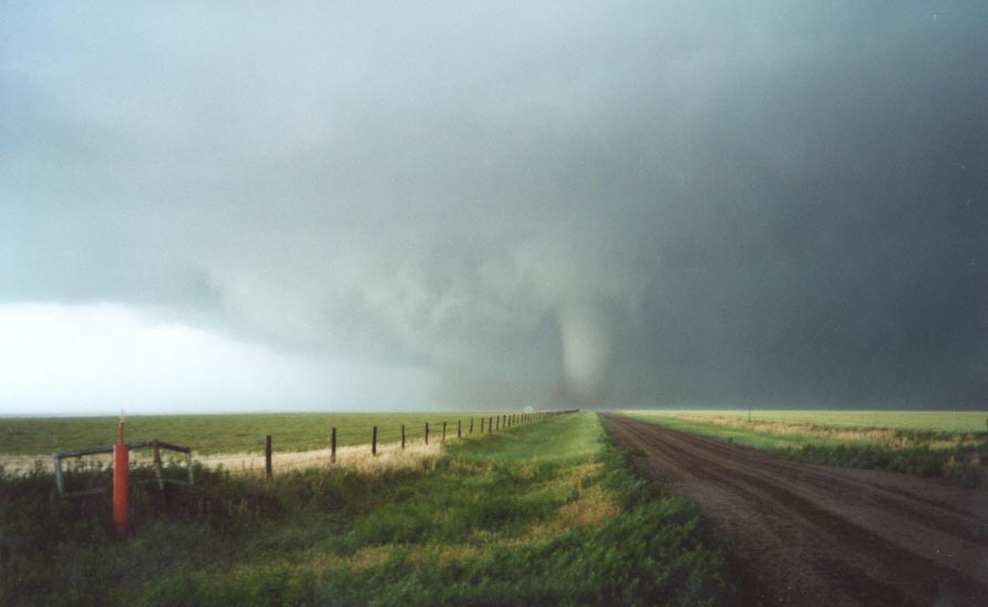
the moments of the funnel descending and finally - touchdown!!! An elephant trunk
at first, it quickly grew into a pipe tornado. We stopped at another dirt road
intersection as the elevated railway line was in the way.
We quickly headed
back onto the road as we felt a little unsafe being on the wrong side of the railway
track. Umm tornadoes and trains don't go hand in hand. Back on the road and the
tornado was not showing any signs of weakening. It was in a steady state and growing
larger. Now a truncated cone was forming above the pipe and slowly descending
to the ground forming a wedge. The wall cloud below the updraught was rotating
like nothing I had seen before - a clear hook structure. I was driving and filming
whilst David snapped a few pictures and probably was lost out of reality throughout
the ordeal. Perhaps being in the driving seat, I had to completely concentrate.
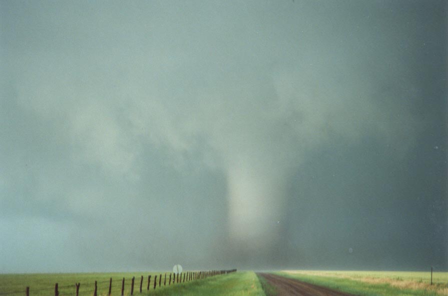
Then the inevitable
happened: the large tornado was slowly becoming rain-wrapped. It slowly faded
from view over the next few minutes as heavy rain driven by jets of up to 130km/h
shook our vehicle. Chaser cars ahead of us turned their nose into the winds. I
started to but losing sight of the tornado, I decided against it. We carefully
advanced forward watching again for changes in velocity of the wind driven rain.
But our run with the tornado was over: all we had were the memories and also the
damage. Six power poles snapped in a line on one side of the road indicated where
the tornado had crossed. We even had to cross over power lines with the sheriff
looking on.
We made it to White
Deer and passed through incredible amounts of water through town streets (lack
of drainage). Then just outside of town, we stopped. The storm seemed to be getting
away and it seemed to us that it had weakened. In fact, it had occluded itself
in the rain-wrapping process. The tornado had apparently been on the ground for
half an hour and reached an estimated � mile wide at the base. Four tornadoes
had occurred with this storm.
We watched a small
LP supercell develop under the anvil shield. It even had a small
beaver tail!! This was to be the end of the day's proceedings.
So after some evening
pictures of an approaching roll cloud and mammatus, we called it quits. We made
it to Shamrock where we had dinner at MacDonalds. We found that chasers such as
Sam Barricklow and Gene Rhoden were here as well discussing this major tornado.
It was at this stage that we REALLY began to realise the significance of this
event. I found myself trembling - a mixture of excitement, nerves and fear I guess.
Here are some other
references to this tornadic event:
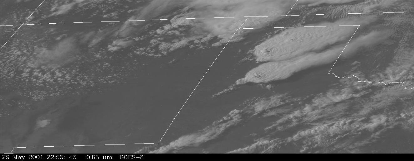
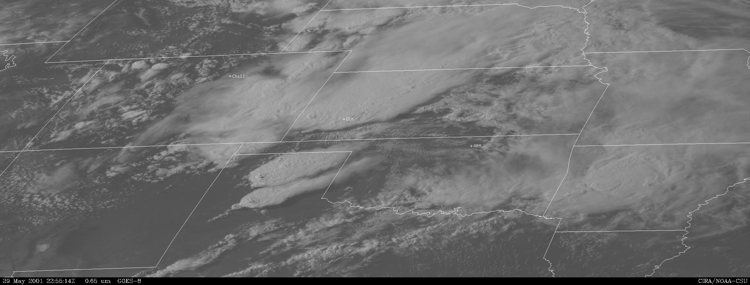
Satellite images showing the massive complex moving extending into Oklahoma Note the massive overshooting top shown mainly in the northern complex of the two.
Cut-out very high resolution satellite image depicting the two main supercell complexes in the Texas Panhandle 5:55pm
Full very high resolution satellite image 5:55pm
Courtesy CIRA/NOAA - CSU
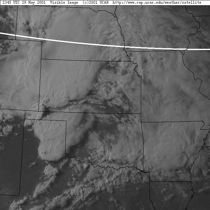
High resolution resolution satellite image 6:45pm
Courtesy of UCAR - http://www.rap.ucar.edu/weather/satellite
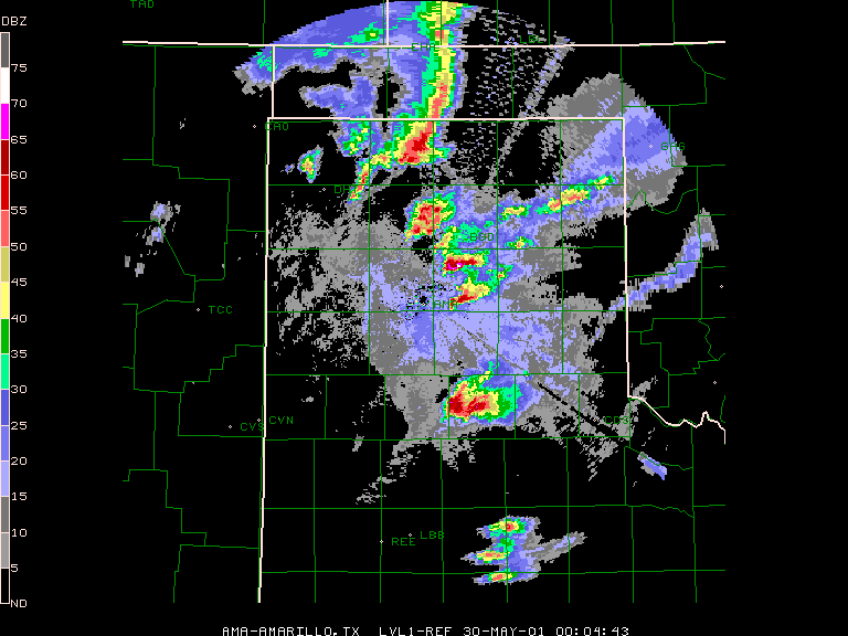
Radar Images showing the various stages of storm development and rapid intensification about 6 - 7pm. Images available from the National Weather Service NWS - http://www.nws.noaa.gov/
radar image 7:04pm This is the time when the White Deer supercell exhibited serious tornadic behaviour.
This day turned
out to be a dud - perhaps the only excitement was a persistent funnel that apparently
was part of a landspout.
Chase
in Tornado Alley 2001 - Special Report: Episode 1
Chase
in Tornado Alley 2001 - Special Report: Episode 3
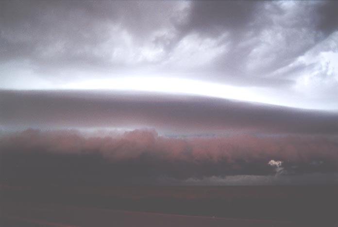
David then heard
reports of base ball sized hail in a county to the north. The structure developed
into one of the most impressive shelf cloud formations reminiscent of a flying
saucer with three lenticular layers. It was as if a fluorescent light was shining
through these layers in the fading light. And then, lightning.
For more photos of
this event taken on David's camera, check out: David's
Report on this storm.
Monday 28 May
2001
Tuesday 29 May
2001 Dryline supercell outbreak produces violent White Deer tornado
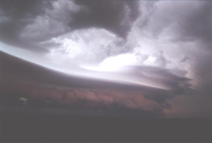
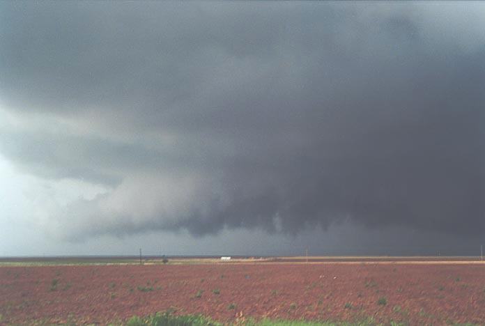
 After
early morning severe thunderstorms, we awoke to stratocumulus cloud just visible
above the thick mist. The mist and cloud broke sufficient to reveal and thunderstorm
anvil. Once ready to leave we took photographs and some video of the side-shearing
anvil to the northwest. For an early storm, it looked rather impressive.
After
early morning severe thunderstorms, we awoke to stratocumulus cloud just visible
above the thick mist. The mist and cloud broke sufficient to reveal and thunderstorm
anvil. Once ready to leave we took photographs and some video of the side-shearing
anvil to the northwest. For an early storm, it looked rather impressive.
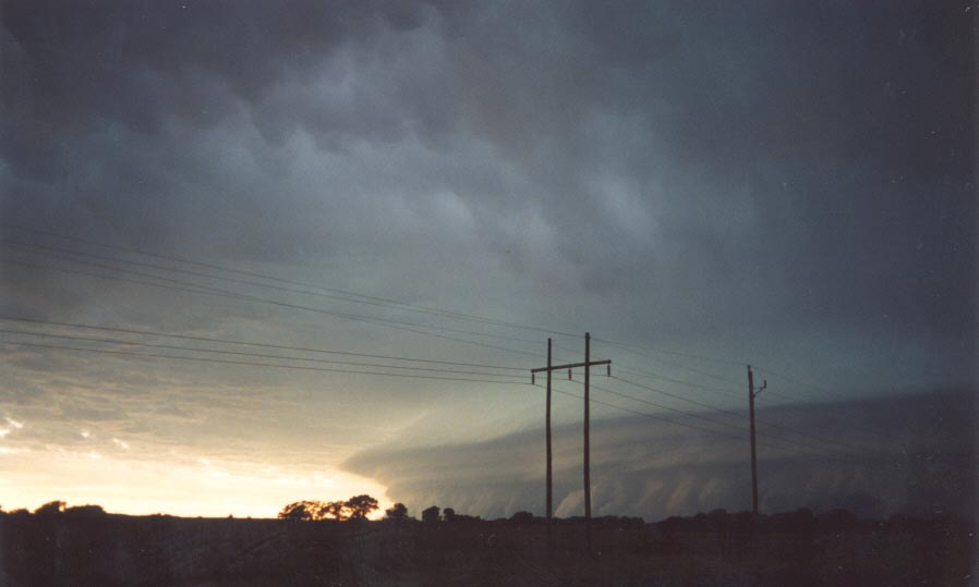
 Then
finally this storm began to reveal its structure. The transformation was unbelievable.
An inflow band had begun to develop simultaneously with the development of a powerful
twisting updraught. What went through my mind - this was a mirror image of the
November 5th Coffs Harbour supercell. I got David's attention and he also stared
with astonishment. The same thing was going through his mind. Taking a real interest
in this storm we took some quick footage and photographs, and headed back onto
the main road.
Then
finally this storm began to reveal its structure. The transformation was unbelievable.
An inflow band had begun to develop simultaneously with the development of a powerful
twisting updraught. What went through my mind - this was a mirror image of the
November 5th Coffs Harbour supercell. I got David's attention and he also stared
with astonishment. The same thing was going through his mind. Taking a real interest
in this storm we took some quick footage and photographs, and headed back onto
the main road.
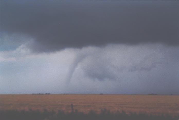
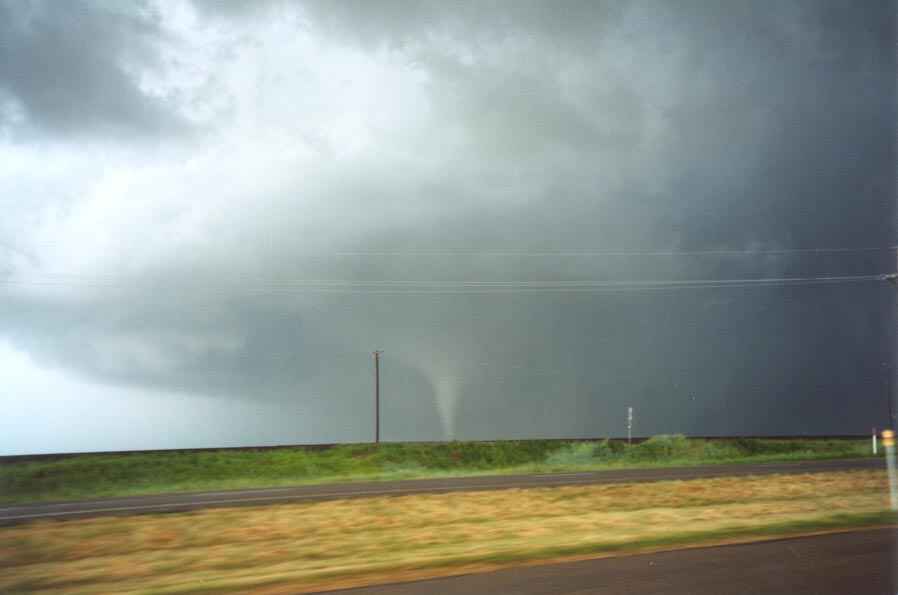
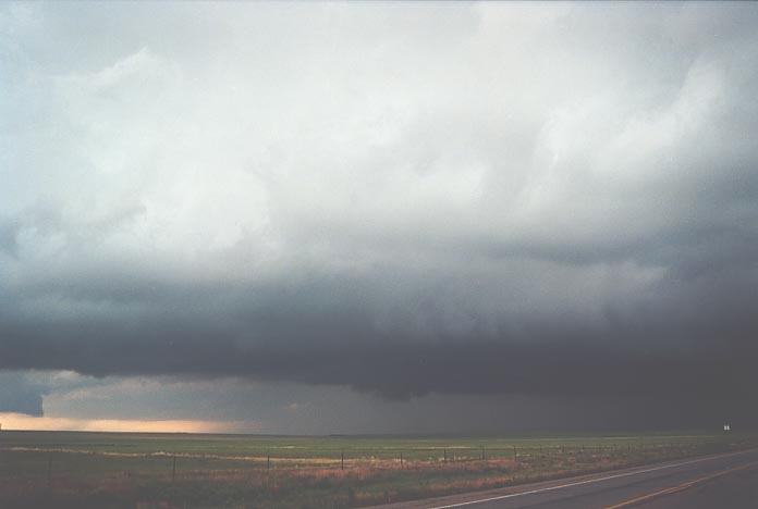 Suddenly,
scud began to rise for a second time and persisted sending a funnel. The adrenaline
was rushing through my body. This storm was going through text-book phases, slowly
organising itself. We knew it was a classic supercell but surely we could not
be observing a cyclic supercell!! As I had expected, the storm had started the
process of making a right turn and the circulation increased. We headed along
the road to White Deer. "Funnel", David shouted!! A white funnel started to form
very quickly and soon hit the ground. We had a tornado on the ground. Incredible!!
I quickly stopped to get photographs and video but thankfully, David had got it
all on film. This lasted a couple of minutes and then it roped out. Amazing!!
Suddenly,
scud began to rise for a second time and persisted sending a funnel. The adrenaline
was rushing through my body. This storm was going through text-book phases, slowly
organising itself. We knew it was a classic supercell but surely we could not
be observing a cyclic supercell!! As I had expected, the storm had started the
process of making a right turn and the circulation increased. We headed along
the road to White Deer. "Funnel", David shouted!! A white funnel started to form
very quickly and soon hit the ground. We had a tornado on the ground. Incredible!!
I quickly stopped to get photographs and video but thankfully, David had got it
all on film. This lasted a couple of minutes and then it roped out. Amazing!!
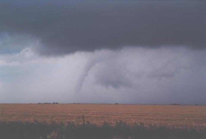
 Then
we noticed a base where the second tornado had developed organising into a major
wall cloud. When this started to visibly rotate even from our distance, we knew
something better could come of it. We stopped along the side of the road and again
more video and photographs. David set up tripod to film the rotation. You could
hear me screaming to "..come on - let's go!!".
Then
we noticed a base where the second tornado had developed organising into a major
wall cloud. When this started to visibly rotate even from our distance, we knew
something better could come of it. We stopped along the side of the road and again
more video and photographs. David set up tripod to film the rotation. You could
hear me screaming to "..come on - let's go!!".
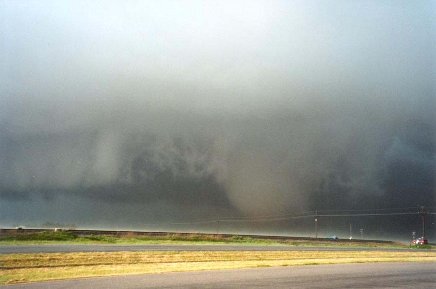
 What
an awesome sight, a cloud of dust was already circulating this major tornado.
No time for viewing, I was out in a flash. The determined look on my face was
caught on David's video camera. I was out of the vehicle but my video camera wasn't.
I didn't want to stay in David's way so through trying to be quick, my video camera
got caught on something. Finally free, I raced around to the other side of the
car, ducking to keep out of the rain and wind being wrapped by the tornado. The
setting could not be any more perfect - a nice flat plain, no trees, no obstacles.
It certainly made good video footage. David even suggested he heard the roar at
this stage. I must admit I was totally oblivious to this. A bit disgusted in fact.
What
an awesome sight, a cloud of dust was already circulating this major tornado.
No time for viewing, I was out in a flash. The determined look on my face was
caught on David's video camera. I was out of the vehicle but my video camera wasn't.
I didn't want to stay in David's way so through trying to be quick, my video camera
got caught on something. Finally free, I raced around to the other side of the
car, ducking to keep out of the rain and wind being wrapped by the tornado. The
setting could not be any more perfect - a nice flat plain, no trees, no obstacles.
It certainly made good video footage. David even suggested he heard the roar at
this stage. I must admit I was totally oblivious to this. A bit disgusted in fact.
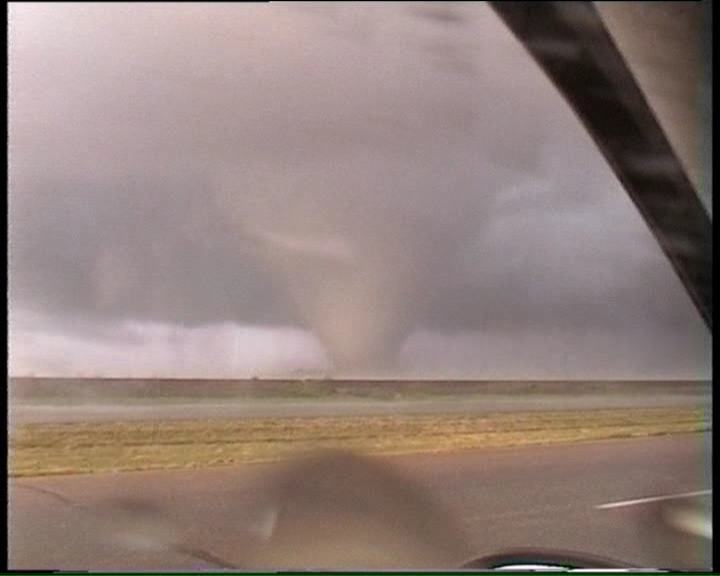
 Now
at times, videoing was becoming difficult as the rain wrapping around the tornado
was coming inside the car. Unknowingly, it was spraying the windscreen on the
inside. I hit the fan button to clear the windscreen for more video. Then the
rain stopped and I was able to get some of the best footage of a major, brown
Cone shaped tornado grinding away at the countryside. Then as I drove further towards the tornado,
more rain wrapped around. The tornado was now a barrel shaped tornado. "Look at
the size of it", I commented whilst filming. I simply had not seen a tornado that
big before in real life. I ran out of words to describe it. It had grown into
a monster sized tornado.
Now
at times, videoing was becoming difficult as the rain wrapping around the tornado
was coming inside the car. Unknowingly, it was spraying the windscreen on the
inside. I hit the fan button to clear the windscreen for more video. Then the
rain stopped and I was able to get some of the best footage of a major, brown
Cone shaped tornado grinding away at the countryside. Then as I drove further towards the tornado,
more rain wrapped around. The tornado was now a barrel shaped tornado. "Look at
the size of it", I commented whilst filming. I simply had not seen a tornado that
big before in real life. I ran out of words to describe it. It had grown into
a monster sized tornado.
Wednesday 30
May 2001 Landspot tornado and funnels on a day with lack of organisation for a trigger
Some chasers observed dust on the ground though I am
not sure if it was confirmed. We headed back to Plano, Texas completing a second
successful excursion.
Document: 200105-04.html
Updated: 20th January, 2003
[Australian Severe Weather index]
[Copyright Notice]
[Email Contacts]
[Search This Site]