Author Topic: NSW/SE QLD Severe storms and supercells : 25 - 29 January 2010  (Read 18907 times)

0 Members and 1 Guest are viewing this topic.

Offline Paul D

  • Multi-vortex F1
  • *
  • Posts: 90
  • Gender: Male
A few cells look to have cranked up near Newcastle yesterday evening, and the forcast is for showers/storms to extend into southern QLD over Wend - Friday, Predictions for CAPE and IL for Thursday appear good at the moment but shear seems lacking.

Cheers
Paul


Thurs avo LI & CAPE
« Last Edit: 27 January 2010, 03:48:07 AM by Paul D »

Offline Michael Bath

  • storm chaser
  • Administrator
  • Wedge tornado F5
  • *
  • Posts: 1,602
  • Gender: Male
    • Australian Severe Weather
RE: NSW/SE QLD Severe storms and supercells : 25 - 29 January 2010
« Reply #1 on: 27 January 2010, 05:28:45 AM »
Could do with some rain locally - missed out on the decent falls at the end of the first week in January - it was mainly west of my location.  So a bit "scotched earth" here - which is NOT normal.

Yesterday the capping was quite strong so it took ages for storms to take off but some decent ones did pass through the Wollemi and then parts of the Hunter and adjacent districts into the evening.
Location: Mcleans Ridges, NSW Northern Rivers
Australian Severe Weather:   http://australiasevereweather.com/
Lightning Photography:   http://www.lightningphotography.com/
Early Warning Network: http://www.ewn.com.au
Contact: Michael Bath

Offline David C

  • Global Moderator
  • Barrel tornado F4
  • *
  • Posts: 643
  • Gender: Male
    • Thunderbolt Tours Storm Chasing Adventures
RE: NSW/SE QLD Severe storms and supercells : 25 - 29 January 2010
« Reply #2 on: 28 January 2010, 08:43:18 AM »
Nicely (radar) structured storm south of Jenolan caves at the minute. Assumed a hook-shaped echo on Sydney radar and still appears to be in a somewhat steady state, and feeding on east winds. I actually thought that this evening might be better for western Sydney, but this storm has left moved with some momentum right now and although it will probably ride the eastern side of the mountains the outer west suburbs north from Penrith might still be in the firing line.......
Storm Chaser,
Thunderbolt Tours - USA & Australia Storm Chase Tours
www.thunderbolttours.com

Offline Mathew Townsend

  • Elephant Trunk F2
  • *
  • Posts: 151
  • Gender: Male
  • Watching storms since 1998
RE: NSW/SE QLD Severe storms and supercells : 25 - 29 January 2010
« Reply #3 on: 28 January 2010, 08:56:55 AM »
Interesting storm cells across the NE NSW atm. I thought we having moisture issues today but the radar shows them really heavy??

Offline Jason(pato)

  • Elephant Trunk F2
  • *
  • Posts: 136
  • Gender: Male
RE: NSW/SE QLD Severe storms and supercells : 25 - 29 January 2010
« Reply #4 on: 28 January 2010, 11:07:53 AM »
Just back from a brief chase about 10kms west of Lismore (small area known as Fernside). Encountered very heavy rain and hail up to around 3cm. Wind was very strong at times probably around 100-110km/hr, the car was certainly doing some rocking. Visibilty was reduced to no more than 50m. Got a few pics of structure leading up to the core punch and some shots during which I'll try and get up a bit later. Also took some video on my phone and if I can work out how to get it up on the net I'll try and post that as well. Overall a nice storm which surprised me a bit with its severity.
South Lismore, Northern Rivers NSW.....Supercells are us!!

Offline Michael Bath

  • storm chaser
  • Administrator
  • Wedge tornado F5
  • *
  • Posts: 1,602
  • Gender: Male
    • Australian Severe Weather
RE: NSW/SE QLD Severe storms and supercells : 25 - 29 January 2010
« Reply #5 on: 28 January 2010, 12:53:47 PM »
Some photos of the storm in the Northern Rivers region as it passed through Casino area.

First one is taken a couple of ks East of Casino. There were lots of pulsing CGs at the eastern end.


These ones in Casino:


Just about to get hit. There was extreme rainfall for quite some time before the hail started - which was mostly small but increased to about 3cm for a while. But the rain and wild winds were the main event.


It was a rushed chase but was great to see some fierce structure - and get some hail :)


How was that green colour Jase !!


Location: Mcleans Ridges, NSW Northern Rivers
Australian Severe Weather:   http://australiasevereweather.com/
Lightning Photography:   http://www.lightningphotography.com/
Early Warning Network: http://www.ewn.com.au
Contact: Michael Bath

Offline Jason(pato)

  • Elephant Trunk F2
  • *
  • Posts: 136
  • Gender: Male
RE: NSW/SE QLD Severe storms and supercells : 25 - 29 January 2010
« Reply #6 on: 28 January 2010, 02:01:28 PM »
Ok heres a few pics from my brief chase this afternoon after work. Made my way to the Parrots Nest vantage point and I was greeted by an immense guster.


As you can see the greenage is very obvious in the second pic.

Watched this for about 10mins and noted that the storm was heading west of my location so I decided to head west of Lismore on the road to Kyogle. The storm was ahead of me and the scud was being whipped along fiercely. I managed to get some snaps on the fly as I was moving along side then eventually under the guster. Made it to about 10kms out of town before I was halted in my tracks by an eerie green wall.


Managed to find a safe place to park and waited for the onslaught. At first there was only very heavy windblown rain  but after about 5 mins of this the hail started. Admittedly it was only up to about 3cm max but the sheer force of it being driven horizontally at approximately 100km/hr was enough to put the first hail dints in the Fozzie.

This pic taken in the height of the storm.....visibilty was only about 50m at most.


And I hope this works.....heres the video of the storm going nuts. About a minute before I started it was complete whiteout conditions with the other side of the road becoming invisible.

Severe storm 27/1/2010 near Lismore NSW

Its about 7mins worth so I hope you can view it.

Anyway was a pretty exciting day considering and I'm looking forward to tomorrow.

Cheers Jason

PS: Lol MB....yeah it was pretty insane, the greenage, driving into it. It was almost a turquoise colour at times. Good times  ;D
South Lismore, Northern Rivers NSW.....Supercells are us!!

Offline Shaun Galman

  • Stove pipe F3
  • *
  • Posts: 441
  • Gender: Male
    • ridgelightning.com
RE: NSW/SE QLD Severe storms and supercells : 25 - 29 January 2010
« Reply #7 on: 28 January 2010, 02:53:16 PM »
Hi guys,

MB and Pato: That storm looks insane! What a beast!

Look like things are forecast to pick up over the coming days. We've had the odd storm sitting out west (near Brewarrina) but nothing has come near enough to town to get out on as yet.

The past few threads over January have been really interesting!

Take it easy,
Shauno

EDIT: Some lightning on approach from the Brewarrina area towards us now. If I can fight my way through the mosquito's I'll head out to grab some shots soon!
« Last Edit: 28 January 2010, 03:01:40 PM by Shaun Galman »
Chasing Region: Lightning Ridge. N.S.W.
Website: www.ridgelightning.com

Offline Jimmy Deguara

  • Australian and Tornado Alley storm chaser
  • Administrator
  • Wedge tornado F5
  • *
  • Posts: 2,218
  • Gender: Male
  • Storm Chaser since 1993, Tornado Alley 2001
    • Australia Severe Weather
RE: NSW/SE QLD Severe storms and supercells : 25 - 29 January 2010
« Reply #8 on: 28 January 2010, 07:25:23 PM »
Hi,

Impressive storms you intercepted Northern Rivers crew! Good to see some action as well as some rain up there!

Chase Report 27th January 2010 - Capertee to Ilford to Mudgee supercells and storms

After analysing the models carefully this morning, my target was to head in the region - well basically where the storms occurred south of Mudgee and north of Lithgow. Modified CAPE values were in some cases in excess of 2000J/kg. GFS had very much underestimated the moisture! Furthermore, this was one of those dryline setups - moisture dropping off rapidly in the region near Bathurst to Orange and Dubbo. A strong cap was in place but models suggest this was going to be overcome by early afternoon!

Earlier, I was tempted to go after some storms that had developed to the northwest of Mudgee but I stopped and then turned back just after Gulgong. Small cumulus had developed to the south and knowing the potent environment these were going to feed off, I basically headed back south to near Ilford!

By now, a cumulus field had developed and a few storms were in the vicinity of Lithgow. In fact, David Croan called me to indicate a possible hook echo on the storms west of Warragamba further south. I would not have doubted this based on the hodographs.
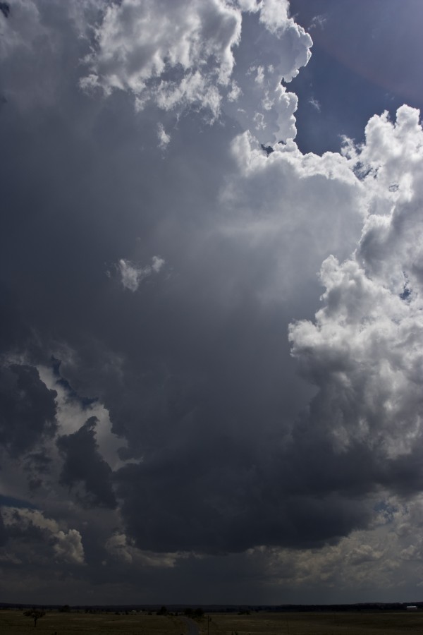
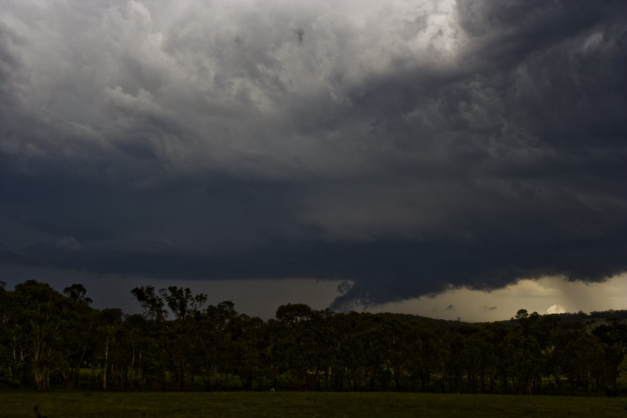
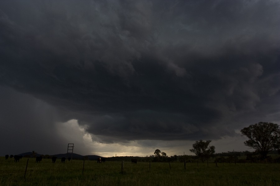
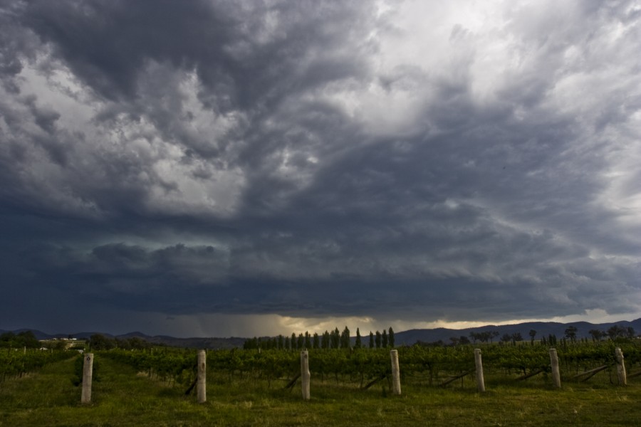
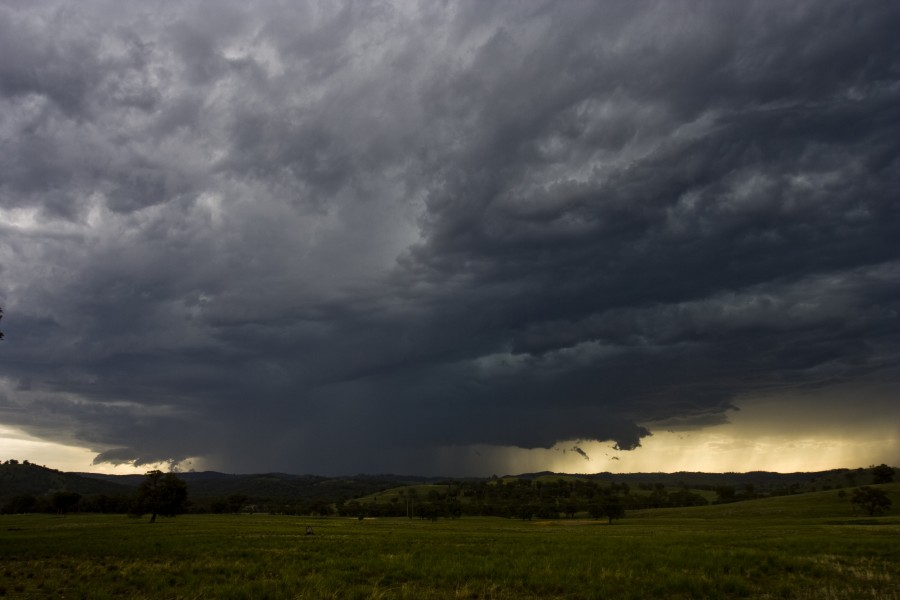

The small storm


Supercell

My focus was now on trying to see what storms were dominating. A nearby cumulus albeit relatively small had exploded and developed an anvil. Should I chase this? There was another storm which this storm was now hiding from view so I made a quick check on the other side of the Cherry Tree Hill range to investigate - passing through some pretty heavy rain from the so-called small storm.


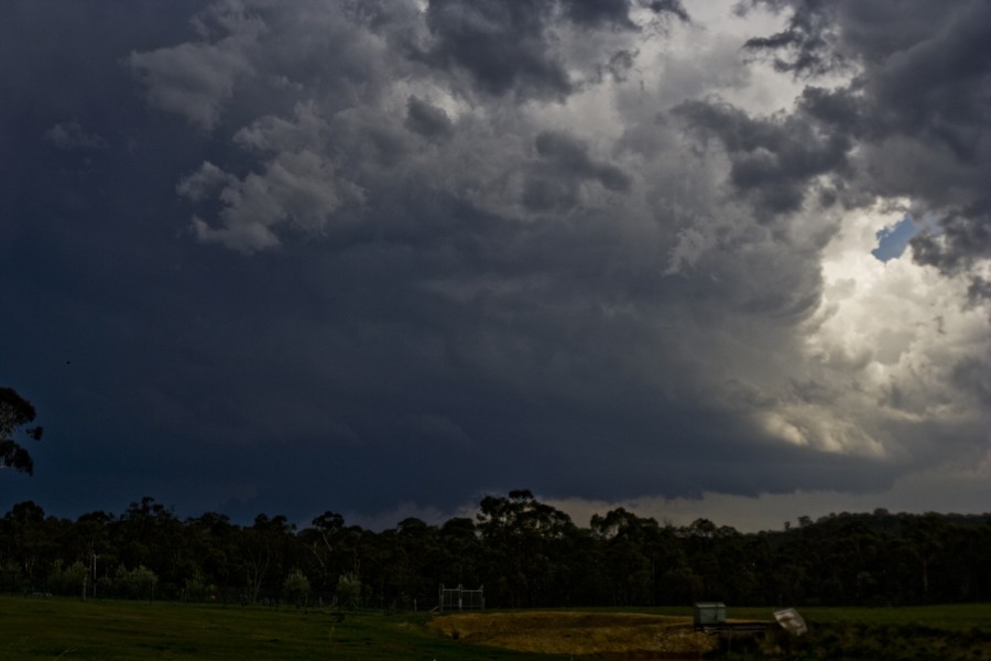
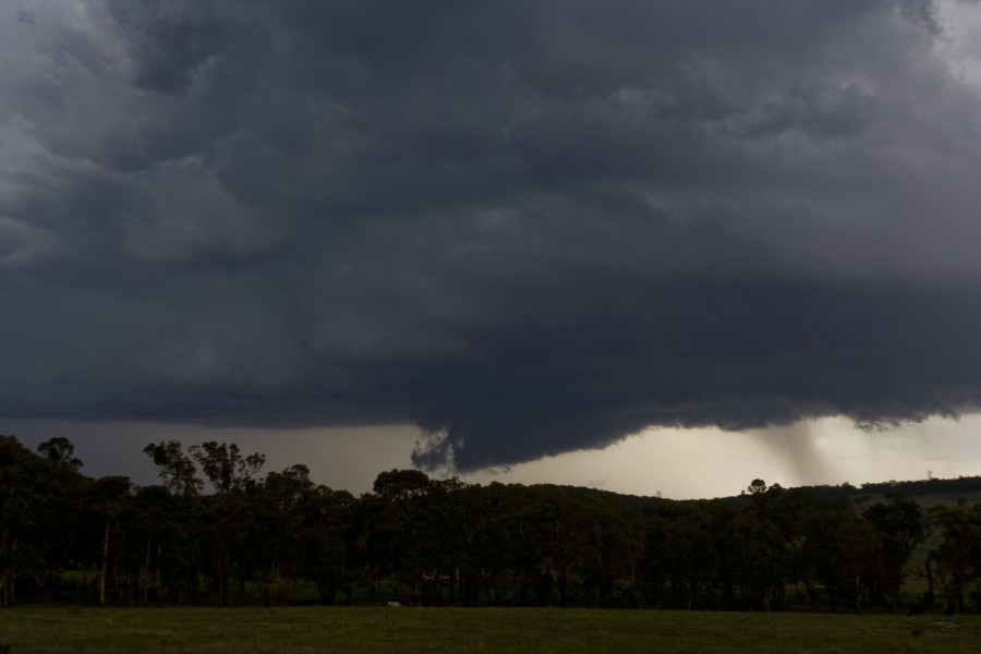
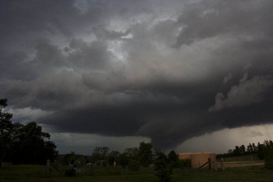
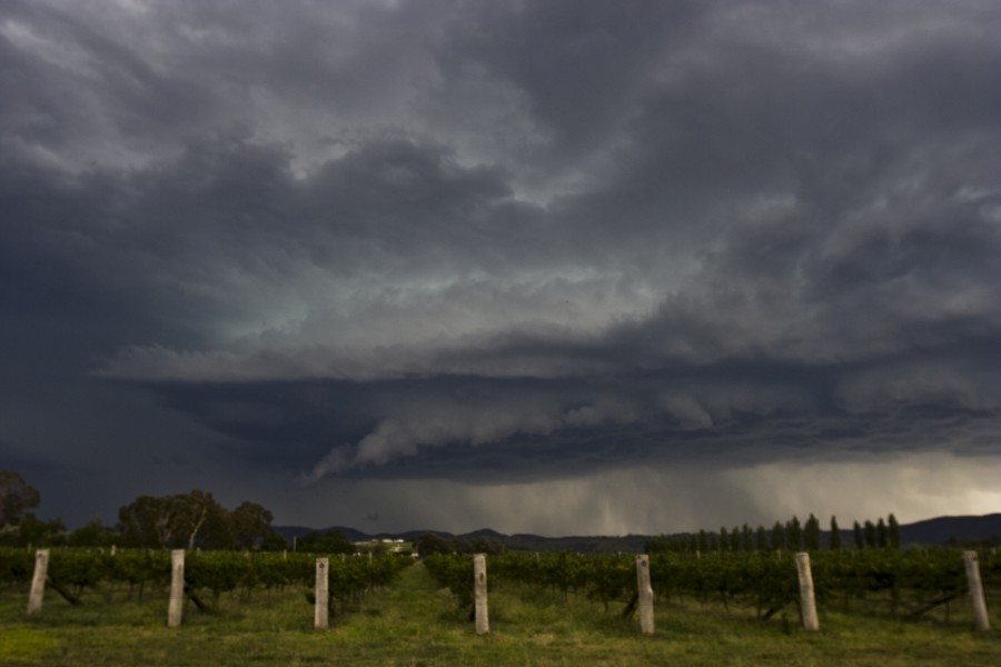
Low contrast wall cloud and supercell structure

I knew it! Supercell structure emerged but there were trees hindering my view. Finally an opportunity arose near Capertee. The cloud base was rather low and a wall cloud was visible but not the best contrast. I began to timelapse nevertheless. What was that sound? Huge drops of rain pelted down temporarily haulting the timelapse. I resumed further up the road when I realised the storm structure was still quite impressive and improving in contrast!


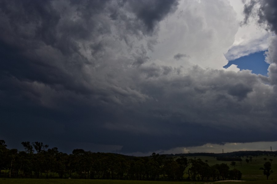
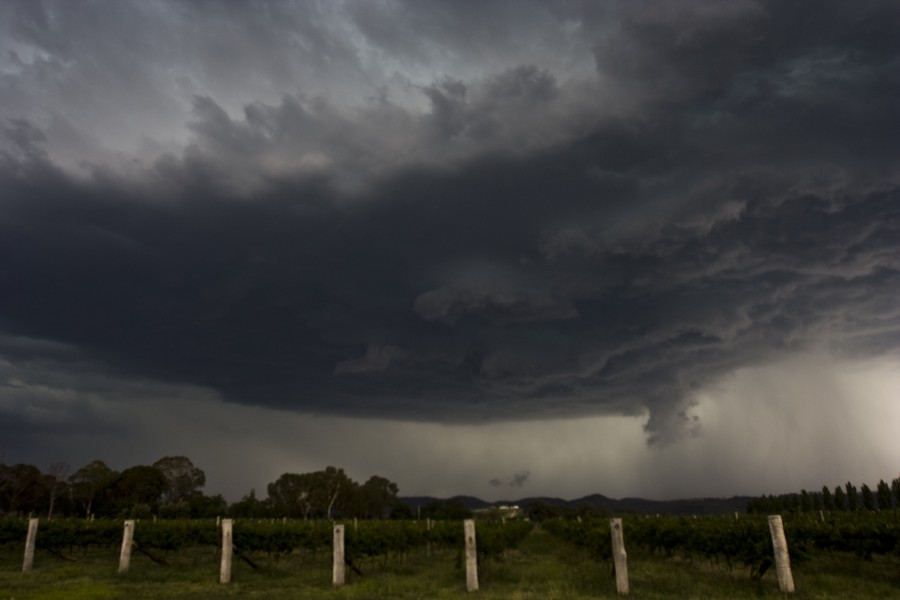
The structure was defintely a text book classic supercell wall cloud with inflow stinger! The base rotation was clearly visible in real time and now an RFD was also evident. Then a huge bolt and associated thunder! What seemed to be from nothing merge a hazy base - preciptation falling to its south. Another rather close bolt and thunder was sufficient warning to depart north.

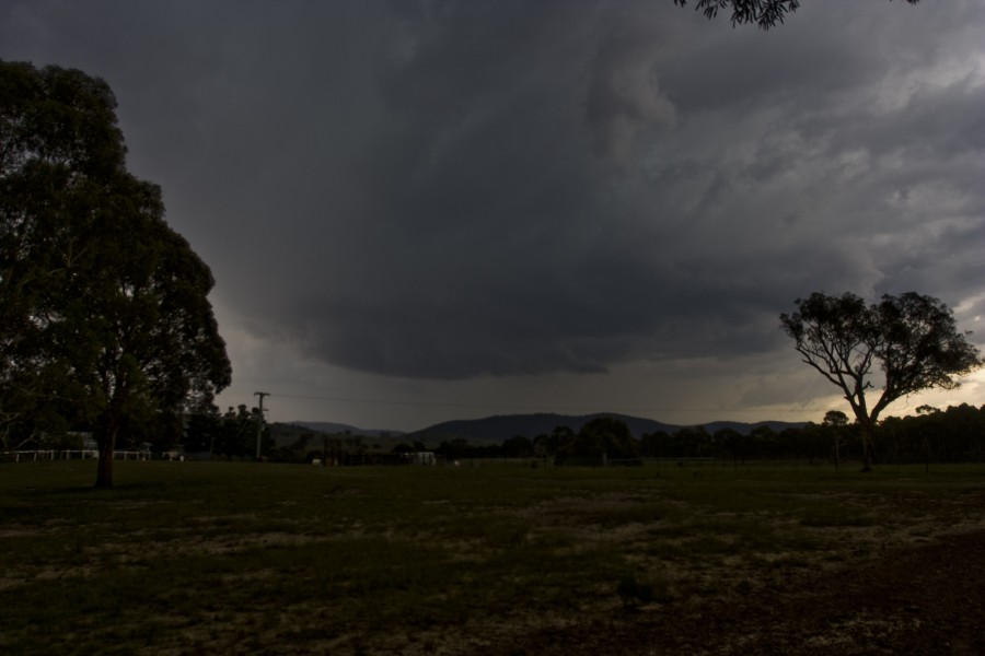
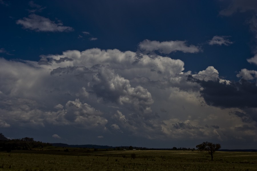
Next supercell developing

The 'small storm' much larger


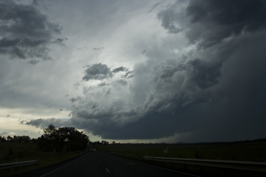
This storm rapidly developed and organised a base - and then later a wall cloud! To my northeast, the now not so small storm was also very well organised - nice separation between the base and precipitation. With rain iminent, I retreated back to ner Ilford. The storms although mature had amalgamated into a complex. I can't believe I had to let go three supercell cores in the quest of an isolated supercell.

Next supercell


Messy cores


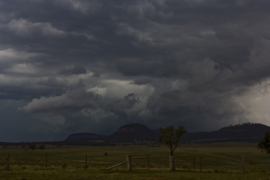
That isolated storm came into view near Mudgee. Nick Moir suggested to hear for the cell near Gulgong. Yes I know the one - the one with a massive back shear nuckle on its anvil - but was that an anvil above the anvil? With such a large base, I decided to remain with the Mudgee storm. It made for impressive timelapse. The lightning was very frequent! Not sure if this was a supercell though.
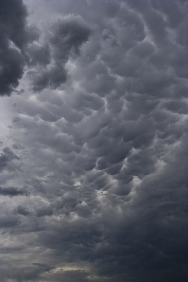

Mammatus


Severe storm near Mudgee


Entering the core was exciting not to mention the tree I saw blown over! Hail was intercepted with this storm east of Mudgee after  a couple of driving scans of the core and its downpour.

Tree that I saw fall as the microburst hit


Next stop - Gulgong with the possibility of intercepting the cell east of Mudgee. The cell looked quite impressive but was in a weakening phase. After some timelapse, I was alerted almost within quick succession of the cell approaching Merriwa (David and then Nick). I had made a quick dash for it but realising the time frame, I knew it was near impossible ( radar suggests that this was a wise move in hind sight as the storm weakened shortly after).

Gulgong storm


I passed through more hail immediately east of Mudgee - this time hail was of the order up to 1.5cm in diamater. Lightning and heavy rain occasionally interrupted my journey home ending a remarkable and rather intense chase day!

Regards,

Jimmy Deguara
« Last Edit: 28 January 2010, 07:44:04 PM by Jimmy Deguara »
-------------------------------------
Australian Severe Weather
www.australiasevereweather.com

Australian Thunderbolt Tours
www.thunderbolttours.com

Phone  0408 020468  (International :  61  2  408 020468)

Offline scottme

  • Multi-vortex F1
  • *
  • Posts: 37
  • Gender: Male
RE: NSW/SE QLD Severe storms and supercells : 25 - 29 January 2010
« Reply #9 on: 29 January 2010, 03:55:22 AM »

Wow, the soundings for Sydney, Newcastle and Nowra show large LI and CAPE and moderate shear. Might be even better than yesterday given surface temps >25 and some elevated heating!

Offline Mathew Townsend

  • Elephant Trunk F2
  • *
  • Posts: 151
  • Gender: Male
  • Watching storms since 1998
RE: NSW/SE QLD Severe storms and supercells : 25 - 29 January 2010
« Reply #10 on: 29 January 2010, 04:36:31 AM »
Yesterday action was crazy!! No photos because there so many lightning over Ballina to get the pictures. Skies was evil green!!

Given today soundings it looks horror for us. Li and CAPE values are pretty high between Sydney to southern Brisbane.

Offline Mike

  • Australian Severe Weather Moderators
  • Wedge tornado F5
  • *
  • Posts: 1,348
  • Gender: Male
  • Dry season here...boring!
    • http://StormscapesDarwin.com
RE: NSW/SE QLD Severe storms and supercells : 25 - 29 January 2010
« Reply #11 on: 29 January 2010, 12:51:42 PM »
No shortage of lightning active cells riding that trough through NSW and into the coastal regions...good luck to those chasing and look forward to those images and reports!  For my bit we're getting gravity waves pushing out squall lines 300km inland and moving north to Darwin then becoming severe warned for winds...we're chasing about 900km tomorrow as a dry slot should help things further afield for decent discreet storms!

Your structures in the photos always impress - I love 'em!

Darwin, Northern Territory.
StormscapesDarwin.com
Lightning Research 2010/14

Offline enak_12

  • Elephant Trunk F2
  • *
  • Posts: 153
  • Gender: Male
RE: NSW/SE QLD Severe storms and supercells : 25 - 29 January 2010
« Reply #12 on: 29 January 2010, 09:46:42 PM »
I made a drive to Grafton yesterday. Unfortunately the storms hugged the ranges to closely. I spotted this nice LP structure from the west side of town though..


Offline Michael Bath

  • storm chaser
  • Administrator
  • Wedge tornado F5
  • *
  • Posts: 1,602
  • Gender: Male
    • Australian Severe Weather
RE: NSW/SE QLD Severe storms and supercells : 25 - 29 January 2010
« Reply #13 on: 29 January 2010, 10:24:31 PM »
Was out on chase with Jason Paterson and Rodney Wallbridge late yesterday arvo and into the evening )28th Jan).

Storms were quite featureless for a while with anvil rain making things difficult. Lightning became very frequent towards dark with a shelf cloud forming on the outflow.

These photos all taken at on the outskirts of Casino


The winds picked up and the rain increased a little - as it does when the lightning is close!  The storm did look like it was dying for a short while then went nuts with CGs and the heavy rain for what seemed like ages. Many, many bolts hit right on top of us


This last one was taken in the car through the windscreen


We were hoping for some more shots later but the rain just persisted and the bolts became less visible amongst the rain and all the directions it was coming from.

Michael
Location: Mcleans Ridges, NSW Northern Rivers
Australian Severe Weather:   http://australiasevereweather.com/
Lightning Photography:   http://www.lightningphotography.com/
Early Warning Network: http://www.ewn.com.au
Contact: Michael Bath

Offline TroyVR

  • Elephant Trunk F2
  • *
  • Posts: 113
  • Gender: Male
  • B.O.M Storm Spotter
RE: NSW/SE QLD Severe storms and supercells : 25 - 29 January 2010
« Reply #14 on: 30 January 2010, 01:32:20 AM »
Chase Report 28/1/2010

After receiving EWN warning of potential damaging storm in the sutherland area i went out to investigate but was a let down, plenty of thunder, but mainly intracloud lightning, no real visible cloud structure and some moderate rainfall. Nothing worth taking pictures of unfortunetly.