Author Topic: Severe Thunderstorms SE QLD and NSW 14 - 18 January 2010  (Read 33281 times)

0 Members and 1 Guest are viewing this topic.

Offline Clayton

  • Multi-vortex F1
  • *
  • Posts: 48
  • Gender: Male
Severe Thunderstorms SE QLD and NSW 14 - 18 January 2010
« on: 15 January 2010, 02:45:24 AM »
Hey
This may be a bit early but there is potential for some severe storms Monday in SE Qld and NE NSW. Will keep you posted.

Clayton
« Last Edit: 15 January 2010, 02:50:41 AM by Jimmy Deguara »

Offline Macca

  • Elephant Trunk F2
  • *
  • Posts: 171
RE: Severe Thunderstorms SE QLD and NSW 14 - 18 January 2010
« Reply #1 on: 15 January 2010, 05:07:09 AM »
This is shaping up as one of the best systems I've seen for a number of years.  The last similar prolonged slow moving system like this was Dec 7th/8th 2004 so quite a long time ago. 

Storms have been occuring in NSW for quite a few days now but that activity should contract to the NE quarter of the state (and coastal areas as far south as Canberra) by Sunday with SEQ/NE NSW being the focus for Monday and Tuesday.  Monday and Tuesday have some real potential although with these days being 4 and 5 days out they are subject to change.

Will definitely be keeping a close eye on this one.

Cheers,

Macca

Offline Michael Bath

  • storm chaser
  • Administrator
  • Wedge tornado F5
  • *
  • Posts: 1,602
  • Gender: Male
    • Australian Severe Weather
RE: Severe Thunderstorms SE QLD and NSW 14 - 18 January 2010
« Reply #2 on: 15 January 2010, 11:33:05 AM »
Have adjusted the dates of this thread to start today given the NTs action:

Jimmy just phoned to report on the cell which is now just south of Armidale. He encountered 2-3cm hail about 10ks N of Walcha and damaging winds nearby. The lightning and storm structure is very impressive too - could tell he was excited :)
Location: Mcleans Ridges, NSW Northern Rivers
Australian Severe Weather:   http://australiasevereweather.com/
Lightning Photography:   http://www.lightningphotography.com/
Early Warning Network: http://www.ewn.com.au
Contact: Michael Bath

Offline DanTheMan

  • Rope Tornado F0
  • *
  • Posts: 18
  • Gender: Male
RE: Severe Thunderstorms SE QLD and NSW 14 - 18 January 2010
« Reply #3 on: 15 January 2010, 04:03:04 PM »
Shame that 12z CAPE chart you posted didn't stay as colourful! Still looks to be a great setup though, will be doing a fair bit of driving by the looks of things!
Ill be off towards the border Sunday so hopefully I bump into some other chasers.
« Last Edit: 16 January 2010, 01:07:00 PM by Jimmy Deguara »

Offline Clayton

  • Multi-vortex F1
  • *
  • Posts: 48
  • Gender: Male
RE: Severe Thunderstorms SE QLD and NSW 14 - 18 January 2010
« Reply #4 on: 15 January 2010, 05:25:51 PM »
Hey

Looking at the latest forecast and the main storm day looks to have changed to Sunday, mostly due to the trough passing and a dry line coming through
Hopefully it will change and we will be able to see some storms on Monday and if we do they will most likely be very fast moving and head to the coast quickly.

Great to hear that someone was on the Armidale storm hope to see some great pics Jimmy.

By the way I'll be out there chasing on Sunday and hopefully Monday

Clayton
« Last Edit: 16 January 2010, 01:26:11 PM by Jimmy Deguara »

Offline Clayton

  • Multi-vortex F1
  • *
  • Posts: 48
  • Gender: Male
RE: Severe Thunderstorms SE QLD and NSW 14 - 18 January 2010
« Reply #5 on: 16 January 2010, 07:39:57 AM »
Hey

Looking at the forecast for Sunday I am liking the look of the Northern Tablelands around Armidale.
Good Cape and Shear is strong. Does anybody else agree?

I was thinking that storms may be better than ones that form elsewhere due to the stronger overall shear and higher cape.
Monday is looking questionable as they may form but they will move very fast and quickly end up out to sea.
Still waiting on the later forecasts to see how it turns out.

Clayton

Offline Jimmy Deguara

  • Australian and Tornado Alley storm chaser
  • Administrator
  • Wedge tornado F5
  • *
  • Posts: 2,218
  • Gender: Male
  • Storm Chaser since 1993, Tornado Alley 2001
    • Australia Severe Weather
RE: Severe Thunderstorms SE QLD and NSW 14 - 18 January 2010
« Reply #6 on: 16 January 2010, 04:59:08 PM »
Hi guys,

Been a busy day and finally am able to write the report for this day.

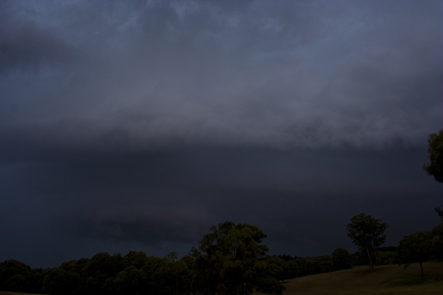
Chase Report 14th January 2010 - Walcha region, Northern Tablelands

The conditions on this day were anticipated to be unstable but with relatively weak upper level support. Moist air was expected to persist over the ranges. My thoughts were that storms would head north and contain lightning. When I got there I was rather disappointed!

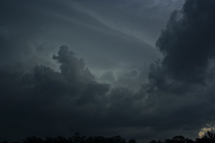
Storms had begun to develop and looked rather weak and I thought it was simply a day of numerous storms. Two cells consolidated to the west with the southern one organising first and moving south. No roads there and it seemed the northern was developing a soft base and backbuilding west. There was a road towards Tamworth that headed west - a good road option. Perhaps 10 to 15km west, I noticed and photographed some interesting structure but the further west I headed just heavy rain and lack of structure.


Finally back east I returned to see if the structure was still there. It wasn't! This day was going to be a up and down with brief maturity of cells! I called Michael to see if he could see these cells and they were definitely active in terms of lightning though not really visible on radar. I simply had to act virtually alone.

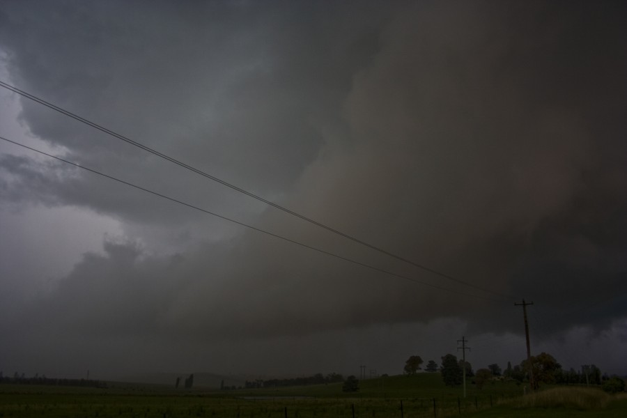
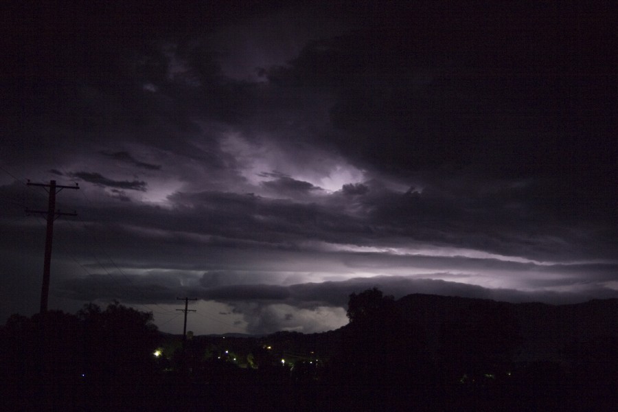
I simply headed north to see what other cells may have been developing. Past the rain and WHAT THE!! I was in disbelief - the original storm had begun a northerly track and gained - "supercellular characteristics". I found the first available stop to shoot timelapse. Bolts were already ripping from the updraft and anvil. Inflow streaming in from the ground into the updraft. A ground hugger - I could barely see the base. This was bloody awesome. I had to control my nerves to feel reality! I mean weak wind shear was producing THIS! A green tinge began to show as the updraft consolidated and was now clearly rotating. The bolts were so frequent and pulsing that long I was able to photograph a few.


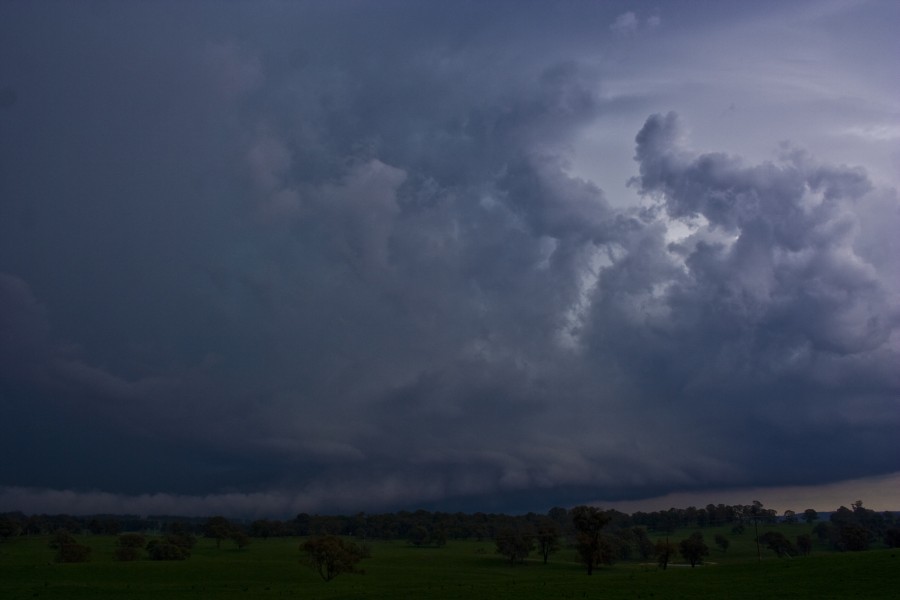
Further north, after a relatively brief period of inactivity, it was now the frequent powerful pulsating bolts that alerted me stop once more. The storm was trying to re-organise on the northern end. The structure was still evident though I was relatively closer.  


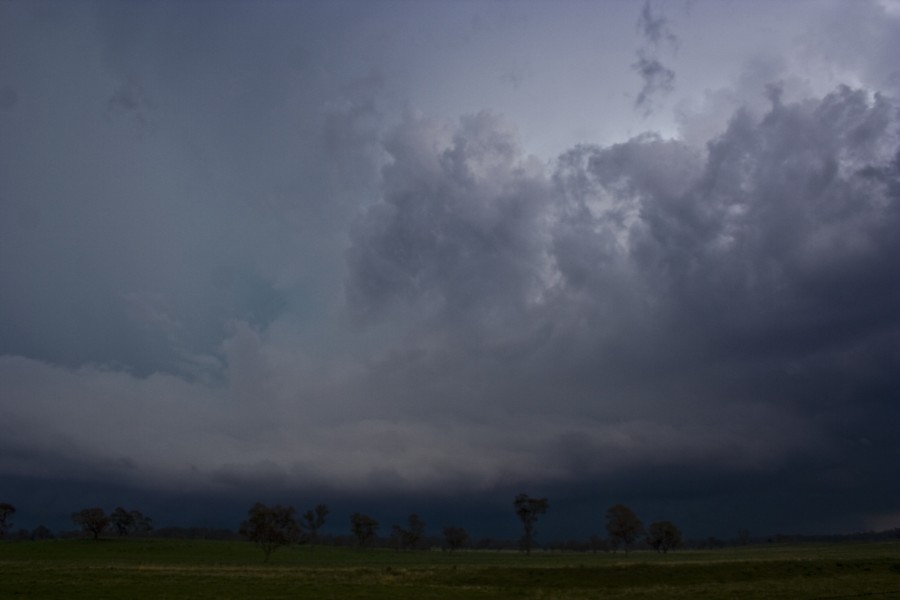
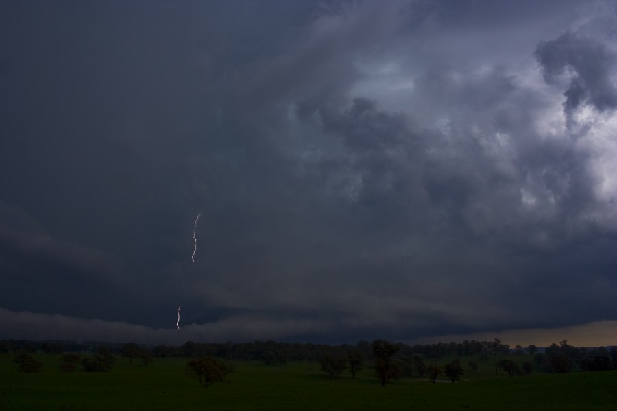
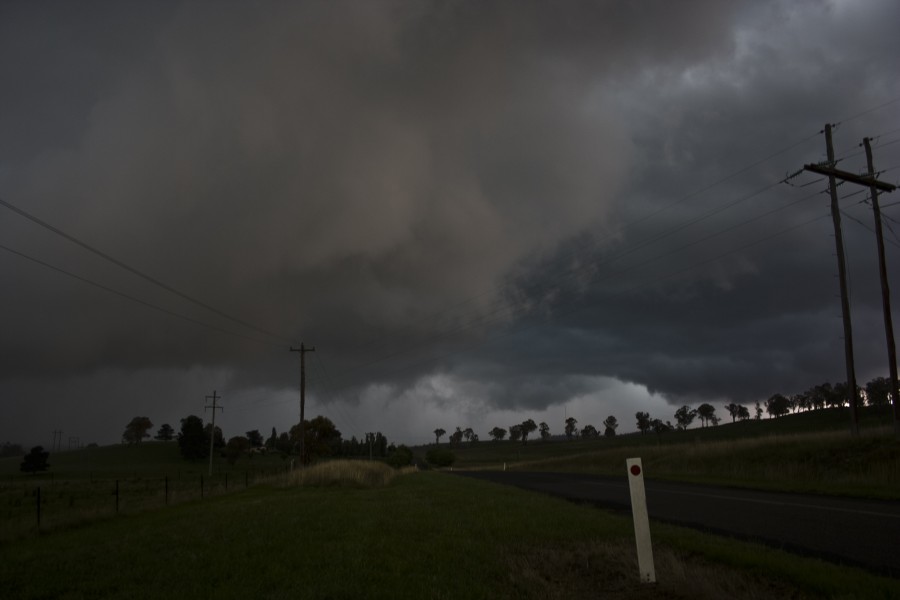
My focus turned to the emerging base - at first it seemed like a shelf cloud.


But when the whole structure revealed itself, it was showing signs of rotation. Time for timelapse. The base was so low and it was rather dark. Lightning was drawing near. The end of the tape seemed to coincide with light rain.


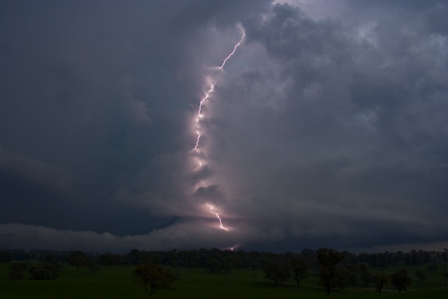
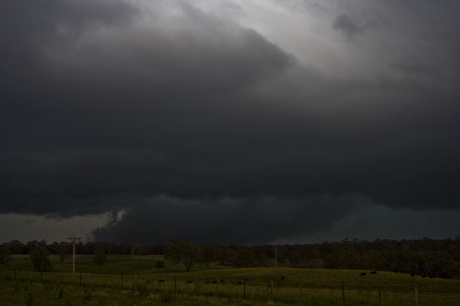
Next stop with new tape rolling - right under the base north of Walcha. Bolts were dangerously close and rather frequent. Close was understatement - one bolt with almost instantaneous thunder deafended me! I pratically s--t myself! I turned the car around a little and a bolt hit the powerline with a spark explosion. Another explosion occurred in the powerlines on the nearby field. My mind began to ponder thoughts of the car being struck.


The rain curtain finally closed in and the bolts moved northeast so I made my way north - to sample the core. I was met by violent winds and blinding rain. The road's centre line was barely visible! Debri littered the road in patches - evidence of powerful gusts. A tree further along caused chaos as cars stopped - others including myself manouvering around them. Hailstones with diameter of 2 to 3cm rattling the aerial and unsettling car panels. Rain and hail was driven horizontally. Visibility was so poor that I had little time and no choice but to drive over a small branch. In fact driving further north was dangerous of hydro-planing so I proceeded with care. The intention was to get the storm east of Armidale - but the storm seemed to weaken from outflow confirmed by Michael

After pondering what to do next and whether to head back home - not another a 1am arrival. A severe thunderstorm warning came through and Michael confirmed that a cell was situated near Gunnedah heading northeast. Heading to Tamworth would place me in position to this cell depsite the risk of it dissipating. What more evidence do I need now to stay overnight!

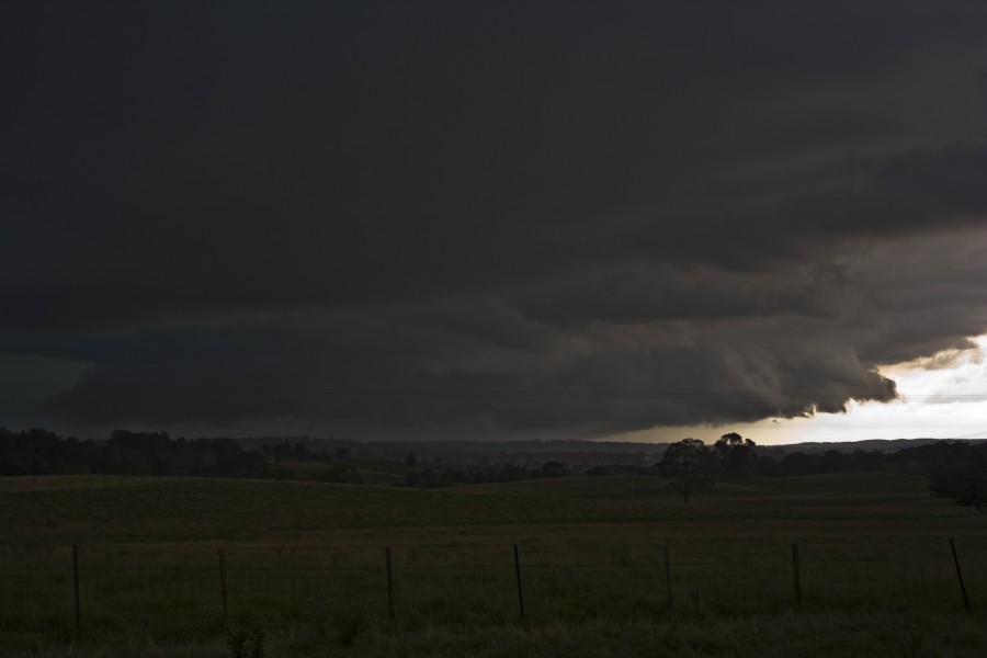
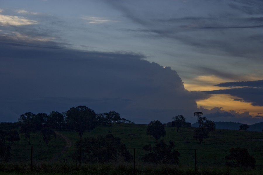
The cell came into view as I made my way towards the last descent off the Northern Tablelands. It had rounded top to a leaning updraft - anvil streaming southeast. Based on its perspective the storm was headed on a track north of Tamworth.


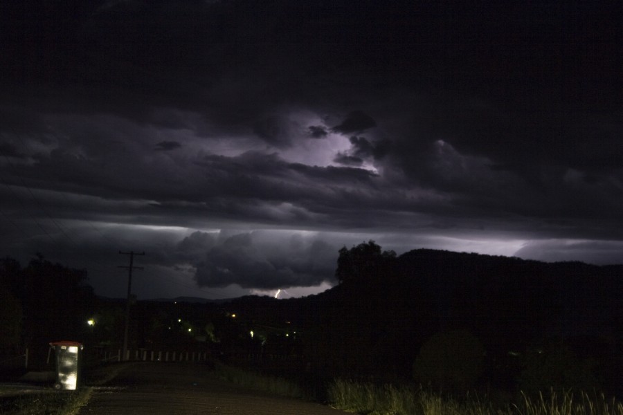
It was about 7:30 in the evening - I did not feel like making the treck to Manilla. But I just had to see if there was some interesting structure given the inflow. The storm was rather lightning active. However, by the time I got to Manilla - you guessed it - it was in a weakening phase! Taking pictures with dogs barking around the place and pure darkness just did not make it an attractive prospect. I was hungry and also needed to get accommodation anyway. Lucky this was just prior to the Tamworth Country Music Festival. The road to Tamworth showed some very nice anvil crawlers becoming less frequent. By the time I was in Tamworth, lighning seemed to cease altogether with only distant flashes.


This was another surprising day - incredible structure and some awesome opportunities to photograph and video. It took me some time to crash out - not until I browsed that footage. Suddenly the disappointment of the worst start to a storm season in storm chasing history seemed to fade away - lost in the past.

Regards,

Jimmy Deguara
« Last Edit: 16 January 2010, 05:27:11 PM by Jimmy Deguara »
-------------------------------------
Australian Severe Weather
www.australiasevereweather.com

Australian Thunderbolt Tours
www.thunderbolttours.com

Phone  0408 020468  (International :  61  2  408 020468)

Offline Jason(pato)

  • Elephant Trunk F2
  • *
  • Posts: 136
  • Gender: Male
RE: Severe Thunderstorms SE QLD and NSW 14 - 18 January 2010
« Reply #7 on: 17 January 2010, 03:36:49 AM »
A little bit disappointed with this mornings 00z run from GFS for Sunday. It has scaled back the shear in the lowers a bit for our region. CAPE still looks pretty good (around 1700) and LI's are still nice too (-5). There is a CAP in place, which has had me a bit concerned from the start, but with forecast temps set to reach 34 deg at Casino it should be overcome hopefully. Looking at the forecast sounding for Sunday it has the temp and DP lines closing in on each other moreso than previous runs. Whether this will result in cloud cover remains to be seen (its apparent for 03z as well). Anyway we'll see what happens and all things aside its just good to be talking about possible stormage in our region, which has otherwise been a lacklustre season so far.

BTW great stuff Jimmy good to see someone able to get out there and document storms in other parts of state. Hopefully us guys in the NR's will have something to share with everybody come Monday morning  ;)
South Lismore, Northern Rivers NSW.....Supercells are us!!

Offline Brad Hannon

  • Thunderbolt Tours Group
  • Stove pipe F3
  • ******
  • Posts: 427
  • Gender: Male
  • Colorado Beast - 2nd June 2005
RE: Severe Thunderstorms SE QLD and NSW 14 - 18 January 2010
« Reply #8 on: 17 January 2010, 03:39:25 AM »
Wow Jimmy, your post is a great read.  Thanks for the summary.  Awesome ground hugger and incredible base features as you described!
hmmm June 2nd......

Offline Clayton

  • Multi-vortex F1
  • *
  • Posts: 48
  • Gender: Male
RE: Severe Thunderstorms SE QLD and NSW 14 - 18 January 2010
« Reply #9 on: 17 January 2010, 03:43:08 AM »
Hey Everyone

Just had a look at the 18z Run for Sunday at 4pm.
The models have definitely picked up overnight and it looks promising but don't want to get to excited.


CAPE is into the mid to high 2000 and shear is passable.
Looks as if it would be situated in the Northern Rivers around Casino area and maybe into the SE QLD. Still a bit early to know for sure.


Awesome Photos Jimmy glad someone was there what an unexpected storm in those conditions.


Clayton
« Last Edit: 17 January 2010, 03:48:54 AM by Clayton »

Offline pingtang

  • Multi-vortex F1
  • *
  • Posts: 70
  • Gender: Male
    • Southcoastweather
RE: Severe Thunderstorms SE QLD and NSW 14 - 18 January 2010
« Reply #10 on: 17 January 2010, 05:29:21 PM »
Today turned out to be a great chase!!! Realising how weak the shear was this morning,myself and Lightning Chaser decided to take on Goulburn. We met up with Michael Thompson, Grinch , and CanonCloud at Marulan. Here we got onto a very CG active but otherwise unexciting storm. Numerous bolts were pulsing however they were quite distant. Eventually the rain and outflow forced us to abandon this storm. We stopped in the heart of Marulan to discuss our next chase options when a 200metre flang hit just up the road. This motivated me to pull the video camera but unfortunately that was the last of the bolts. Next we drove down to the abbatior at Goulburn where we witnessed more CGs which were frequent at times but not close. Some of the structure NE of Goulburn was interesting as well with plenty of scud getting sucked up into the base. At about this time, we noticed the shear had picked up considerably compared to the morning. Seeing an especially nice updraft to the north, saw us driving to the very northern outskirts of Goulburn. During this drive CGs became freqent enough to get the video camera out, luckily I was rewarded with a CRAZY staccato which hit 3kms up the road with great contrast!!!! This storm produced nothing apart from a few more CGs which Lightning chaser nailed on video.

Checking the lightning tracker on the laptop we were excited to see a strong line developing to our southwest. The strongest cell appeared to be heading for Tarago, so off we went. Eventually this line came into view with the western and southwestern horizon getting darker with occasional CG. In Tarago itself we found a hill that had good views to the west. Here the storm was looking quite organised with healthy inflow bands feeding into it,and even a mid level funnel at one brief stage. Eventually a nice guster became apparent to the west, however this didnt look special at first as it was quite distant. CGs were less active compared to earlier in the day unfortunately. Rain from a nearby and totally unrelated cell had us considering a move but we stuck it out, and were rewarded with an amazing rapidly rotating guster that pumped out a couple of massive staccatos. The rain even stopped completely for about two minutes when the best structure was available!!!! As it moved overhead we were hit with outflow winds estimated at 70-80km/hr. With no other option we core punched it heading to Goulburn encountering torrential rain and several close strikes. Hail was dissapointing small, only about 2cms. We encountered a few more nice CGs near Goulburn, but the storm was quickly weakening. After grabbing maccas we headed for home.


Heres a short video clip from today

awesome guster


Offline Jimmy Deguara

  • Australian and Tornado Alley storm chaser
  • Administrator
  • Wedge tornado F5
  • *
  • Posts: 2,218
  • Gender: Male
  • Storm Chaser since 1993, Tornado Alley 2001
    • Australia Severe Weather
RE: Severe Thunderstorms SE QLD and NSW 14 - 18 January 2010
« Reply #11 on: 18 January 2010, 03:10:29 AM »
Nice action there guys! Glad you had an enjoyble chase and some nice structure! Great consolidated shelf cloud.

Chase Report Cowra Grenfell and Bathurst 16th January 2010

Not much excitement for me really today.

Earlier convection of the storm near Portland


I attempted to get to the very large storms out west but once I got to Grenfell, it was clear they were already embedded in cold outflow!

Developing cumulus SW of Bathurst


Ahhhh! Dust... time to turn around


I hate these situations and made an effort to go northeast but the gusts were catching up. So I made my way briskly towards Cowra once more to get into better cumulus fields building on the higher terrain. This was when the chase began.

The cumulus that had quietyly develop towards the east rapidly developed and organised dumping rain.


It seemed this may have been developing in response to the upper trough - increasing lighning and anvil streaming over. But my excitement of a very spectacular storm was short lived once I knew the line from Grenfell and Cowra had caught up and overtaken the line. The cores quickly became embedded towards the back with the lightning. Still I filmed a nice gurst front close to the ground for timelapse. Some intense pulsing bolts were now embedded in this cell. I suspect with the cool outflow there was hail in these cells.


Heading further east, Bathurst provided some brief excitement when I stopped for a look at the approaching gust front. A loud thunder deafended my from behind me - scary stuff. A developing shower had formed to the northeast. This simply developed rapidly and dumped some intense precipitation just north of Bathurst.


Whilst making a turn and moving down the road in Bathurst a massive flash brightly lit behind me with an instantaneous deafening bang! My head shook - it was most likely from the anvil!

I turned towards Sofala and it took me to nearing Sofala before I was ahead of the gust front.


This provided some artistic opportunities and to relax a little. Once I made Ilford, the sunset provided some scenery and I missed a nice chaotic anvil crawler on camera in between pressing the camera button! I got so close to kicking the tripod!

Even whilst I passed through the rain, occasional bolts and anvil crawler would light up the side window just to tease. Home I went.

Regards,

Jimmy Deguara
-------------------------------------
Australian Severe Weather
www.australiasevereweather.com

Australian Thunderbolt Tours
www.thunderbolttours.com

Phone  0408 020468  (International :  61  2  408 020468)

Offline Michael Thompson

  • Multi-vortex F1
  • *
  • Posts: 57
RE: Severe Thunderstorms SE QLD and NSW 14 - 18 January 2010
« Reply #12 on: 18 January 2010, 03:13:05 AM »
A video from the 16th at Tarago. If you watch in the HQ size you may be able to pick up the rotation in the rare bits I have the camera still

Severe storm Tarago, NSW 16th Janaury 2010


Offline Mathew Townsend

  • Elephant Trunk F2
  • *
  • Posts: 151
  • Gender: Male
  • Watching storms since 1998
RE: Severe Thunderstorms SE QLD and NSW 14 - 18 January 2010
« Reply #13 on: 18 January 2010, 05:25:30 AM »
Thanks Jimmy.

Looks rather interesting today but i wouldn't write off yet. Theres a possibility for those thunderstorms to be severe.

One question, why BoM not plotting any rainfall for us today? They forecasted 'showers and thunderstorms' as usual but without precipitation?

Mathew
« Last Edit: 18 January 2010, 05:42:38 AM by Jimmy Deguara »

Offline Michael Thompson

  • Multi-vortex F1
  • *
  • Posts: 57
RE: Severe Thunderstorms SE QLD and NSW 14 - 18 January 2010
« Reply #14 on: 18 January 2010, 12:44:17 PM »
Some more footage from Goulburn yesterday, some timelapse of scud movement and a couple of nice lightning strikes.

Timelapse and lightning, storm near Goulburn, 16th January 2010

Some stills of the strikes