Author Topic: SE Qld / NE NSW Severe Storm Potential 15th October 2011  (Read 34995 times)

0 Members and 1 Guest are viewing this topic.

Offline Jeff Brislane

  • Global Moderator
  • Multi-vortex F1
  • *
  • Posts: 36
  • Gender: Male
SE Qld / NE NSW Severe Storm Potential 15th October 2011
« on: 15 October 2011, 08:36:59 AM »
Hi all,

I'll get straight to the point, tomorrow looks set to be a whopper of a day for South East Qld with the potential for a large hail supercell outbreak! I'm really impressed by the forcast and i'm seriously considering driving up there tonight! If anyones driving up from sydney let me know.

So far the forcast is indicating -8 Lifted index, around 2000-2500 CAPE, plebnty of turning wind shear and a nice dry slot in the upper levels. Batten down the hatches in Brisbane area tomorrow.

Jeff.

Offline Michael Thompson

  • Multi-vortex F1
  • *
  • Posts: 57
Re: SE Qld / NE NSW Severe Storm Potential 15th October 2011
« Reply #1 on: 16 October 2011, 04:51:19 AM »
Hi all,

I'll get straight to the point, tomorrow looks set to be a whopper of a day for South East Qld with the potential for a large hail supercell outbreak! I'm really impressed by the forcast and i'm seriously considering driving up there tonight! If anyones driving up from sydney let me know.

So far the forcast is indicating -8 Lifted index, around 2000-2500 CAPE, plebnty of turning wind shear and a nice dry slot in the upper levels. Batten down the hatches in Brisbane area tomorrow.

Jeff.

I'd be there in a flash if work, family, petrol, time where not an issue. I agree hailers are certain. Reminds me of 19th October 2004.

Offline Macca

  • Elephant Trunk F2
  • *
  • Posts: 171
Re: SE Qld / NE NSW Severe Storm Potential 15th October 2011
« Reply #2 on: 16 October 2011, 05:05:11 AM »
Certainly shaping up for a nice day up this way today.  I'm heading out and chasing to the north of Brisbane today.  Not exactly sure yet but I like the area which MT suggested on the other fourm of Childers/Bundy but I also like the area around Gympie (not ideal for chasing). Shear is pretty nice and the atmosphere will rapidly destabilise over the next 4-6hrs. 

Will keep you guys posted.

Macca

Offline Jeff Brislane

  • Global Moderator
  • Multi-vortex F1
  • *
  • Posts: 36
  • Gender: Male
Re: SE Qld / NE NSW Severe Storm Potential 15th October 2011
« Reply #3 on: 16 October 2011, 10:21:54 AM »
Things seem to be panning out a bit further south initially than the models were suggesting yesterday. There appears to  be two potential supercells along the border ranges, a larger high precipitation looking cell south of a line west of Kyogle and a more discrete cell north of Nimbin. If things go according to the models than more severe cells should initiate on the northern side of the line currently heading east towards the Gold Coast and north Brisbane and the sunshine coast hinterland should be in for lots of activity over the next few hours.

Offline Jeff Brislane

  • Global Moderator
  • Multi-vortex F1
  • *
  • Posts: 36
  • Gender: Male
Re: SE Qld / NE NSW Severe Storm Potential 15th October 2011
« Reply #4 on: 16 October 2011, 10:23:49 AM »
I should clarify that the current severe looking cells are on the NSW side of the border ranges.

Offline Karina Roberts (slavegirl)

  • Multi-vortex F1
  • *
  • Posts: 84
  • Gender: Female
Re: SE Qld / NE NSW Severe Storm Potential 15th October 2011
« Reply #5 on: 16 October 2011, 03:10:09 PM »
will post pics up as soon as i get them off my camera, out here at Canugra we got a nice wild storm.. had hail mostly pea sized with a few larger stones (about cherry tomato size) strong wind and lots of close lightning.
The only difference between tattooed people and non-tattooed people is that tattooed people don't care that your not tattooed. - Wildfire tattoos

Offline Colin Maitland

  • Barrel tornado F4
  • *
  • Posts: 614
  • Gender: Male
Re: SE Qld / NE NSW Severe Storm Potential 15th October 2011
« Reply #6 on: 16 October 2011, 03:52:14 PM »
Just a few shots of today's supercell.


Offline Colin Maitland

  • Barrel tornado F4
  • *
  • Posts: 614
  • Gender: Male
Re: SE Qld / NE NSW Severe Storm Potential 15th October 2011
« Reply #7 on: 16 October 2011, 03:54:32 PM »
Then came the hail, still working on the photos so I can post them. What an afternoon.


Fortunately we were on the tail end of the storm.

Offline Paul D

  • Multi-vortex F1
  • *
  • Posts: 90
  • Gender: Male
Re: SE Qld / NE NSW Severe Storm Potential 15th October 2011
« Reply #8 on: 16 October 2011, 06:50:05 PM »
observed a couple of the storms Nth of Bris this arvo

Caboulture storm after it appears to split, left split inflow at 4:50pm app


Bellthorpe storm 4-55pm app

This storm seemed to get organised for a brief period and produced at the very least a funnel for app 1 minute before disapating
-5:01pm app video shot with funnel inprogress

I'll try and get the vid contrasted a bit and see what is visible.
And a bit after a shot from my missus


Paul D

Offline Michael Bath

  • storm chaser
  • Administrator
  • Wedge tornado F5
  • *
  • Posts: 1,602
  • Gender: Male
    • Australian Severe Weather
Re: SE Qld / NE NSW Severe Storm Potential 15th October 2011
« Reply #9 on: 17 October 2011, 03:51:13 AM »
Jason Paterson and I chased yesterday though didn't go too far. Spent most of the afternoon just north of Casino. Local cumulus blocked developing storms for a while then the contrast was pretty terrible but it eventually become better by mid-afternoon.

A storm developed near Tabulam and other activity NW of Kyogle.
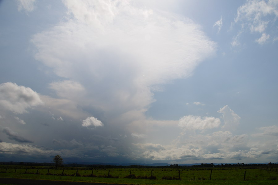


They struggled for moisture at first but then took off with solid high tops - though the windshear really didn't help them develop further locally. Looks like the forecast wind shear profile did not eventuate.
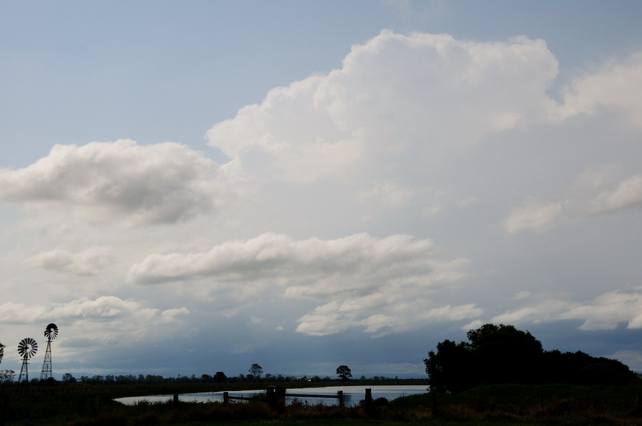
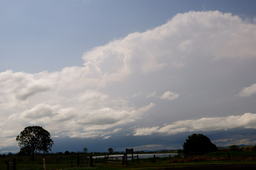
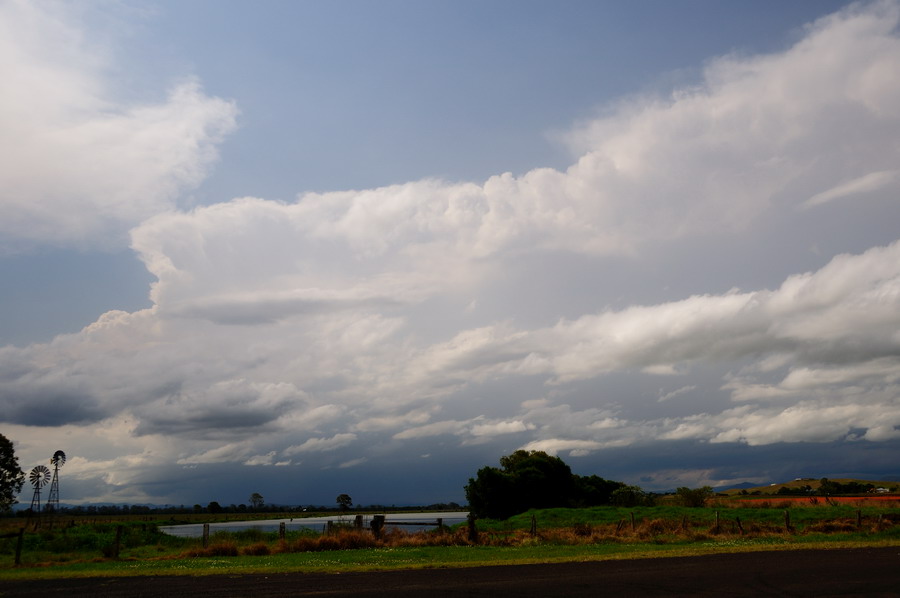
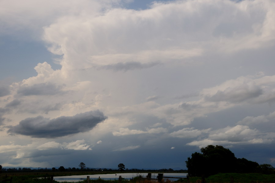


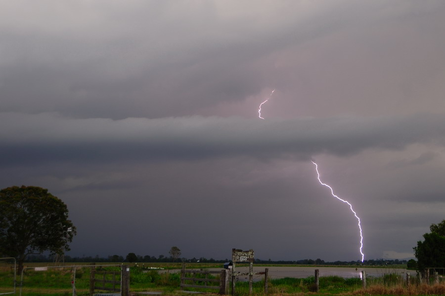
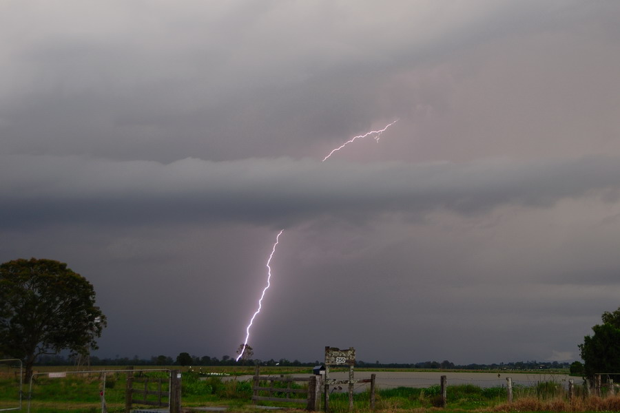
We met up with Bec Armatyge and enjoyed a barrage of CGs from the blob of storms over the far NW of the Northern Rivers / NE part of Northern Tablelands.

These were taken with a lightning trigger.
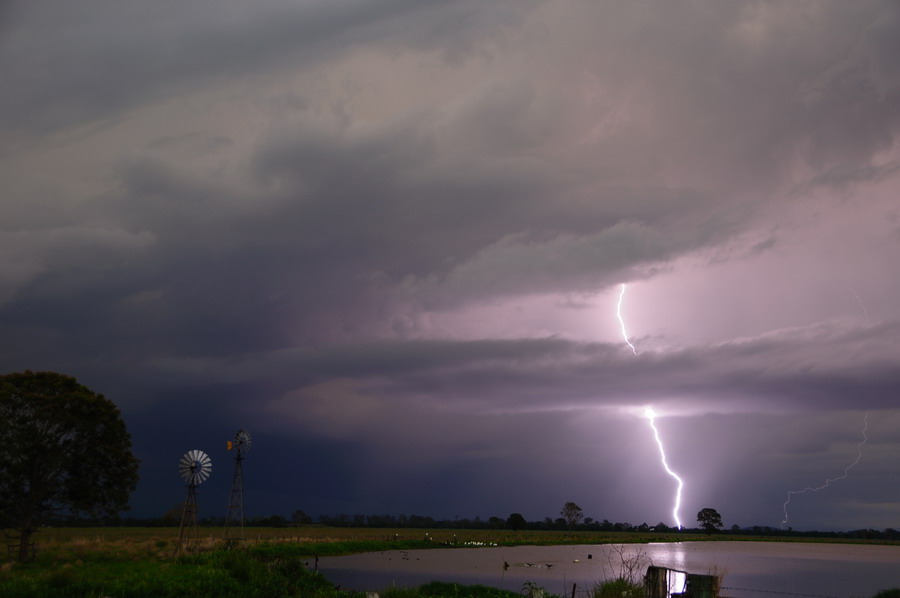


Would have been nice to get some hail too, but not to be.

MB
Location: Mcleans Ridges, NSW Northern Rivers
Australian Severe Weather:   http://australiasevereweather.com/
Lightning Photography:   http://www.lightningphotography.com/
Early Warning Network: http://www.ewn.com.au
Contact: Michael Bath

Offline Colin Maitland

  • Barrel tornado F4
  • *
  • Posts: 614
  • Gender: Male
Re: SE Qld / NE NSW Severe Storm Potential 15th October 2011
« Reply #10 on: 17 October 2011, 06:01:00 AM »
This would have to be the best shot of yesterdays storm I have seen, as I said earlier we had some good rotation within the cell over Bracken Ridge as it approached Moreton Bay.

The photo is by Tracy King courtesy of the Courier Mail,


Col

Offline Michael Bath

  • storm chaser
  • Administrator
  • Wedge tornado F5
  • *
  • Posts: 1,602
  • Gender: Male
    • Australian Severe Weather
Re: SE Qld / NE NSW Severe Storm Potential 15th October 2011
« Reply #11 on: 17 October 2011, 06:35:13 AM »
The webcams got a great show across the region:

http://webcams.bsch.au.com/gallery/20111015.html

Looks like you got the biggest hail Col - nice :)
Location: Mcleans Ridges, NSW Northern Rivers
Australian Severe Weather:   http://australiasevereweather.com/
Lightning Photography:   http://www.lightningphotography.com/
Early Warning Network: http://www.ewn.com.au
Contact: Michael Bath

Offline Steven

  • Global Moderator
  • Stove pipe F3
  • *
  • Posts: 410
  • Gender: Male
Re: SE Qld / NE NSW Severe Storm Potential 15th October 2011
« Reply #12 on: 17 October 2011, 08:11:43 AM »
Having kept an eye on a cell to the south, I ducked outside to take the first photograph which showed some impressive structure of the Caboolture/Bribie Island cell.


From then on I moved location so I could get in a better spot to take photos. A new storm was rapidly approaching from the SW, but just as it was about to hit, it weakened slightly and nudged south, so all we got from it were brief gusts of wind and large rain drops.


This little guster came over about 25 minutes later from a new cell.


Soon after we were beset by heavy rain and squally winds by the newer cell. I managed to take perhaps my first semi-decent lightning shot.


Offline Karina Roberts (slavegirl)

  • Multi-vortex F1
  • *
  • Posts: 84
  • Gender: Female
Re: SE Qld / NE NSW Severe Storm Potential 15th October 2011
« Reply #13 on: 17 October 2011, 10:05:25 AM »
link to 3d lighting video i took on 15th oct (hail image is just one pile picked up from the front door)(lightning is a still from the video i have linked to)(there is an option to turn 3d off on the you tube video)(second vid is of hail falling)

 www.youtube.com/watch?v=gNlw8q05bvw&feature=player_embedded

MAH00168.MP4

MB edit - can't seem to embed the 3d video
To view the clip in 3D you have to view it on you-tube (puzzling as t why the 3D wont embed)
« Last Edit: 17 October 2011, 05:25:51 PM by Karina Roberts (slavegirl) »
The only difference between tattooed people and non-tattooed people is that tattooed people don't care that your not tattooed. - Wildfire tattoos

Offline Jason(pato)

  • Elephant Trunk F2
  • *
  • Posts: 136
  • Gender: Male
Re: SE Qld / NE NSW Severe Storm Potential 15th October 2011
« Reply #14 on: 17 October 2011, 02:35:52 PM »
Gday All,

As MB alluded to earlier we chased out to a location just north of Casino. We basically sat there for the entire duration of the cells we were observing and were treated to a spectacular CG barrage late in the piece. The cells passing to our NW were so electrically active that on two occasions MB and I felt our hairs stand on end from crawlers passing overhead!! I've never experienced this before and was a bit of an adrenaline moment but a touch scary at the same time. Anyway I'll share a few more pics to compliment MB's

Some solid updrafts from activity to the NW


Activity to the West


After this the CG barrage started. All shots taken with lightning trigger.


Dirty that this one blew out, but you get the idea


In all a fun afternoon with nothing severe to report. Thanks to MB for driving.

Cheers Jason
South Lismore, Northern Rivers NSW.....Supercells are us!!