Author Topic: NSW & S Qld Severe Storms: 19-23 September 2008  (Read 90900 times)

0 Members and 1 Guest are viewing this topic.

Offline Richary

  • Barrel tornado F4
  • *
  • Posts: 680
  • Gender: Male
Re: NSW & S Qld Severe Storms: 19-23 September 2008
« Reply #75 on: 23 September 2008, 04:50:27 PM »
Missed out here in Sydney. A few spots of rain mid afternoon and that was it. The wind hasn't gusted anywhere near forecast. All the severe weather warnings had a band to north and south of here with warnings but the gap went over Sydney. Looked like offshore on the south coast might have had some storms as well as a few isolated ones on the north coast near Dorrigo looking at the radar.

Offline Michael Bath

  • storm chaser
  • Administrator
  • Wedge tornado F5
  • *
  • Posts: 1,602
  • Gender: Male
    • Australian Severe Weather
Re: NSW & S Qld Severe Storms: 19-23 September 2008
« Reply #76 on: 24 September 2008, 04:41:14 AM »
My full sets of photos from the weekend storms in NE NSW are available here:

Sat 20th Sep 2008 | Sun 21st Sep 2008


Brisbane soundings for the past few days:

Brisbane 19th Sep 00z & 12z


Brisbane 20th Sep 00z & 12z


Brisbane 21st Sep 00z & 12z
Location: Mcleans Ridges, NSW Northern Rivers
Australian Severe Weather:   http://australiasevereweather.com/
Lightning Photography:   http://www.lightningphotography.com/
Early Warning Network: http://www.ewn.com.au
Contact: Michael Bath

shanesmp

  • Guest
Re: NSW & S Qld Severe Storms: 19-23 September 2008
« Reply #77 on: 24 September 2008, 06:53:56 AM »
Thanks to everyone for showing such fabulous pictures. And Michael Bath I want to thank you for taking the time to save and display indepth analysis so often, really appreciate it.

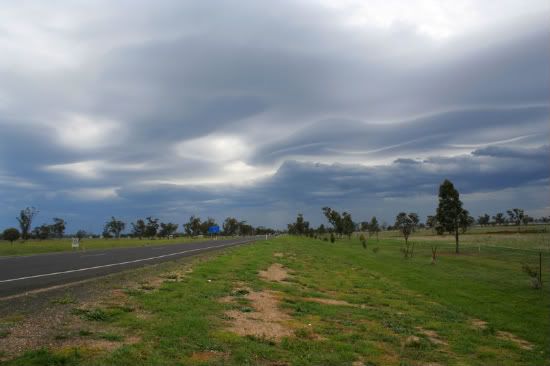
A bit (fairly) dissapointed about the outcome for our chase to NT's on sunday (Although you all know what severe SDS can make you do for a storm). But Phil, Ben and I headed up early on sunday morning to hopefully beat the NT storms (that we knew would develop, but they developed a tad too early). We got to GI about 2pm and saw some unstable looking convection of the sorts to our west, we could have probably made our way into NE NSW, but with no garuntee that we would make the storms (We most likely would have been driving all arvo to get infront of them so we decided not to). So we were hoping something would develop to our west or ontop of us and we would chase it east, but unfortunately... such is life, nothing developed.  :-\ . Unfortunately by this time we had no chance what so ever to get the stuff even in QLD, so we decided to get a motel in GI for the night and hope for something tomorrow. But as I was keeping an eye on radar, we noticed some decent storm/s out near Goondiwindi moving east towards Tenterfield, so we decided to take a drive a bit north (of course after we sat in the local RSL and had some beautiful meals and watched the elderly dance) but unfortunately all seemed too far away for any photos (More like flashes just illuminating the sky). (We were hoping for stuff to develop more to our west). After about 1hr of watching distance lightning we got back to our Motel by about 10pm. At this stage we were all in sleep mode because of our long drive and minimal sleep the night before, but I was so desperate for some storm action I stayed awake for another 2hrs watching the radar. To my suprise stuff went up to our west and let out some bright and powerful but infrequent flashes, too infrequent to photograph and I feel asleep by 12am (I had in the back of my mind that I definitely needed some sleep for the driving tomorrow),only to be woken up by a flang at 1.30am, which was a rather pleasant surprise then another load boom about 2 mins after. These two unfamiliar occurences made me peer out the window for a while hoping that it was becoming more frequent, but to my disappointment we seemed to have received the only two strike in the region within quick succession, back to sleep it was... in hope tomorrow would produce something good.

I woke up about 7am to people next door making loud noises to fellow family members, it was probably about time I got up anyway. Eventually Phil and Ben got up too. by about 7.40am we were all up, and to our annoyance it turns out the close strike that knocked out the power very briefly lastnight fried the modem, so no internet for us... except what we had on Phil's mobile (Which was highly useful). We noticed storms already forming out west and heading for southern part of the plains, so off we set to Narrabri after a quick petrol stop in GI. It was nice to go over Mount Kaputar NP, magnificent views NE and west of the NP, abosutely stunning. As we came over the NP we began to notice decent updrafts to our W and SW, we knew they would be heading SE so we headed for Boggabri, which did give up options east.(although I was wanting to stay out of the cloud and on the NW edge, it made more sense to make our way a bit further south because we did have to get back that night). Just out of boggabri on the road south towards Gunnedah we met a high base guster that had such a lovely and enjoyable cloud feature (Anyone know a name for it?).


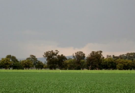
After this we made our way further into Gunnedah and had lunched and watch the storms (which were by then very weak) move over. I knew more would form, but I was hoping they would form soon, and that they did. It start to really perk up with lightning and orange echoes on Moree radar for Narrabri and Boggabri area about 1.50pm so we decided to make our way a bit further north again to have a much better perspective of all the storms, as we did we watched a cell near boggabri take its time but eventually the base began to lower as scud was getting sucked up. We noticed a lowering pop out of the base after rapid up motion from the scud.


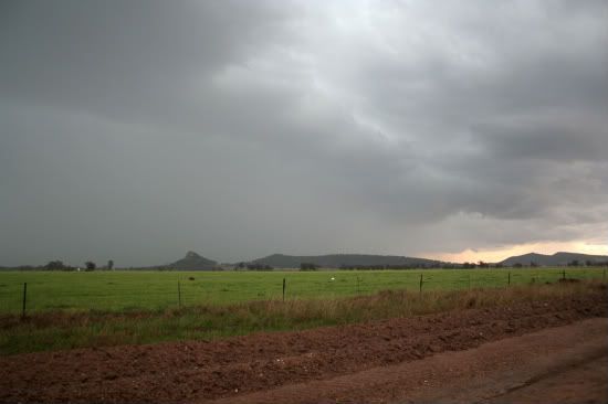
This base feature then became rainwrapped (or what happened that way from the angle we had) so we decided to go north and then east to get another view of the base. So off we went into and through Boggabri then east on the road towards Manilla. to be greeted by a big rain curtain coming our way with slight green tinge.


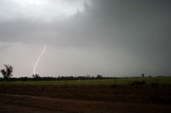
Not long after I scored a daytime CG, which I was stoked about.


We then went a bit further east and then decided to core punch and get through to the other side to see if anything was behind it. We were greeted by very torrential rain (We were on an unsealed road at the time, which was getting quite slushy and slippery) and even some decent hits of hail (I reckon some tinks would have been stones to about 1cm, but most pee or slightly bigger). After this we noticed not much was happening and decided to make our way a bit further south, by this time most of the rain was covering the whole general area, which is great news for that area!

Hope the pictures aren't too big

All in all not the best of chases, but fun to get out nonetheless. I have to admit Sunday was quite disappointing, especially to find a very large HP which hit a couple of hundred km's to our north east, but as I have said to a couple of people, you have to draw the line somewhere otherwise you'll keep going further and further. haha (Which I will probably do on some chases this season when I get back from Canada).

Off to Canada on October 5th and coming back for January, hoping for some big outbreaks in January in NSW. I'll definitely be there haha. (Going to make the most of January and early feb before I begin college).

P.S. Jimmy, I have decided weather is to stay my hobby rather than my job (I need a balance somewhere). Chasing, the best hobby one could have. (I am not sure if you recall MB, yourself and I discussing it in October last year sometime on the NR's). Take care all!


Offline nmoir

  • Elephant Trunk F2
  • *
  • Posts: 200
  • Gender: Male
  • "busting chases since 1999"
    • Oculi.com.au
Re: NSW & S Qld Severe Storms: 19-23 September 2008
« Reply #78 on: 24 September 2008, 07:37:29 AM »
 Narrabri and area was too far for me to make so i took a punt on the mid north coast on advice from jimmy and MB , heading for Kempsey where a weak storm developed on the boundary of NNE winds and NW winds , it had good moist inflow but was killed by the nasty nth westerlys in the 850s , still got a few nice bolts and the tele photographer in port macquarie got a nice frame,


heres a few from the day including and early cell at buledelah and the boundary then some lightning from the eventual storm , very little structure
Nick Moir
Photographer
The Sydney Morning Herald
and www.oculi.com.au

Offline Michael Bath

  • storm chaser
  • Administrator
  • Wedge tornado F5
  • *
  • Posts: 1,602
  • Gender: Male
    • Australian Severe Weather
Re: NSW & S Qld Severe Storms: 19-23 September 2008
« Reply #79 on: 24 September 2008, 08:00:03 AM »
Hi Shane, thanks for putting together a detailed chase report. Pity the action started up so early on Sunday - so close yet so far!

I do remember that conversation - it was 30th Oct - 2nd page of this thread

Monday and today are your more typical September setups - fast moving with marginal moisture in parts, cloud bands and rain in others - certainly a contrast to the weekend situation. Something should spread through here later - hopefully with lightning and not just rain. Moree sounding this morning was quite encouraging.

Nick - sure was a lot of lightning on tracker in the Port Macquarie area well into the evening. Some more there now.
Location: Mcleans Ridges, NSW Northern Rivers
Australian Severe Weather:   http://australiasevereweather.com/
Lightning Photography:   http://www.lightningphotography.com/
Early Warning Network: http://www.ewn.com.au
Contact: Michael Bath

shanesmp

  • Guest
Re: NSW & S Qld Severe Storms: 19-23 September 2008
« Reply #80 on: 24 September 2008, 09:33:01 AM »
No worries Michael. Yes it was a pity.. Although to be completely honest with you, I was thinking that was just 'early convection' that wasnt really going to get going. But Ended up being rather wrong unfortunately. I am far from a fan of chasing early convection, been there and done that in the past and learnt heavy becasue of it. (I love my clear air at 12pm)

Thanks for the link to that thread, even though it was the most average storm you had all of October (And yes it landed on the day I had free and decided to chase haha), I still enjoyed it! Tis all part of learning.

My car is on 290,000km now, hoping it doesnt cark it for this storm season (haha), though it still starts first go etc which I am certainly pleased about. I need it to keep going so I'm going to get some stuff that needs done on it when I get back from Canada (Dec 30th). No immediate issues, just the ones you dont know about and will cause problems down the track.. as they say, better safe than sorry. I love my Toyota Cressida, especially because it is on LPG, get some great mileage out of it for the price I pay.

(Sorry that was a bit off topic, I apologise)

P.S. I am rather looking forward to some chases in the NWSP this season (Well after 30th Dec). Really hoping the season wont end early this year, because i'll definitely have severe SDS when I get back! (No SNOWDS though)
« Last Edit: 24 September 2008, 09:40:08 AM by Shane Watson »

Offline Harley Pearman

  • Barrel tornado F4
  • *
  • Posts: 584
Re: NSW & S Qld Severe Storms: 19-23 September 2008
« Reply #81 on: 24 September 2008, 02:41:31 PM »
Excellent photos of lightning strikes from everyone and cloud formations.

Out of interest and during this latest weather event, the cold front racing across New South Wales 22/9/2008 triggered a major dust storm from Broken Hill to Mt Kosciusko. I was unable to find sizeable photographs however winds of 117 km / h in Broken Hill caused damage in town but it seems the dust was the big talking point here.

During the dust storm it started to rain and thus the rain fell as mud or wet dust in town.

In Hay wind gusts reached 115 km /h and similar gusts occurred around Griffith.

The dust storm reached Mt Kosciusko and turned the snow an orange colour. This was followed by a dumping of rain and Thredbo recorded 97 mm of rain.

Harley Pearman

Offline Rodney Wallbridge

  • Multi-vortex F1
  • *
  • Posts: 71
  • Gender: Male
    • Red Bubble
Re: NSW & S Qld Severe Storms: 19-23 September 2008
« Reply #82 on: 24 September 2008, 03:10:50 PM »
On Sunday the Northern Rivers was primed for storms with some nice storm numbers. GFS suggested some better more potent setups not far away. I selected Woodenbong near the QLD border to start from  I had a look at OBS for the Lismore area and saw a very dry Se SFC mass moving in taking Dp’s down to single figures, which made me decide my original target.
Just south of Woodenbong I snuck around the northern edge of a developing cell and saw some lovely Cg’s and nice thunder. Rain free base along a line with the cells affecting the casino area that Michael and Jason were at.I drove through town and sat about 6k’s to the west to survey the weather. It became apparent the  cell I drove very close to was proceeding north so headed off through to the border gate and onto Rathdowny. Took a few pics south of town along the Palen creek area .Some great wall cloud structure and rippled RFB areas.


Passing through Rathdowney ,chaser convergence occurred soon after with Anthony , Dave ,Julian and Jeff. We then spent the next while hop skipping one another enjoying the storm which then began to gust out in a huge way! It was observed the cell had too much moisture and became outflow dominant with spectacular photogenic results.


In the meantime a cell to the NW flank had developed which was 30k’s or so away along the line. We then proceeded to drive towards Ipswich and get over to that cell which ended up just going across it north of Ipswich and only just. Heaps of crawlers were seen and two gunshot flangs within 100mtrs in Fernvale north of  Ipswich, after the cell passed overhead with some isolated 1cm hailstones and the village losing power. which made it easier to aim for the sky for lightning. I headed home and encounted an extremely lightning active cell just to the north west of Kyogle which put on an amazing Lightning retina burnage show.Lightning got closer with some amazing stacattos! all images uncropped


548kms travelled  was an enjoyable chase! Home at 1230am.
« Last Edit: 24 September 2008, 03:46:15 PM by Rodney Wallbridge »

Offline Carlos E

  • Elephant Trunk F2
  • *
  • Posts: 135
  • Gender: Male
Re: NSW & S Qld Severe Storms: 19-23 September 2008
« Reply #83 on: 24 September 2008, 03:56:55 PM »
Amazing pictures as well Rodney! I'm extremely jealous and amazed at the same time!

Offline Michael Thomas

  • Elephant Trunk F2
  • *
  • Posts: 172
  • Gender: Male
Re: NSW & S Qld Severe Storms: 19-23 September 2008
« Reply #84 on: 24 September 2008, 07:35:52 PM »
I like the photos there, quite good structure. The second photo there looks particularly interesting. Going by the radar I would have to say the storm that formed in NSW and moved northwards towards Rathdowny was the most spectacular of the day. On the radar a not so obvious V-notch is present and on a couple of frames there is also an inflow notch or hook. A guess the second and third are taken during this time. To me it almost look like the is a clear slot on the far right on the second photo (indicative of a RFD). Then there's the lowering almost touching the ground attached to the base. Could you see any upward motion in this lowering? It really looks quite interesting. Certainly outflow dominated the scene afterwards when the two storms collided.

Michael

Offline Rodney Wallbridge

  • Multi-vortex F1
  • *
  • Posts: 71
  • Gender: Male
    • Red Bubble
Re: NSW & S Qld Severe Storms: 19-23 September 2008
« Reply #85 on: 25 September 2008, 12:20:14 AM »
Gyday Michael, yes the lowering had some nice upmotion. the cell was just cruzing along which enabled me to stay with it thankfully.The road was perfectly aligned to stay just to the NW flank very nicely as well.The amount of moisture this cell was sucking up with anvil and then huge guster it prolly could have done with some decent inflow winds to keep it going before it became outflow dominant would have seen a monster packing a more then fair dinkin punch.

Offline Michael Bath

  • storm chaser
  • Administrator
  • Wedge tornado F5
  • *
  • Posts: 1,602
  • Gender: Male
    • Australian Severe Weather
Re: NSW & S Qld Severe Storms: 19-23 September 2008
« Reply #86 on: 25 September 2008, 09:12:49 AM »
Thanks for that report Rodney - I very much like the structure in that 2nd photo as well. Glad you were there to capture it ! :)

The Lismore based newspaper, The Northern Star had this report about the Kyogle hailstorm event:

Quote
Kyogle hails storm season
September 23, 2008
 
By MEL MCMILLAN

NORTHERN NSW's official thunderstorm season has begun with hailstones 'bigger that golf balls' being reported in western areas of the region during Saturday's storm.

Kyogle SES duty officer Phil Copeland said the worst-hit area was Geneva, west of Kyogle.

"We had lots of broken skylights in Geneva, but no major damage to property," Mr Copeland said.

"The golf club lost a few tiles off its roof and there was some damage to cars."

Kyogle SES attended 11 hailstorm-related jobs at the weekend.

Mr Copeland said Saturday's hailstorm was not a major event, but warned there may be more storms to come and people should use their common sense to stay safe.

"People should stay in their cars if they find themselves in the middle of a hailstorm," he said. "It's better to have a few dings on your car than to put yourself at risk of injury from hailstones."

Hail is often accompanied by wind and strikes at an angle.

"It is important to keep away from windows and doors. People can be at risk of injury from shattering glass," Mr Copeland said.

Bureau of Meteorology severe weather forecaster Michael Logan said the North Coast storm season continued until the end of March.

"September and October, and March and April are the peak periods for storm activity in Northern NSW," he said.

Hailstorms form when humid hot air rises rapidly into the atmosphere.

"The updraught transports water high into the atmosphere which is very cold," Mr Logan said.

"Hailstones form there and when they become too big for the updraught to suspend them, they fall to earth."

The Northern Rivers was one of the few places in Australia likely to experience super cell hailstorms capable of producing 10cm hailstones, Mr Logan said.

The most dramatic recent example of a super cell on the North Coast was last year's October hailstorm, which flung hailstones almost as big as softballs at Lismore and surrounding areas.

Australia's largest reported hailstones were 10cm in diameter. They fell in the Hunter Valley in 1990.
Location: Mcleans Ridges, NSW Northern Rivers
Australian Severe Weather:   http://australiasevereweather.com/
Lightning Photography:   http://www.lightningphotography.com/
Early Warning Network: http://www.ewn.com.au
Contact: Michael Bath

Offline Mike

  • Australian Severe Weather Moderators
  • Wedge tornado F5
  • *
  • Posts: 1,348
  • Gender: Male
  • Dry season here...boring!
    • http://StormscapesDarwin.com
Re: NSW & S Qld Severe Storms: 19-23 September 2008
« Reply #87 on: 25 September 2008, 09:18:56 AM »
Great report and pics Rodney - dramatic images.  A great read from all the reports from everyone and it's even better to see the big grins on all your faces while we are still waiting for our storms!
Darwin, Northern Territory.
StormscapesDarwin.com
Lightning Research 2010/14

shanesmp

  • Guest
Re: NSW & S Qld Severe Storms: 19-23 September 2008
« Reply #88 on: 25 September 2008, 10:48:27 AM »
Sensational pictures and report Rodney. Just arranged my flight back from overseas, I'll be leaving Los Angeles on the 30th December to get into Brisbane 7.45am on the 1st then leave Brisbane at 9.15am and get into Sydney at 11.20am. Hoping from some serious storms as I cross the equator.


JulianR

  • Guest
Re: NSW & S Qld Severe Storms: 19-23 September 2008
« Reply #89 on: 26 September 2008, 01:54:41 PM »
Hi All!

This is my first time posting on here I think so I will come up with the goods to share with all :)

Last weekend certainly has to be one of the most spectacular chases I have ever experienced in my life - Ever since seeing the Meso Mothership of Dave Ellem's on www.nswstorms.com I have longed to come across one in the flesh, and saturday I just got that .... And still I cannot believe my luck! Full credit to Anthony Cornelius for sticking with this particular cell - certainly paid off dividends in the end!

Anway enough with the ranting, on with the pics - enjoy :)

Saturday 20/09/08


Sundays Images will follow shortly