Author Topic: NSW/SE QLD Storms and Snow Event 7 - 10 September 2011  (Read 11943 times)

0 Members and 1 Guest are viewing this topic.

Offline enak_12

  • Elephant Trunk F2
  • *
  • Posts: 153
  • Gender: Male
NSW/SE QLD Storms and Snow Event 7 - 10 September 2011
« on: 08 September 2011, 02:55:18 PM »
Out shooting with Dan at Sawtell NSW again today (Sep 7). A storm died quickly after sunset but managed a few cg's on its way out to sea.


September 7 2011 storms.


Offline Michael Bath

  • storm chaser
  • Administrator
  • Wedge tornado F5
  • *
  • Posts: 1,602
  • Gender: Male
    • Australian Severe Weather
RE: NSW/SE QLD Storms and Snow Event 7 - 10 September 2011
« Reply #1 on: 09 September 2011, 05:13:37 AM »
A few cells also crept up the eastern part of the Northern Tablelands though nothing close enough for a look. Low topped cell got right up to the QLD border but it collapsed after sunset.

Besides the storms a snow event along the central and northern tablelands is fairly likely tomorrow into early Saturday. Latest 18z GFS supports snow in the Guyra area so may have a drive up there if the setup can hold till tomorrow. Models have struggled with the weather this week.

Location: Mcleans Ridges, NSW Northern Rivers
Australian Severe Weather:   http://australiasevereweather.com/
Lightning Photography:   http://www.lightningphotography.com/
Early Warning Network: http://www.ewn.com.au
Contact: Michael Bath

Offline enak_12

  • Elephant Trunk F2
  • *
  • Posts: 153
  • Gender: Male
RE: NSW/SE QLD Storms and Snow Event 7 - 10 September 2011
« Reply #2 on: 09 September 2011, 03:04:36 PM »


September 8. Was hoping today would be better but shear was still crap, not much made it off the ranges. This was a small cell which managed a few strikes as it moved out to sea between Coffs and Woolgoolga. The bright lights on the coastline are for the World Rally Car stadium which is on at Coffs atm.


This would have been the best shot, but the bolt struck out of the frame.

Offline Michael Bath

  • storm chaser
  • Administrator
  • Wedge tornado F5
  • *
  • Posts: 1,602
  • Gender: Male
    • Australian Severe Weather
RE: NSW/SE QLD Storms and Snow Event 7 - 10 September 2011
« Reply #3 on: 11 September 2011, 01:14:58 PM »
Jason Paterson and I headed up to the Northern Tablelands leaving Lismore at 3.30pm yesterday (9th Sep). The first sleet shower occurred along Inn Road into Ben Lomond about 7pm with some more into Guyra but the temp was still mostly above 2 so not many proper snow flakes were observed. We hunted around for more but only encountered frozen drizzle and sleet.

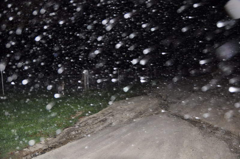
Had a rest then headed out again between 1 and 3am today (10th Sep). Showers of precipitation were fairly frequent but still mainly frozen drizzle and sleet around. Some wet snow was found at Black Mountain with some light settling there. There was no settling around Ben Lomond at this stage.

These at Black Mountain:


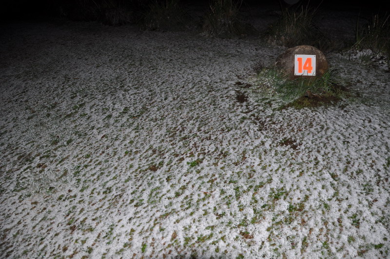
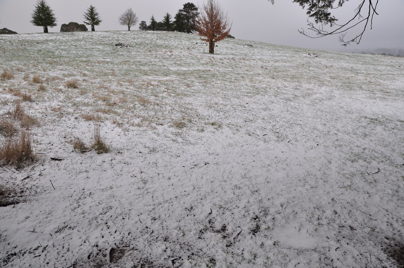
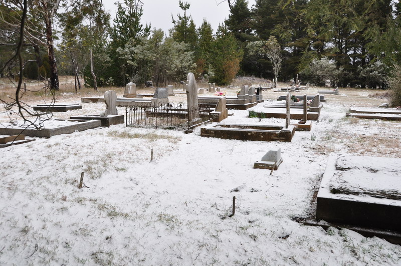
The precip eased again so went back to Guyra for a couple of hours. Dawn showed some snow has fallen in town so headed out again for a proper look. Snow showers persisted for a while. Black Mountain appeared to have the best with a 1 to 1.5cm cover (measured) with drifts 2-3cm in favourable locations.

Black Mountain:


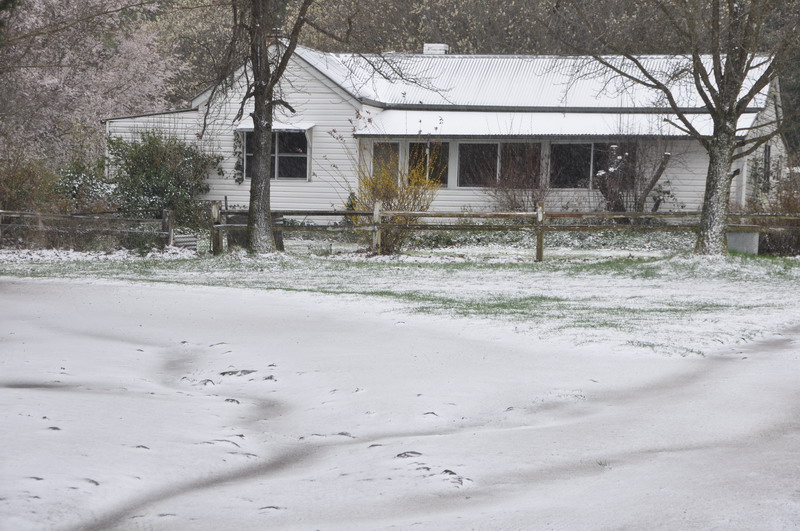
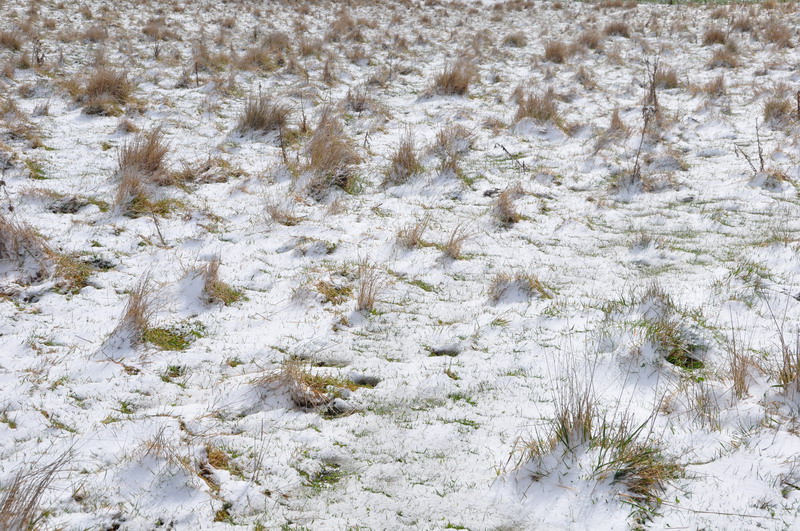
South Guyra picked up more than the rest of town but it was only 0.5 to 1cm cover. It can look more on lawns but it was barely covering things.

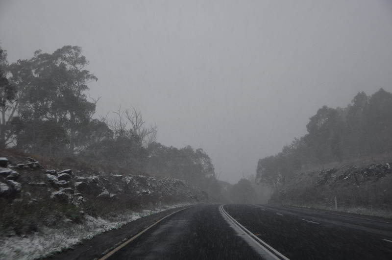
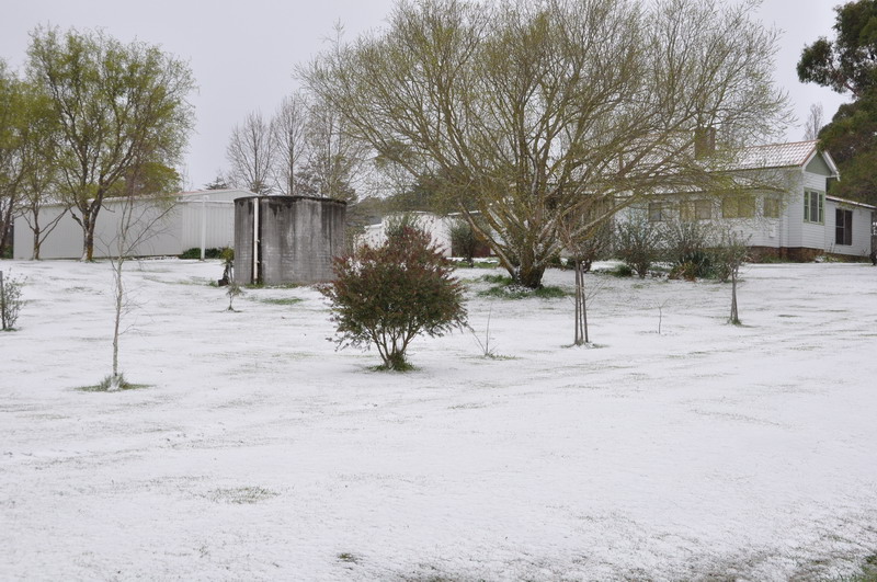
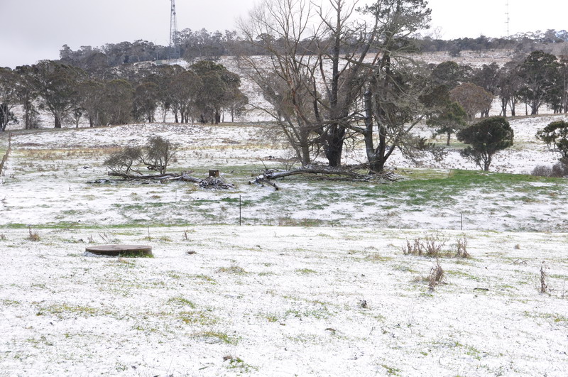
Later in the morning we went to Ben Lomond and found some areas that had received 1-2cm but it was patchy. Some drifts/clumping of about 3cm were found.

Ben Lomond:


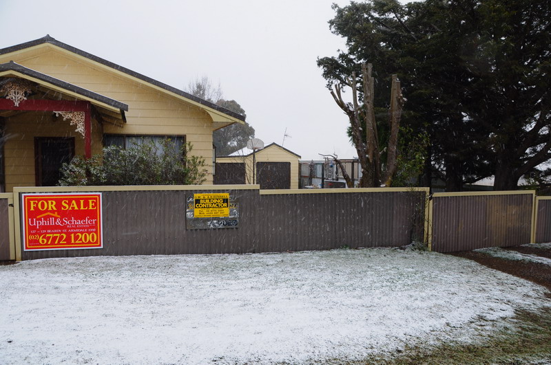
So Guyra didn't do too well this time with Black Mountain the pick of the region. Ben Lomond saved face with some decent early morning snow, though patchy and not the best in the village itself.

MB
« Last Edit: 11 September 2011, 01:24:07 PM by Michael Bath »
Location: Mcleans Ridges, NSW Northern Rivers
Australian Severe Weather:   http://australiasevereweather.com/
Lightning Photography:   http://www.lightningphotography.com/
Early Warning Network: http://www.ewn.com.au
Contact: Michael Bath

Offline Jason(pato)

  • Elephant Trunk F2
  • *
  • Posts: 136
  • Gender: Male
Re: NSW/SE QLD Storms and Snow Event 7 - 10 September 2011
« Reply #4 on: 13 September 2011, 02:42:53 PM »
Gday All,

Just a few more to add to MB's awesome report and pics. Most of mine are from around the Black Mountain area.


It was pretty satisfying to see some snow up around the usual haunts of Guyra, Ben Lomond and Black Mountain after poring over the models for several days in the leadup. This was our second chase up there this year and this time we managed to come away with the goods even though the cover wasn't as significant as some models were forecasting. Got home at 5pm Saturday after leaving Lismore at 330pm Friday.....950km later ( tied in a side trip down the Old Grafton Road on the way home) and only about 4hrs sleep!! Suffice to say I was a tad weary but it was well worth the effort. Thanks to Michael for his company...its always enjoyable to share events like this with mates. Full set of pics can be found here

Cheers Jason
South Lismore, Northern Rivers NSW.....Supercells are us!!

Offline supercellwish

  • Rope Tornado F0
  • *
  • Posts: 14
Re: NSW/SE QLD Storms and Snow Event 7 - 10 September 2011
« Reply #5 on: 20 September 2011, 11:33:18 AM »
Seriously beautiful Lightning pics and Hail / Snow lol pics too. So far I have only managed to get just 2 Lightning stills. They where taken Just east of Finley. Finley is in the Southern Riverina of NSW. They are nowhere as good as yours so i wont bother posting them lol.