and Chasing
[Index][Archives]
17/05/2008 00z GFS model run +00 to +30 hours in 6 hour increments
[Snow Weather Data: 17-18 May 2008] [17/05/2008 00z MLAPS model run] [NSW Northern Ranges Snow Chase Forecasting Guide]
| Storm News and Chasing [Index][Archives] |
17/05/2008 00z GFS model run +00 to +30 hours in 6 hour increments [Snow Weather Data: 17-18 May 2008] [17/05/2008 00z MLAPS model run] [NSW Northern Ranges Snow Chase Forecasting Guide] |
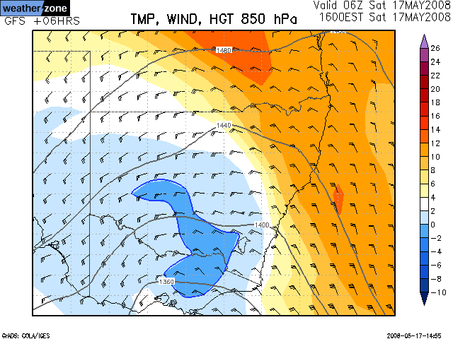
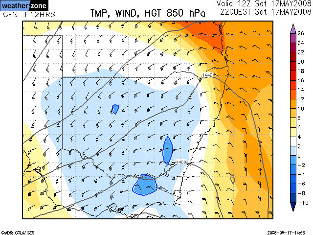
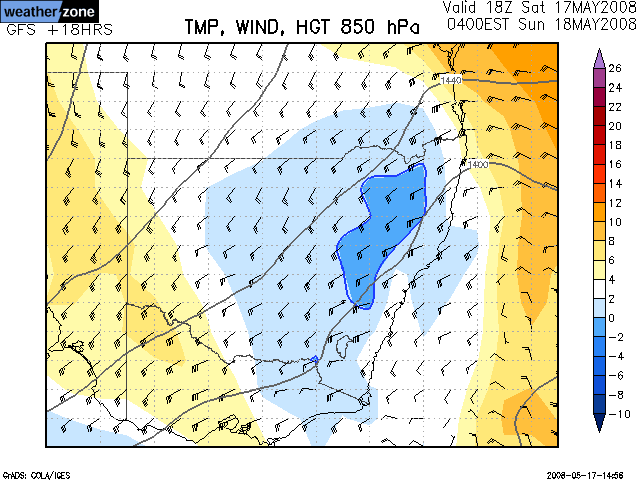
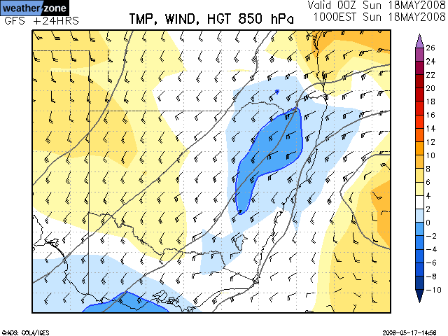
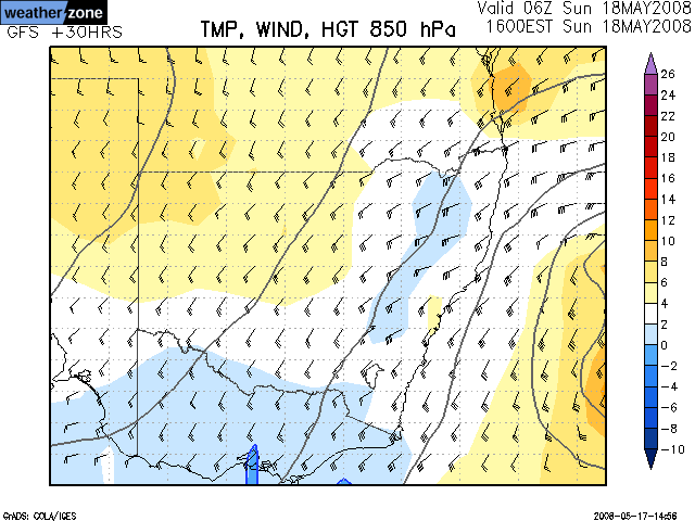
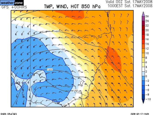
| 850 hPa Temperature / Height / Winds [Loop] |
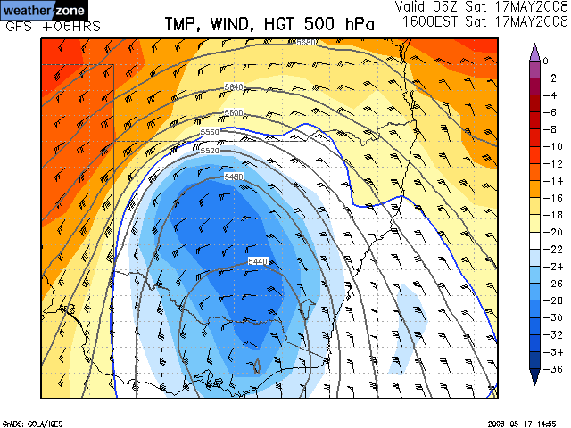
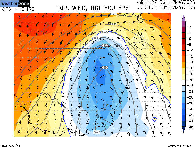
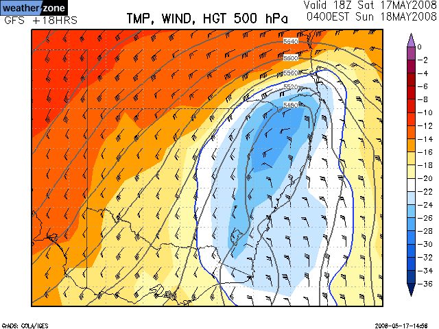
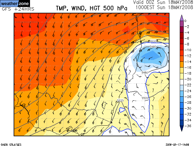
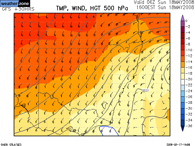
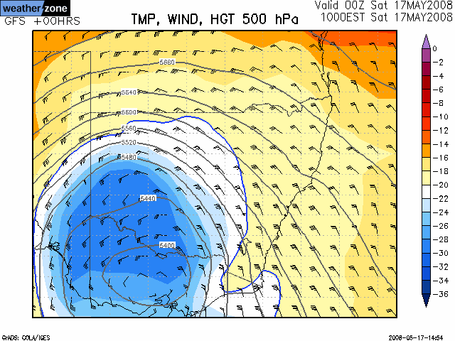
500 hPa Temperature / Height / Winds [Loop] |
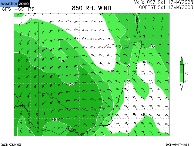
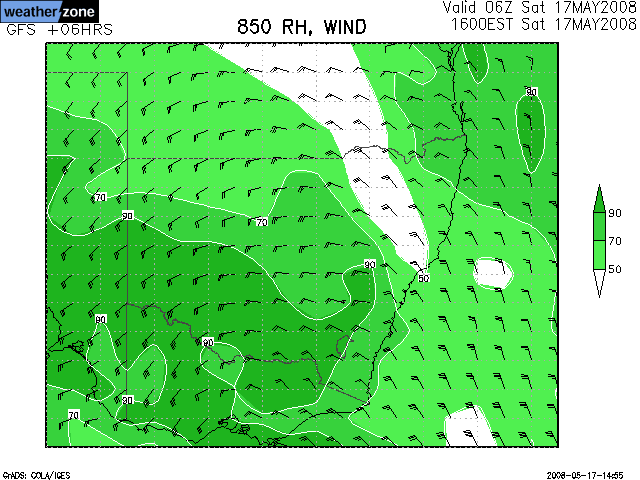
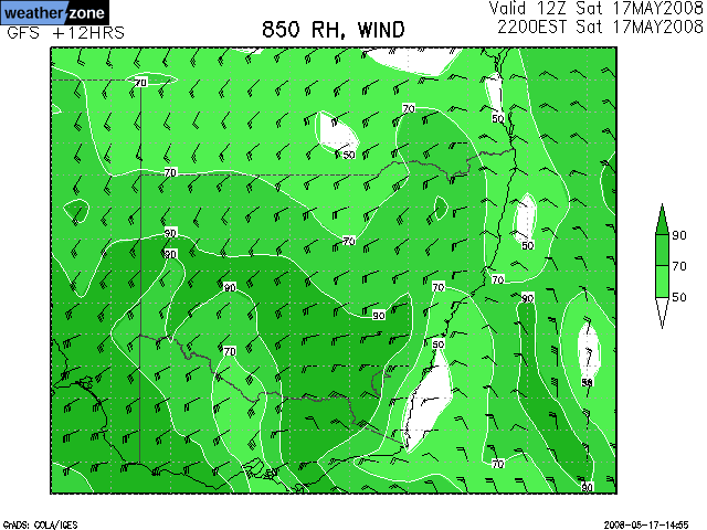
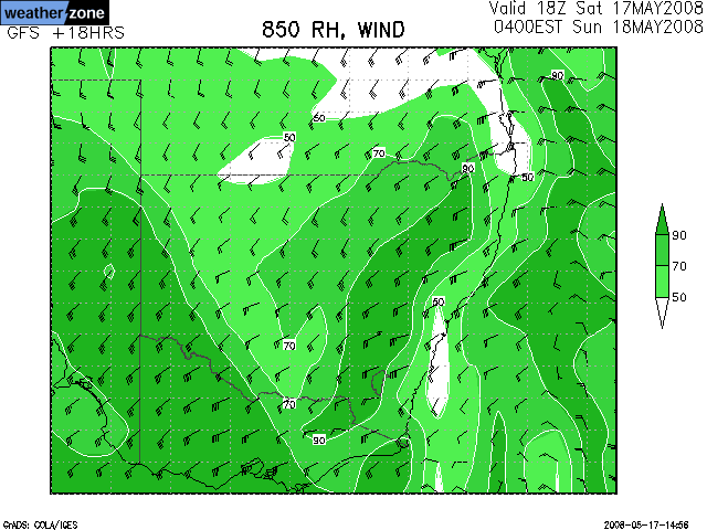
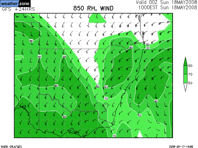
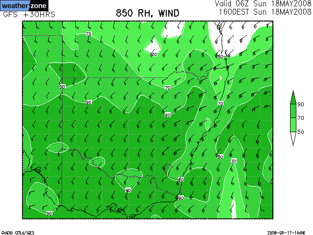
850 hPa Relative Humidity / Winds [Loop] |
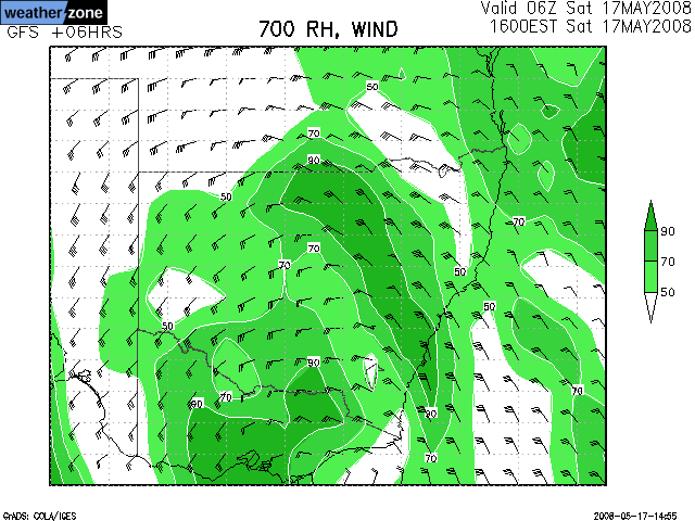
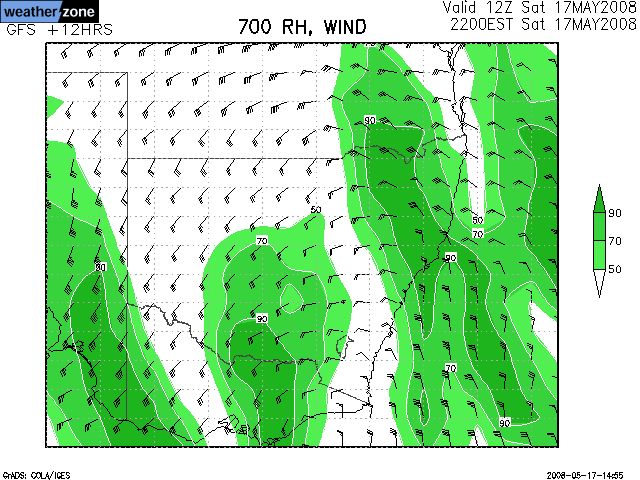
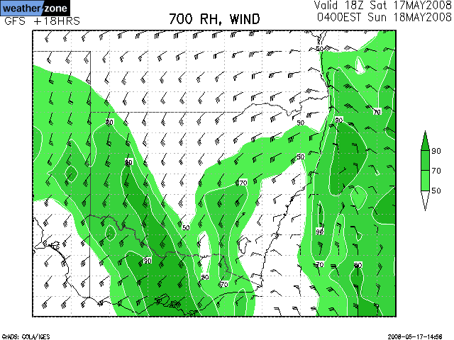
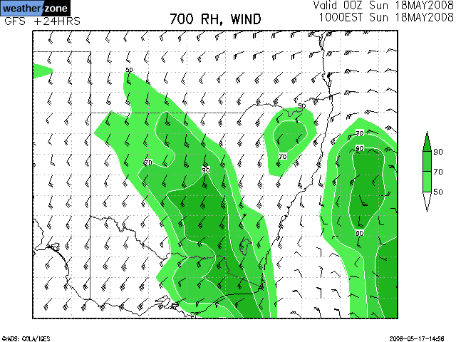
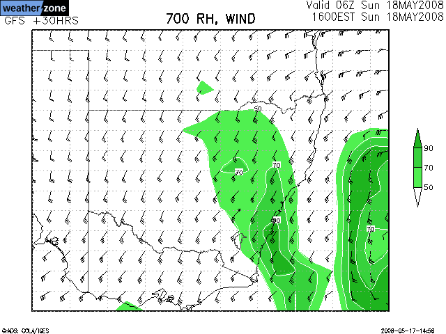
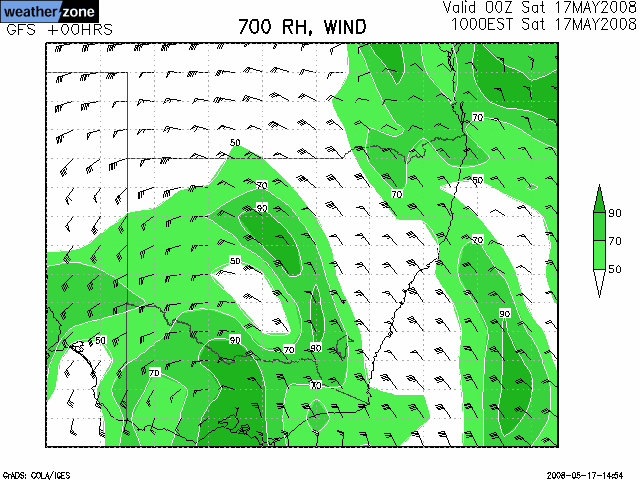
700 hPa Relative Humidity / Winds [Loop] |
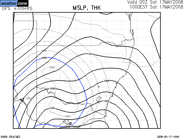
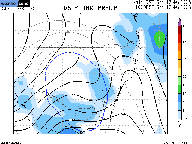
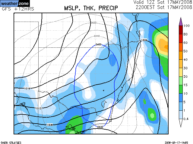
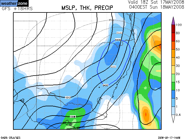
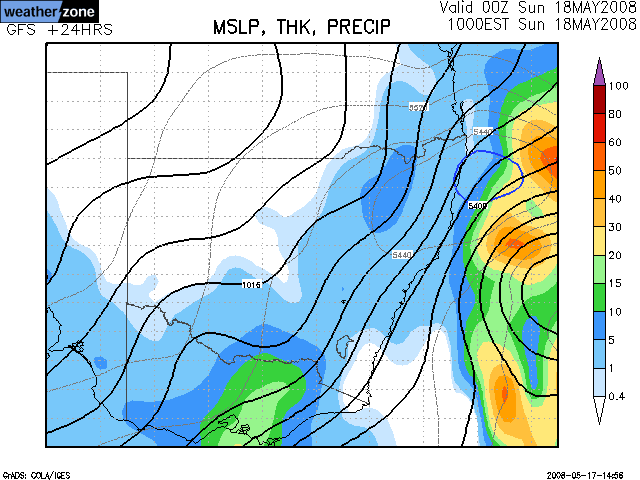
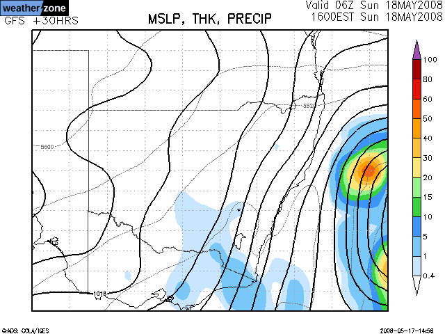
MSL Pressure / 500 hPa Thickness / Rainfall [Loop] |
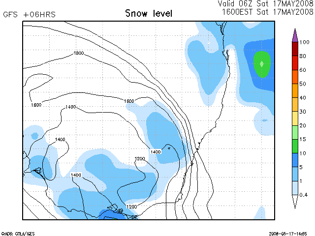
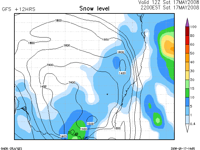
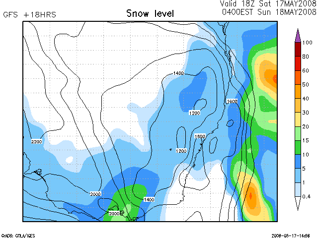
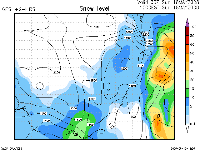
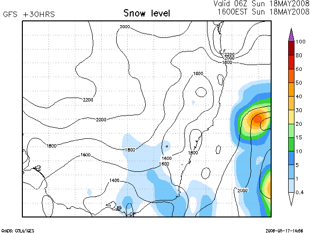
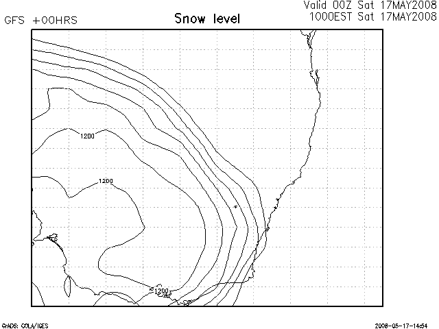
Snow Level / Precipitation [Loop] |
 |
 |
 |
 |
 |
 |
 |
 |
 |
 |
 |
 |
 |
 |
 |
 |
 |
 |
 |
 |
 |
 |
 |
 |
 |
 |
 |
 |
 |
 |
 |
 |
 |
 |
 |
 |
| 850 hPa Temperature / Height / Winds [Loop] |
500 hPa Temperature / Height / Winds [Loop] |
850 hPa Relative Humidity / Winds [Loop] |
700 hPa Relative Humidity / Winds [Loop] |
MSL Pressure / 500 hPa Thickness / Rainfall [Loop] |
Snow Level / Precipitation [Loop] |
|
Document: 20080517_snow_data_gfs.htm Updated: 2nd June 2008 |
[Australian Severe Weather index] [Copyright Notice] [Email Contacts] [Search This Site] |