and Chasing
[Index][Archives]
Violent supercells with giant hail pound the Northern Rivers: Saturday 17th December 2005
Report compiled by Michael Bath, Dave Ellem and Rodney Wallbridge
| Storm News and Chasing [Index][Archives] |
Violent supercells with giant hail pound the Northern Rivers: Saturday 17th December 2005 Report compiled by Michael Bath, Dave Ellem and Rodney Wallbridge |
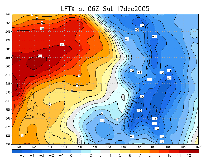
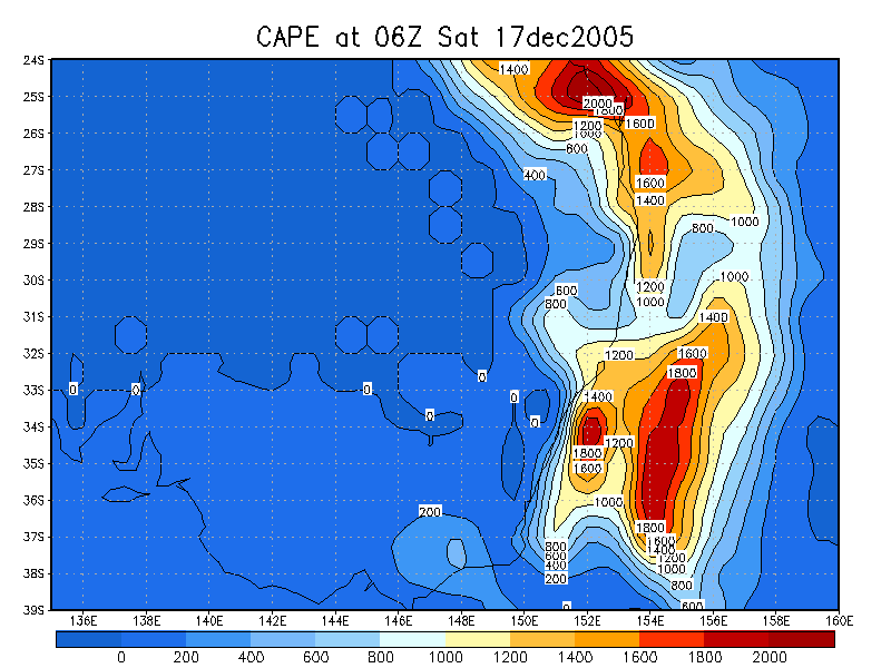
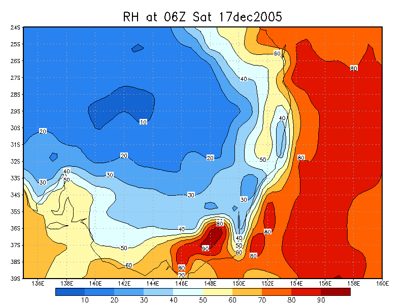
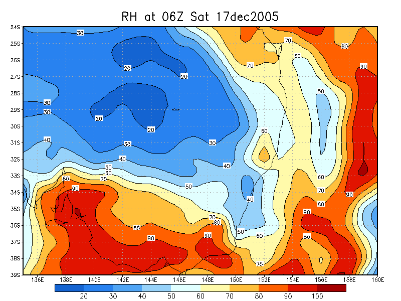
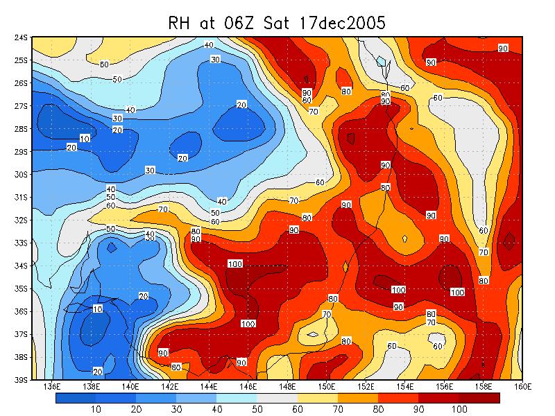
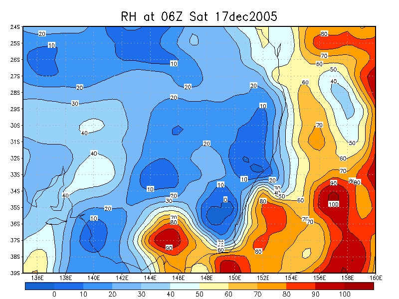
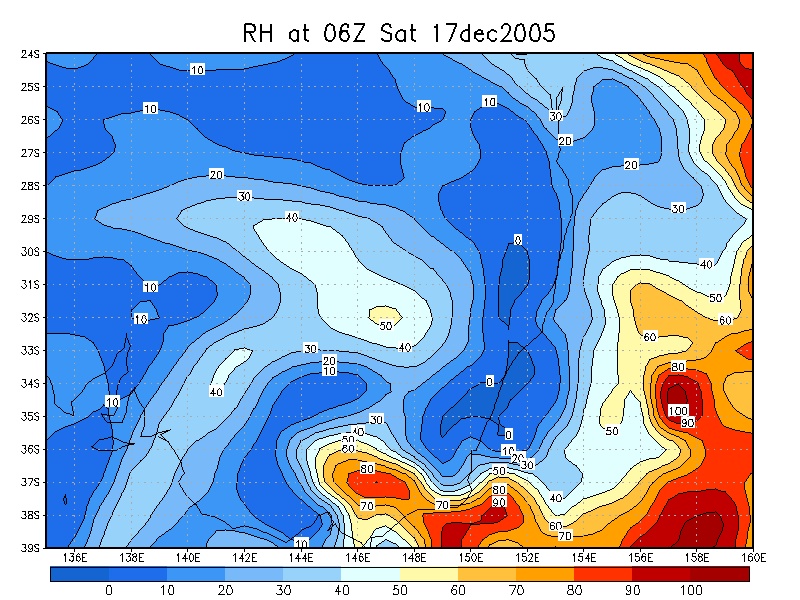
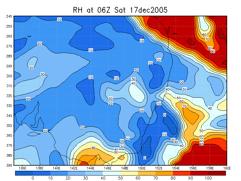
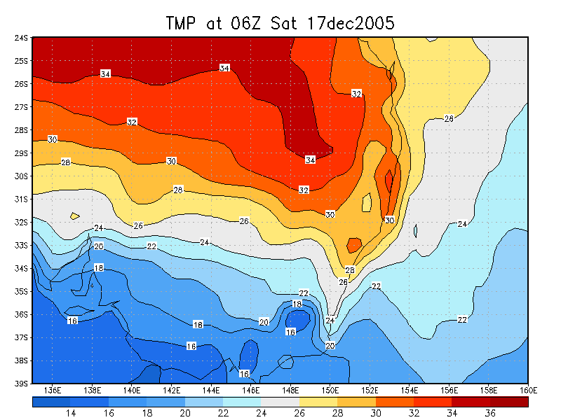
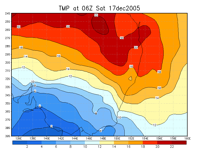
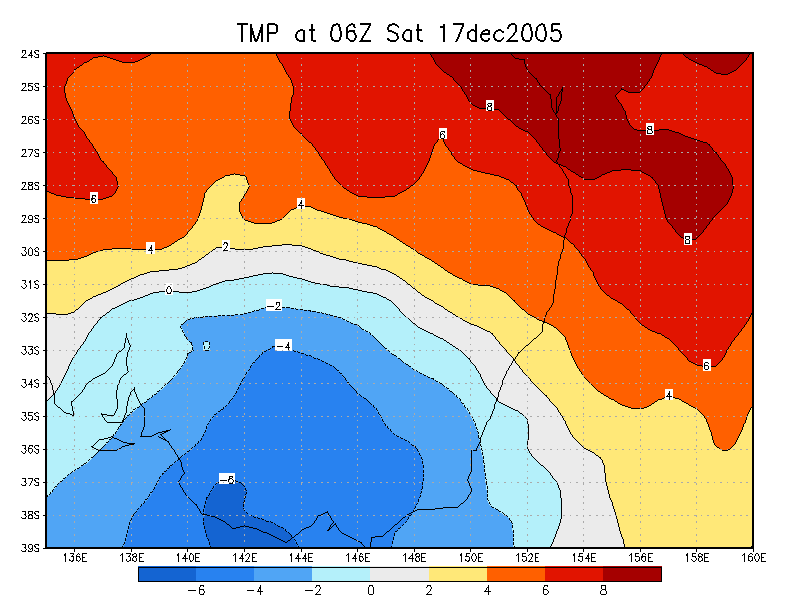
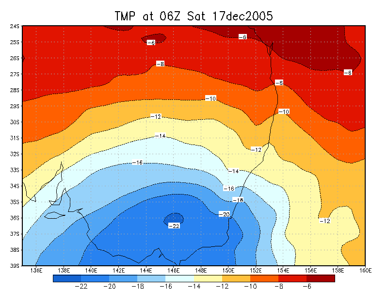
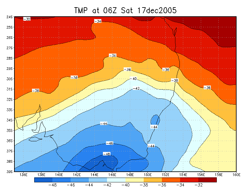
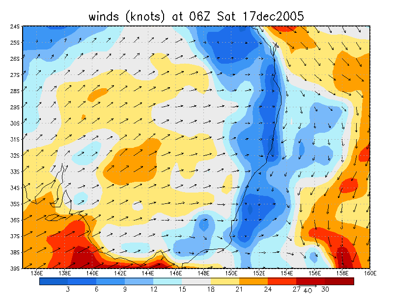
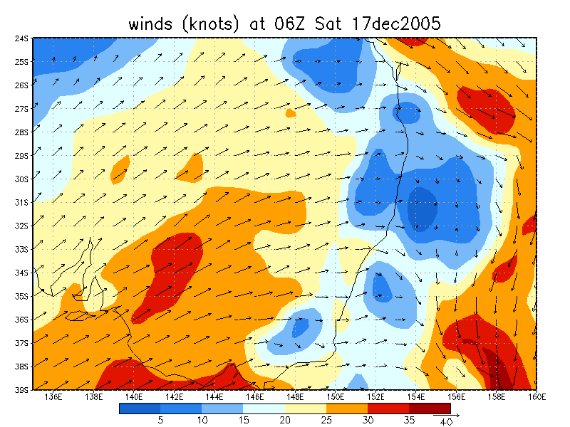
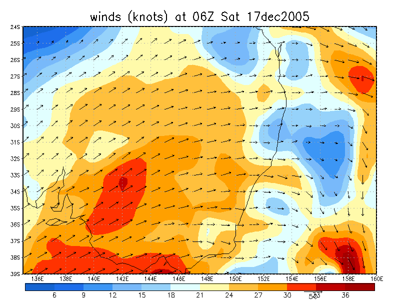
The GFS forecast and analysis really doesn't reflect the instability that existed over the Northern Rivers on this day, with the moisture profile appearing quite wrong. However, it does show the ideal shear for supercells and destabilising atmosphere, together with a good 850hPa cap. The Mesolaps model forecast the moisture better, but it isn't until seeing the Moree sounding that the true potential is obvious: deep moisture to 600hpa with dry air aloft, and strong shear in the mid and upper levels. The Moree sounding is fairly indicative of what the Northern Rivers would have been like during the afternoon. In fact, the replotted sounding (see charts below) with 32/21 - the temperature / dew point just prior to the storm hitting Casino - gives CAPE over 4000 and LI of -10 ! The North Coast also had the advantage of surface northerlies. Storms were expected to move east today, with supercells likely to head ENE or NE. The WNW jet was ideal to keep anvil rain away from updrafts - and chasers !
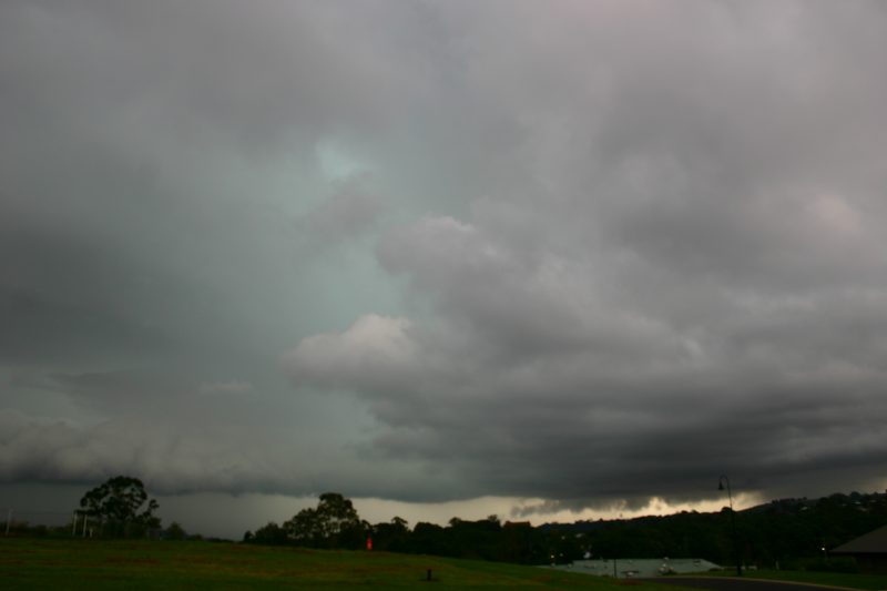
The morning was completely sunny in the local area. However, radar showed
showers and storms creeping into the region from the SW and a lot of strong
storms in the Hunter. The activity was initially not expected to continue, however
the line did persist, most likely with the first trough of the day. Weak looking
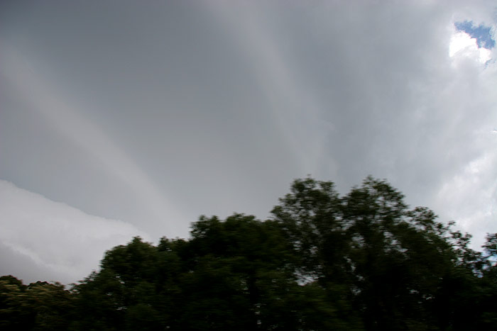
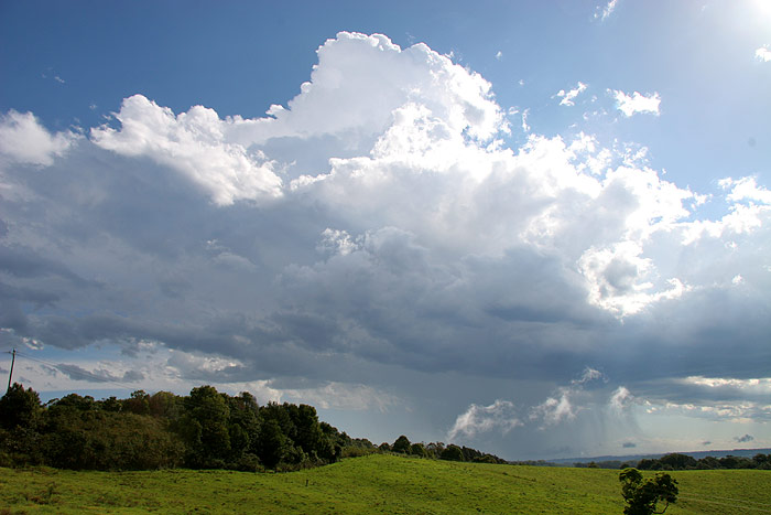
cumulonimbus were observed from late morning to the SW, with other cumulus developing
in western parts of the region.
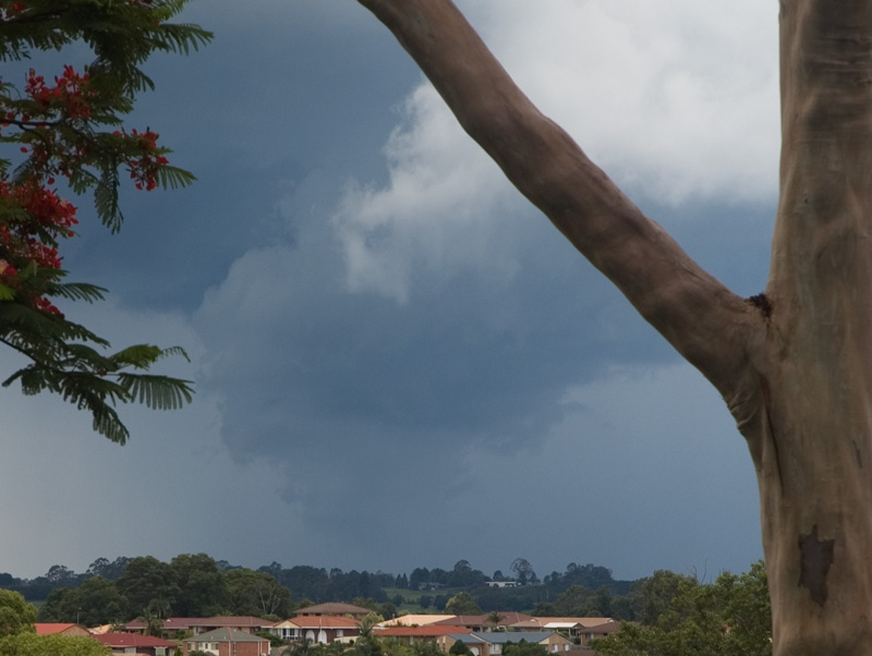
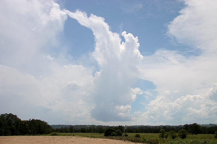
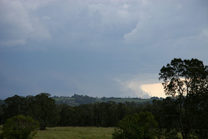
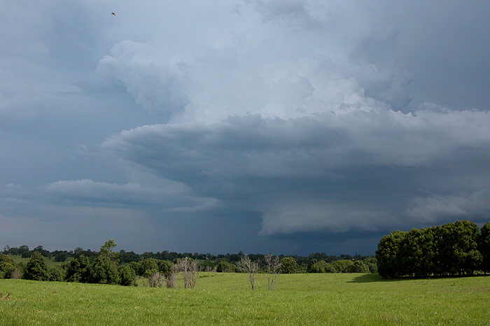
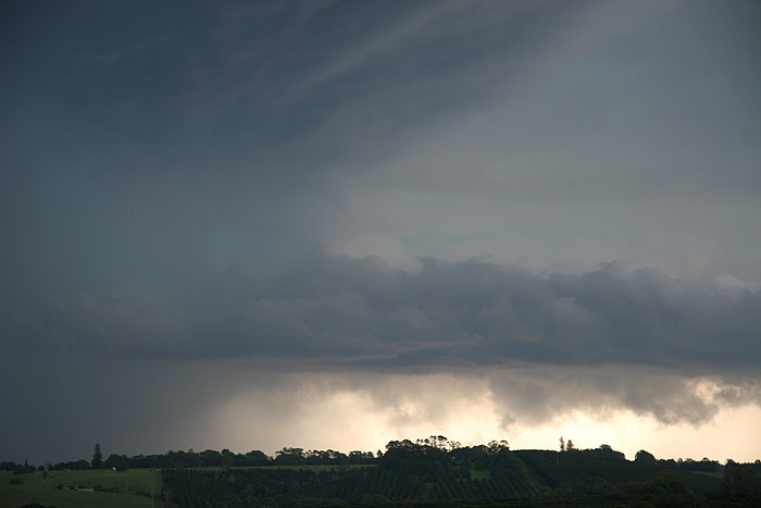
Dave and I headed over to Tregeagle about 1230 when the cells were a bit closer.
The storm was not impressive at first but that picture very quickly changed.
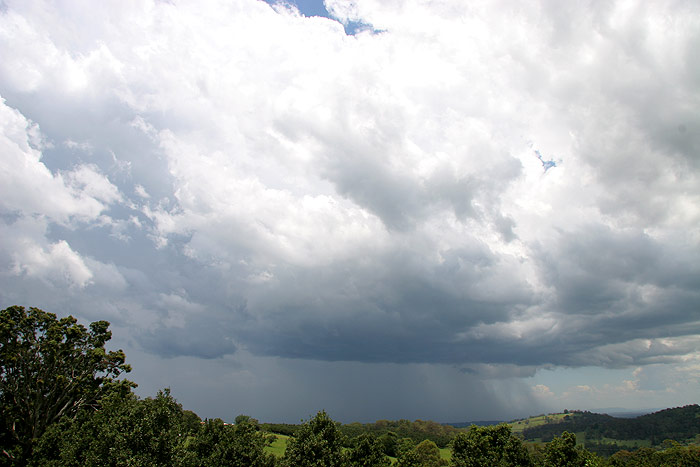
Updrafts pushed higher and a rippled rain free base formed on the northern side
quite close to us, and heavy precipitation fell on the SW flank.
This storm was now on the move and with CG lightning now hitting nearby it was
time to move. This cell underwent and amazing change in the 10 minutes it took
us to drive to Wollongbar. From a rippled rain free base it had evolved into
a rotating wall cloud with powerful updrafts and intense precipitation.
Ray Mullens at Goonellabah captured some great shots of this structure and noted
the very obvious rotation.
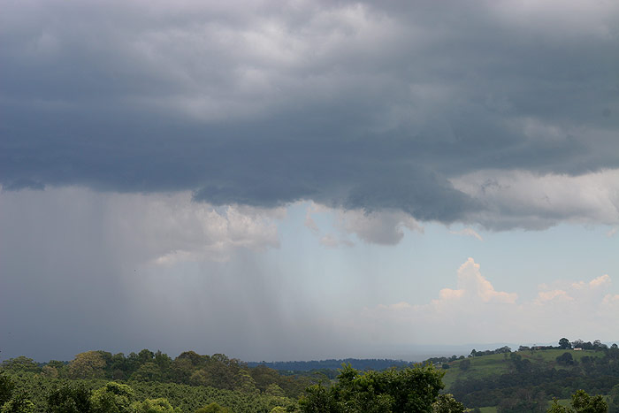
The storm looked like it would hit Ballina so we raced SE along the Bruxner
Highway to intercept. Just as we entered a heavy rain area on the Ballina cutting,
we heard reports of large hail on the UHF which we soon found out was at Wardell.
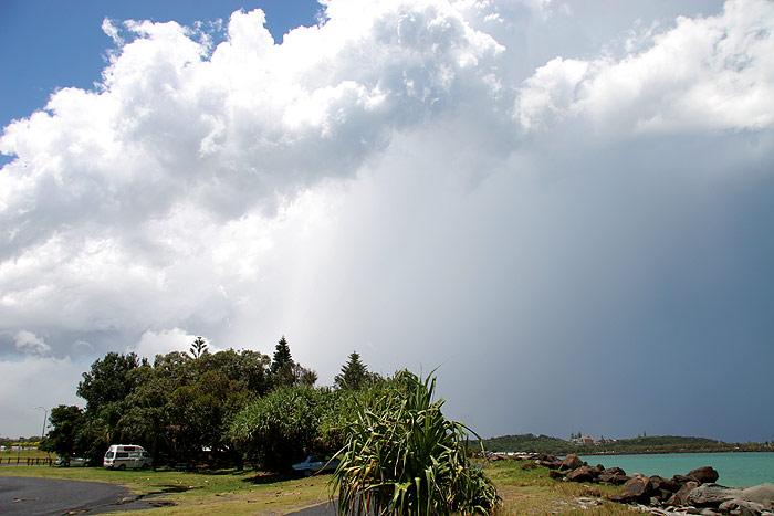
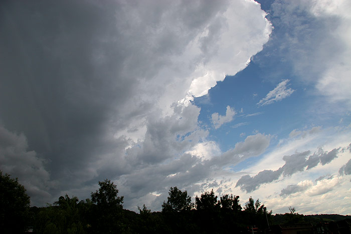
We continued on to East Ballina and stopped by the Richmond River as the storm
moved out to sea - it was just too quick for us after having to contend with
Ballina traffic! But the dramatic scene was just perfect - very high updrafts,
CG lightning out the back and the colours of the water.
Someone stopped to say hello and reported that small hail fell at West Ballina
so we must have just missed it. We spoke to Rodney who was approaching Parrots
Nest south of Lismore. He reported new storms in the west of the region and
we could see some of that activity from Ballina. Ray also provided a radar update
and mentioned a strong storm in the Tenterfield area heading into the Northern
Rivers, as well as other activity along the Richmond Range.
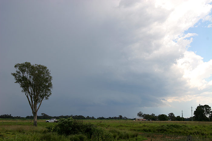
We moved to a spot near the intersection of the Pacific Highway and Teven Road
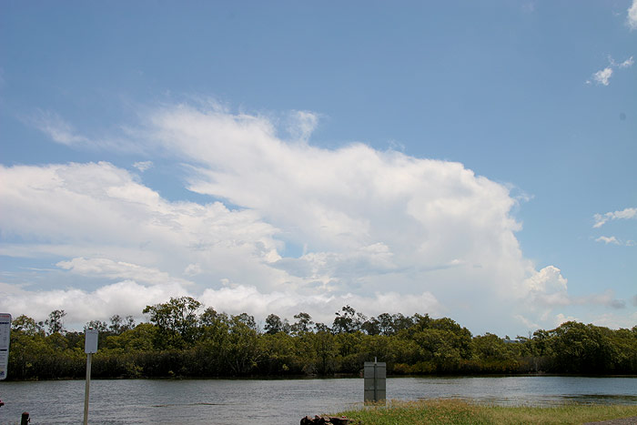
just west of Ballina. The storm that passed through Ballina rapidly died and
was soon just an anvil. Other local activity tried to get going but just wouldn't.
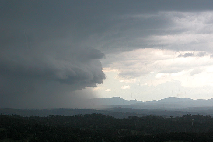
We watched for a while as a tall but narrow looking storm with nice updraft
- downdraft separation tried to get going to our west (it was in fact near Casino).
Anvils spreading to the ESE further south of this storm got our attention. The
one near Casino seemed to be dying so we took off south along the Pacific Highway.
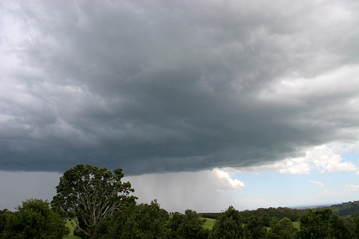
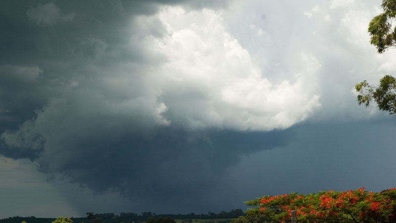
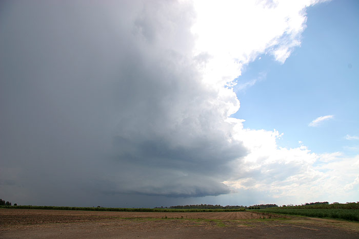
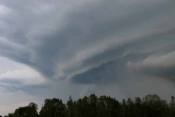
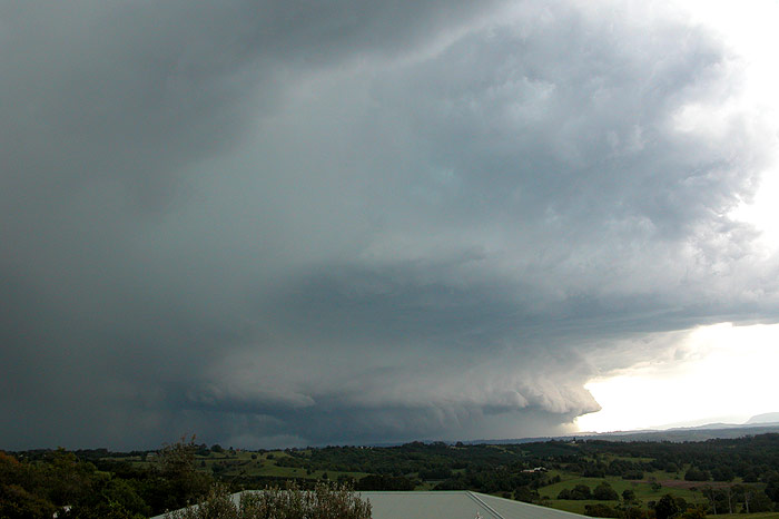
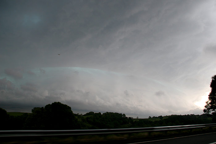
We fuelled up at Wardell and it was pretty obvious a strong storm was organising
to our WSW. We got through Broadwater then 10 ks west to the Wyrallah Road.
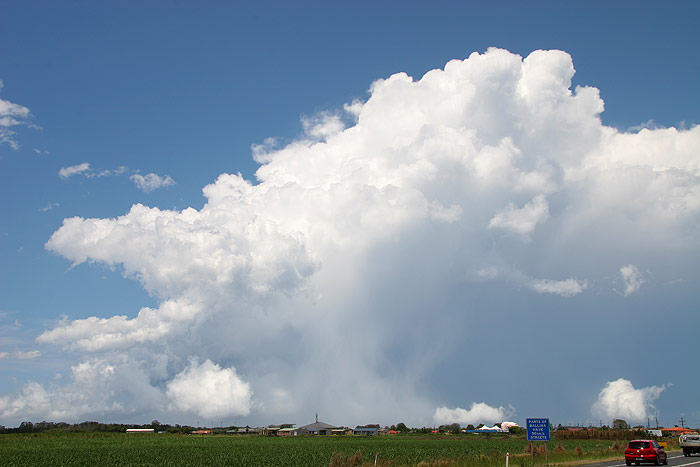
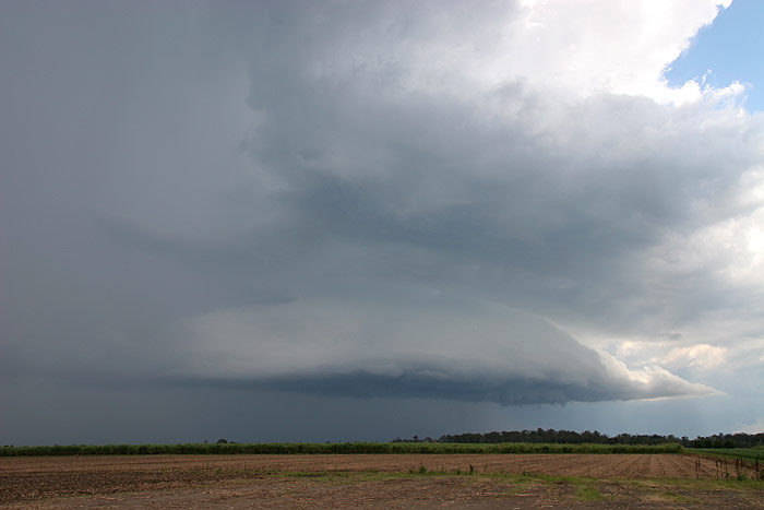
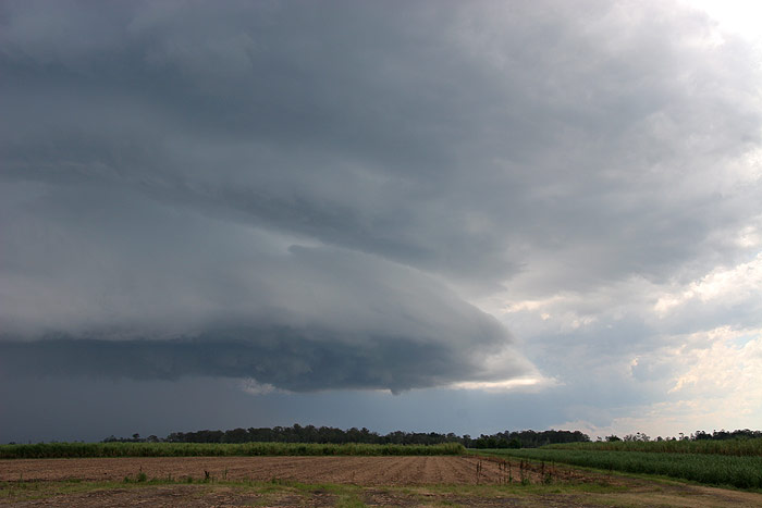
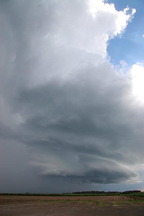
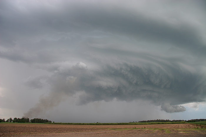
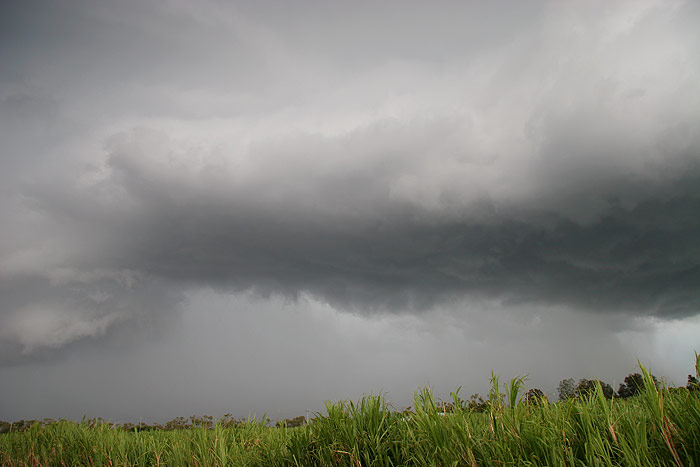
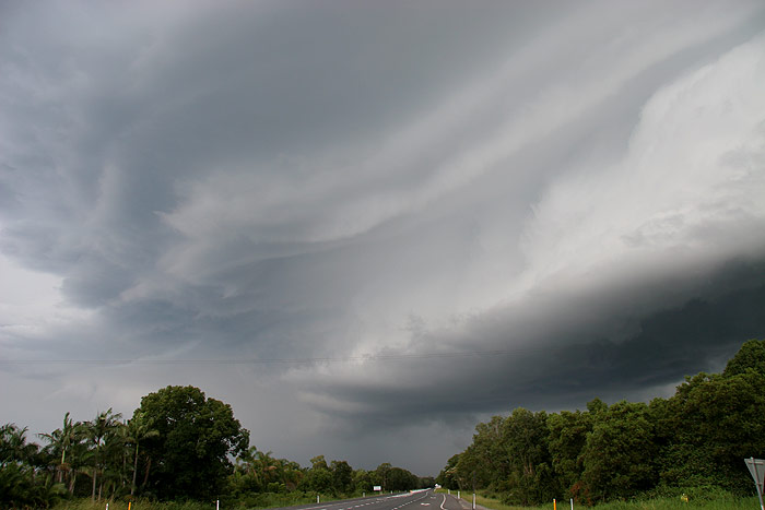
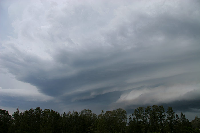
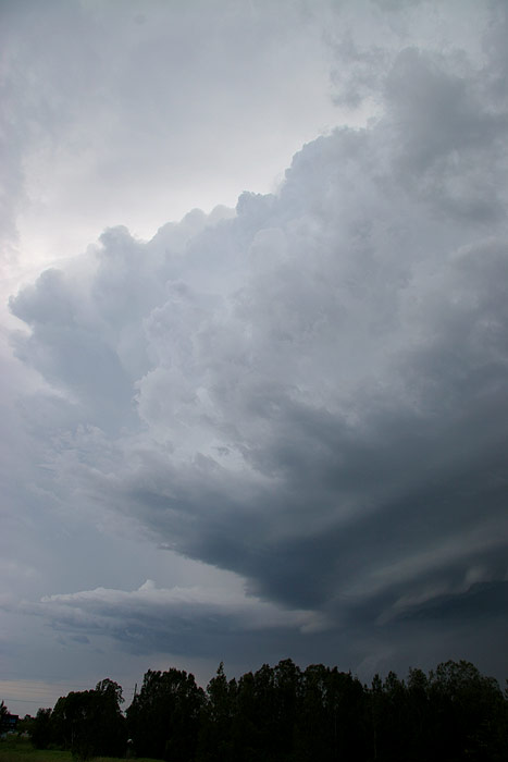
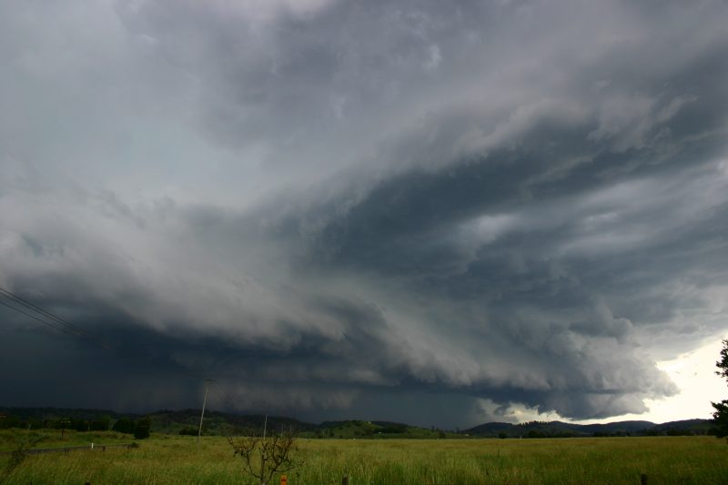
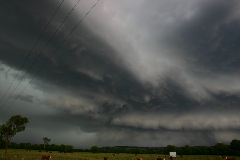
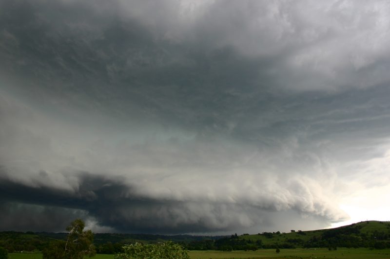
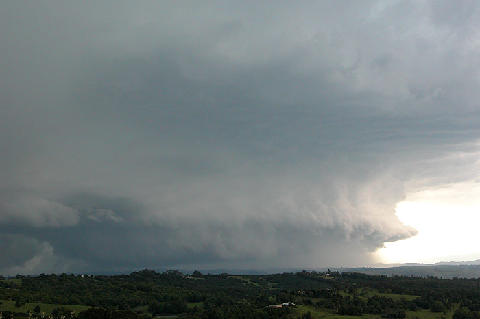
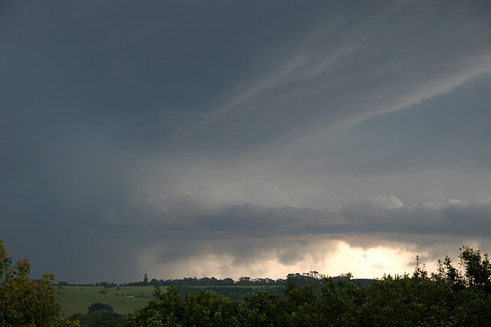
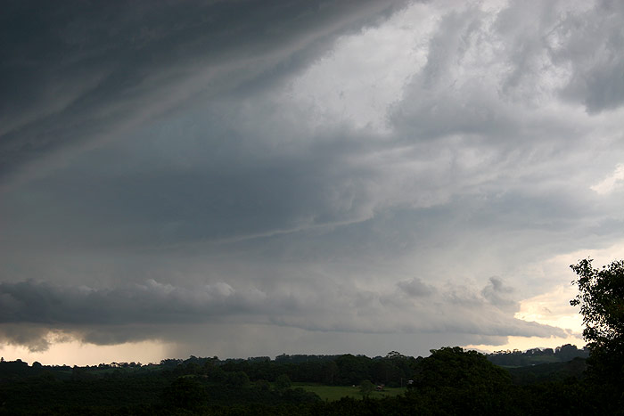
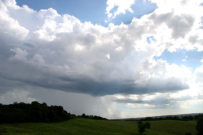
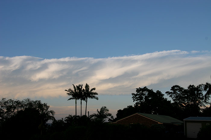
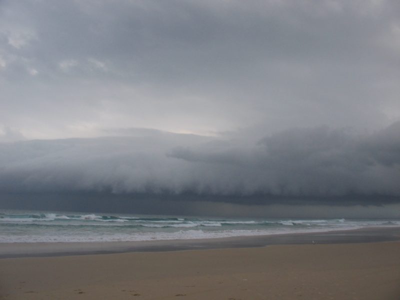
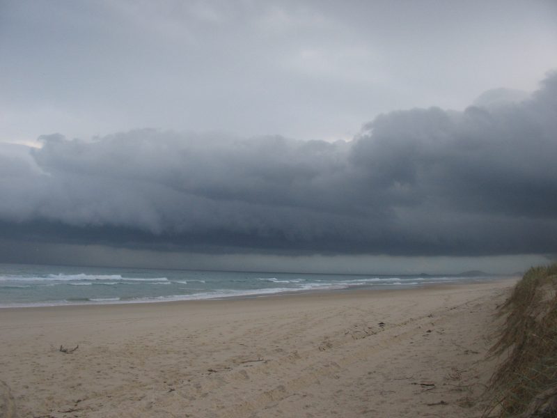
A shelf cloud feature had already formed on this very large storm's NE flank.
Watching this evolve was breathtaking. There was no hint of it becoming outflow
dominant, with smoke from nearby fire illustrating that nicely. Lightning was
regular and the thunder was just beautiful, in fact it was a case of "watching
lightning crack over cane fields" (or words to that effect from a well know
Aussie pop song). The towers were pushing higher and higher with a thick anvil
spreading off to the ESE.
Rodney was watching this beast from Parrots Nest so the cell was very well documented.
He even managed to get one of those elusive "smokenados".
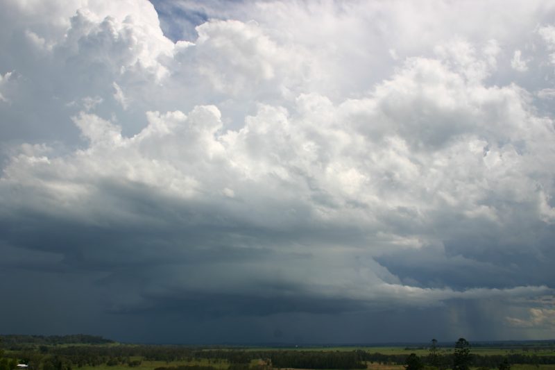

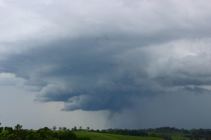
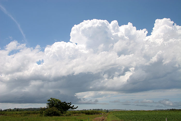
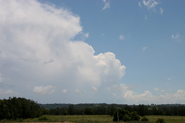
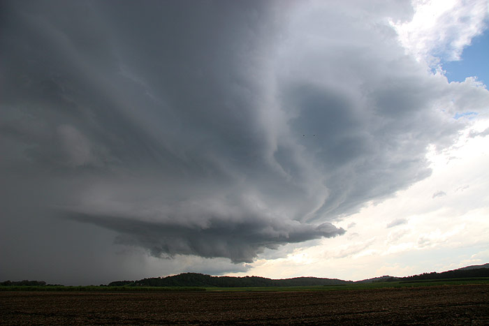
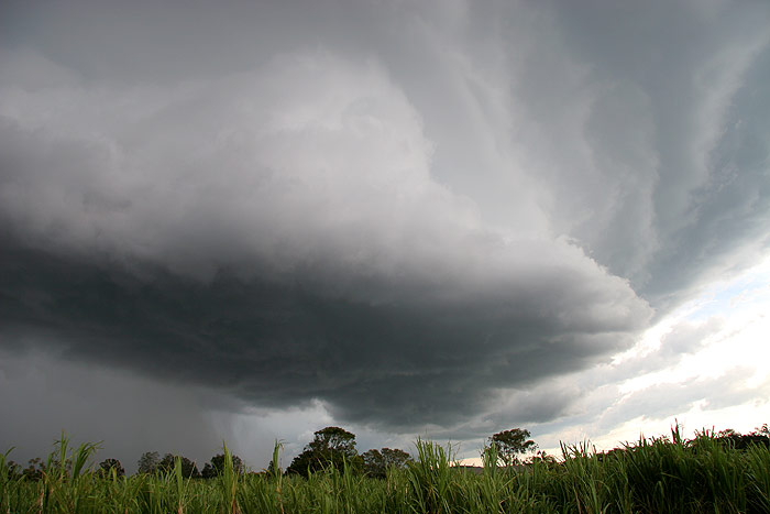
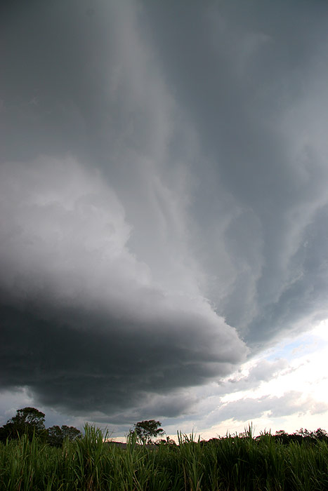
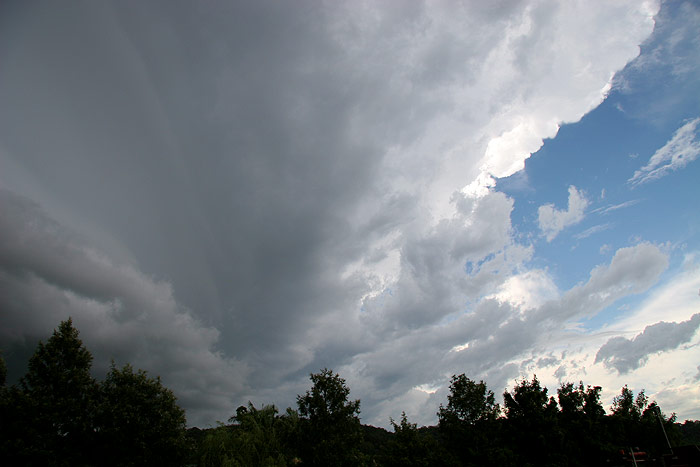
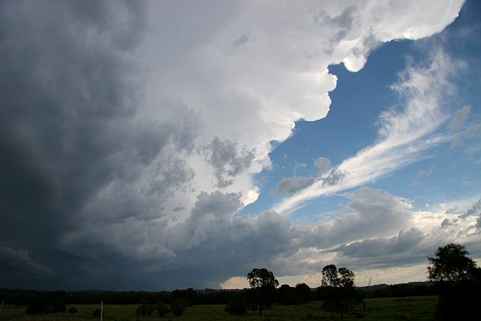
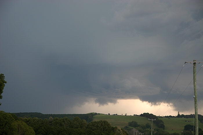
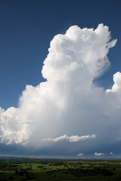
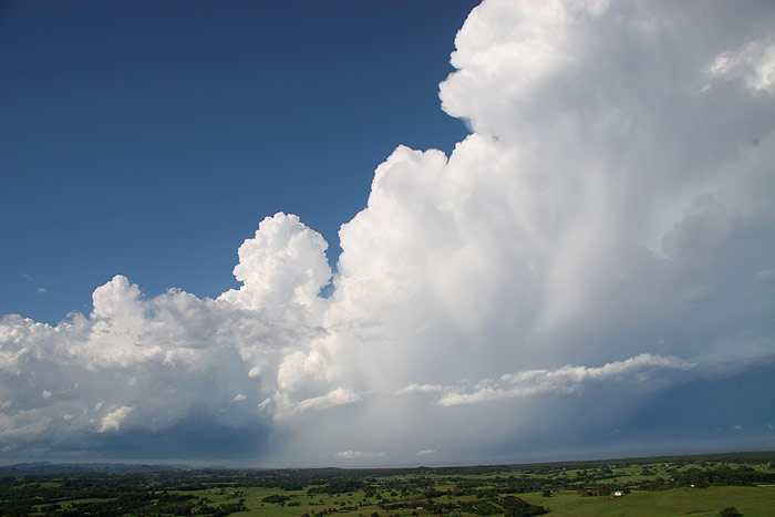
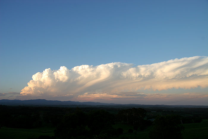
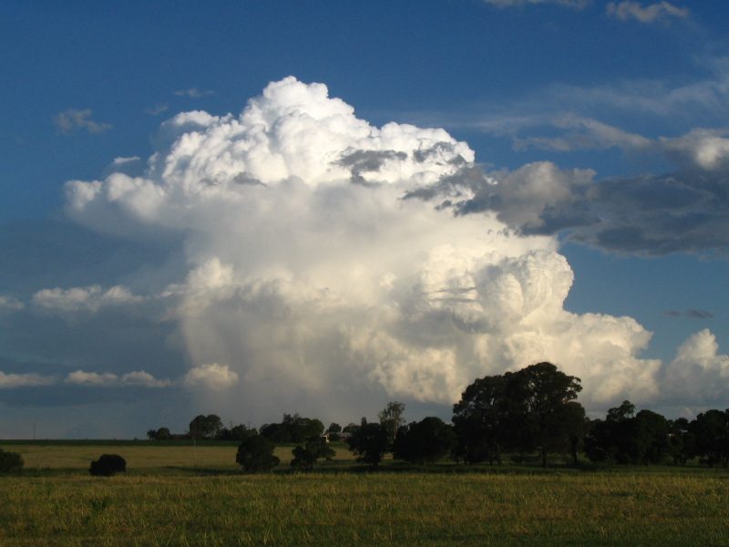
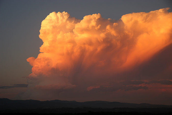
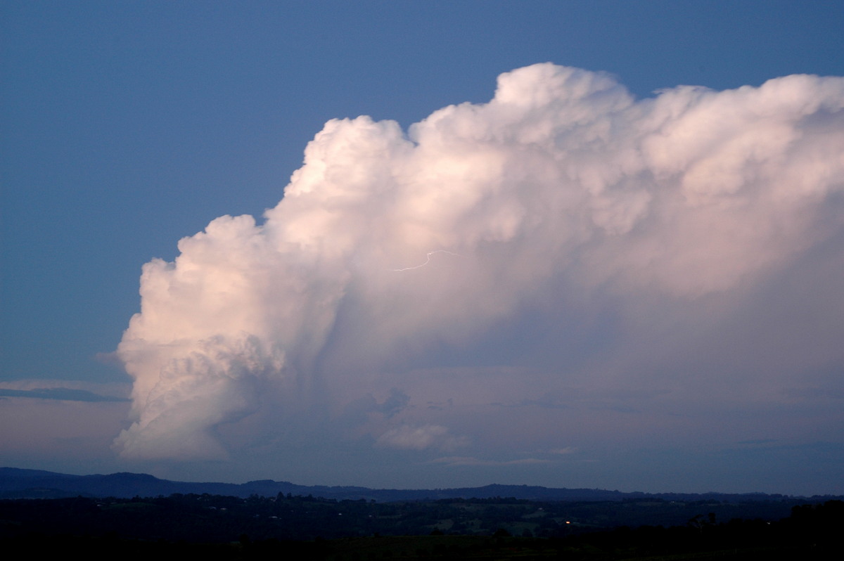
As the storm got closer its overall structure was very much of a supercell.
We had this amazing storm to watch but had to move as it was now getting a little
too close. On top of that, we could see the really big storm of the day coming
into view to the WNW.....
As soon as we left, we got stuck behind a cane truck going 40km/h on a one lane
road! Stuff that ! We chose to stop a couple of times and let the truck get
ahead. We continued on but I knew this storm was a beast by the regular groans
of excitement by Dave : )
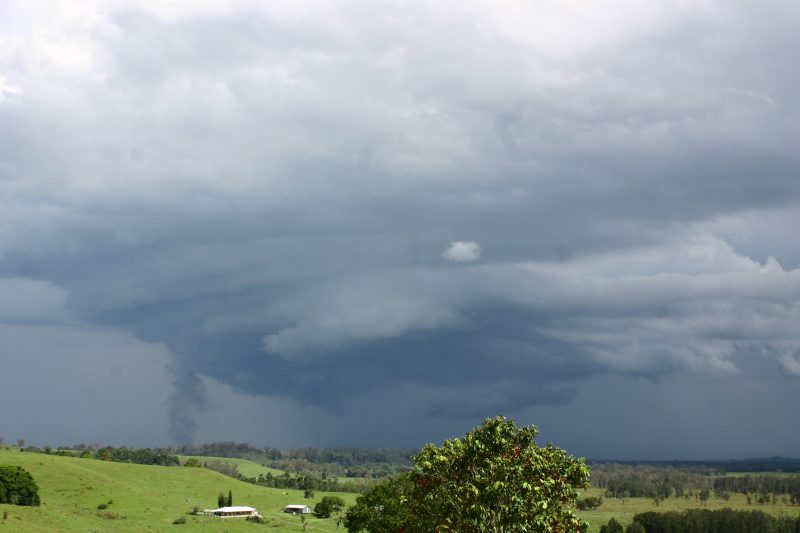
We got back into Broadwater and noted a brief funnel from the storm which was
really only about 3ks from us. We headed north, leaving the storm behind. Very
large drops of rain spatted on the windscreen.
John Bath in Ballina captured a few shots as this storm came over town.
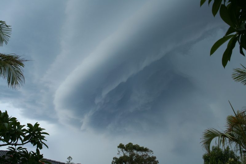
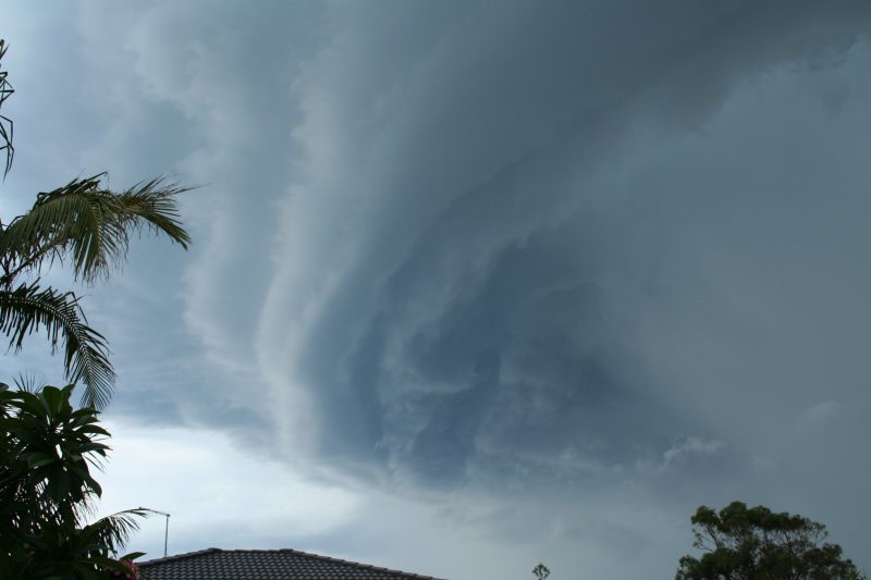
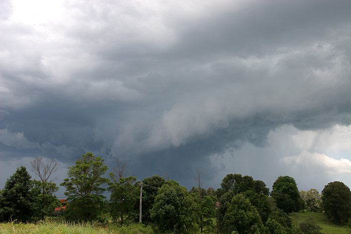
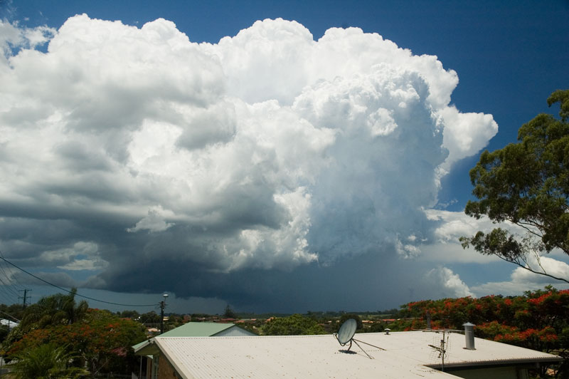
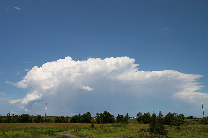
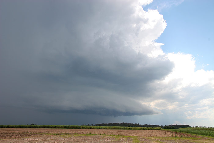
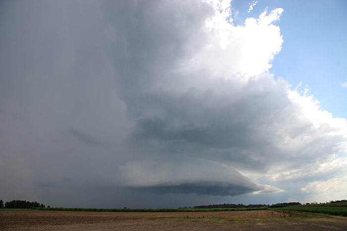
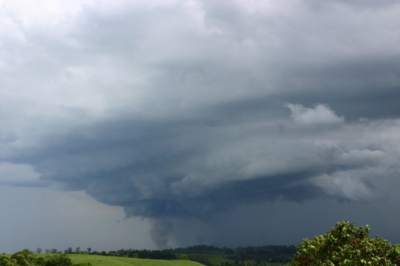
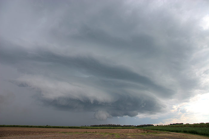
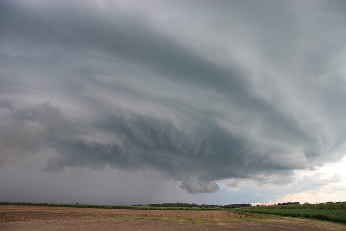
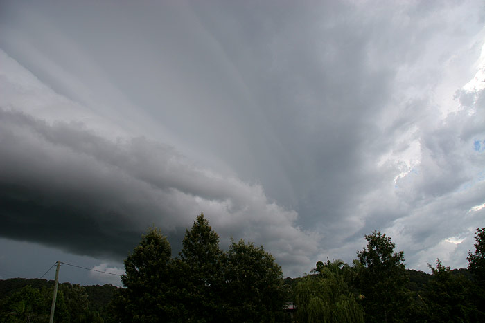
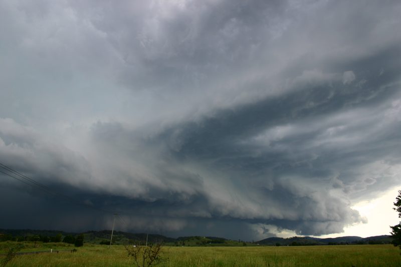
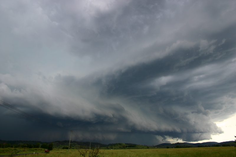
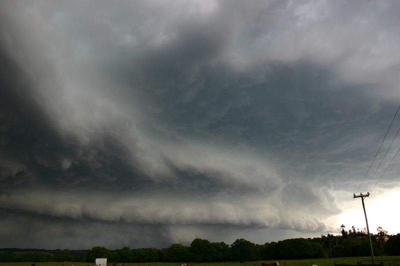
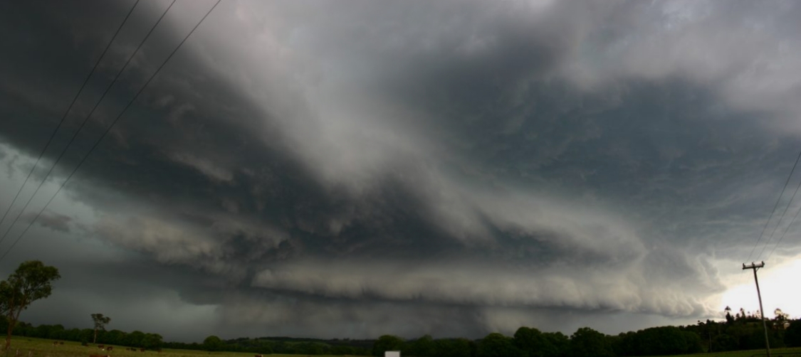
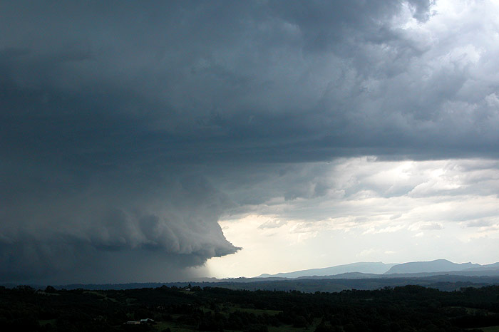
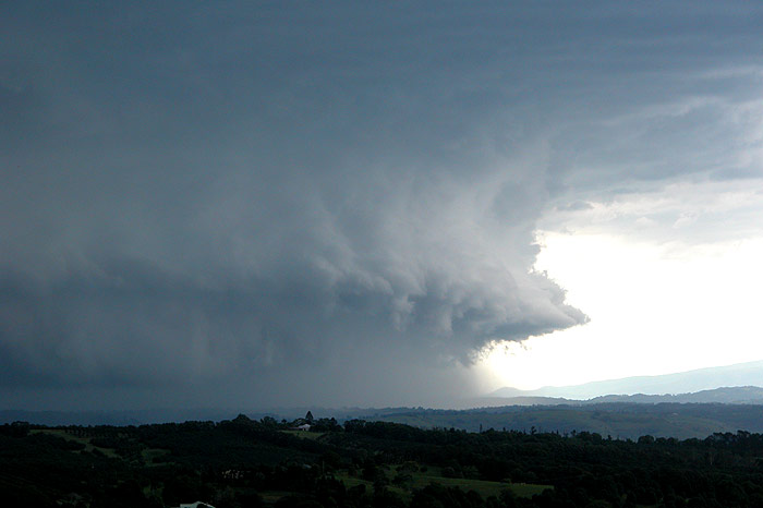
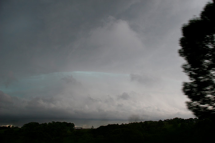
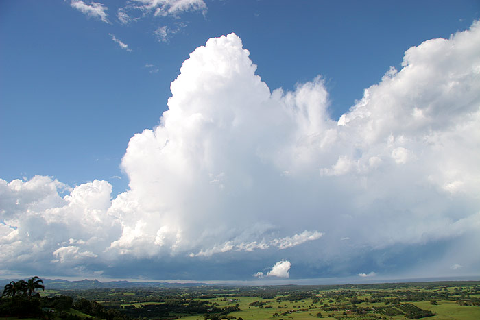
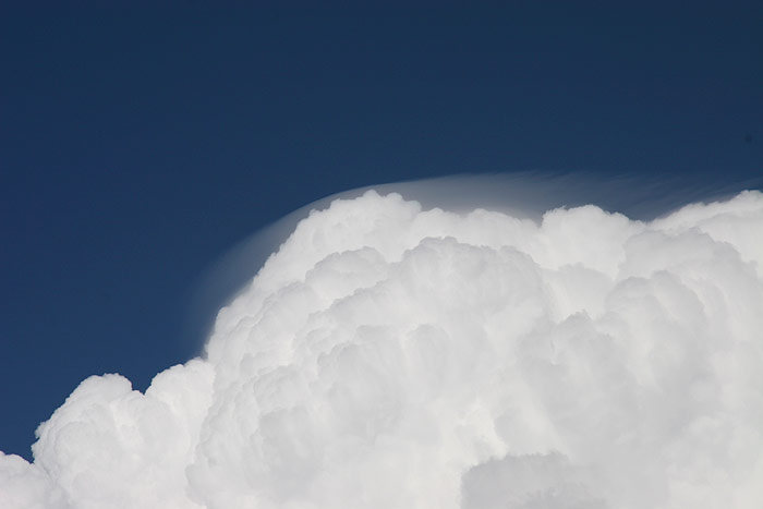
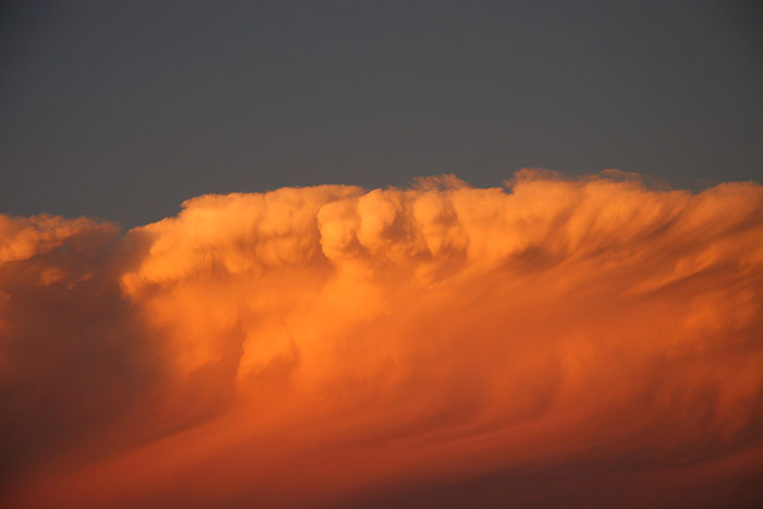
The main event was now coming into better view. The forward anvil structure
was some of the most powerful looking we have witnessed - so high topped, thick
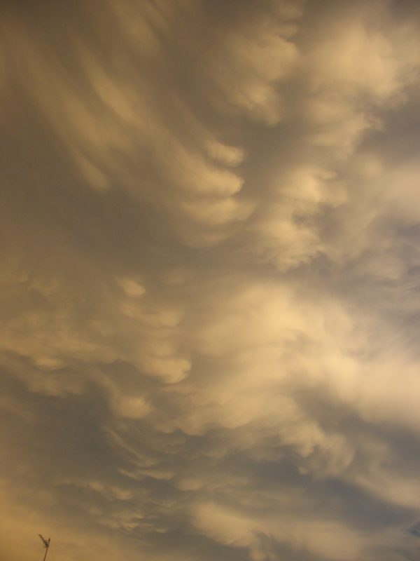
and full of knuckles. Striated 'donuts' were also visible overhead during the
drive. We were soon back at the Pacific Highway, Teven Road spot.
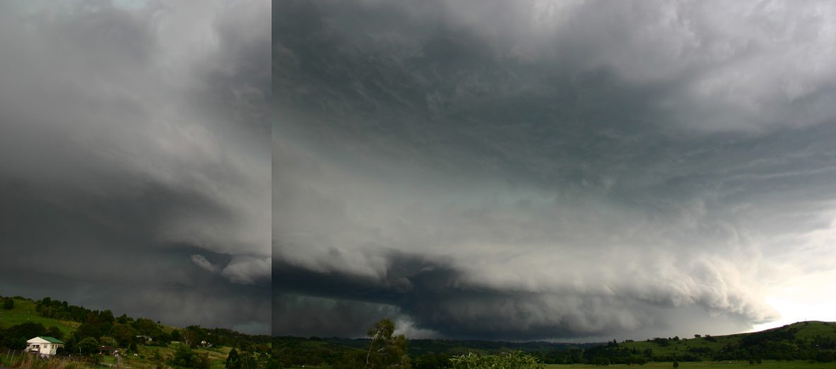
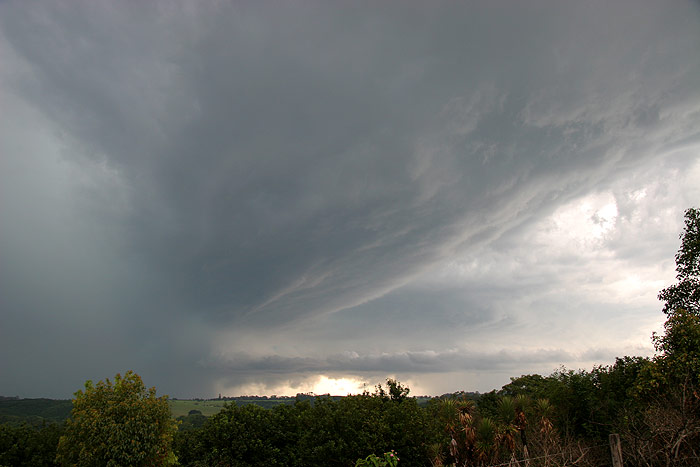
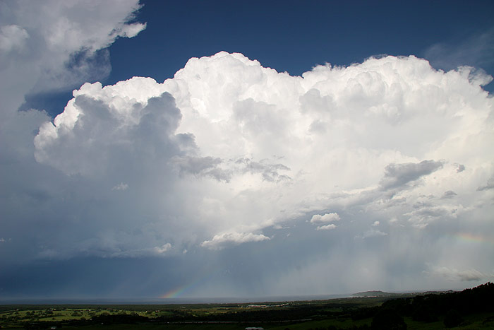
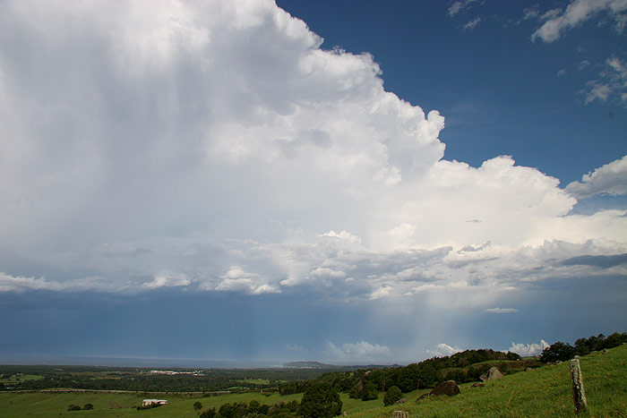
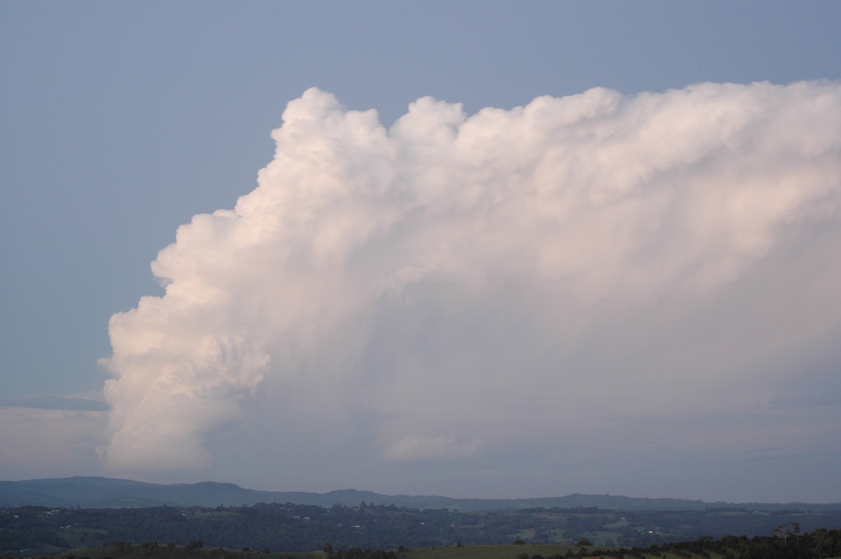
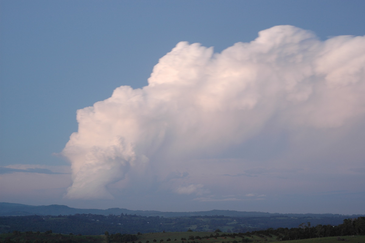
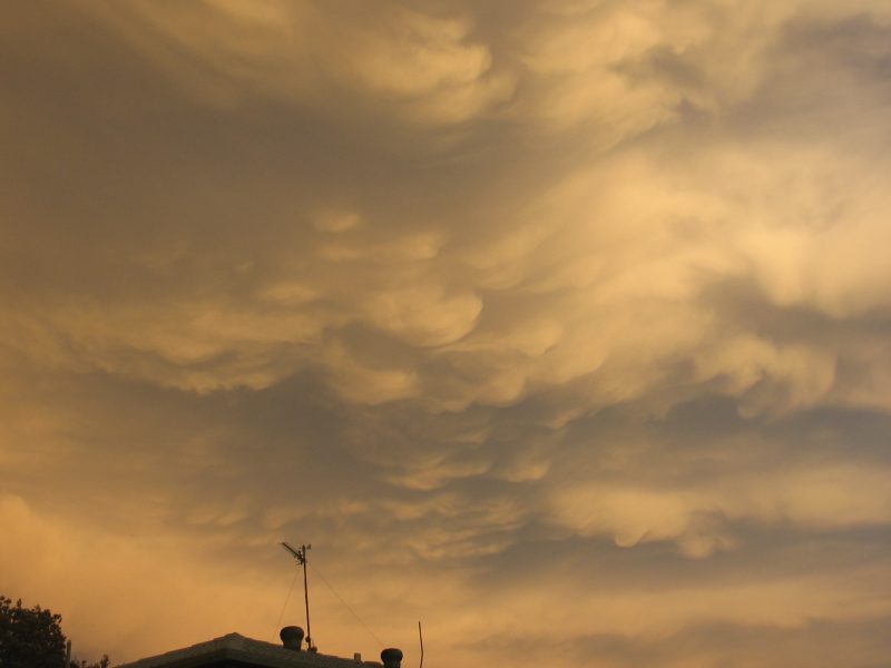
The scene was almost unbelievable - the shelf cloud structure to the south of
the storm we had just let pass, and this enormous supercell to the west ! Geeez
! We had no time to wait and had to keep heading north.
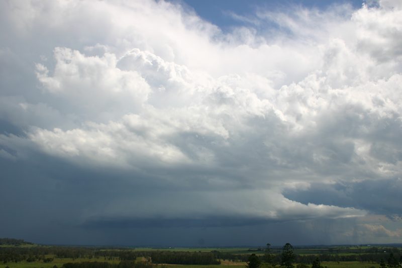
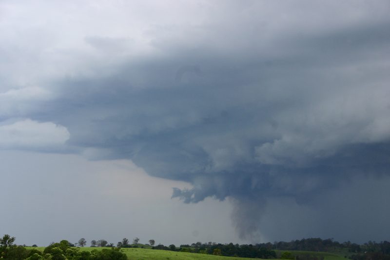
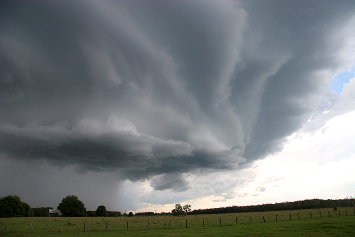
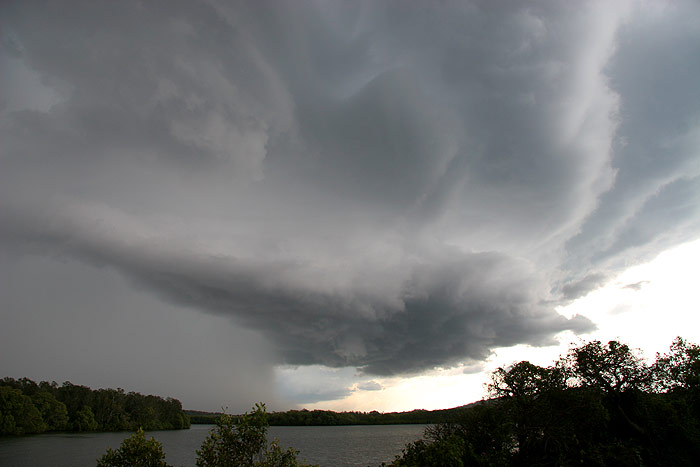
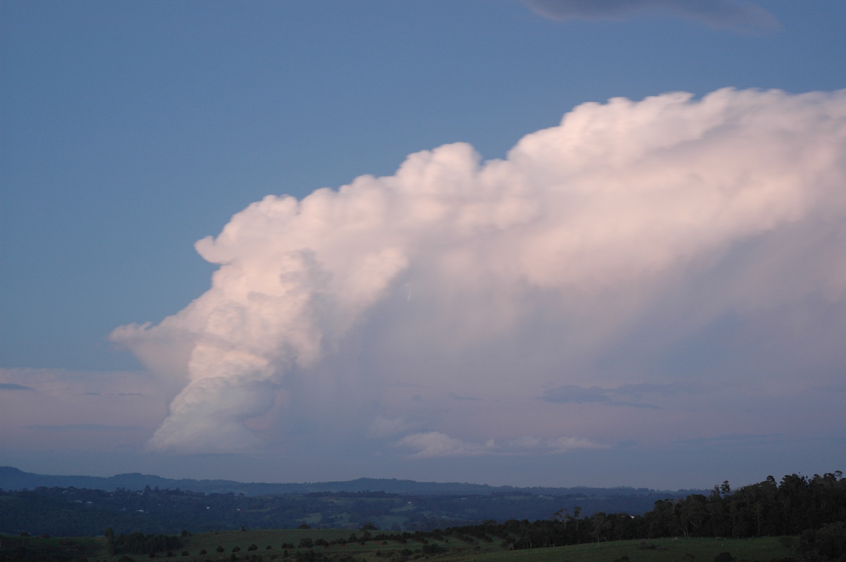
Meanwhile, Rodney was perfectly positioned ahead of the supercell after moving
through Lismore and onto the Bangalow Road. He captured these amazing shots
of the base structure from just west of Lismore, north of Lismore and then at
Bexhill.
Owen Ellem was also photographing the scene from his home at Wollongbar,
including one photo of the earlier supercell.
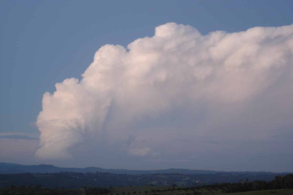
Dave and I headed along the Teven Road then back onto the Pacific Highway at
Tintenbar, avoiding the Ballina congestion. The structure of this massive storm
continued to amaze us. We had not seen anything like it since the HP Supercell
with Mothership feature of 30th March 2003. We stopped briefly at a couple of
spots and continued to video before getting to Knockrow for a better view. Awesome
!!!! There was a constant background noise from the thunder.
We had to keep heading north to ensure we would not cop any severe weather,
though it was noted the BoM had issued a severe thunderstorm advice and mentioned
this cell was "particularly dangerous". It looked like the storm was passing
over our homes at McLeans Ridges and Wollongbar, but fortunately only heavy
rain and some smallish hail fell there. The main core moved just west and to
the north of Lismore.
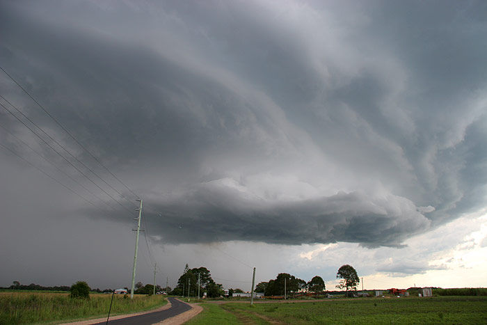
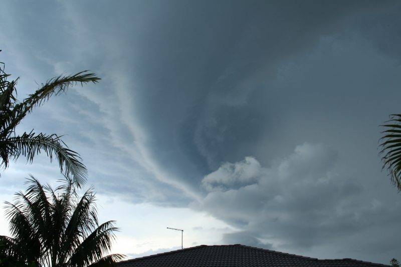
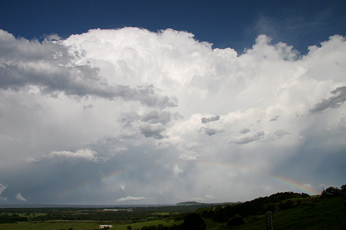
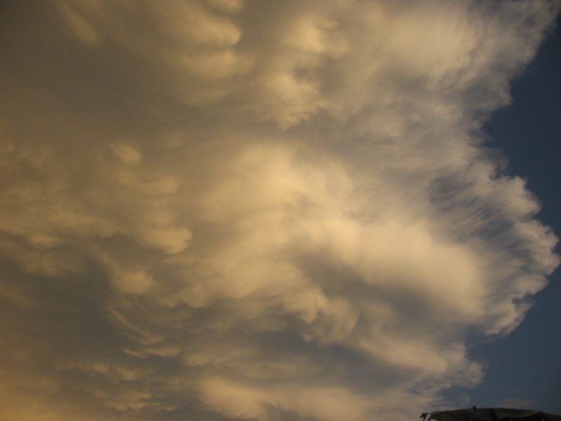
The greenage above the shelf cloud structure was unreal but we were not to see
it for long. Dave snapped a couple of pics at Bangalow, but just as we arrived
at Saint Helena, stratus covered the sky as it raced into this storm. It was
quite weird, knowing the huge storm was just to the SW, but not being able to
see much apart from the precipitation cascades and constant CG lightning.
We decided to head further north to one of the Pacific Highway overpasses in
case we got clobbered. It was a lucky move as these freaky clear air CGs starting
raining down right in front of us ! Bang, crack, pulsating bolts, it was so
amazing, driving near the Byron Bay turn off and all these bolts happening -
and captured on video.
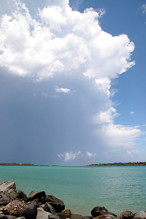
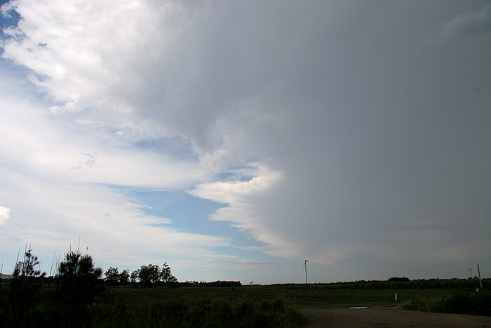
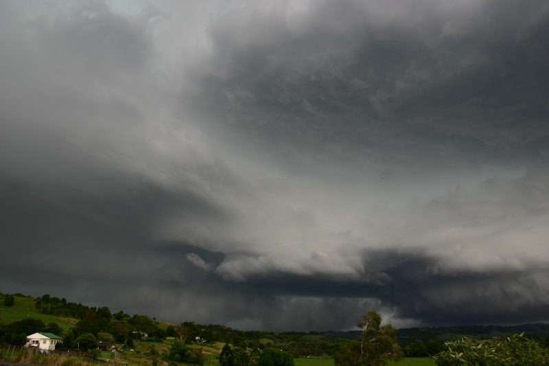
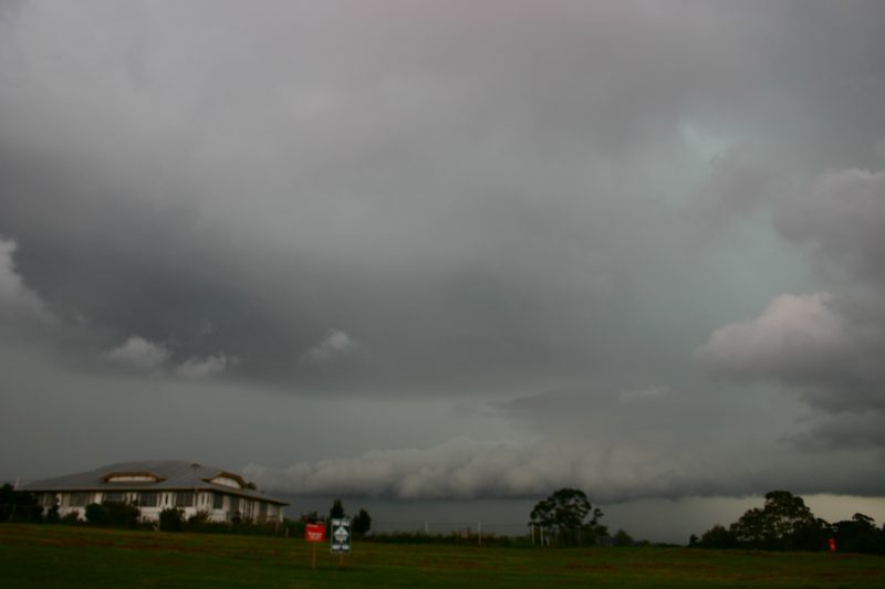
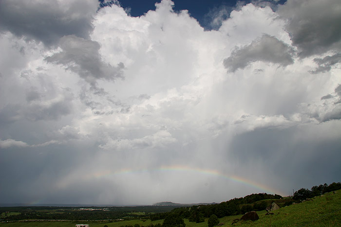
It was really hard to know what to do now. Ray gave us a radar update saying the storm would go over Byron Bay. Good- we were enough north of it now, but was it firing up to our NW as well ? We stopped on the Brunswick Heads turn off and waited. Extremely heavy rain hit and then John Graham phoned from Bangalow with the tink tink tink sound of hail pelting his car. It appeared the storm was now just to our southeast, so we headed back south. Violent rear flank downdraft winds ripped through the area just south of Brunswick Heads. Another incredible scene - the air was now almost completely clear at our location and to the west and southwest, yet the winds were gale force with lightning !
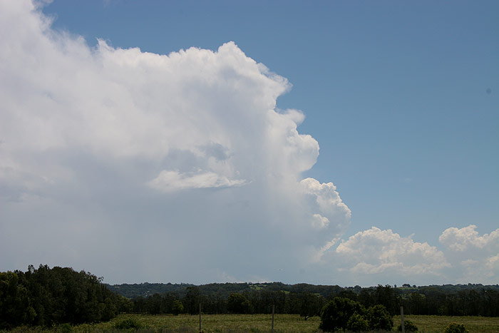
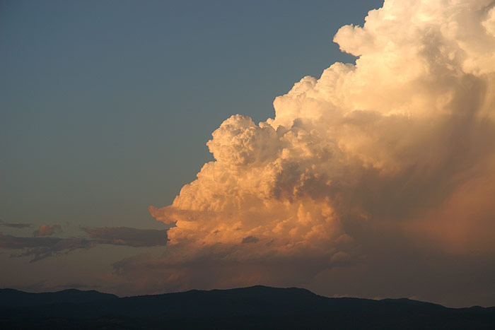
We went back up the hill to Saint Helena to watch the activity now out to
sea and another cell that had popped up just to the southwest. The height of
the supercell and new storm development was breathtaking. They were easily 15km
high and the rear flank lightning was constant. The new nearby storm developed
a nice base and started to fire out some CGs too.
After about 20 minutes I decided to phone Rodney and find out where he got himself
to in all this action. Hello, where are you ? Saint Helena... Oh, so are we,
where abouts? at the lookout.... hmmmm - sure enough just 50 metres away up
the road and we hadn't spotted each other !
We all enjoyed the rest of the show and talked excitedly about what had just
happened and what an amazing day it had been.
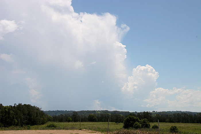
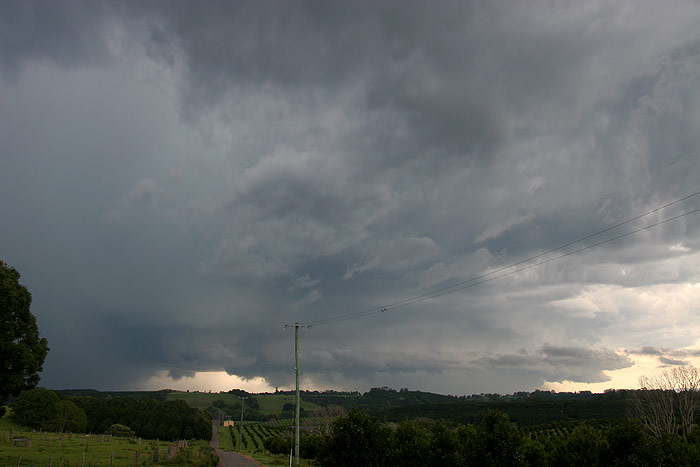
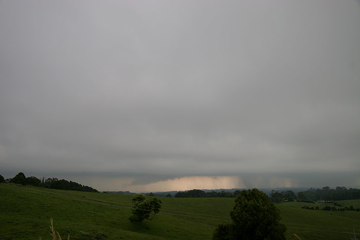
Western parts of the Northern Rivers now looked dried out so we decided to head
home about 6pm. One final small cell got going and dumped torrential rain on
us for about one minute near Knockrow.
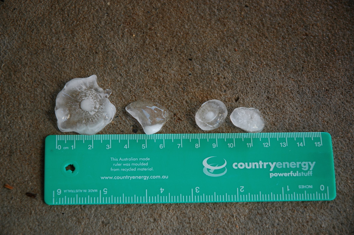
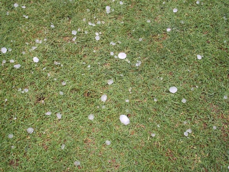
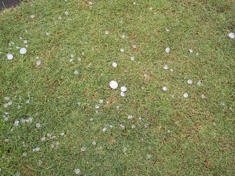
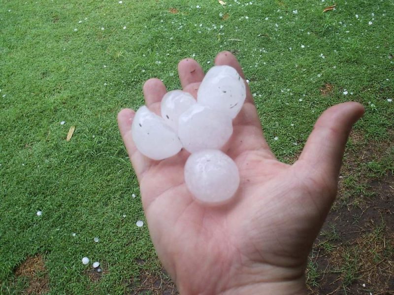
Dave went home just in time for a family BBQ at Wollongbar, and Rodney came back to my place at McLeans Ridges. My wife Alison had saved some hail for us to see. The largest was 3cm in diameter, but most of it was half that size.
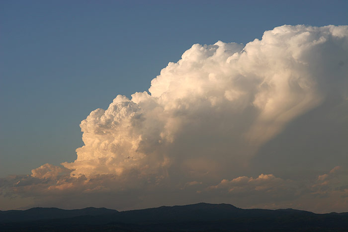
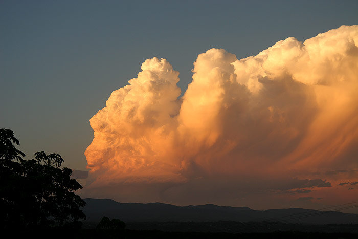
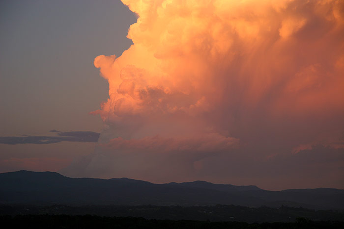
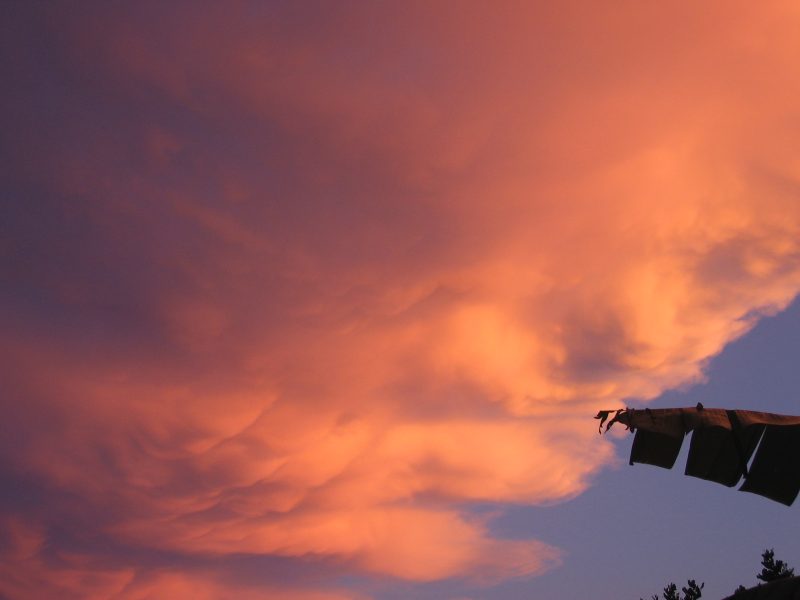
The storm action was not over. An isolated cell developed to the NW about
100km away just over the border into Queensland. This multicell persisted into
sunset and headed ESE, crossing the border near Murwillumbah. The sunset structure
and colours were incredible. It then evolved into a rotating LP storm as the light
faded, spitting out faint updraft lightning. This cell collapsed completely by
about 8.45pm.
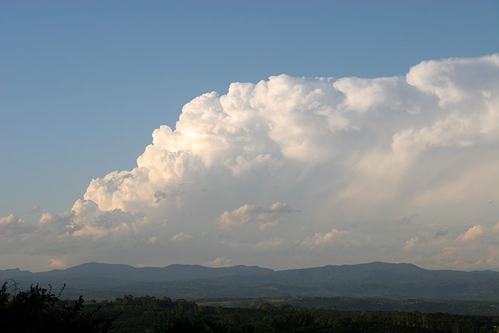
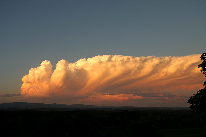
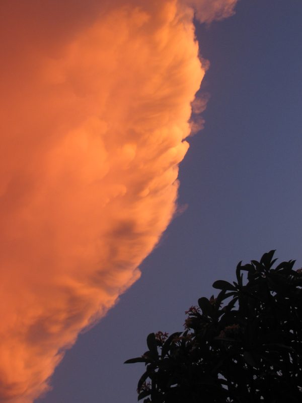
Neil Pennell from Kalbar in SE QLD took this photo of the same storm above, but from the northern side at 7.06pm:
It was interesting to note that the storm pushed up fresh updrafts at the back
continuously for about 1.5 hours, until the corkscrew structure commenced, at
which point no new updrafts formed and just the one rotating one persisted until
the storm's demise.
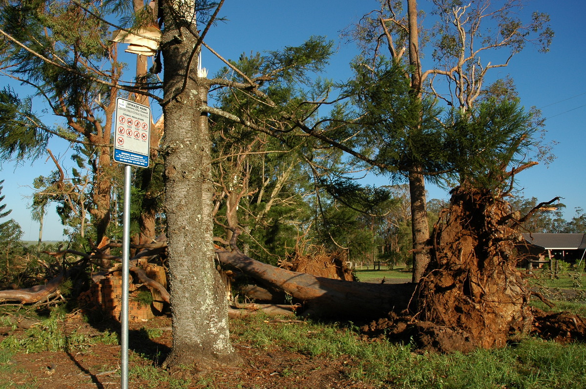
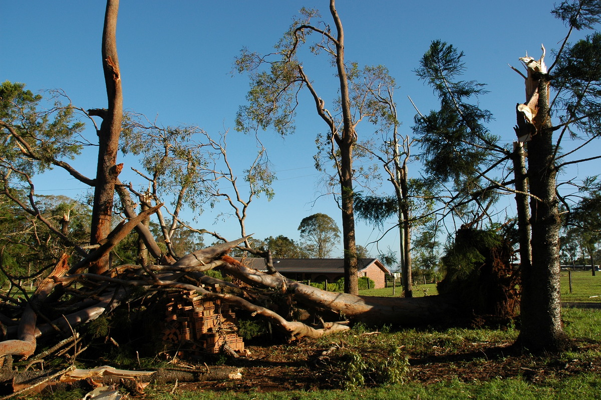
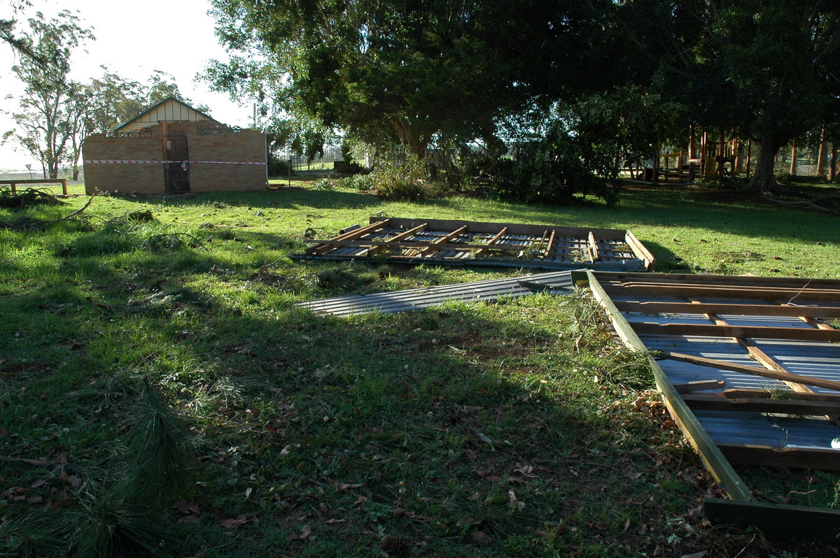
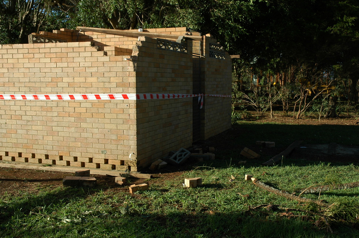
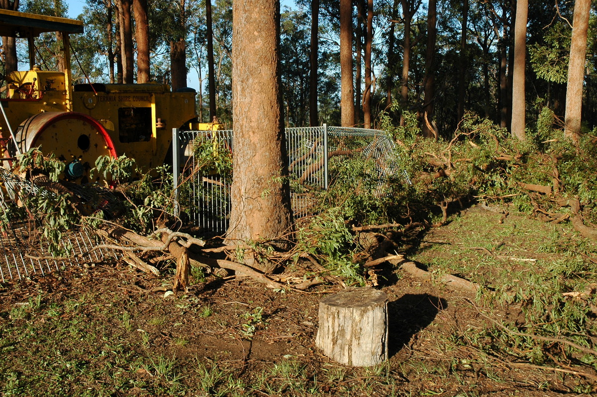
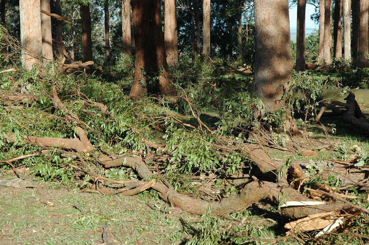
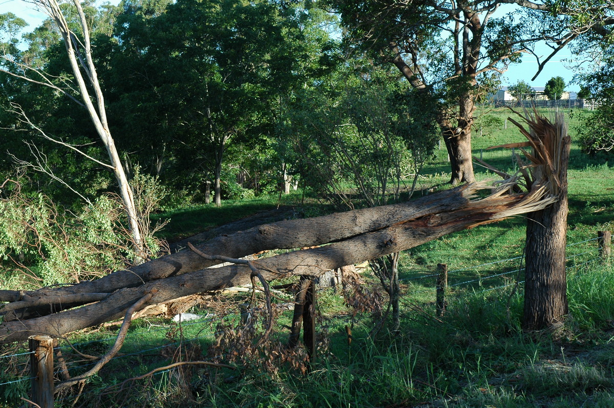
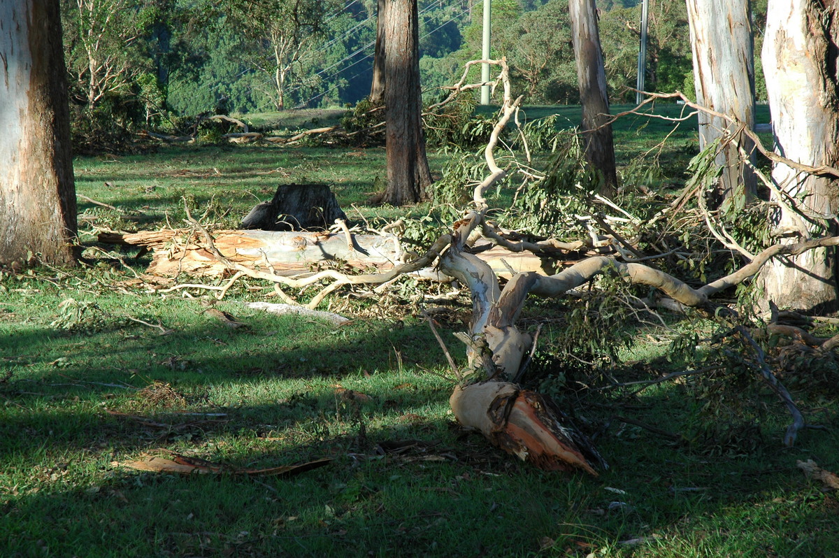
Aftermath
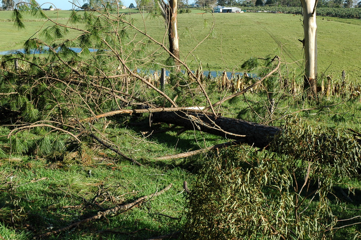
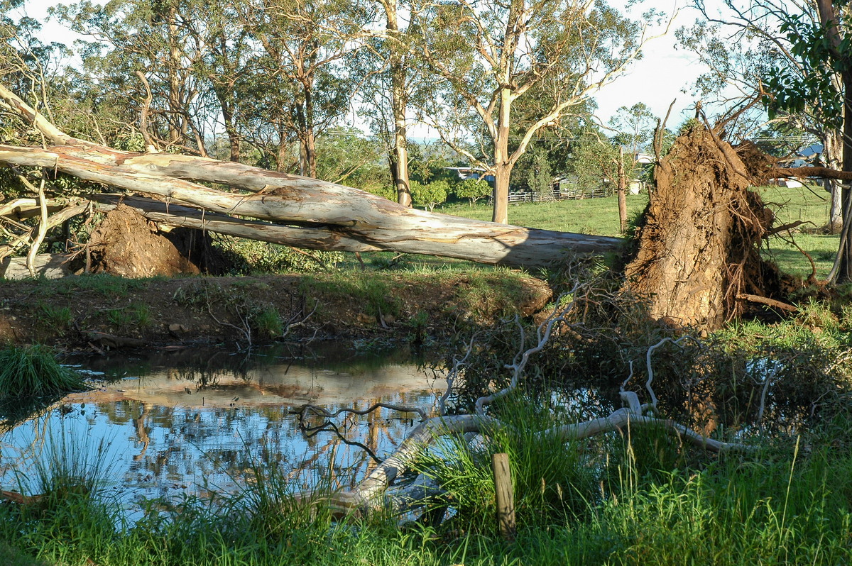
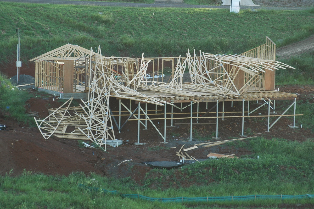
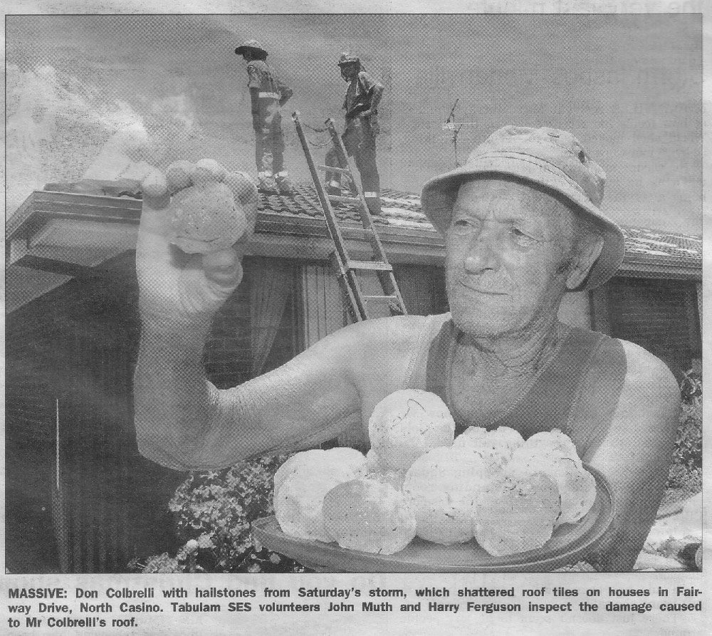
The storm caused extensive damage to homes at North Casino - in particular from giant wind driven hail. The SES has responded to over 230 calls for assistance. Modanville and Tullera just north of Lismore also received extensive wind damage to trees, property and farms. Winds are estimated to have reached at least 150km/h. These photos were taken mainly along the Dunoon Road.
Claudia Halstead from Casino took these photos during and just after the storm passed:
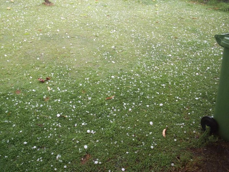
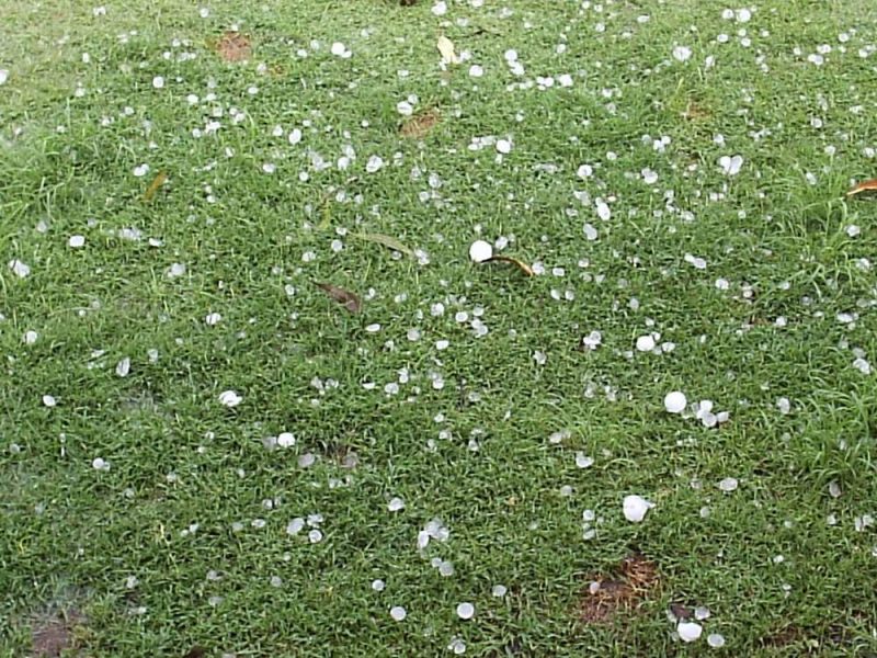
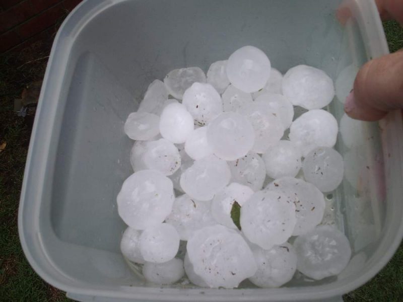
The Northern Star newspaper obtained a photo of the giant hail that fell at North Casino.
Halden Boyd of Evans Head reported that the Jetstar flight into Ballina was struck by lightning about 3.55pm. He saw the bolt hit the aircraft and exit the wing tips of the low flying jet.
The Casino Airport observations of wind gusts and direction are interesting, and clearly show the mesocyclone passing over the AWS.
15:34  44km/h  SSE
15:35  63km/h  SSW
15:36  95km/h  SSW
15:40  109km/h  W
15:43  109km/h  N
15:44  109km/h  NE
15:46  109km/h  ESE
15:47  67km/h  E
Other Photos
Bec Van der Waal took these photos at Kingscliff of the main storm crossing the coast, and later the sunset LP storm structure:
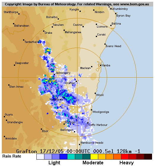
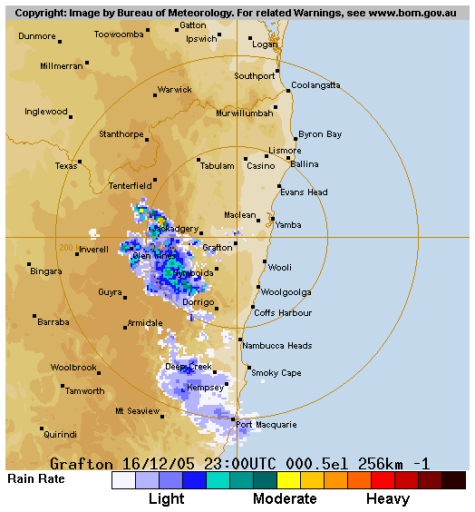
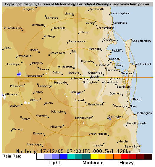
From Weatherzone and MODIS: Land Rapid Response System
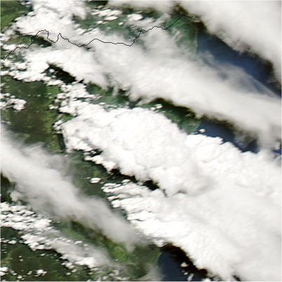 3.15pm local
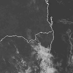
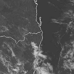
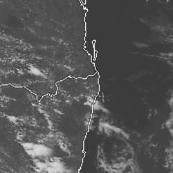
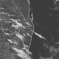
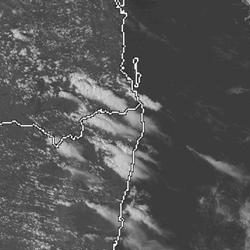
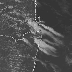
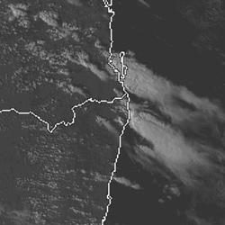
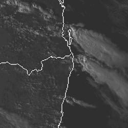 11am to 6pm local
From Bureau of Meteorology
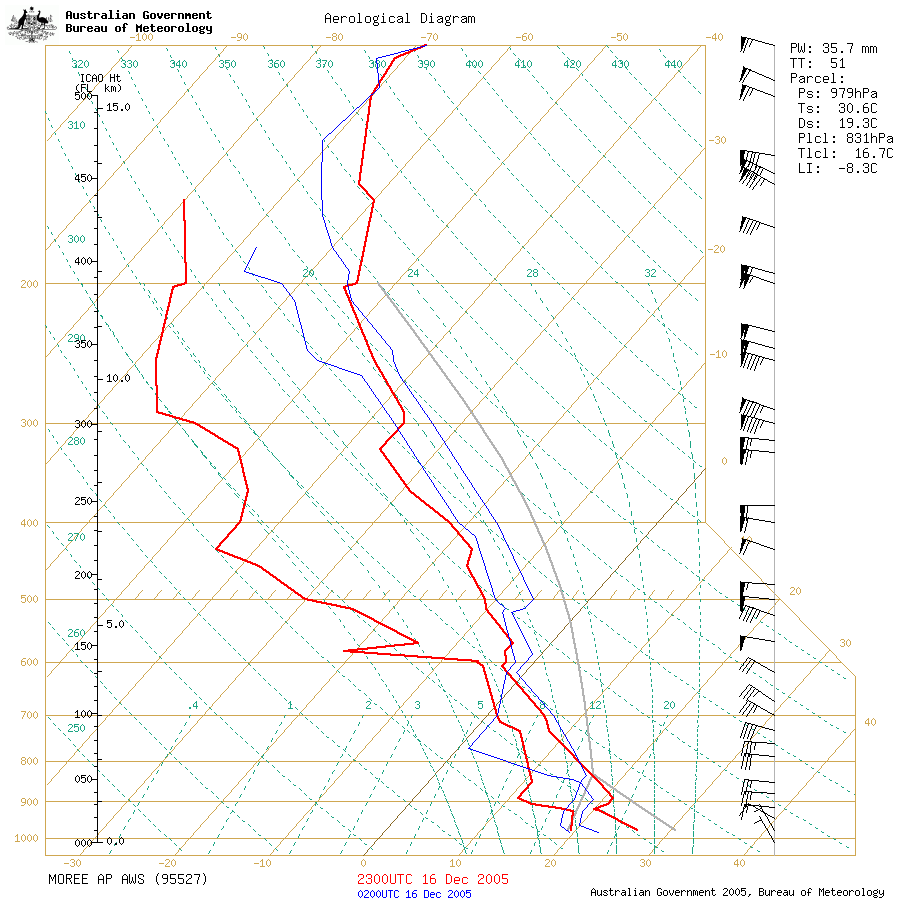
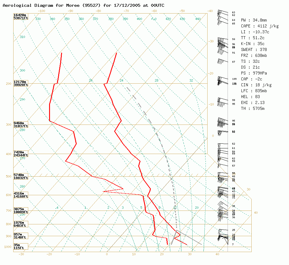 Moree sounding at 9am 17/12 local (second one is modified to 32/21)
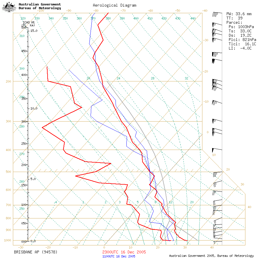 Brisbane sounding at 9am 17/12 local
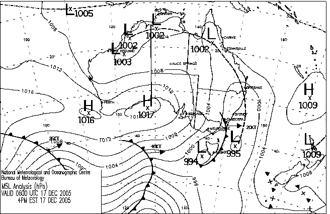
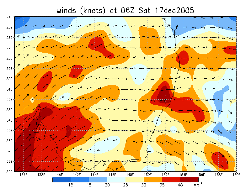
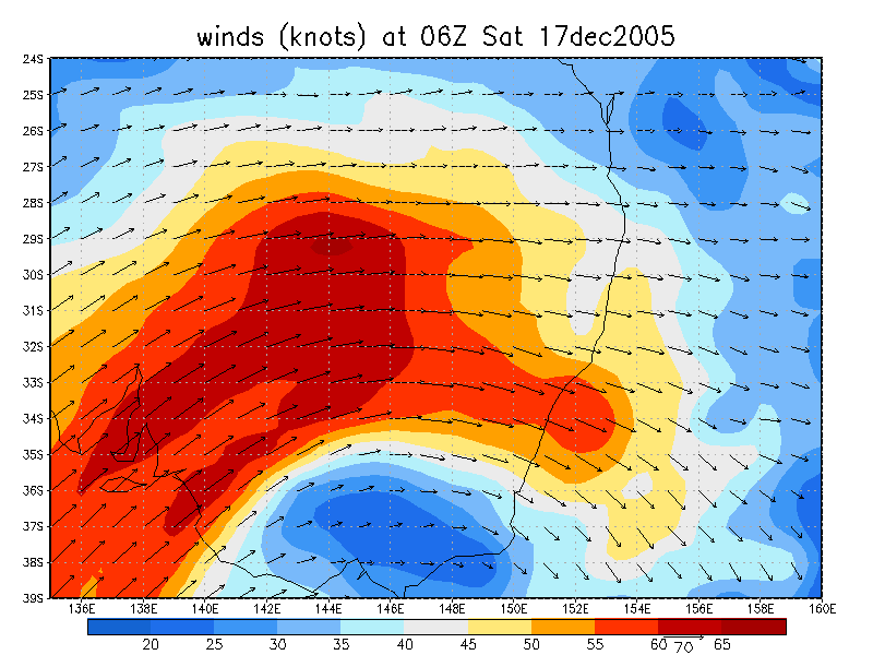
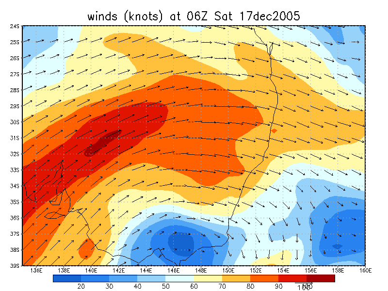
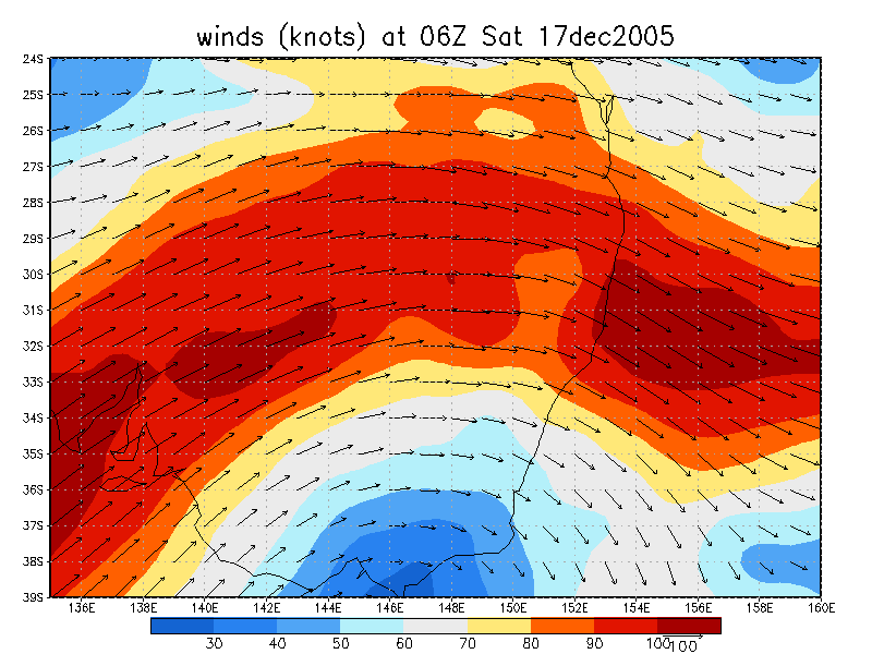
From NOAA 17/12/2005 06z analysis
|
Document: 200512-04.htm Updated: 31st December, 2005 |
[Australian Severe Weather index] [Copyright Notice] [Email Contacts] [Search This Site] |