and Chasing
[Index][Archives]
Storm Chase 3rd to 5th November - Including the day of the "Beaver Tail" inflow band
by Jimmy Deguara
| Storm News and Chasing [Index][Archives] |
Storm Chase 3rd to 5th November - Including the day of the "Beaver Tail" inflow band by Jimmy Deguara |
Michael Bath's chase on the same afternoon.
Download the updated
video clips of the beaver tail funnel and supercell structure below...
I took Friday
off as I thought it was an ideal set up. Actually Sydney was not looking too bad
either but the models had the Hunter firing and this took my fancy. You simply
don't take the day off and hang around Sydney. Well what an idea that was!! The
models were indicating instability and a favourable moisture profile for severe
thunderstorms. The dew points were very high particularly in Sydney and the Hunter
compared to normal.
I decided it was
time to head for the Hunter and whilst on the way to Richmond around late morning,
large congestus were already starting to fire over the Wollemi National Park just
east of Lithgow. The first may have collapsed but the second exploded into a major
updraught and eventually into a major hailstorm. Perhaps radar will confirm a
supercell that basically remained active for the next few hours.
I arrived at Muswellbrook
about 1:30pm and met up with Paul Graham and David Croan about 2:00pm. We had
lunch and discussed this storm and another storm they had seen down southwest
of Sydney. We then decided to go to a vantage point on the outskirts of Muswellbrook
to observe this severe thunderstorm coming over Jerrys Plains (the one we had
both observed earlier).
So when David and
Paul heard of the activity in Sydney: smashed windscreens on the F5 Freeway and
then later the activity moving into Sydney, I didn't really try hard enough to
keep them from getting back. (We then found out about the Sydney tornado - half
an hour by car from my home). But I soon received a phone call from David and
Paul that they were observing a wall cloud and rotation nearby them at Jerrys
Plains (more about their chase in David's report here).
Wow! And we had observed what seemed to be a not so impressive system. I believe
that the vigorous scud activity was a significant observation indicating the storm
was still in progress. I had planned to stay for a couple of days so I began making
decisions where I should go.
After checking
the models, it was apparent that storms would go up with extremely unstable air
(predicted lifted index values of about -9 to -12). This would be in the region
around Moree and even further north and northwest from there. My decision though
was to head to the North West Slopes and this way I could head east or west wherever
action would decide to take off.
I was encouraged
by the exploding congestus on the hills. I decided to have lunch at Bingara, and
then headed to the top of the hill just outside of town. I saw some powerful updraughts
from this system. One thing I did notice was that cumulus congestus was occurring
all over. I could also see in the distance thunderstorms developing rapidly over
Dorrigo (which got smashed by giant hail late that morning).
I was so excited
about the prospect of severe weather, I failed to notice the slight wind change
from north northeast to northwest. I watched as the cell to my south remained
stationary and slowly spread an anvil but really never got going. The closer I got
to Glen Innes, it was quite apparent that the main activity was along the coastal
ranges and along the coast. I simply could not believe that the storms were all
around except where I was. I made a quick dash to the coast through to Grafton.
On the way, I observed and stopped for a brief photograph and video session of
a mushroom shaped supercell which seemed to be heading due north according to
radar reports from Mario Orazem.
I booked into
the Roaches Hotel for the evening and caught up with a mate there and discussed
the day's activity. I observed some large cumulus with reasonable structure developing
to the south but thought it would dissipate during the night.
I asked Michael
Bath to give me a careful run through what was the expected conditions that day.
When he read out the winds at various heights, I could not hold back my excitement.
I knew that the section from Coffs Harbour northwards was in a zone for supercells,
in fact I would not rule out tornadoes, though you don't tend to look much into
those sort of thoughts.
I decided to make
my way down to Coffs Harbour region as that was where the storms seemed to be
most active and closest to the coast. As I got closer I realised that there was
persistent castellanus cloud. It seemed there was a trough of sorts extending
from off the coast to the hills inland. I remained about Urunga area and watched
as the lower level cumulus (moisture source) began to clear slightly. Coming to
think of it, you could see the shear within the cumulus but I somehow missed it
at the time.
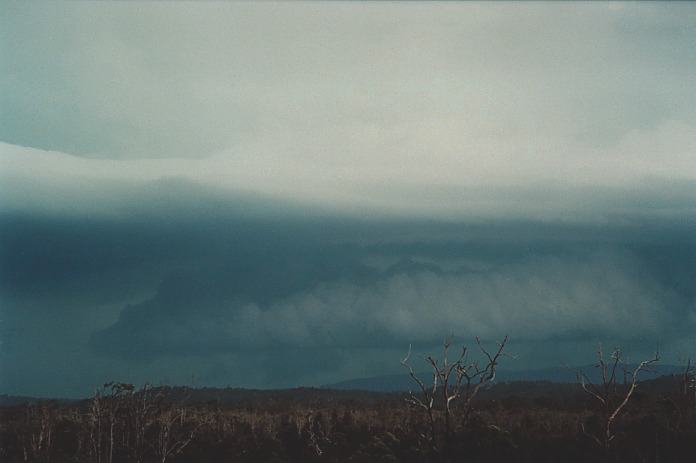
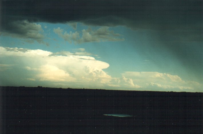
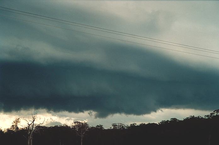
The spreading
of the side anvil indicated two things: the storm was going to edge more north
of my position and it was already severe. In fact, it would have already dropped
large hail. (I have confirmation that some areas in the hills such as Ulong received
giant hail but mostly hail fused together but I am unsure of the time).
It was here I
realised that it was turning into a classical supercell structure. The whole massive
column indicated rotation and still although the storm was within 20 km from me,
you could not see the base. The inflow into the storm at times was gusty but not
strong and directed to the area where the rain cascade met the rain-free base
aiding the cyclonic rotation. At times you could see the back-shearing of the
anvil. Truly amazing. The contrast of the storm was incredible. The anvil had
spread well off the coast covering most of the sky-zone to the east!! After some
time taking video footage and photographs, it again began to rain mainly from
the anvil. So it was again time to move on.
Woolgoolga was
not the best place to stop. Again the hills seemed to be hiding the main base,
and for some reason it did not look as good. One could have easily been mislead
at this point to think the storm was weakening and becoming featureless. So I
headed north along the Pacific Highway knowing that I would be running into bushland
very soon and little viewing areas. Then I saw a turnoff to Corindi Beach. This
turned out to be the best position that day - slightly elevated and I could finally
see the whole storm.
Those who wish
may want to download the video
clip showing the storm structure consisting of two mesocyclones - 1.2mb More
below
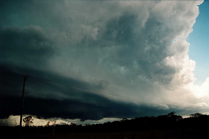
All I can say
that it went through a phase of truly awesome structure. I really didn't care
who was around me, what time it was. I think that anyone that rang me on the mobile
phone or I rang them would have thought I was going mad. It seemed that a chaser's
dream of high contrast awesome structure and a classical supercell had come in
one hit. Paul Graham at this point in one of the phone calls and also from a previous
phone call to a person at the Weather Company, indicated that the storm seemed
to be weakening. In a protective fashion, my response to Paul was swift, "the
radar must be not picking it up". I then realised that it was because the storm
was developing a second major updraught.
Please click to
view the video clip showing
the back sheared anvil, storm structure and inflow bands - 1.8mb. I apologise
for my excitement but that is what happened at the time.
Here is another
video clip showing the
storm structure and lightning through the inflow band - 1.9mb
More below
Here are some
video stills for those who would rather not download the video itself.
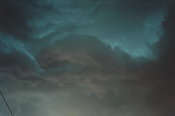
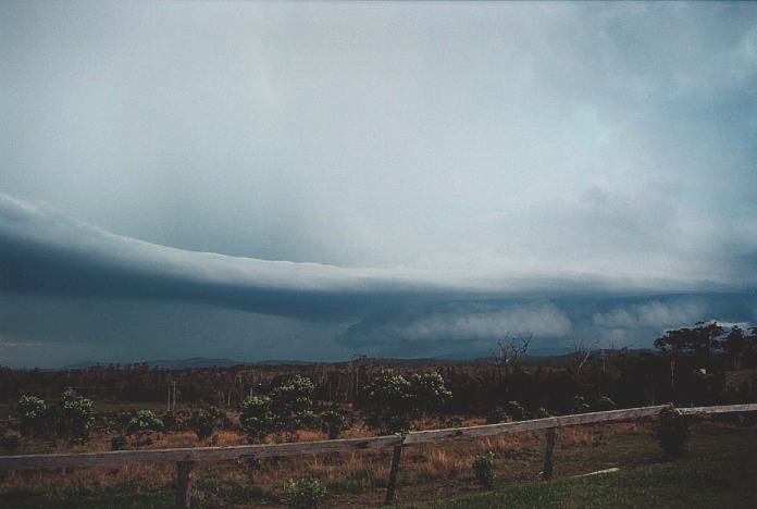
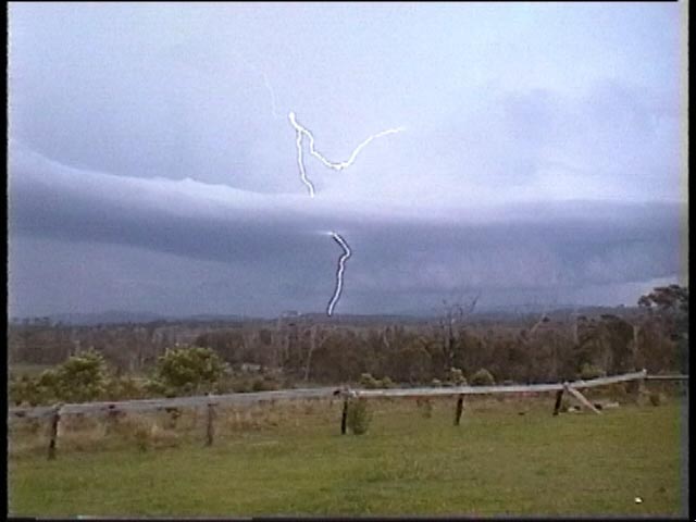
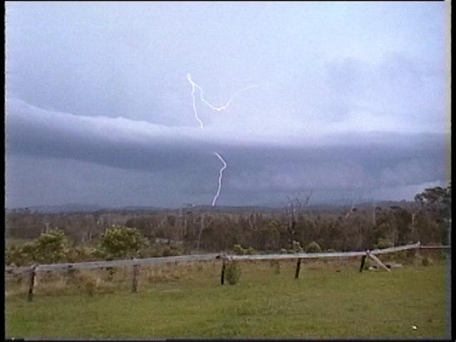
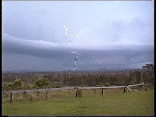
I was videoing
during the phone call and suddenly recognised an inflow band. I had scanned it
earlier without recognising it. I then shouted, "Hey. That's an inflow band".
I moved to get a better view because of a tree and then confirmed it, "Yep. That
is an inflow band!!" It stretched at least 15 kilometres to wards the base region.
It slowly began to connect. This was a sight I would never forget. It certainly
confirmed a classical supercell structure.
Michael had called
earlier to say he was chasing another supercell near Casino and that he had seen
a funnel. However, it was the second phone call that surprised me. Normally Michael
would say, "Hi. It's me". But this time it was, "Hey. It's f�. huge". He suggested
there were two overshoots observed from his position. Obviously cloud had cleared
to reveal this system. I again described the scene but he was about to move and
had to go.
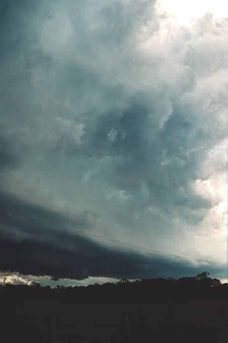
Where was the
wall cloud, or wall clouds. Well it seems that there may have been a few updraughts
within this system. And this meant that there was a wall cloud under the main
tower and possibly another in the next updraught. The old decaying updraught was
still evident next to the main tower but within the main precipitation area.
Download this video
clip showing the storm structure and start of visible wall cloud and funnel
- 1.6mb
The video
clip showing the wall cloud and funnel activity - 5.2mb
Suddenly whilst
videoing, I noticed an area of rapidly spinning scud. It was a definite funnel
but difficult to observe whether the funnel had touched trees or the ground. In
fact due to the amount of moisture haze even with the sun well hidden, it was
difficult to make out features. I also had not learned how to lock in the exposure
setting on the video camera as you see in the video above. I decided it was time
to move to try and stay ahead of the funnel region. I knew that even though the
road turned left towards it, the road would again head northwest. I did make it.
As I was travelling, I could see the updraught rising into the anvil. Then without
warning, came a bright flash and bang. It hit me straight into the heart!!! The
only window I had open was my side window. I simply was not expecting it. I believe
it was within a couple of hundred metres. It had come straight out of the tower
I was viewing and hit a tree or something. (In fact I commented later that this
lightning bolt and thunder combination made me shit my pants!)
This video clip shows the wall cloud afterwards with similar structure when the lightning
bolt/thunder combination hit - 1.6mb
I then stopped
to photograph the base and associated wall cloud number two perhaps associated
with the earlier funnel. Then next stop was a service station but could not really
get a good view of the storm base. I was also recovering from the lightning bolt
experience and remained in the car. Finally I stopped off the main road on a side
road with some clearer areas. I had by now realised that it was going to be a
late night and that any further north and I was going to be moving away from Sydney.
There were towers developing along the main storm zone with suspicious lowerings
observed. Hail began to fall, probably up to 3cm in size but very sporadic. I
tried to take cover but I only copped a few dents from the hail. I believe hail
close to if not about the size of giant hail may have fallen further along the
path of this cell, definitely large hail perhaps the size of golf balls.
In fact all the
way down the coast, I observed various right flank and left flank structures.
I also observed
a nice strong updraught developing off the coast and the sunlit features were
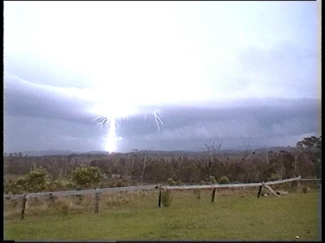
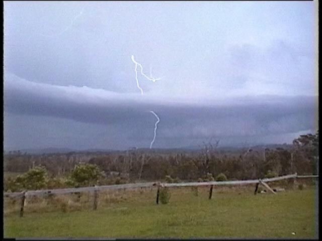
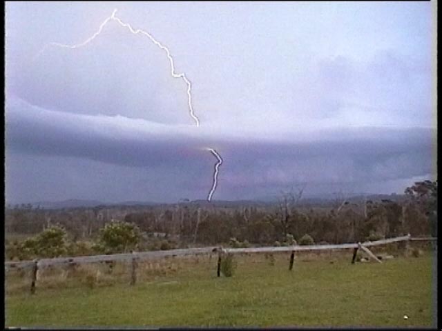
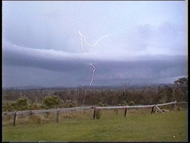
awesome. I also observed later on the lightning it displayed.
Whilst at Taree,
an interview with The Weather Company had taken place (arranged earlier). I took
the opportunity to make sure the video was on the car. I was a little annoyed,
but later laughed, at the truck who created a wind that tipped the video camera
to an angle. I was on a high right down the coast. Even as I approached Bulahdelah,
there was another supercell that had tracked off the coast and giving a spectacular
lightning display. It seems the whole coastline north of Sydney had storms and
supercells gradually moving off the coast. I had made several mobile phone calls
that day and it helped run up the highest bill. I was not a little bothered though.
Looking back at
the day, I wished now I had stayed up north for the night and stayed ahead of
the classic supercell. I could have easily awoken early the next morning and made
the trip down to Sydney. Although I don't like comparing storms, the feelings
and emotions I got from this storm will ensure I will never forget it. I also
looked back and thought just how difficult the chase was to navigate, answer phones,
take videos and keep track of the storm in an area where I for one did not know
much about and except for the main road but also was very difficult to observe
the storm due to the trees and hills. I would like to thank all those who again
were able to give updates as to what was going on but mainly for being able to
share the excitement. I felt even though I was physically alone, that there was
someone there to share the experience. This was one special chase.
Chase 3rd to 5th
November 2000
 The
chase from the 3rd to 5th November 2000 will be regarded as one my favourite all
time chases. I went through the emotions of frustration at missing the Sydney
supercell and tornado (see article by Matt
Smith), to absolute astonishment as I watched a supercell with the most incredible
structure develop before me two days later. It is the beaver tail photograph that
will take the honours of this chase. This part of the chase was also special as
I watched a supercell develop and go through various transitions and changes in
structure. More below.
The
chase from the 3rd to 5th November 2000 will be regarded as one my favourite all
time chases. I went through the emotions of frustration at missing the Sydney
supercell and tornado (see article by Matt
Smith), to absolute astonishment as I watched a supercell with the most incredible
structure develop before me two days later. It is the beaver tail photograph that
will take the honours of this chase. This part of the chase was also special as
I watched a supercell develop and go through various transitions and changes in
structure. More below.
Friday 3rd November
2000
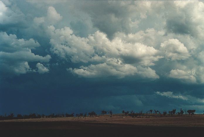
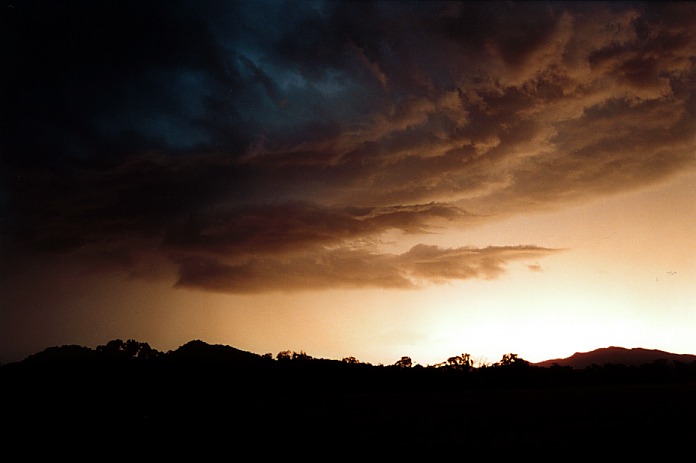
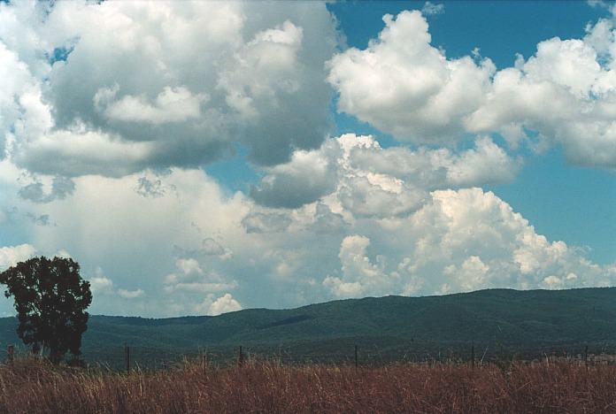
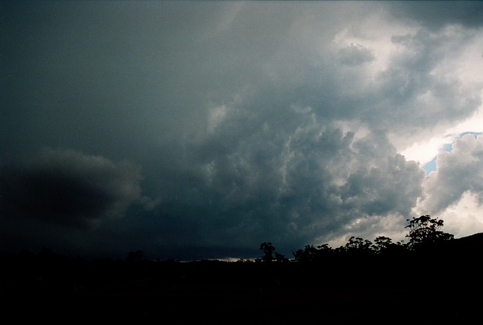
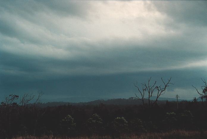
 Because the storm was observed from the outside and it was hot and hazy, the storm
did not look that spectacular. Though I began to draw attention to low level scud
activity that persisted for some time indicating strong outflow and perhaps convergence.
It was dry outside of the storm and cumulus fields were not as strong.
Because the storm was observed from the outside and it was hot and hazy, the storm
did not look that spectacular. Though I began to draw attention to low level scud
activity that persisted for some time indicating strong outflow and perhaps convergence.
It was dry outside of the storm and cumulus fields were not as strong.
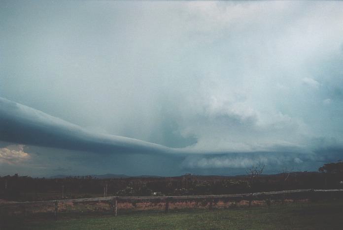
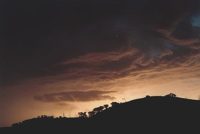
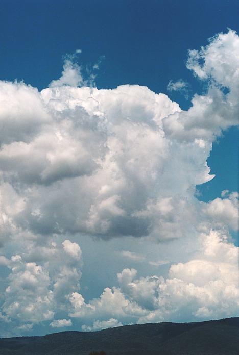
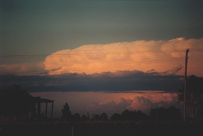
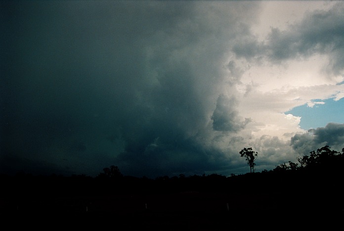
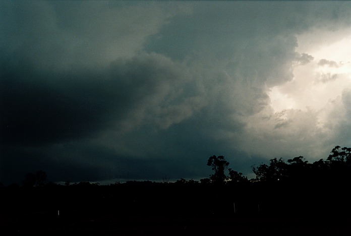
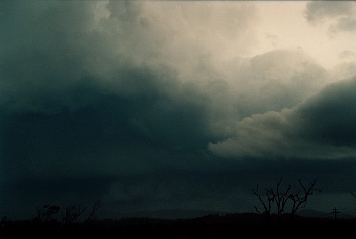
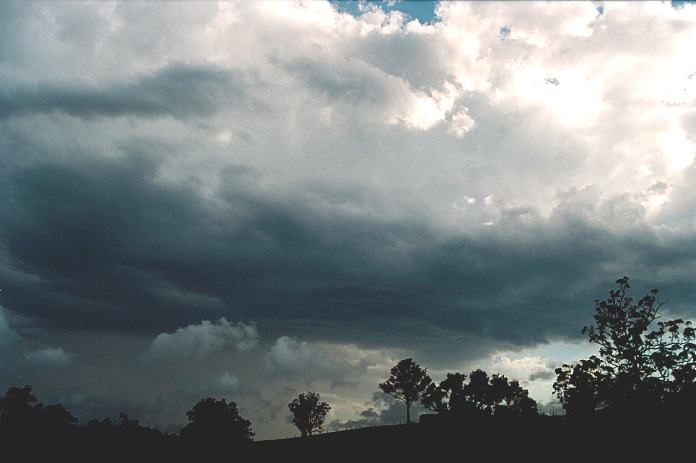
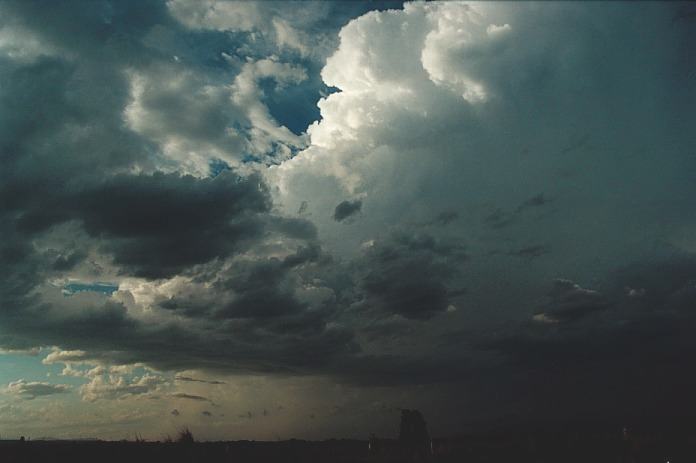
 The Sydney tornadic supercell.
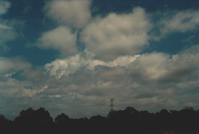
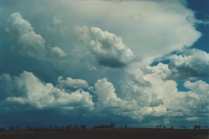
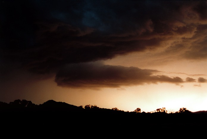
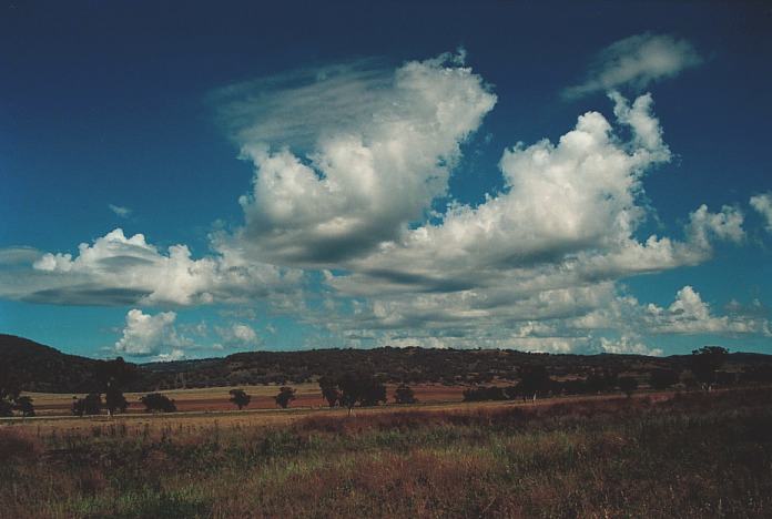
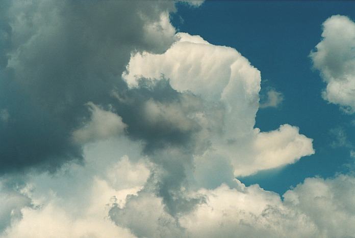
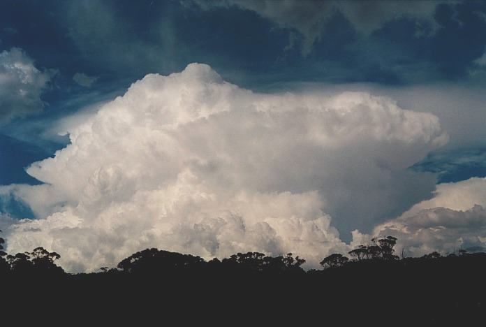
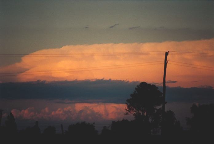
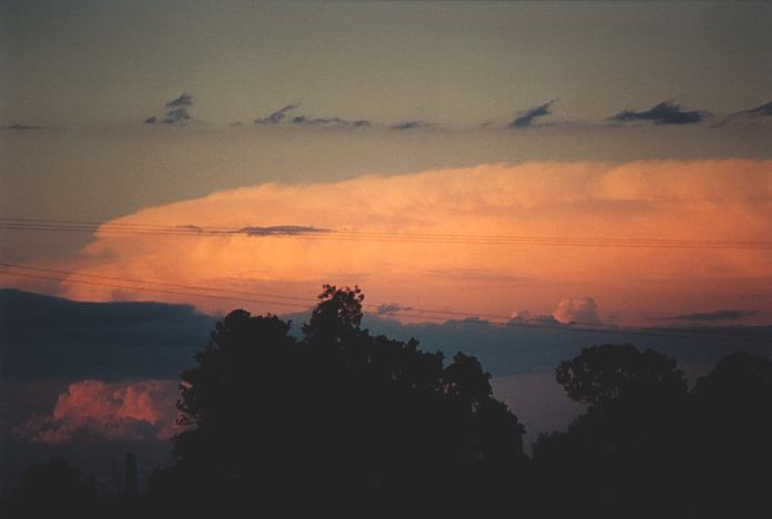
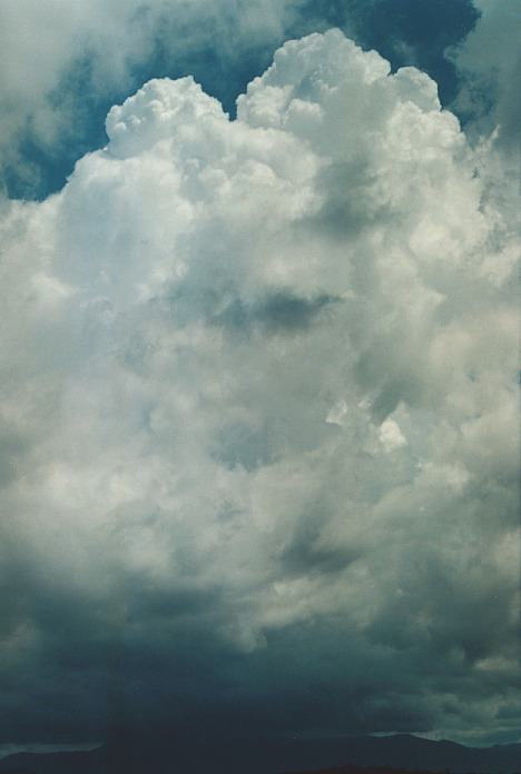
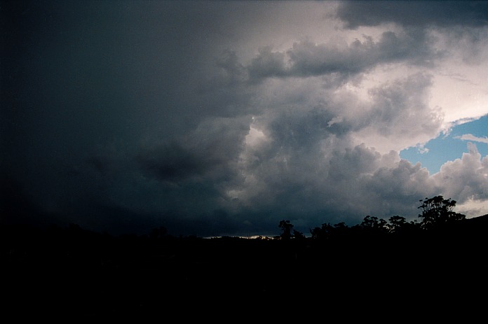
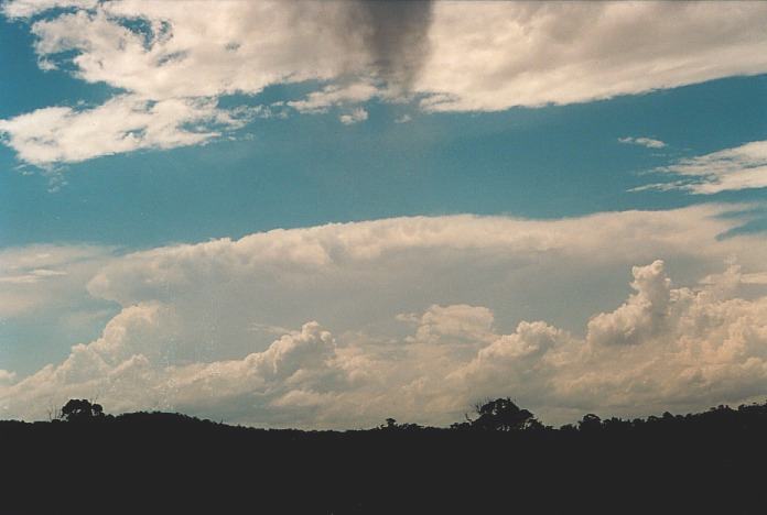
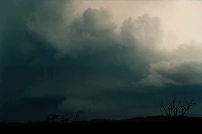
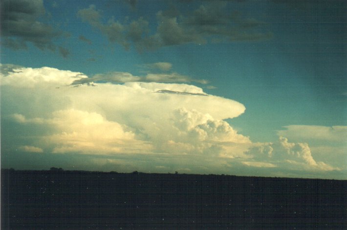
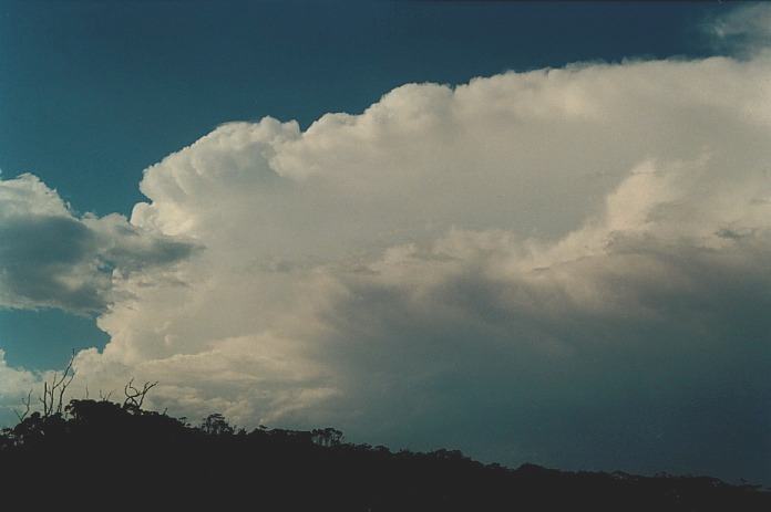
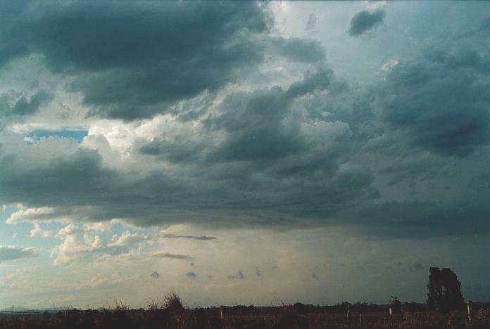
 Another
storm developing explosively on the ranges.
Another
storm developing explosively on the ranges.
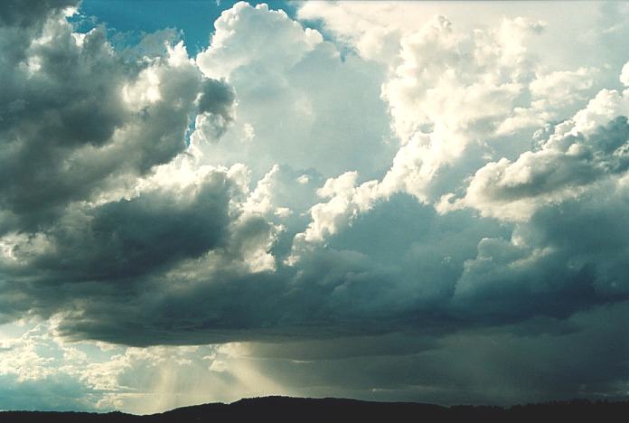
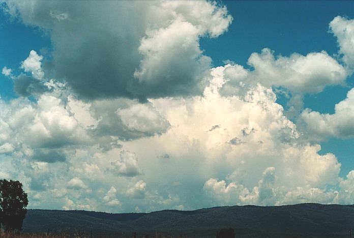
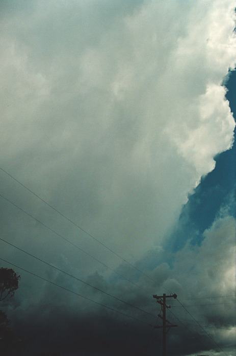
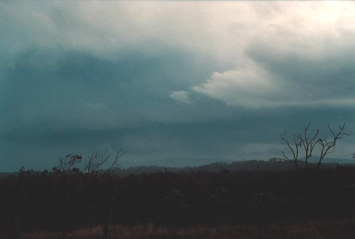
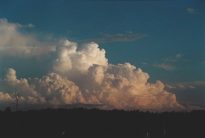
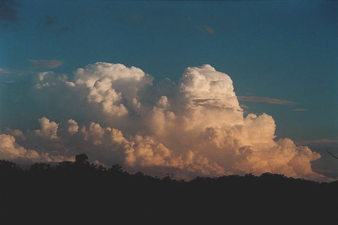
 After a few change of minds, I headed for Scone and Murrurindi. What a sight unfolded,
a spectacular base and strong updraughts along the right flank of the storm. As
I made the rise over the Great Dividing Range, I realised that this was going
to dump hail. And the rain got so heavy I simply had to stop and then the hail
started. It only got to about 1.5cm in size (perhaps some stones to 2cm) but it
lasted for about 15 to 20 minutes or so. After deciding to move along towards
Willow Tree, I noted that a more serious rain free base section was developing
at the rear of the storm. There was a light green tinge observed in the cloud
base. I decided to stay ahead of it but it seems that the windshear was not ideal
for anything to develop. I stayed the night at a place in Tamworth.
After a few change of minds, I headed for Scone and Murrurindi. What a sight unfolded,
a spectacular base and strong updraughts along the right flank of the storm. As
I made the rise over the Great Dividing Range, I realised that this was going
to dump hail. And the rain got so heavy I simply had to stop and then the hail
started. It only got to about 1.5cm in size (perhaps some stones to 2cm) but it
lasted for about 15 to 20 minutes or so. After deciding to move along towards
Willow Tree, I noted that a more serious rain free base section was developing
at the rear of the storm. There was a light green tinge observed in the cloud
base. I decided to stay ahead of it but it seems that the windshear was not ideal
for anything to develop. I stayed the night at a place in Tamworth.
Saturday 4th November
2000
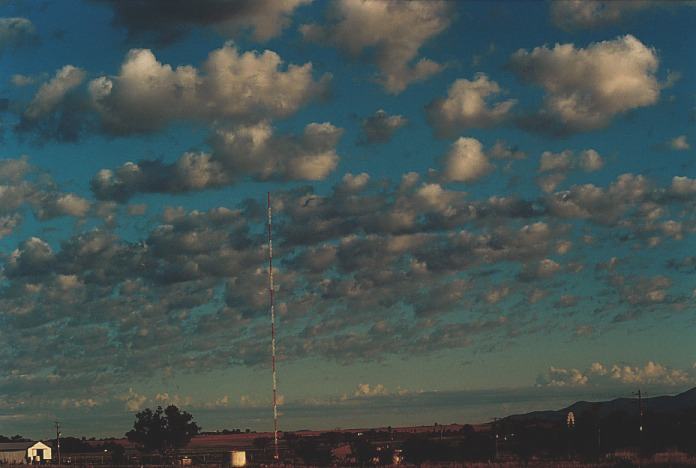 It is always great to wake up to sight of altocumulus castellanus. Well this morning
was no exception and was a clear sign the atmosphere was very unstable.
It is always great to wake up to sight of altocumulus castellanus. Well this morning
was no exception and was a clear sign the atmosphere was very unstable.
 I then decided it was time to make a move and I headed for Delungra on the way
to Inverell. Whilst passing through Inverell and on the phone to Geoff Thurtell,
I noted a dust devil developing on the road and trees swaying. Geoff actually
could hear it over the phone.
I then decided it was time to make a move and I headed for Delungra on the way
to Inverell. Whilst passing through Inverell and on the phone to Geoff Thurtell,
I noted a dust devil developing on the road and trees swaying. Geoff actually
could hear it over the phone.
 It was a definite HP supercell (High Precipitation Supercell). I had another chance
to photograph the whole structure with the precipitation coming out the back end
but was in so much of a hurry to get to it. I then found out that the storm was
not along the road and low cloud killed any chance of more photographs. So I made
my way to Grafton. From here, I noted there was a storm in the distance confirmed
by Paul Graham.
It was a definite HP supercell (High Precipitation Supercell). I had another chance
to photograph the whole structure with the precipitation coming out the back end
but was in so much of a hurry to get to it. I then found out that the storm was
not along the road and low cloud killed any chance of more photographs. So I made
my way to Grafton. From here, I noted there was a storm in the distance confirmed
by Paul Graham. 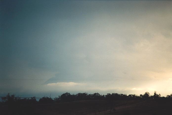
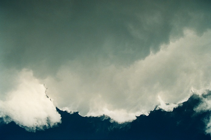
 It was yet another supercell with a nice side shearing anvil but difficult to
observe due to the moisture haze. It was the second of a set of storms that had
developed along the same path, the first being not as severe. I also made out
a wall cloud structure along the northern flank which remained rain free the whole
time until sunset. It seemed the coastal areas and especially in Queensland, supercells
were going strong all over. One strong cell was observed over the border in Beaudesert
- about 250km or so away!!! What a sight.
It was yet another supercell with a nice side shearing anvil but difficult to
observe due to the moisture haze. It was the second of a set of storms that had
developed along the same path, the first being not as severe. I also made out
a wall cloud structure along the northern flank which remained rain free the whole
time until sunset. It seemed the coastal areas and especially in Queensland, supercells
were going strong all over. One strong cell was observed over the border in Beaudesert
- about 250km or so away!!! What a sight.
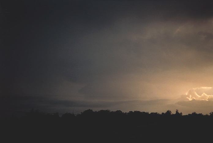
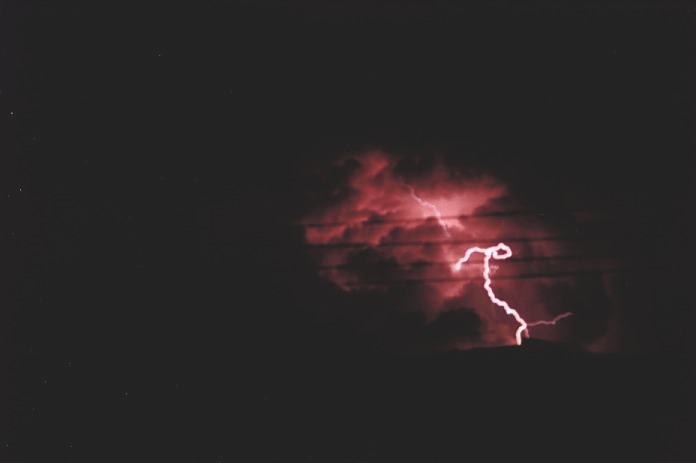
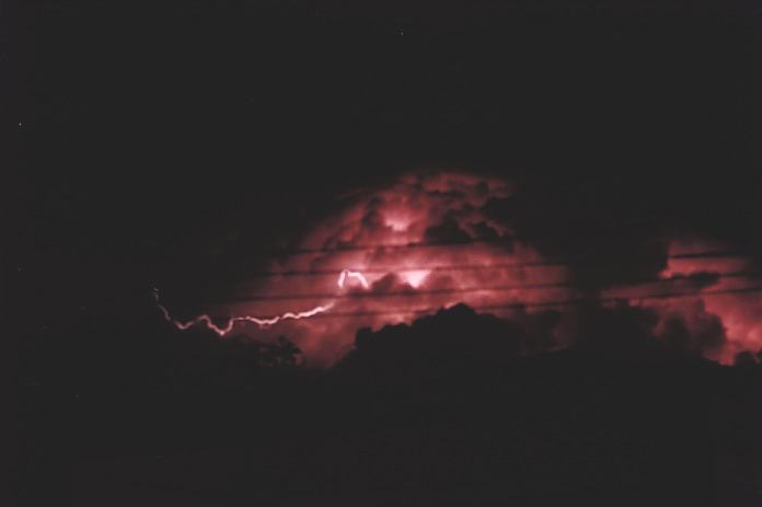
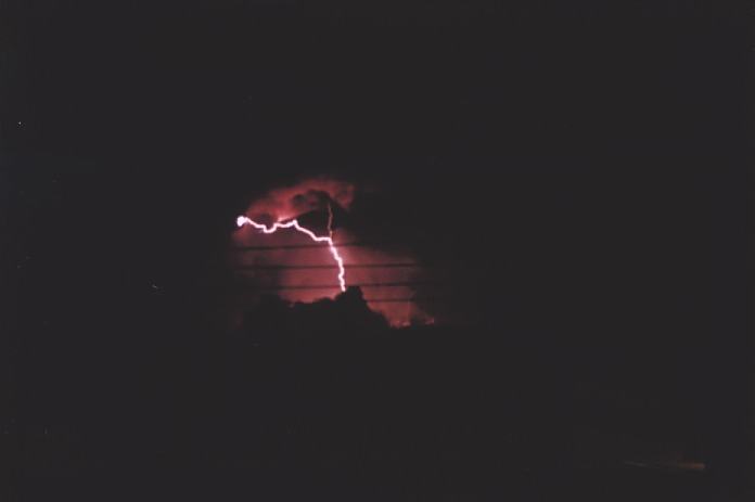
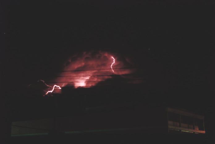
 I went to bed about 11pm and whilst closing my eyes, noticed a flash. I thought
my mind is playing tricks on me so I shut my eyes again. Alas - another flash!!
I looked out the window to see what it was. I'll be damned!! There was a tower
popping up to the east and it had amazing structure but no anvil. This meant that
some of the lightning bolts were coming out of the side and top of the storm.
I could stand it no longer so I decided to take some footage and photographs of
it. It was quite awesome and was quite noticeable by people making comments about
the flashes and finding out what it was. Low cloud spoilt the party so I finally
went and got some rest. (I found out next morning that the low cloud had cleared
and the storm had still remained active. In fact I believe that there was a line
of storms linked with those Michael Bath had photographed, see
chase report).
I went to bed about 11pm and whilst closing my eyes, noticed a flash. I thought
my mind is playing tricks on me so I shut my eyes again. Alas - another flash!!
I looked out the window to see what it was. I'll be damned!! There was a tower
popping up to the east and it had amazing structure but no anvil. This meant that
some of the lightning bolts were coming out of the side and top of the storm.
I could stand it no longer so I decided to take some footage and photographs of
it. It was quite awesome and was quite noticeable by people making comments about
the flashes and finding out what it was. Low cloud spoilt the party so I finally
went and got some rest. (I found out next morning that the low cloud had cleared
and the storm had still remained active. In fact I believe that there was a line
of storms linked with those Michael Bath had photographed, see
chase report).
Sunday 5th November
2000 - The day of the Coffs Harbour Supercell and "beaver tail"
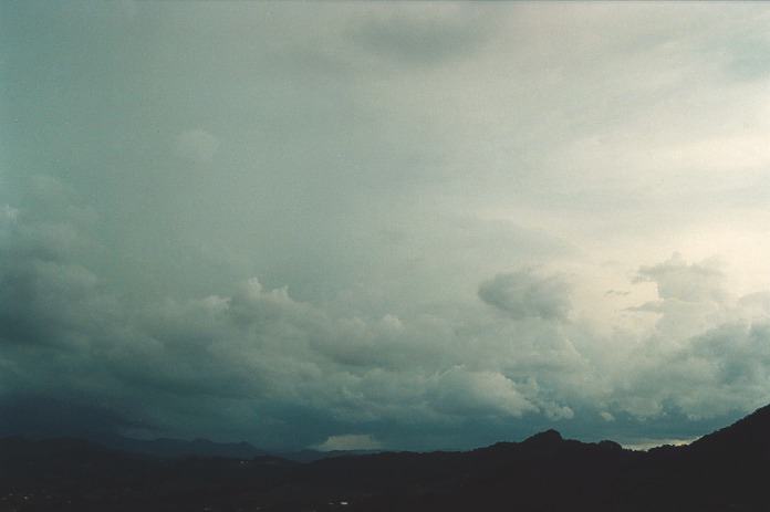
 There didn't seem anything unusual about this day. There were storms towards the
coast coming closer to the coast near Coff Harbour. Being Sunday, I knew I had
to head home. But I wanted a piece of the action on the way down. Little did I
realise what was going to happen that day.
There didn't seem anything unusual about this day. There were storms towards the
coast coming closer to the coast near Coff Harbour. Being Sunday, I knew I had
to head home. But I wanted a piece of the action on the way down. Little did I
realise what was going to happen that day.
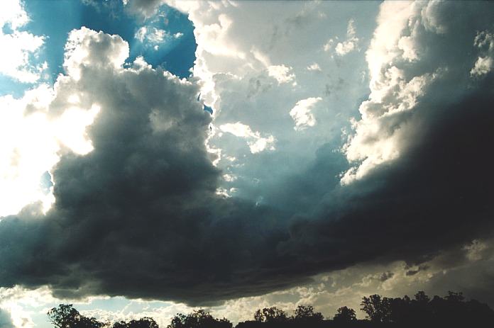
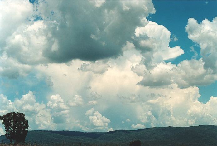
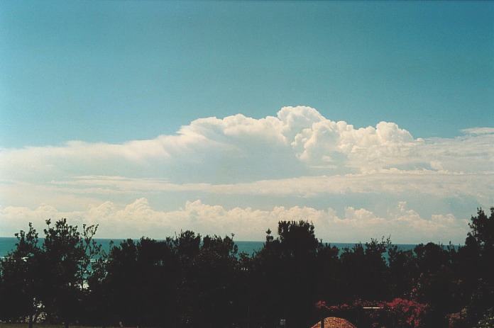
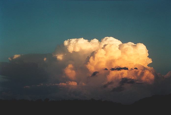
 I then noticed a large cumulus develop along the range towards Dorrigo. The mountain
became enshrouded by the base of the large cumulus. This quickly developed an
anvil and dropped some large drops onto areas south of Coffs Harbour. But it seemed
the storm became quite active with a second strengthening of the anvil and the
base of the storm became larger. I was a little disappointed I recall that the
storm after so much promise seemed so small. But the more I watched and moved
into any available position, I realised that the side anvil was starting to spread.
I then noticed a large cumulus develop along the range towards Dorrigo. The mountain
became enshrouded by the base of the large cumulus. This quickly developed an
anvil and dropped some large drops onto areas south of Coffs Harbour. But it seemed
the storm became quite active with a second strengthening of the anvil and the
base of the storm became larger. I was a little disappointed I recall that the
storm after so much promise seemed so small. But the more I watched and moved
into any available position, I realised that the side anvil was starting to spread.

 I gradually made my way north stopping at any position I could with at least some
view of the storm. This proved difficult with the hills and trees in the area.
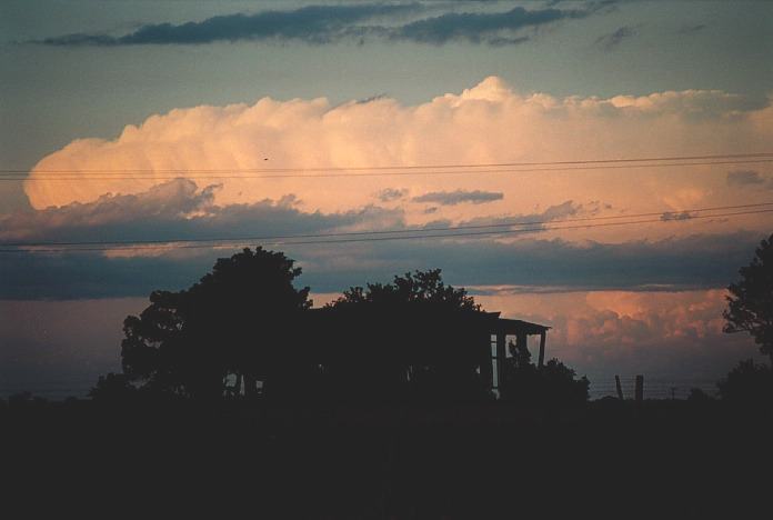
The storm was growing in size indicated by the strengthening anvil. In fact by
the time I got to the first ideal position to watch the storm, it had grown into
a monster. This vantage point overlooked the whole of Coffs Harbour. I could make
out rotation in the base and the rain free base was massive. Cloud to ground lightning
occurred reasonably frequently under the base. The base was so low that the base
was almost touching the hills. This made it quite difficult to observe any features
that could develop under this base. The system was making a left turn northwards
(left mover). After some time viewing, the anvil began to drop large drops of
rain and it meant I was confined to the car. Instead I decided to head further
north. Next stop, an estate just north of Coffs Harbour.
I gradually made my way north stopping at any position I could with at least some
view of the storm. This proved difficult with the hills and trees in the area.
The storm was growing in size indicated by the strengthening anvil. In fact by
the time I got to the first ideal position to watch the storm, it had grown into
a monster. This vantage point overlooked the whole of Coffs Harbour. I could make
out rotation in the base and the rain free base was massive. Cloud to ground lightning
occurred reasonably frequently under the base. The base was so low that the base
was almost touching the hills. This made it quite difficult to observe any features
that could develop under this base. The system was making a left turn northwards
(left mover). After some time viewing, the anvil began to drop large drops of
rain and it meant I was confined to the car. Instead I decided to head further
north. Next stop, an estate just north of Coffs Harbour.
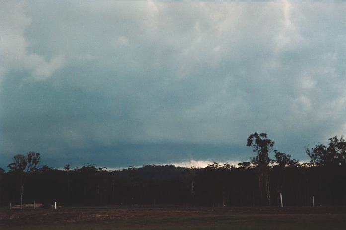
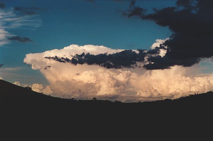
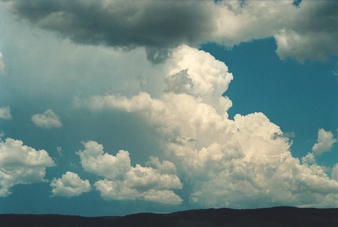
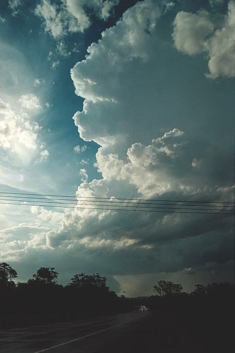
 My
view of the supercell Michael Bath was chasing at that time, see
chase report.
My
view of the supercell Michael Bath was chasing at that time, see
chase report.

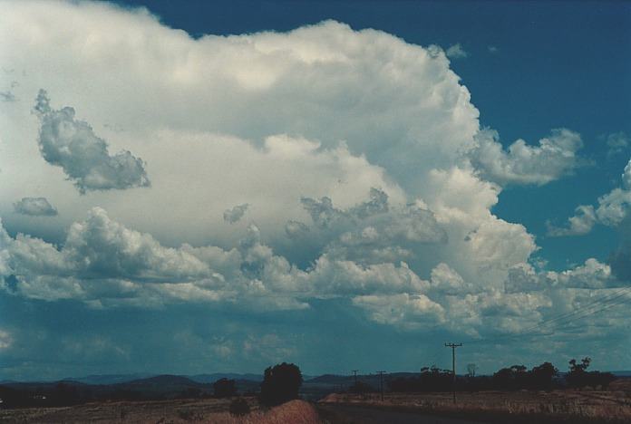
 Michael's
view of the storm 150km north
Michael's
view of the storm 150km north
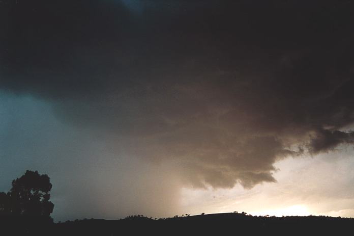
 This
was to be the turning point of the day. I had to make the decision to move further
south again and gradually head for home. I made my way to Corindi Beach. I was
able to get a view from the southern side of the storm. It was very crisp and
white. It was a very large system as well. Also to the south, there was a supercell
probably very close to the coast. So I decided to get closer to it.
This
was to be the turning point of the day. I had to make the decision to move further
south again and gradually head for home. I made my way to Corindi Beach. I was
able to get a view from the southern side of the storm. It was very crisp and
white. It was a very large system as well. Also to the south, there was a supercell
probably very close to the coast. So I decided to get closer to it. 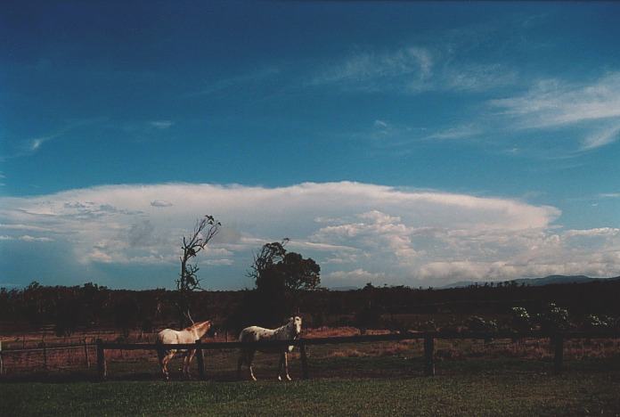
Document: 0011-05.html
Updated: 17th May, 2002
[Australian Severe Weather index]
[Copyright Notice]
[Email Contacts]
[Search This Site]