and Chasing
[Index][Archives]
The Quirindi - Tamworth Storm Chasing Expedition: 25th to 27th September 1999
by Jimmy Deguara
| Storm News and Chasing [Index][Archives] |
The Quirindi - Tamworth Storm Chasing Expedition: 25th to 27th September 1999 by Jimmy Deguara |
I indicated to other chasers that I would be chasing as I was on holidays. What luck can you ask for - for once!!! The only takers were Matthew Piper and with dreary eyes - James Harris (he had only 3 hours sleep). I must say he had courage to come along on short notice. But there is no rest for the wicked!!
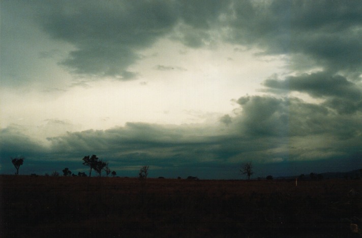
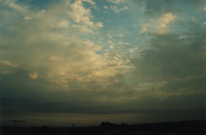 I picked up Matthew from Schofields station and we were to meet James in Muswellbrook. I had already taken a few photos of the altocumulus castellanus around Sydney and this was observed all the way into the Hunter: the difference being that the lower stratocumulus clouds disappeared almost suddenly whilst on the Putty Road. About just after 11am, we met up with James and had a quick lunch break. Skies were darkening to the SW and W of Muswellbrook. Upon checking for static on the radio, it became evident that the storm was intensifying mainly on the northern section. The best consolation was some video footage particularly of the lightning strikes. One of the frames perhaps could be used for a future Toyota Camry commercial. Lightning in line with my car!!!! The storm moved over the highland country with cells developing on the northern flanking line. Throughout the afternoon, more cells developed along that line.
Closer to Murrurundi, James and Matthew indicated that they saw a storm to the far S. I then received a call from Rune Peitersen verifying that the storm was just north of Lithgow. Radar indicated a large area of hail which I wasn't surprised considering just how large this cell was. We had seen this storm earlier but it was more or less obscured by other cloud and therefore not all its structure was observed.
It was decision time!!! Do we head back an hour and a half towards this cell or wait to see what else happens near Quirindi. At about 3pm, we made the decision to head towards the cell near Lithgow.
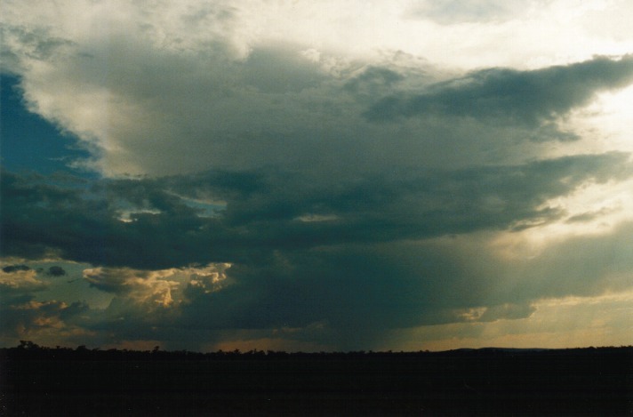
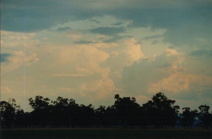
We made our way towards Breeza Plains making sure trees were not obscuring our view. The storm developed, glaciated and precipitated as we watched. The cell grew larger although it looked weak. Precipitation continued to develop and the storm gradually spread its anvil overhead and towards the north-east. The slow spread of the anvil indicated the light upper level winds.
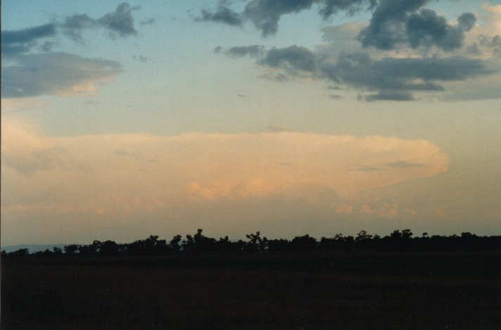
During the late afternoon period, other cumulus developed into thunderstorms. But it was the cell near Lithgow that had us salivating. We watched as it developed an extensive, back-sheared anvil; proof that it was still reasonably active!
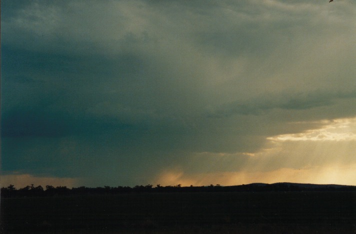
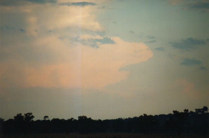
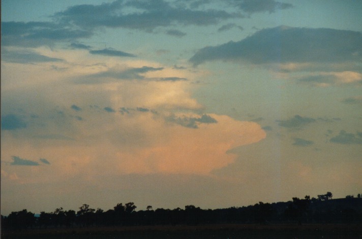
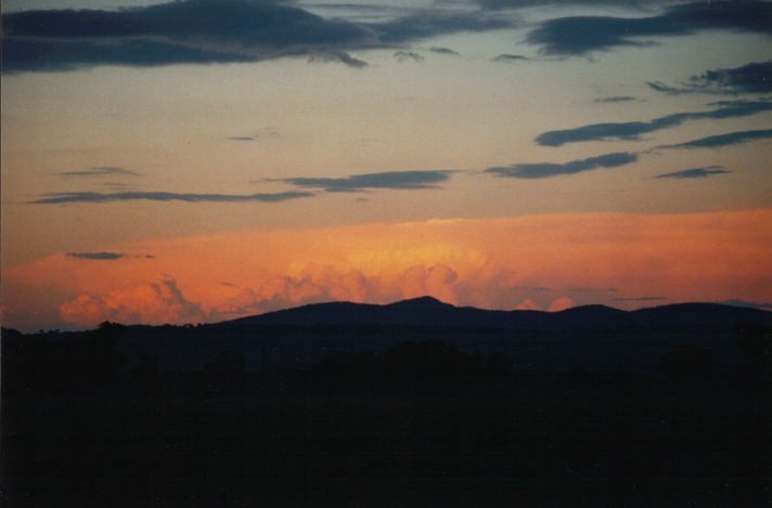
After getting bored watching the same view of the storms to our west, we decided to get ourselves ready for some possible lightning activity viewed from the hill near Quirindi. On the way, we just had to stop and photograph the storm band to the east reflecting the sunset.
 As the evening drew near, lightning became more prominent with some good bolts captured on video. But as the storms moved east, the trees obscured some spectacular lightning bolts. I then decided that moving to an area to the east of town would give us a better view. And it did!!! Some excellent bolts greeted us. We prepared for an excellent lightning show. Soon after arriving there, light rain!!! We could not believe it!! We threw our gear into the cars and waited..... It wouldn't stop. So we decided to book accommodation and then come back. But that was it, if it wasn't the rain, it was the fresh to strong downdraughts and updraughts that made things difficult. One of the interesting features of the last storm we observed was how the strong updraught suddenly changed to a downdraught within seconds!!
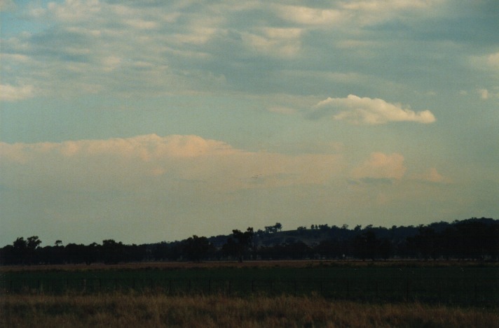
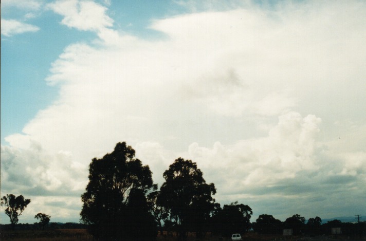
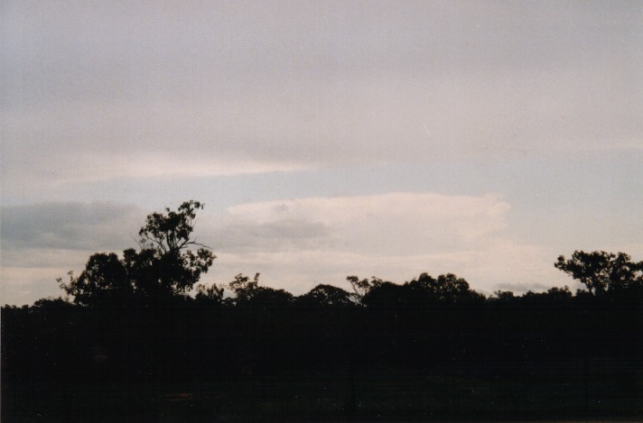
The morning had the tell tails of instability if you looked for it. There was altocumulus castellanus to the north and thick white sheet of cirrostratus or altostratus; not your typical classic unstable look. Broken altocumulus was widespread. The sky to the far south was clear.
It was decided that since the town was basically "dead" with no people activity and the library was closed, we would make our way to Tamworth. You guessed it, the library was closed there as well. In search for an internet cafe, we visited the Information Centre. It was interesting that the internet cafes were closed on Sundays but we could access the internet at the Backpackers hostel!!
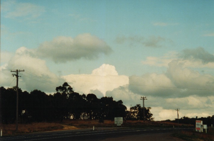
After a brief run down of the situation and noting the Lifted Index values, the satellite pictures, and the synoptic situation, we drove to the lookout for a proper look. I must admit I was confused by the change in direction. Cells were towering to the east and northeast over the Northern Tablelands. There was a moisture haze over Tamworth and the surrounding areas. Some cumulonimbus could be seen to the north and northwest. It was now about 11:30am.
Just out on the bypass of town to go and get a better look, James contacted us to alert us of the towers over the Northern Tablelands. Since we would have had to wait some time for action around Tamworth, it was worth investigating. I contacted Michael Bath to make sure that there were storms within reach. There were no warnings out but the storms were showing on radar. These storms were solid with good anvils indicating motion in the upper levels. First stop was Moonbi Hill.
 After a few pictures here and an update from Michael Bath, we decided to aim for Armidale. There were two main storms near Armidale: one to the east and another cell to the west or northwest. Trees made our trip unpleasant as we only caught glimpses of the storm structure. Suddenly, a lowered base appeared and I had to restrain my foot from the accelerator so that the speed limit was not exceeded. Finally we rose onto the plateau and much clearer country. The lowering was still there but not doing much; certainly not rotating.
 The storms stretched across the horizon with major cells observed in the direction of Armidale. It had that greenish tinge look and there was good separation in the upper level for hail to be probable. After a some video footage and photographs and a call from some of the ASWA folks, we decided to head south as it would be closer to get home from Tamworth. A few kilometres down the road and mobile went off!!! Michael Bath alerts us to the news that an advice was out for the Tablelands and Northwest Slopes and Plains for severe storms with heavy rain, strong winds and large hailstones. Well we knew this at least an hour before. We had to head back to Tamworth so that both James and Matt could be on time for work the next day.
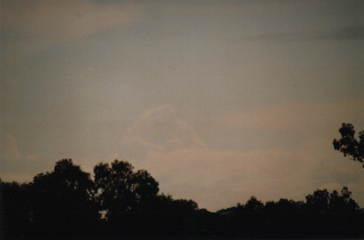
On the way, a nice towering cumulonimbus developed with a rain free base for a while. On arrival to Tamworth - nothing!!! All the action was on the Tablelands. After a browse of the internet, my stomach finally won its way - Maccas!! On the way we could see a decent looking large cumulus partially glaciating which was going to be our next target.
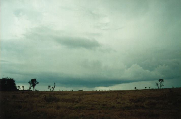
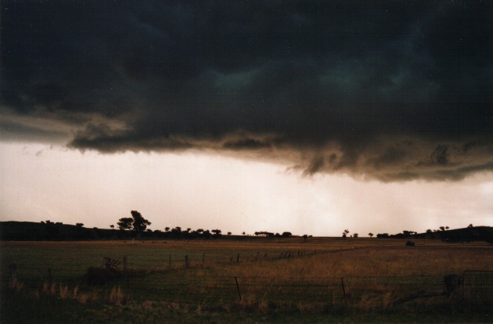
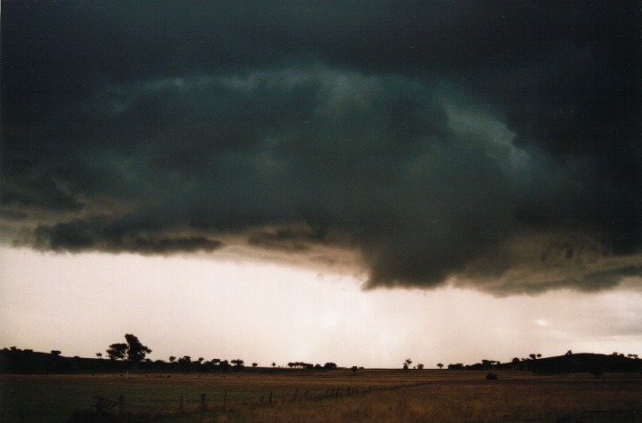
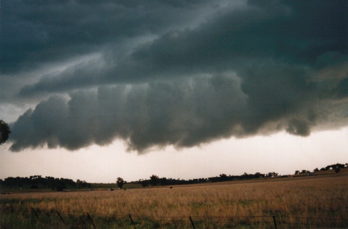
After the late lunch, we decided to head home straight through it. Suddenly, within minutes travelling down the road south of Tamworth, a rain curtain appeared!! Wow. A high contrast base met a thick curtain of precipitation which certainly had some embedded hailstones - enough to get me excited. There was evidence of downburst conditions and occasional lightning bolts.  The anvil was thick and strong on the front indicating the cell had formed within the past half an hour or so. After a brief photo and video stop outside of a driveway, we headed for a safer position on a road off the New England Highway.
Whilst shooting video and photographs, we kept watch of where the main activity was. Lightning bolts seemed to be occurring in different places not as predictable as what I am used to. Then suddenly a flash and bang - from the right hand side. Yep. It was towering overhead so we took some precautions to stay out of the open. 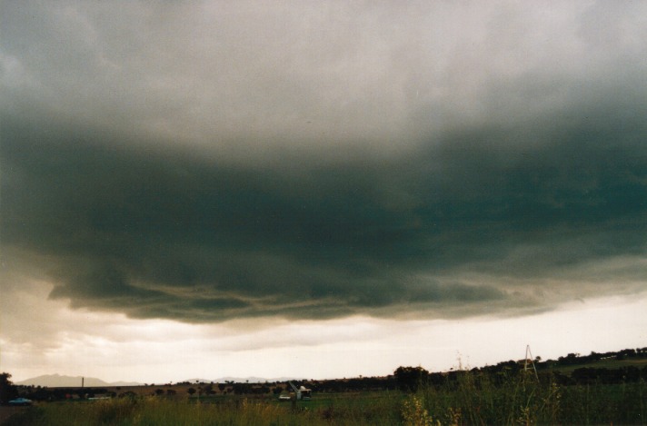 As the storm was gradually sneaking its way to try and trap us and with lightning danger increasing, we decided to move north again. We moved on two occasions and luckily so. It seemed a multi-forked severe bolt with thunder that sent my ears ringing hit in an area where we had just been a few minutes earlier. Just a prompt reminder and warning not to stay to close to storms especially in the open areas.
The storm system lasted to about evening changing into some interesting lowered formations as the undercutting series of downbursts edged northwards. There were other cells developing to the east as well with some good falls. I wanted a taste of some little hailstones!! But, it wasn't to be. 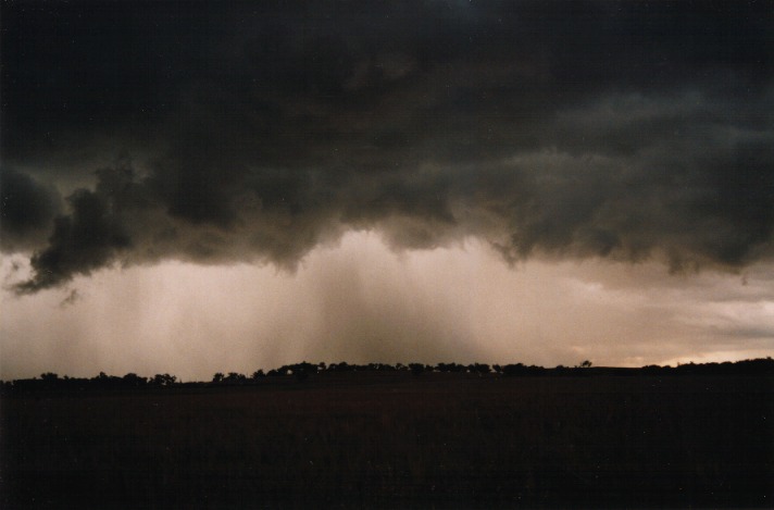 During the evening, we called it quit. Just as well because James Harris found the action, well - rather boring. We almost had to break into his car to awaken him!! Believe me, storm chasing takes a lot of energy out of you, and a combination of lack of sleep had taken its toll.
We had decided that due to expected heavy rain (and some mysterious illness that had set upon the chasers) to stay overnight and travel the inland route to Sydney. Well it was so damn convenient as it just so happened that there were storms possible in Central West. There was light rain over night.
We passed a creek just outside Tamworth which was fast flowing as a result of the storms we has observed the day before. We continued on to Gunnedah and yet it was another sleepy town with the local library opening later. So we made our way into rainy Coonabarabran. We checked out the internet for an hour. The verdict, the action seemed to be more north almost towards the border areas with Queensland even though storms would develop near the Central West. The rain remained a feature until we neared Gilgandra. There was a clearing and James signalled that he had just observed storms. These storms were probably 150 kilometres to the west.

After an update from Michael Bath, we decided to just get out of the rain band edge travelling along the road to Warren for about 12 kilometres. From here, it became even more apparent that the chase was basically over. The storms were weak with fibrous anvils and could not sustain persistent strong updraughts. At around 3:15pm, we parted company. We arrived into Sydney around just after 8pm driving into miserable conditions in the Blue Mountains.
I can say that when we looked back, it was successful and also exciting. We got anything from major storms to night time lightning to heavy rain and probable hail. There were very few times that we felt slight boredom with storms somewhere on the horizon and in most cases some storms within easy reach.
I would personally like to thank all of those who have contacted us or been there to be contacted for keeping us up to date with invaluable information. I know that this played an important role in the success of this mission and for future missions.
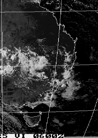
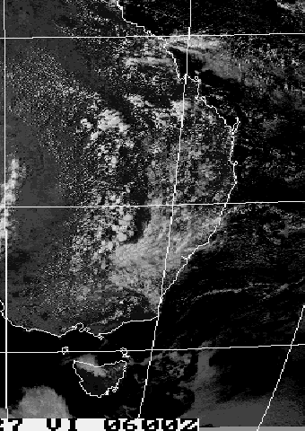
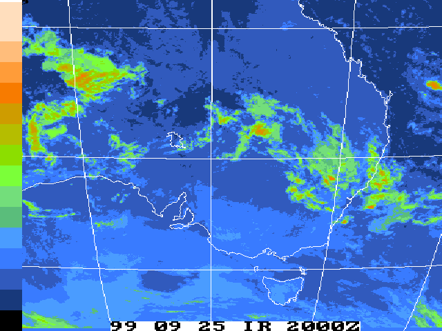
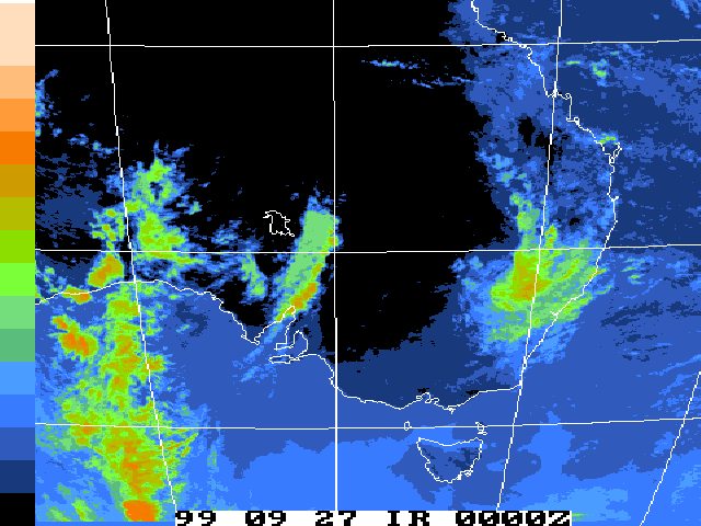
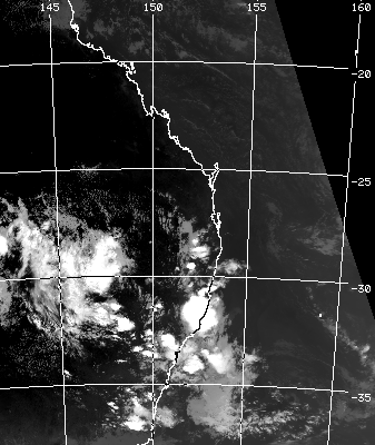
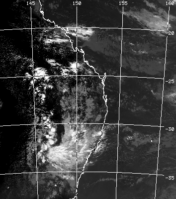
These images from CSIRO Marine Research
These images obtained
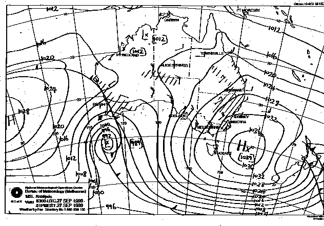
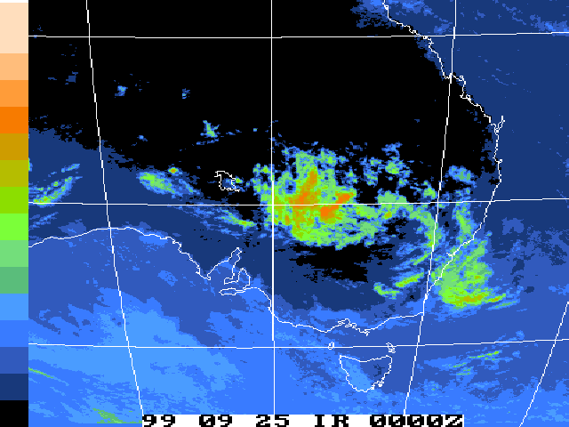
from Bureau of Meteorology.
1pm local 25th, 26th and 27th September 1999


|
Document: 9909-01.html
Updated: 13th January, 2003 |
[Australian Severe Weather index] [Copyright Notice] [Email Contacts] [Search This Site] |