and Chasing
[Index][Archives]
Hunter Valley Storm Chase: 4th March 1999
by David Croan
| Storm News and Chasing [Index][Archives] |
Hunter Valley Storm Chase: 4th March 1999 by David Croan |
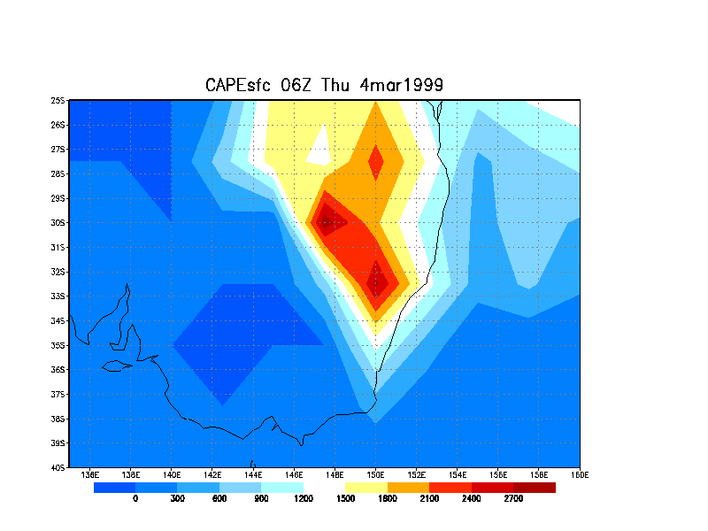
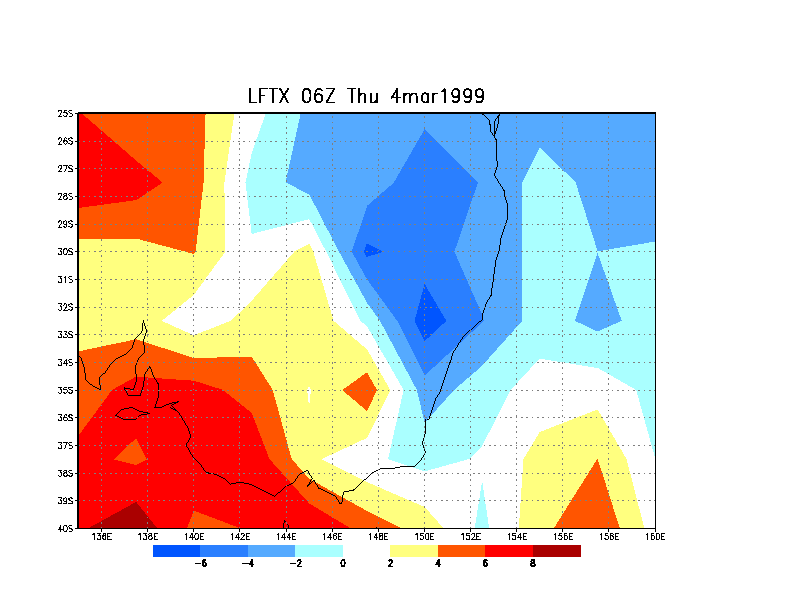
5pm local time analysis maps of [CAPE] and [Lifted Index]
The chase area extended from 34 to 33 degrees S at 151 degrees E.
Other than the photographed storm, large congestus seen over western Sydney. Signs that major activity would develop over the Hunter - much harder TC and two storms already firing. I decided that the Hunter was the best bet as a target area.
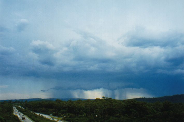
2:35pm - While heading north along the F3 (FWY not tornado!), I had
my eye on a nice cumulus tower which shot up like a bullet - in a
matter of minutes it disintegrated right before my eyes (the fate of a
Sydney chaser) to reveal updraft remnants and a little orphan anvils.
3:00pm - Two large cells were spotted to the NNW so I headed up the F3 in chase of the southern-most one. Got off the FWY at Morriset to the sound of continuous rolling thunder and had a good look around. Target cell about 10km to my NNW. Another cell with nice rear updraft spotted to the SW (over NW Sydney). Plenty of CG lightning now visible from the target cell and also from another smaller cell developing to the NE only a few km away. Continued N but got caught up in the mess that was the southern flank of the storm: moderate rain, continuous thunder.
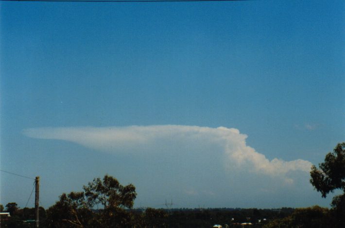
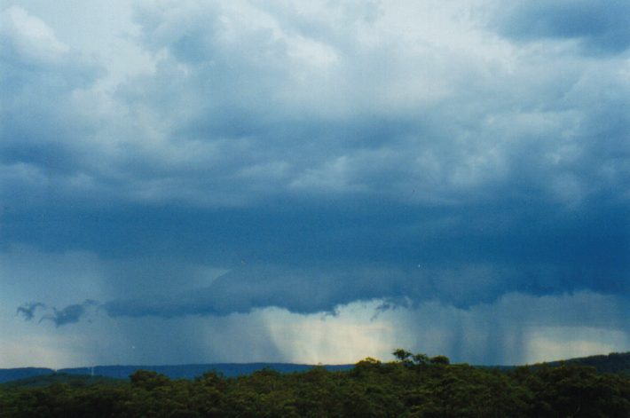
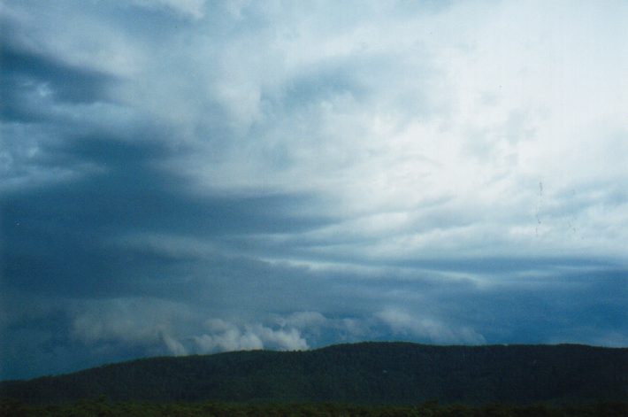
3:30pm - I got a bit east and from there was treated to a nice
high contrast view of the updraft to the west and anvil overhead.
Photograph shows the crisp anvil with a bit of the rear updraft /
flanking line visible.
Storm seemed to be dieing in the wake of a larger storm to the N (Michael Scollay let me know of the storm - I couldn't see it - and that it was at 40-100mm/h). Soon after did manage to see the quite impressive looking Nth storm as the target cell, on it's last legs, moved east. Decided to head west towards Cessnock.
4:00pm - On the way to Cessnock the only stuff visible to the W was at least 150km away. Turned back east with some large cumulus towers to the near SW so I jockeyed for position for 20 minutes and ended up on a FWY overpass. Noisy but ok view.
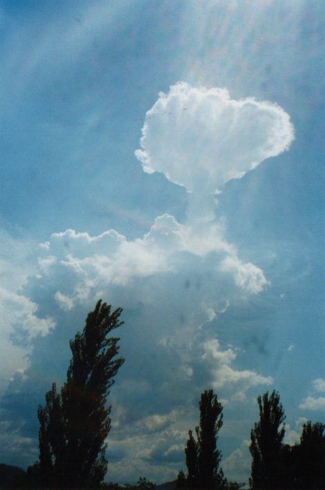
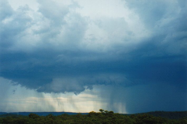
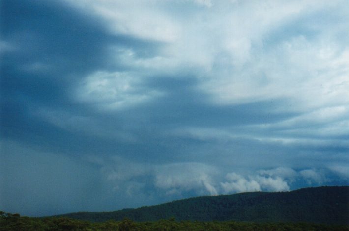
4:30pm - Pic of the main updraft of the now massive Nth storm (now
NNE) which was estimated at about 30km away. The north portion of the
anvil can be seen just above the treetops to the left.
This storm had a single boiling updraft and looked to be very high. The pic shows less than half the updraft height (was taken looking over tree tops and up a hill). I thought it was too east to chase. Looking back the road to Neslons Bay would have been perfect Following this pic an overshooting top persisted for about 10 minutes and was well above anvil level (on video). Suspected it to be a supercell - at least on it's visual characteristics.
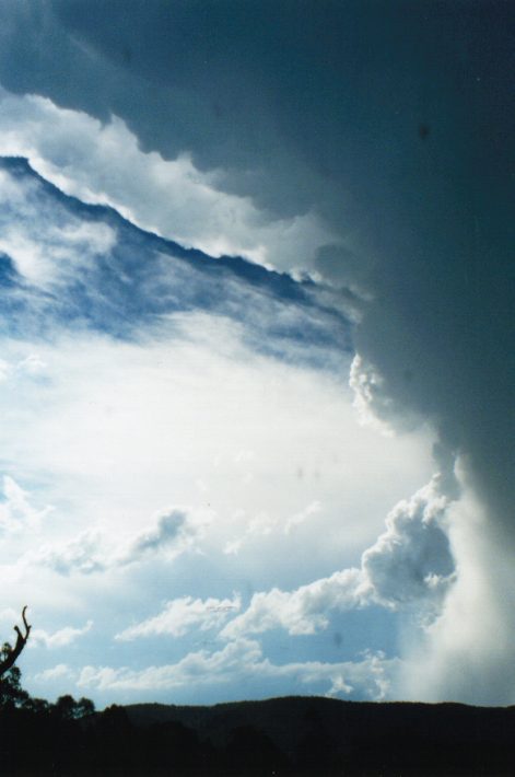
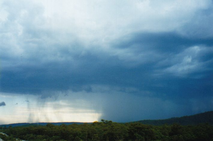
4:45pm - A dominant updraft established in the SW TC cluster and a cell began to take shape quickly. The cell was dropping some very impressive Cgs by now just behind a roll cloud as precipitation broke through
Pics of a roll cloud ahead of the developing cell
5:00pm - Then a microburst accompanied by a barrage of CGs
5:05pm -The storm then began to look menacing with a turbulent
hanging gust front that got lower and lower - wishing I had a chase
partner at this stage. The precipitation curtain was being lit up by
almost constant lightning.
5:15pm - It was getting pretty close so i decided to get out of the
path.
I got a bit nervous when I found out that the FWY entry was one direction only - south towards Sydney, and the storm.
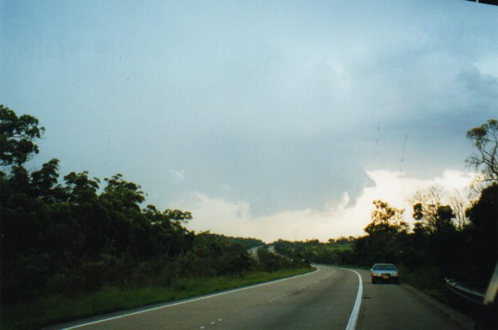
5:20pm - Took off south for about 7km and snapped a photo while
driving.
Eventually I found a U-turn area and so quickly headed N. The gust front was awesome. I clipped the flank on the way N - at first there was very frequent and VERY close CG lightning - although it didn't bother the guy using the emergency phone beside the FWY. The rain was brief and heavy and small hail bounced off the bonnet (around 1cm although a few larger hits were heard).
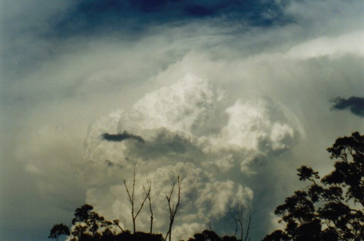
I high-tailed it for about 12 km (10 minutes) until I felt safely out of the path. Being on the FWY and heading in the wrong direction I was only able to get glances of the storm moving east through the rear vision mirror but a prominent lowering was clearly visible under the flanking line at the back. I noticed another car parked on the side so I quickly pulled over as well. I got a pic of the as it moved pretty quickly across the FWY about 5 km S.
Was it a ragged wall cloud??
I suspected that it was although being illegaly parked I didn't get a long look at it. It formed under the flanking line, which you can just see in the top right of the picture, adjacent to the main updraft tower (out of view to the left. The lowering kept it's form for the short time I saw it and stuck out from under and was attached to the rain free base at the very back of the storm, so I dont think it was an arcus cloud. There was definite and quite rapid circlulation in the scud at the bottom although I couldn't tell whether the whole column was rotating. No funnel observed:(
By the time I got back on the Sydney bound lanes the storm has moved further east and was out of reach so I had a glance for anything interesting by the roadside. The only evidence of a storm having moved through (about 25 minutes earlier) was the wet road. I'm not sure if the storm was a SC (didn't see any mid-level banding indicating storm scale rotation) or a very strong updraft of a MC. However, since I videod a prominant microburst and based on the fact that I got into small hail at the very edge of it, I'm almost certain that the storm did go severe.
|
Document: 9903-01.html
Updated: 13th January, 2003 |
[Australian Severe Weather index] [Copyright Notice] [Email Contacts] [Search This Site] |