and Chasing
[Index][Archives]
Tornadic Outbreak: Sunday 29th September 1996
by Jimmy Deguara
| Storm News and Chasing [Index][Archives] |
Tornadic Outbreak: Sunday 29th September 1996 by Jimmy Deguara |
The morning of the 29th saw the end of the rain as the cloud band cleared quickly to the south-east. At the rear of the cloud mass to the west and north-west, large cumulus were already developing. By late morning, cirrostratus from anvils approached from the north-west.
It was a coincidence that Michael and I were heading for the Central Coast to visit a friend. By the time we were making our way to the Central Coast, the anvils were rapidly approaching and we knew that by the time we got there, the storms would be on their way. The storms showed a base structure that indicated they were probably severe. Certainly, we were expecting hail and strong winds. A Severe Thunderstorm Advice was issued by the Bureau of Meteorology after midday for the Central Coast.
The storm struck at 12.45pm with a wind squall followed by tiny hail and heavy rain. This storm lasted about 20 minutes. In the Glenning Valley west of The Entrance, it was not severe. Around mid afternoon, another thunderstorm passed just to the north towards the Newcastle area with thunder and lightning observed. This storm showed signs of being more severe than the Central Coast storm.
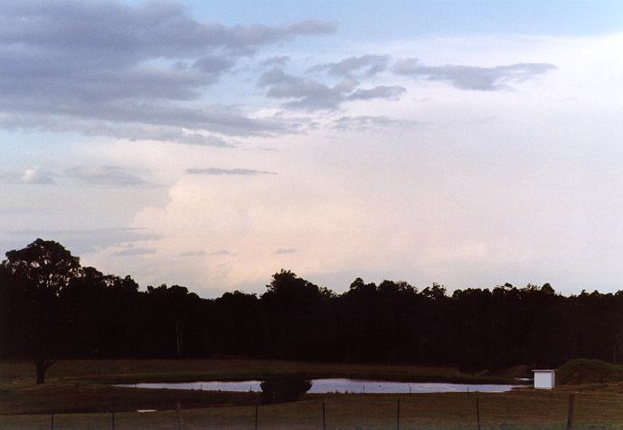
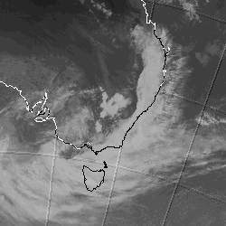
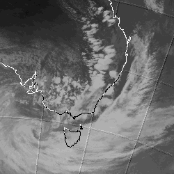
We were able to down-load the 1pm satellite image. It showed that storms were rapidly developing a few hundred kilometres to the west and north-west. We eventually decided to head to an area where we could observe storm activity hoping that some of these storms would move towards us. This also gave us the opportunity to observe the Newcastle storm.
This storm turned out to be quite large and isolated. The anvil was directed south-east off the coast. Its rear flank was crisp and very steep. It had a clear, back sheared anvil. The fact that we could NOT observe the base at this distance indicated the top of this storm was very high. As we headed north, we were able to briefly observe an overshooting bulge. These characteristics indicate that the storm was quite likely a supercell.
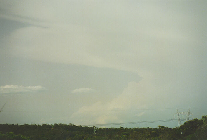
 Probable
supercell thunderstorm south-east of Newcastle at 4pm
Probable
supercell thunderstorm south-east of Newcastle at 4pm
To the west and south-west, we could barely see tops of a thunderstorm band also directed south-east. This band must have been one from the inland observed earlier on the satellite image. We decided to wait around until evening to see what this band would do or if other thunderstorms would develop. During the late afternoon period, the storm band anvils hid the sun making it easier to observe the cloud base features. This band of thunderstorms stretched along the horizon and looked ominous. However, as we headed towards it, we observed lightning and heavy rain. We took a couple of photos of the spectacular base structure. We then headed home passing through some heavy falls of rain.
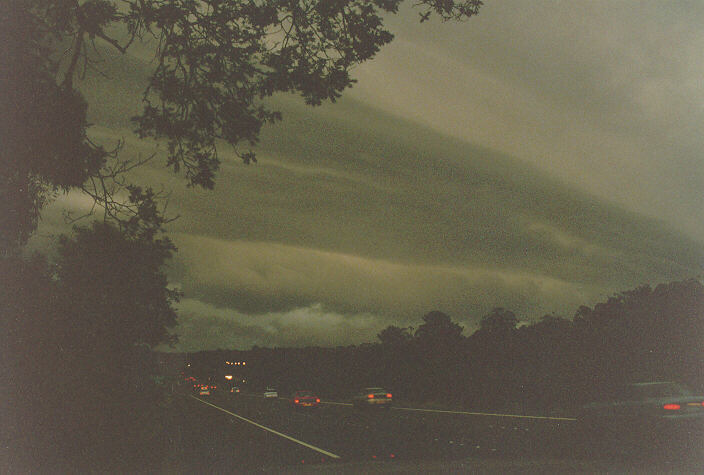 Ominous
clouds ahead on the F3 !
Ominous
clouds ahead on the F3 !
It seemed like this was another disappointing day. The true picture, however, began to unfold over the next few days as reports were received.
Several supercells were observed or reported in the inland of NSW. Some of these supercells produced tornadoes with at least three being reported in the Dubbo area. Regardless of what was reported, there must have been other tornadoes that day considering the fact that the Australian countryside is sparsely populated and many storms go unreported.
One storm in particular passed through the Armidale area. This storm produced one of the most severe events ever recorded in any rural district of NSW. Hail to 8cm diameter driven by southerly wind squalls of up to 150km/hr smashed most southern windows in the town as well as tiled roofs. Hail also damaged hundreds of cars. Trees were uprooted or snapped. Crops in the surrounding districts were flattened. Insurance companies estimated around $100 million worth of damage was caused by this storm, quite significant for a town moderate in size. This day therefore is one of the most significant in recent times.
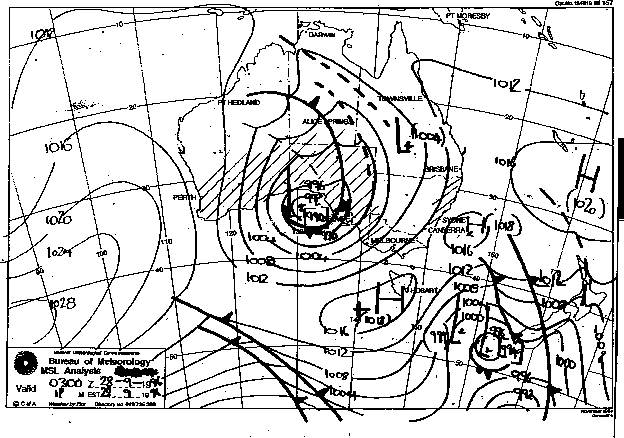
As the satellite image shows, the many tear drop tiny shaped clouds are mostly supercell thunderstorms aligned side by side in a line stretching north to south. This line extends from central NSW to central Queensland. The clearing rain and cloud band that had occurred earlier in the day can be seen off the coast.
Synoptic Charts provided by the Bureau of Meteorology
|
Document: 9609-01.htm
Updated: 6th April, 2004 |
[Australian Severe Weather index] [Copyright Notice] [Email Contacts] [Search This Site] |