Author Topic: QLD & NSW Severe Storms (incl Blackwater hail & Brisbane flash flooding): 19-21 Nov 2008  (Read 49634 times)

0 Members and 1 Guest are viewing this topic.

Offline Michael Thomas

  • Elephant Trunk F2
  • *
  • Posts: 172
  • Gender: Male
I would be interested in seeing the radar from the Backall storm. Certainly sounds very damaging. Fortunately, Backall is within reach of the Longreach radar (not trying to be funny there). Despite the stronger shear yesterday, storms really struggled staying isolated from very long. From the radar it would seem that there were several short-lived supercells on the ranges. The squall line then was the main show for the coastal regions. Within the line it did seem as if there was embedded rotation around the NSW/Qld border. This was picked up on the doppler image as well as showing up as a notch on the line (by reflectivity). From memory there was also a bowing segment afterwards as well in the same general area.

I would have to say there is again potential today as well. I cannot see storms being as wide spread today as the trough is much nearer to the coast. However, Brisbane airport is currently 29/18 with an NE'ly breeze. Replotting a forecast sounding for Brisbane for 28/20 gives around 2000 j/kg of CAPE. I can easily see moisture depth being a problem today but assuming moisture depth is sufficient I would expect severe storms to be possible with large hail the main threat. I am guessing there should be a E-W orientated boundary laying south of Brisbane. That would result is somewhat of a triple point (a poorly define one if any) which I am guessing could be an area to watch....just a guess. Don't take my forecast too seriously.

Michael

Offline Karina Roberts (slavegirl)

  • Multi-vortex F1
  • *
  • Posts: 84
  • Gender: Female
The storm last night was certainly interesting and fast moving to say the least! I was outside my unit with a friont row seat so to speak watching it rapidly approach from Canungra-got small hail here (prob around pea to marble sized) with constant ligtning flickering as it roared through. A couple of pics i managed to get on my phone. Got some nice video which i am working on as to the speed which this storm rapidly approached from the west ( it was amusing to watch the flying fox's trying to fly against the wind and getting no-where lol)
The only difference between tattooed people and non-tattooed people is that tattooed people don't care that your not tattooed. - Wildfire tattoos

Offline Michael Thomas

  • Elephant Trunk F2
  • *
  • Posts: 172
  • Gender: Male
The Brisbane sounding looks great. A nice cap sitting at 850 mbar with deep moisture sitting below, dry adiabatic lapse rate from 850 to 750 mbar with cold dry air above. Plotted at 31/17 gives an LI of -7. I would expect some moistening below the cap during the day which can only increase CAPE. Westerly's are pushing in really close to the coast which is concerning at this stage but the potential for large hail is very real for coastal areas.

Michael

Offline Jason(pato)

  • Elephant Trunk F2
  • *
  • Posts: 136
  • Gender: Male
Gday All,

Here is my report from yesterday November 20 2008

I started my chase initially targeting an area just south of Casino after noticing some nice updrafts and a reasonable echo on the radar. In transit there was some nice development in the area to the south of Casino.


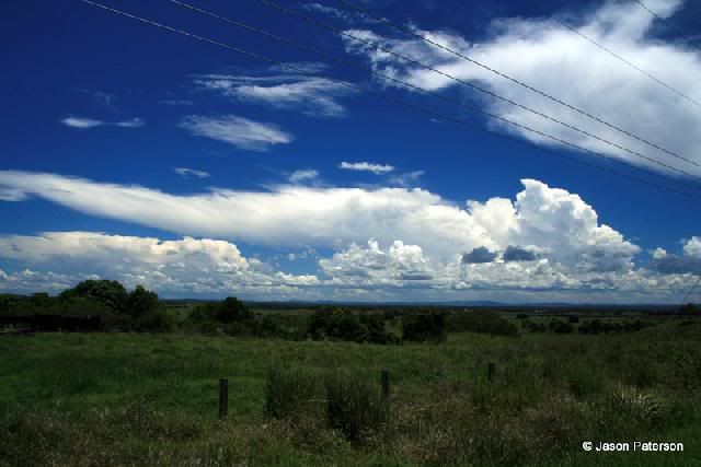
I headed for an area about 10kms south of Casino and watched an impressive but high based cell to my south. Fresh convection was pushing up all the time, with quite a few CG's pumping out of the base. I also noticed some nice clear air CGs shooting out the rear of the cell. Unfortunately this cell was taking a SE'ly track so I let it go in anticipation of more development. At times it exhibited some awesome pileus displays.


I then settled in for a bit of a wait for the next lot of development to arive, but after a quick consultation with Michael Bath (who was unable to chase) on the radar situation it was apparent nothing was in the immediate area. He directed me to a cell which was near Evans Head, so with nothing else around off I went. On the drive down the cell had some nice powerful updrafts, with a nice shelf cloud structure.


It was a race to the coast but it beat me offshore in the end with most of its previous impressive structure now diminished. After another quick call to MB I decided to head back to the Casino area as there was cells coming off the range from Tenterfield and near Urbenville.

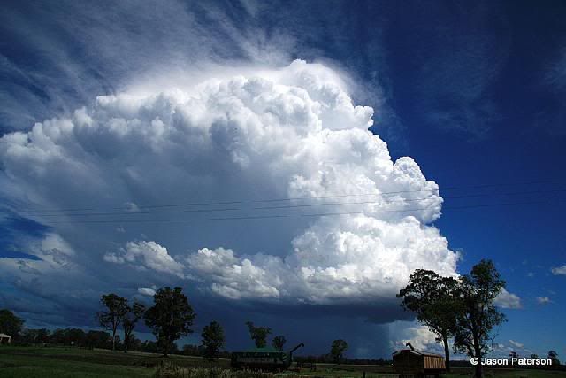
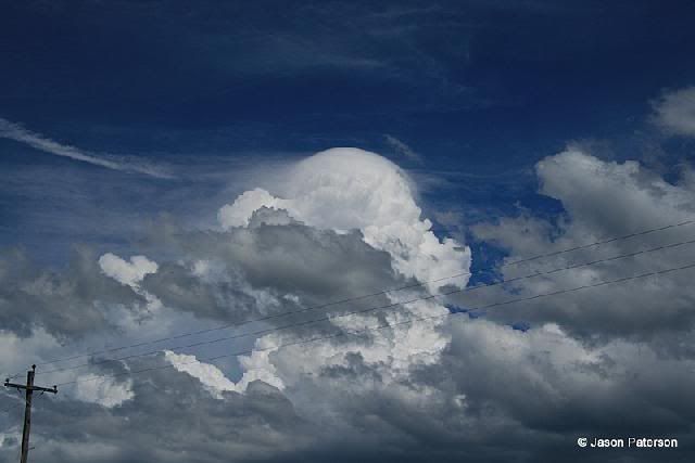
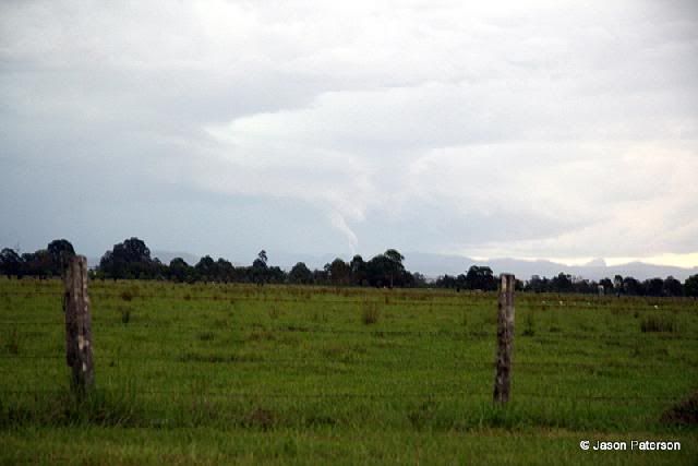
I headed to an area  about 5kms North of Casino which provides an uninterrupted view from the SW to the NE. The two cells coming off the ranges were now in view with the storm coming down from Urbenville(WNW) appearing the stronger of the two. CGs were quite frequent from both cells and just as I was about to set up the tripod for some pics a CG landed not too distant from my position, so I shelved that idea and continued to watch the unfolding scene. The cell from the NW was now showing a decent guster so I decided to make the hop further Nth to Kyogle. Just before I did I noticed a very suspect lowering which lingered for a minute or so. To my eyes it looked like a funnel.


Cropped version


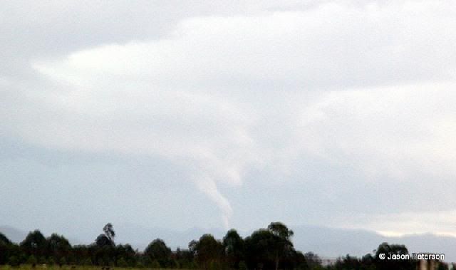
Maybe someone with a bit more knowledge on these things could come up with an explanation

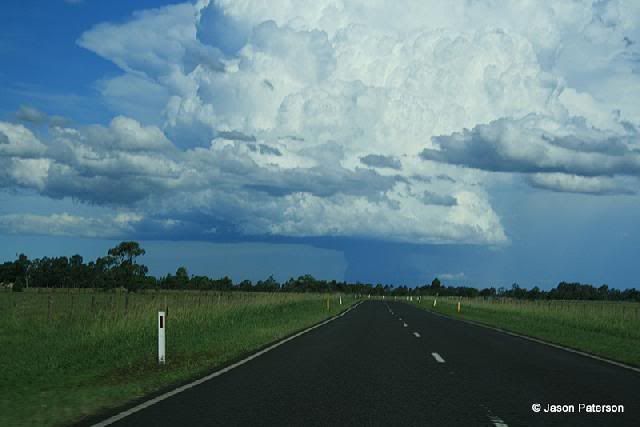
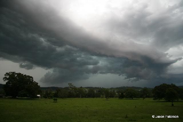
The storm still looked still quite distant so I jumped in the car and headed for Kyogle. On the way it was apparent that I had lingered to long in my previous position and the cell was moving alot quicker than I realised, so it was a race again to try and beat it to Kyogle. All the way powerful CGs were hammering the earth both in front of and within the storm. The cell had an ominous greenish tinge to it, so I stopped on the outskirts of Kyogle to get a few pics.


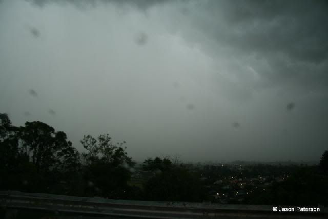
I barely made it to town when the guster passed overhead, leaves and small branches were flying everywhere. I decided to head up to the lookout to try and get a pic but the rain hit and I was confined to the car. Could only snap a dodgy pic out of the windscreen.


I quickly got out of there and headed to the servo to fuel up. When I got out of the car the the rain was almost blowing sideways and there was the telltale tinging of hail on the servo roof. There wasn't all that much though just a few isolated stones around 20 cent piece in size.
I waited for the main part of the cell to pass then put in another call to MB to see what was happening. The cell was now moving towards the Lismore area so I decided to call it a day. On the 45min drive home I was accompanied by numerous CGs, some quite close, for the whole way. Arriving home I was treated to a nice display of some anvil crawlers but I was too tired to bother setting up the tripod.
In all it was pretty good chase (6hrs worth) however with bit more experience I'll learn to position myself better and rely on a bit of gut instinct.

Cheers Jason 
South Lismore, Northern Rivers NSW.....Supercells are us!!

Offline Michael Thomas

  • Elephant Trunk F2
  • *
  • Posts: 172
  • Gender: Male
Nice pictures there. Not looking good for the SE at this stage, it was always going to be close but at this stage it appears as if the W'ly is winning. Dew points are falling which is not good at all. Interestingly though, just south of the border winds are out of the E/NE with dew points around 18C. Maybe, just maybe, later moisture will surge back inland around the gold coast to allow initiation just inland. There are storms further north but these look rather messy. dp's are excellent at 23C up there which is getting pretty moist.

Michael

d_rec

  • Guest
Been reading these forums for some time now and picking up tips and trying to understand some of the terms. I got some decent shots of the build up to 20/11/08 on the Gold Coast but after this shot I had to seek cover(not much at Budds Beach). With all the moisture about and today is quite warm on the coast I expect to see some build up in a couple of hours.
Can any one point to where I can learn about cape shear and half of these terms used here(preferably beginners level)

Offline Michael Thomas

  • Elephant Trunk F2
  • *
  • Posts: 172
  • Gender: Male
Hi, I would recommend reading through the following-

http://www.downunderchase.com/storminfo/stormguide/

I think this is an excellent overview of storm forecasting. On another note, looks like we have an organised storm in the making near Childers. Looks as in it will move to the N or NE and strengthen.

Offline Michael Bath

  • storm chaser
  • Administrator
  • Wedge tornado F5
  • *
  • Posts: 1,602
  • Gender: Male
    • Australian Severe Weather
Was sent these pics of the Blackwater storm (20/11) by an SES member - who had his own house damaged.

Trying to track down radar - Strikeone archives failed yesterday.

Been another very busy day - the storms yesterday afternoon and evening were very nice - will post some pics tomorrow. Jason- excellent report and pics :)

Location: Mcleans Ridges, NSW Northern Rivers
Australian Severe Weather:   http://australiasevereweather.com/
Lightning Photography:   http://www.lightningphotography.com/
Early Warning Network: http://www.ewn.com.au
Contact: Michael Bath

Offline Steven

  • Global Moderator
  • Stove pipe F3
  • *
  • Posts: 410
  • Gender: Male
Did anybody save last night's radar? The Archive doesn't seem to have them available.

Spectacular shots there Rodney, betcha those lowerings were low enough to touch!

Today things are a bit of a disappointment, but we have a drying out from westerlies to blame for that. Shame too, because the sounding went nuts with -9 LI and 4000 CAPE!

Offline Richary

  • Barrel tornado F4
  • *
  • Posts: 680
  • Gender: Male
Ninemsn has a good selection of reader photos including some nice storm structure and lightning shots, mainly of the Brisbane area storms (though the last couple are from Gosford). Some of these may be from the storms earlier in the week.

http://images.ninemsn.com.au/resizer.aspx?url=http://news.ninemsn.com.au/img/2008/national/2111_cloud_lg_sp.jpg&width=310

Offline Adrian

  • Multi-vortex F1
  • *
  • Posts: 64
  • Gender: Male
Some fantastic shots- thanks for posting !!!

Cheers,
.adrian

eight, nine and ten

Offline Michael Bath

  • storm chaser
  • Administrator
  • Wedge tornado F5
  • *
  • Posts: 1,602
  • Gender: Male
    • Australian Severe Weather
I've put up a gallery of pics for Thursday 20th November 2008

Two small storm cells passed over my place before the main event moved through.


Location: Mcleans Ridges, NSW Northern Rivers
Australian Severe Weather:   http://australiasevereweather.com/
Lightning Photography:   http://www.lightningphotography.com/
Early Warning Network: http://www.ewn.com.au
Contact: Michael Bath

Offline enak_12

  • Elephant Trunk F2
  • *
  • Posts: 153
  • Gender: Male
Just throwing up a couple of photos I took on the 20'th..

my view from Sawtell Headland looking north:


View looking south:


Jeff Brislane

  • Guest
I was reading about the tragic story of the loss of a four year old girl after the failure of an inflaitable lip on top of a weir near Blackwater in Central Queeensland and i was thinking, and this is pruely speculation, but I was thinking about whether or not the hailstorm that went through Blackwater only a few days before might have weakened the device that failed on top of the wier. It seems that the device was inflatable and no doubt would be storm proof but it still makes me think if the hailstones could have caused a structural weakness or further weakened an already fragile area? It sounds bizare to have an inflatable lip to hold back excess water anyway.

Offline Michael Bath

  • storm chaser
  • Administrator
  • Wedge tornado F5
  • *
  • Posts: 1,602
  • Gender: Male
    • Australian Severe Weather
Hey Jeff - I thought the same thing......

I managed to get hold of all the radar for the 20th November. There are other loops available but I won't add unless requested.

---> Newcastle 128km scale radar loop

---> Grafton 128km scale radar loop

---> Gladstone 256km scale radar loop (this shows the Blackwater storm at 0740UTC - max reflectivity 250km from the radar is pretty impressive)

---> Mt_Stapylton 64km scale radar loop

---> Mt_Stapylton 128km scale radar loop

---> Mt_Stapylton 256km scale radar loop

---> Mt_Stapylton Doppler radar loop

Michael
Location: Mcleans Ridges, NSW Northern Rivers
Australian Severe Weather:   http://australiasevereweather.com/
Lightning Photography:   http://www.lightningphotography.com/
Early Warning Network: http://www.ewn.com.au
Contact: Michael Bath