Recent Posts

Pages: 1 ... 6 7 8 9 [10]
91
Hi Jimmy

Nowhere using Firefox 6.0.2 can I see any where to login or register, even though I have clicked the various links to do so in the How To Use page.

Cheers

Richard
92
I picked up the same storm as others on Saturday afternoon. I wasn't expecting a storm so hadn't taken the camera etc with me as we went up towards Seven Hills for some geocaching. As we got out of the car the thunder was getting closer and wind stronger so we decided standing in the bush wasn't the best idea.

We drove back to Baulkham Hills shopping centre where we had intended to be anyway afterwards and parked on the roof to get a view. Quite a lot of good lightning strikes were seen, with some rather close flangs as well. No hail at that spot but it certainly bucketed down quite heavily for a while. Looking at the radar track I thought it had missed home at Rydalmere but there was about 1mm in the guage and the cat had gone into hiding under the house so home must have caught the edge of it.
93
Hi guys,

It is our pleasure to welcome you to Extreme Storms   www.extremestorms.com.au

This website is not a replacement but an extension of the forum like structure here merged into a blog and eventually chat format. The forum discussion will be phased out soon and we encourage you to make the transition over there. The forum will be locked eventually but will remain as an archive.

We would like to thank all who have supported the forum and hope the new format will allow for greater flexibility. Please become a member and continue posting. Ther is information on how to use the website:

http://www.extremestorms.com.au/how-to-use-this-website/

I hope you enjoy and please provide us with ideas and feedback.

Regards,

Jimmy Deguara
94
Oct 11, 2011: QLD central coast:

Hey guys, another long-lived storm has tracked NE crossing the coast just to the south of Mackay - rarely look at this radar so no idea on its calibration but it does look (well, looked) intense.  A pronounced storm split, cell mergers, it all happened over the last 6 hours; and another interesting cell has fired up now too! The deep layer sheer is very good up there  and surface T/Td spreads are quite tight!  Looking at the models you would want to be there right through the weekend!

See : 128km Radar Loop for Mackay, 03:00 11/10/2011 to 15:00 11/10/2011 UTC


David C
95
Storm chase Saturday 8 October 2011

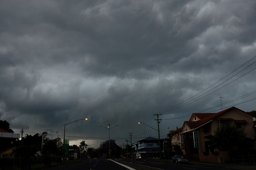
Its been a while since my last report but on Saturday, I also did a storm chase around Castle Hill to Windsor and north to the Wilberforce / Ebenezer area. I had worked out that storms would develop between 2 and 5 pm across Sydney Saturday afternoon. Just before 2 pm, I went to a lookout at Bella Vista where I saw the first storm develop over Blacktown. I soon discovered the storm was building over me so I had to hurry back to the car for shelter. I had planned to photograph lightning but never had the opportunity as the storm was too close.

I made it back to my car just in time as the storm broke with very heavy rain and cloud to ground lightning. I decided to head north west along Windsor Road where I found myself driving through very heavy rain and some outflow winds (SE Winds). Driving was treacherous and I saw people slowing down, stopping or trying to get out of the rain. I did see waterlogged creeks but did not encounter any hail fall. I broke clear of the storm around Rouse Hill. I drove to Windsor and then to Macquarie Park where I observed another storm building just to the NE of me.

I then proceeded to Wilberforce then Sackville and Ebenezer closing in on the second storm and stopping to take the ocassional photo of the cloud structure. I closed right in on that second storm which was by now dumping very heavy rain with the ocassional thunderclap heard. I watched a shelf cloud break free from the storm as it passed over me. The storm seemed to weaken and I stayed and watched the spectacle for a time to see what would happen. After a while, I left and returned home. I watched another cell to the west but I decided not to chase it along Putty Road because there are too few opportunities for photos.

I chose to go this way as I was after cloud structure and contrasts using my new Canon camera.

Jimmy, I read your report and noted that you encountered small hail near the corner of Windsor Road and Old Windsor Road. I was at that intersection for a short time during the event but did not observe any hail. Instead I encountered strong SE winds in that very area and some very heavy rain.

I only took a small number of photos but it is good to see storms in the Sydney region again.

Harley Pearman
96
Bangkok prepares for arrival of dangerous floods - ABC News (Australian Broadcasting Corporation)


Massive

http://www.abc.net.au/news/2011-10-11/bangkok-prepares-for-arrival-of-dangerous-floods/3495512
         
97
Had a few commitments on the 8th but I managed to get out early and watch the main gust front cross the coast didn't encounter any severe conditions locally but the guster was photogenic


Paul D
98
Floods Inquiry heads to Bundaberg - ABC News (Australian Broadcasting Corporation)


Queensland's

http://www.abc.net.au/news/2011-10-10/floods-inquiry-heads-to-bundaberg/3458976
         
99
Hi,

Jason Paterson and I chased Saturday 7th Oct. The sky was very uninspiring when we left the Lismore area with high cloud persisting and not much to see at first. Temps didn't get too high either, perhaps to 23-24 as a max. Radar indicated some cells gathering on the ranges surrounding Grafton from S - SW -W so we headed there via the Summerland Way.

Weak activity was observed from Grafton before one cell started to dominate just south of town:
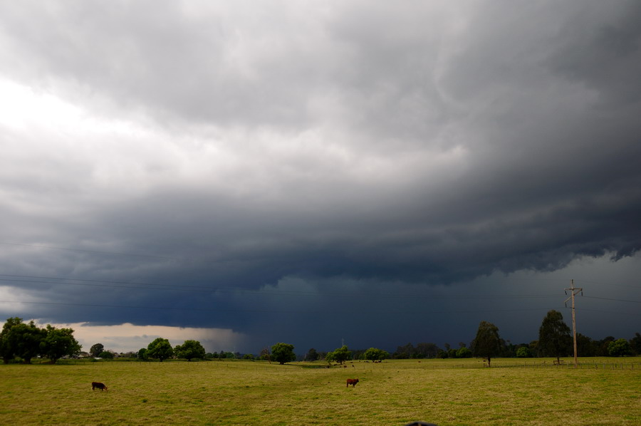


The storm passed through South Grafton and was heading slowly NNE at this point. We decided to brave the Pacific Highway traffic and drove into the storm. There were bursts of very heavy rain and strong winds. Some small hail just northeast of town before the sky darkened even more and hail to 2cm hit near Ulmarra. The winds were quite violent and most other vehicles had parked on the side of the road, including the usual dummies under large trees. The temp was now hovering around 14. We could see the leading edge of the storm but it took until nearly Maclean to get out of it.
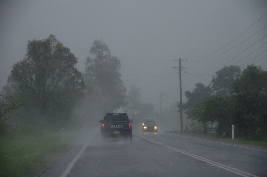
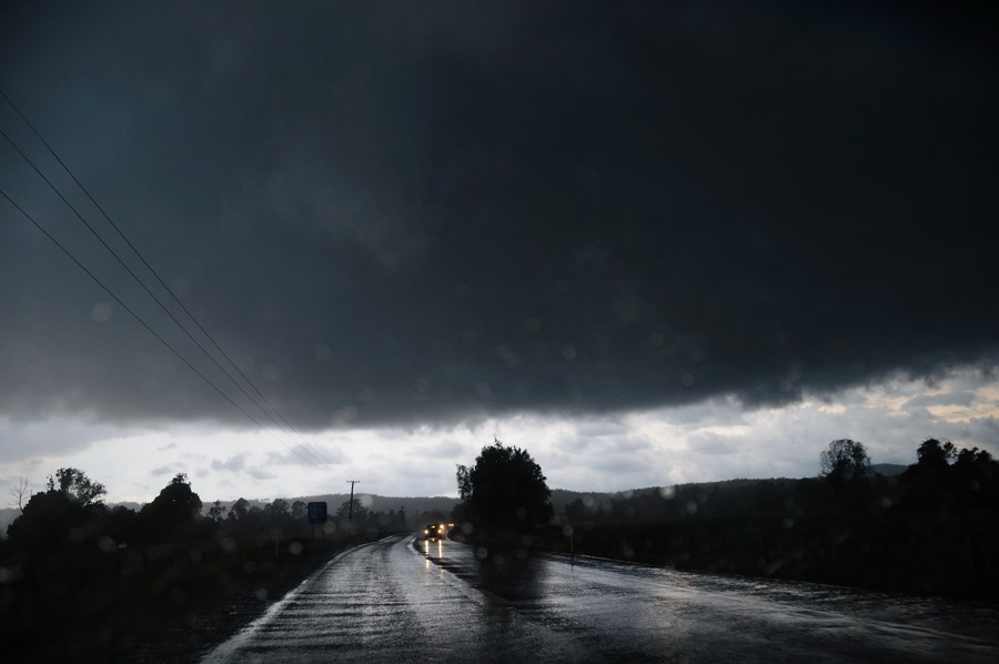


This looking back near Tyndale:
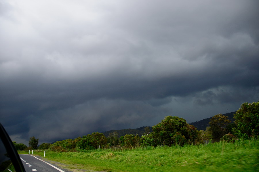


The view from Chatsworth Island north of Maclean was pretty good. The storm was looking very outflow dominated with a whales-mouth type gust front
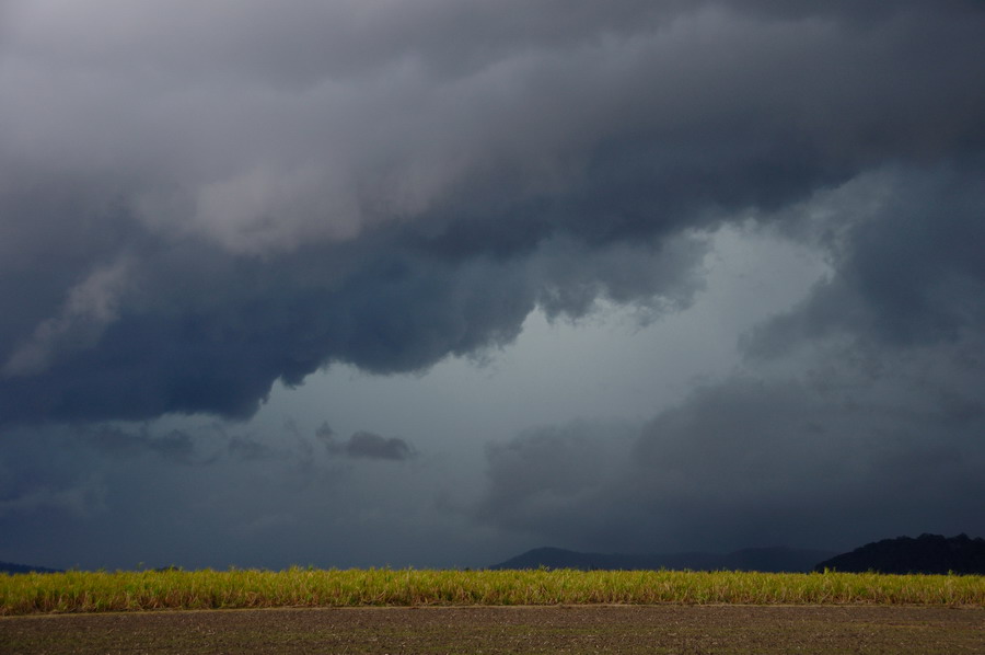
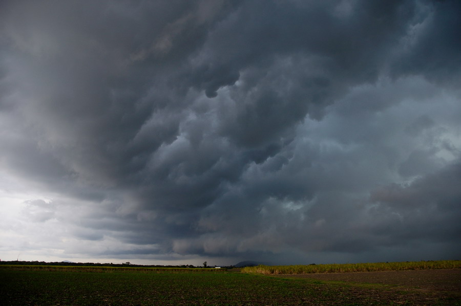
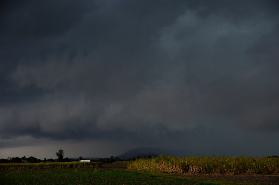


The storm was certainly moving quite fast now so we shot north to Woodburn. Despite travelling 35km north at 100km/h or so the storm was still almost on us at Woodburn:
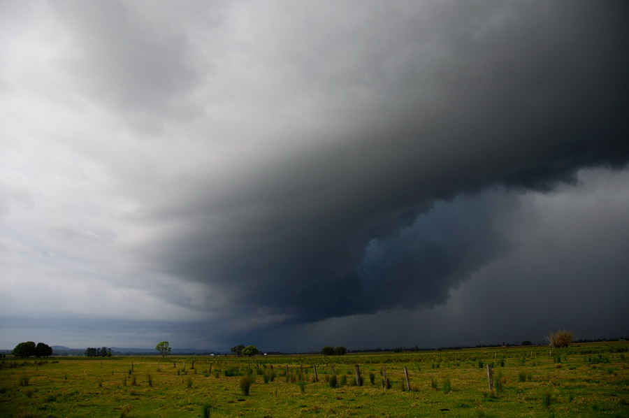
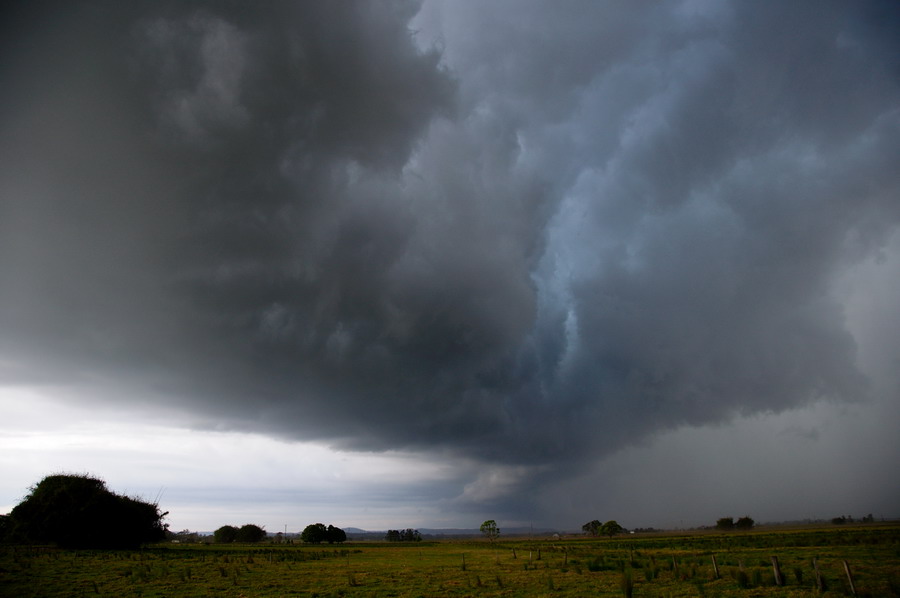


The features here were still very nice. No hail at this point but some very heavy wind-blown rain.


100
Bangkok warned to brace for floods - ABC News (Australian Broadcasting Corporation)


Thailand's prime minister warns residents in Bangkok to brace for the country's worst

http://www.abc.net.au/news/2011-10-10/thailand-pm-warns-of-thai-floods/3457782
         
Pages: 1 ... 6 7 8 9 [10]