and Chasing
[Index][Archives]
Snow Weather Data: Friday 8th to Saturday 9th June 2007
[NSW Northern Ranges Snow Chase Forecasting Guide] [Australian Severe Weather forum thread]
| Storm News and Chasing [Index][Archives] |
Snow Weather Data: Friday 8th to Saturday 9th June 2007 [NSW Northern Ranges Snow Chase Forecasting Guide] [Australian Severe Weather forum thread] |
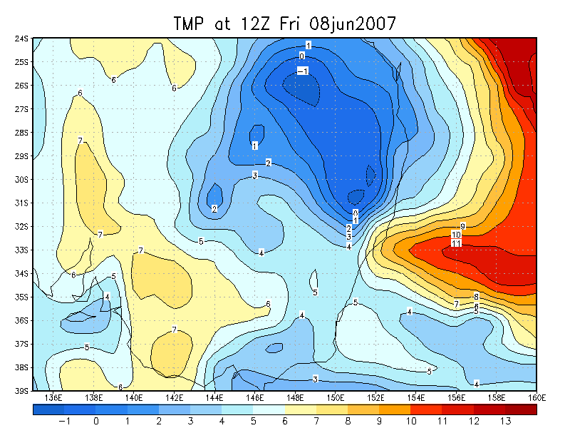
08/06/2008 00z GFS model run
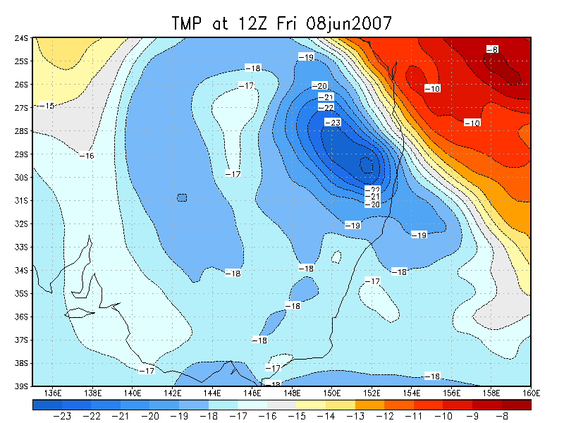
08/06/2008 00z TWC model run
 Infrared satellite loop: 05/06/2007 00z to 09/06/2007 12z [4.8mb]
 Infrared satellite loop: 04/06/2007 00z to 10/06/2007 12z [15.9mb]
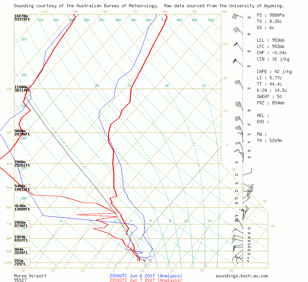 Moree Sounding 9am 8th June
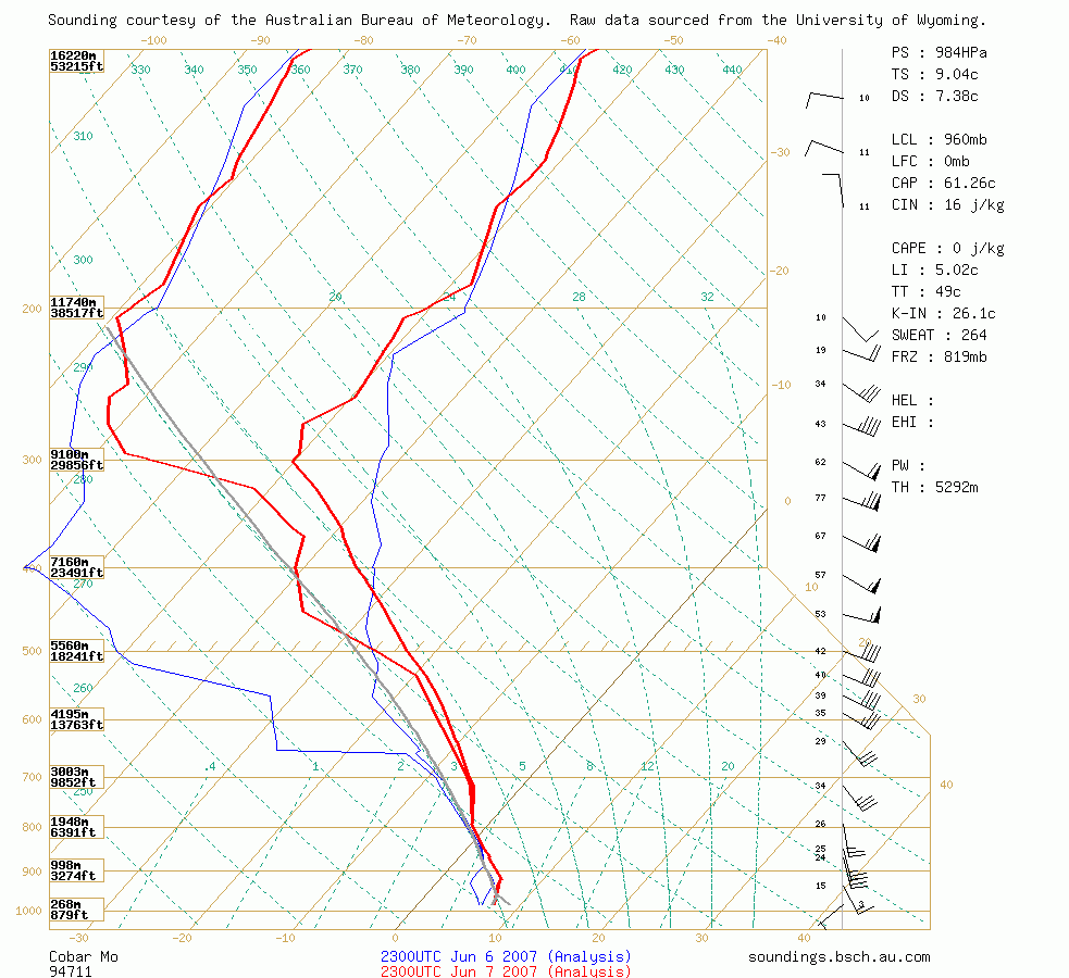 Cobar Sounding 9am 8th June
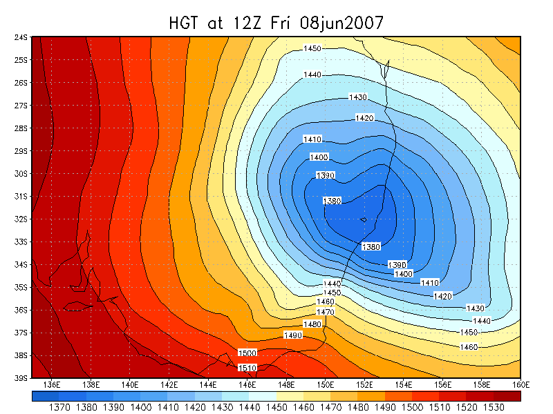
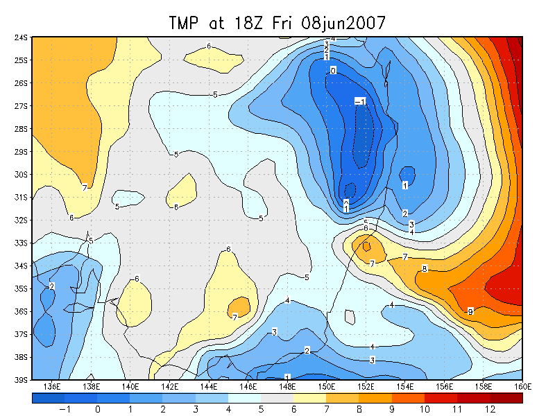
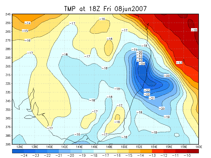
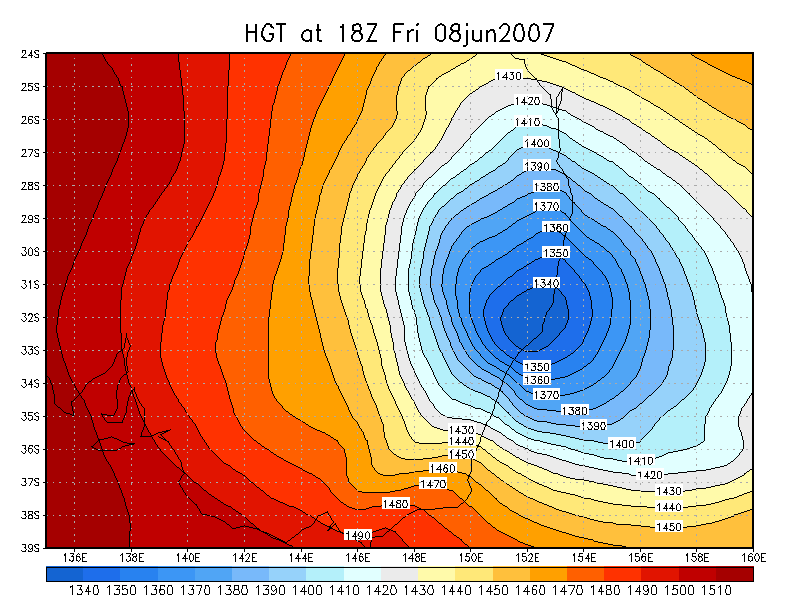
GFS Model Analysis 08/06/2007 12z and 18z runs
| 850 hPa Temp | 500 hPa Temp | 700 hPa RH | 850 hPa Thickness | |
| 12z 8th |
|
|

|
|
| 18z 8th |
|
|

|
|
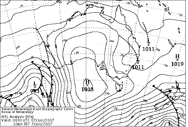
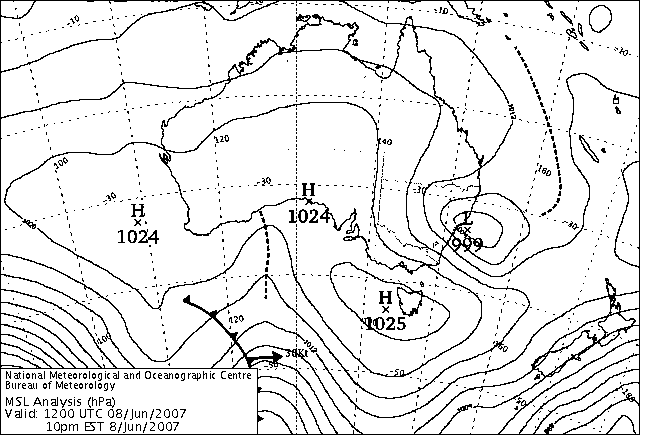
MSL and 500hPa LAPS analysis
|

|

|

|

|

|
|

|

|

|
|
Document: 20070608_snow_data.htm Updated: 30th May 2008 |
[Australian Severe Weather index] [Copyright Notice] [Email Contacts] [Search This Site] |