and Chasing
[Index][Archives]
Thunder Down Under Storm Chasing: 27th to 29th November 2005
by Dave Sercombe
See also: [27th - 29th Nov][30th Nov - 2nd Dec][3rd - 6th Dec][7th - 9th Dec]
| Storm News and Chasing [Index][Archives] |
Thunder Down Under Storm Chasing: 27th to 29th November 2005 by Dave Sercombe See also: [27th - 29th Nov][30th Nov - 2nd Dec][3rd - 6th Dec][7th - 9th Dec] |
After leaving Dave Ellem, where he headed south towards the Gold Coast, Bryan, Anthony and myself decided to risk the southern edge of the featureless supercell moving over the main part of Brisbane, and head west towards Ipswich. There was another likely supercell developing in the area north-west of Warwick.
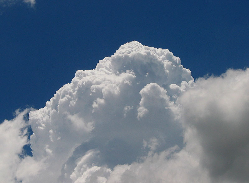
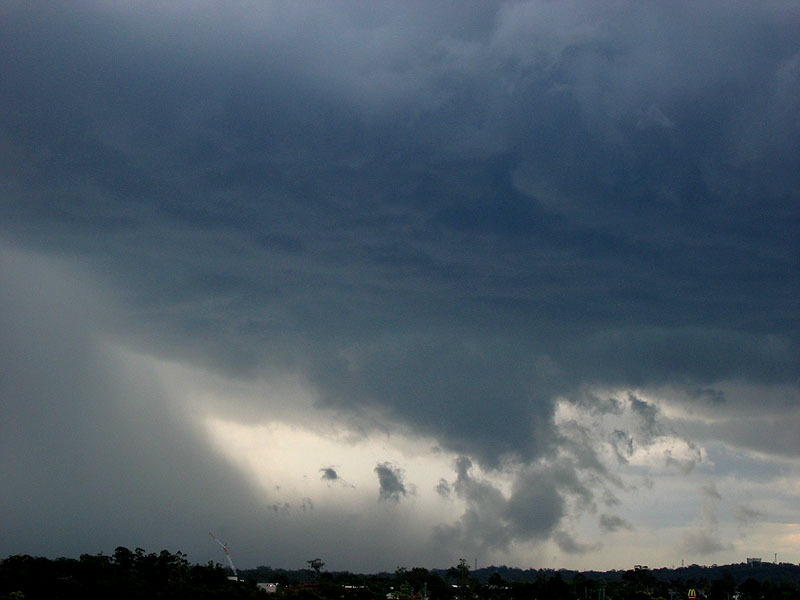
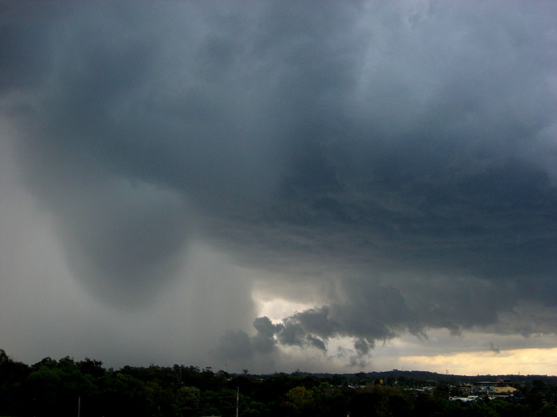
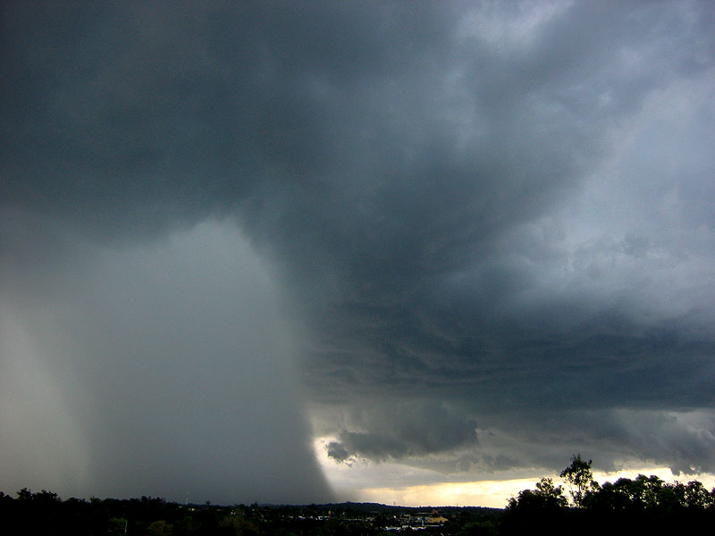
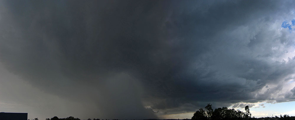
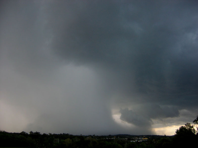
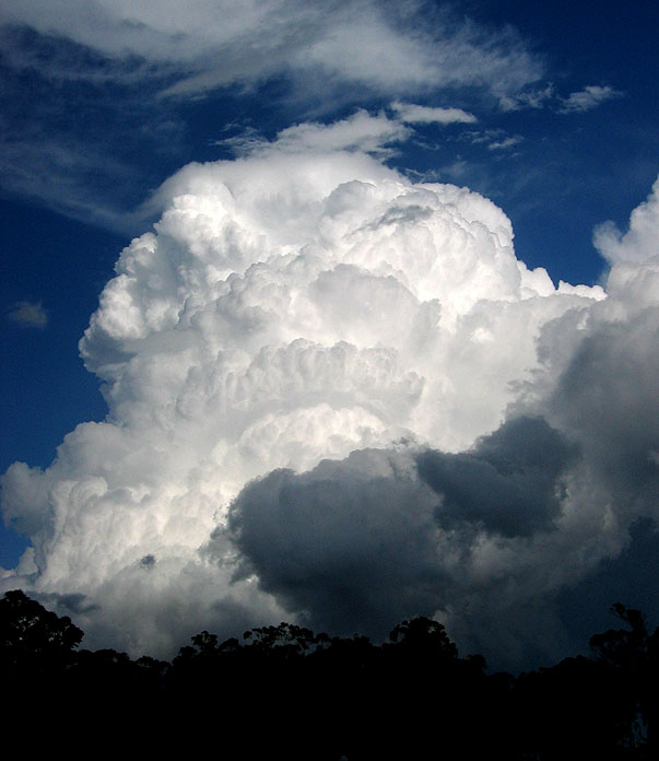
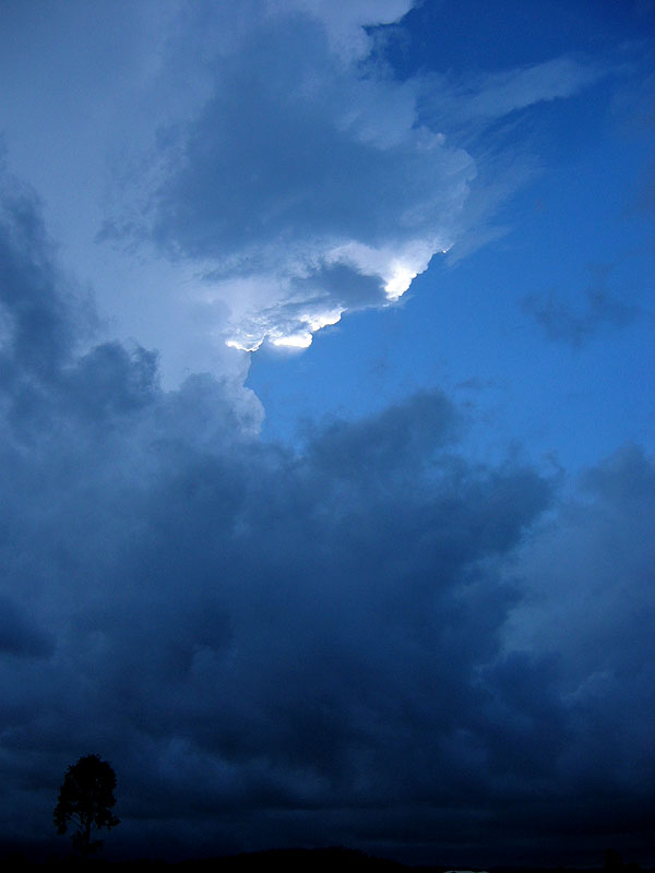
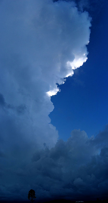
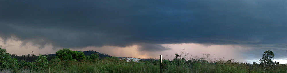
A lot of heavy rain ensued on the Gateway and Logan motorways on the drive west, and by the time we were back on the Ipswich Motorway the storm was well and truly past the New England Highway linking Warwick and Toowoomba and moving into the Lockyer Valley to the south-west of Ipswich. We were still in the heavy rain mess to the south of the Brisbane storm and some strong winds and heavy rain from a weak storm that developed over Ipswich until we approached the Marburg area. Soon after the rain cleared we managed to get a decent view to the south-west, and were confronted with a monster supercell, complete with mothership-like base structure!!!
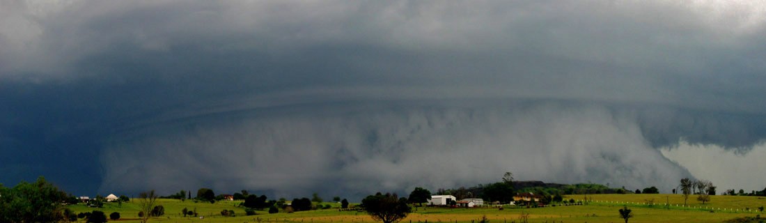
It was now 4pm and after a 5-10 minute stop at Marburg soaking up the structure of this magnificent supercell, we realised that we really needed to get going if we were going to a) stay ahead of the storm and b) stay safe! So we got ourselves back on the Warrego Highway and began to drive to the east towards Brisbane. After a couple of minutes of fast driving we realised that although we were making speedy progress, we were being passed by a lot of other cars! A glance at the speedo suggested that most of the traffic on the Warrego was travelling at 140-150km/h!!! I think a few motorists noticed the supercell that was right behind them, chasing them back to Brisbane!
As we drove through the last part of the Ipswich Motorway, Paul Miracki caught up with us after hearing Bryan conversing with Anthony and myself on the CB radio. One of the goldest quotes of TDU 2005 was said when he realised who we were: "I was just with James and Macca, and they were trying to kill themselves or something!!!"
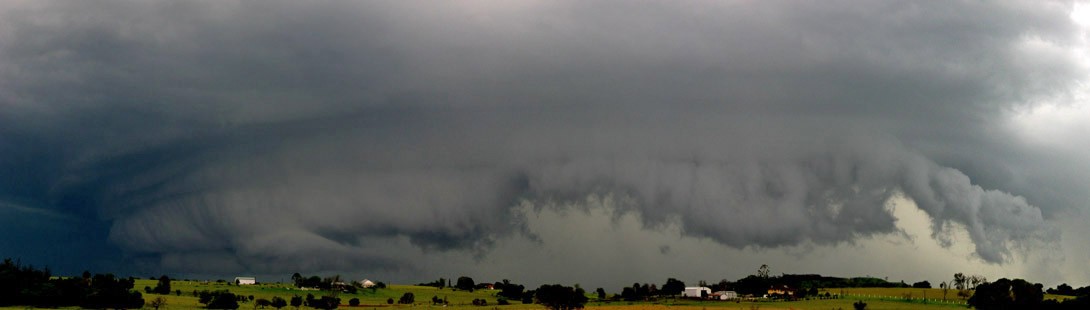
It was smooth sailing until we finished the Ipswich Motorway and moved into the traffic light section leading to the city. Macca caught up with us at this point and told us of some of the things he had seen. It was here that our day nearly ended as the supercell swiftly caught up with us as it progressed towards the city. The storm, now taking on a more outflow dominated appearance, was producing visible hail shafts within a few kilometres of the car on the west AND east. A few minutes earlier, we nearly took the Centenary Hwy route towards the city. Lucky we hadn't, as we found out the day after that cricket ball hail was reported at Jindalee, right on the Centenary Hwy!
Just as we were within a few kilometres of the city, the storm finally caught up with us, with strong winds and very heavy rain - and surprisingly no large hail! We were very fortunate to escape the main hail regions, with only periodic small hail. It was an amazing scene to drive along the Story Bridge only half able to see the skyscrapers on the other side of the river! From here we worked our way through the eastern suburbs along Kingsford Smith Drive towards the Gateway Motorway - but some flash flooding appeared very quickly that turned the short trip into a traffic nightmare! It was here that we experienced some heavy rain rates, and having to drive at very slow speeds while avoiding some of the small creeks that had decided to form on the road!
Entering the Gateway quickly coincided with an easing of the conditions, and an uneventful drive was had until we approached the southern parts of the Caboolture area. Driving through the road works in Narangba, we spotted one of those portable electronic traffic signs on its side, and then a moment later a narrow 100-150m section of trees smashed down, twisted and generally mangled! If my memory serves me correctly, I said "are you thinking what I'm thinking?" to Anthony (gotta love Bananas in Pyjamas quotes!), and luckily an exit off the Bruce Hwy was right in front of us and a road worked its way back, parallel to the highway.
We quickly came upon a couple of houses with obvious damage, with some emergency services vehicles attending the area. We approached the owners of one of the houses and asked if he would mind us taking photos of the damage to which he very kindly said yes. I'll mostly let the photos describe what happened:
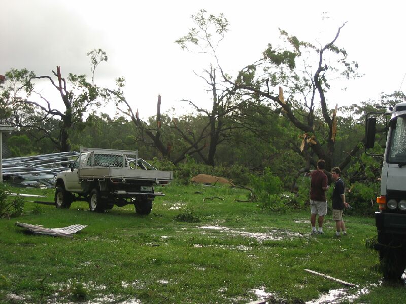
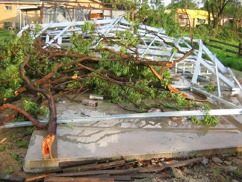
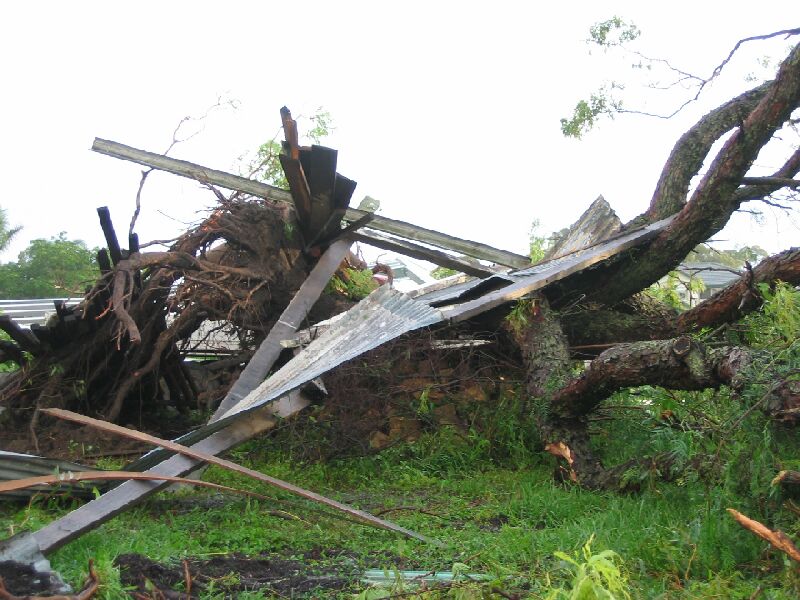
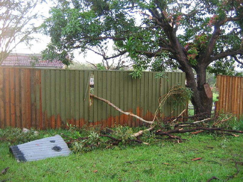
Numerous trees were stripped bare of most branches and leaves, some huge trees were completely felled, a large water tank was moved at least 50 metres, a new shed completely felled, and a 10cm diameter tree branch impaled straight through a fence!
We came to the conclusion that the damage was due to a likely F1 tornado, and a solid F1 at that.
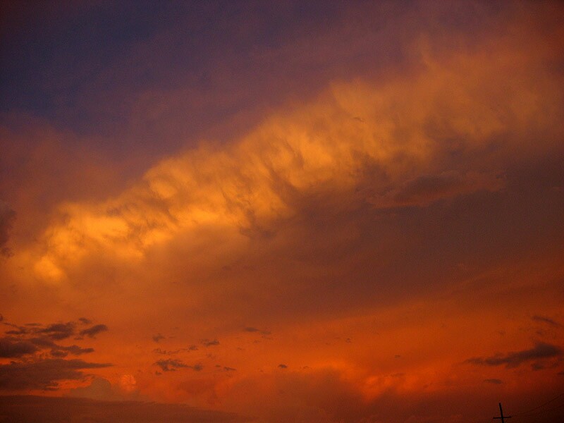
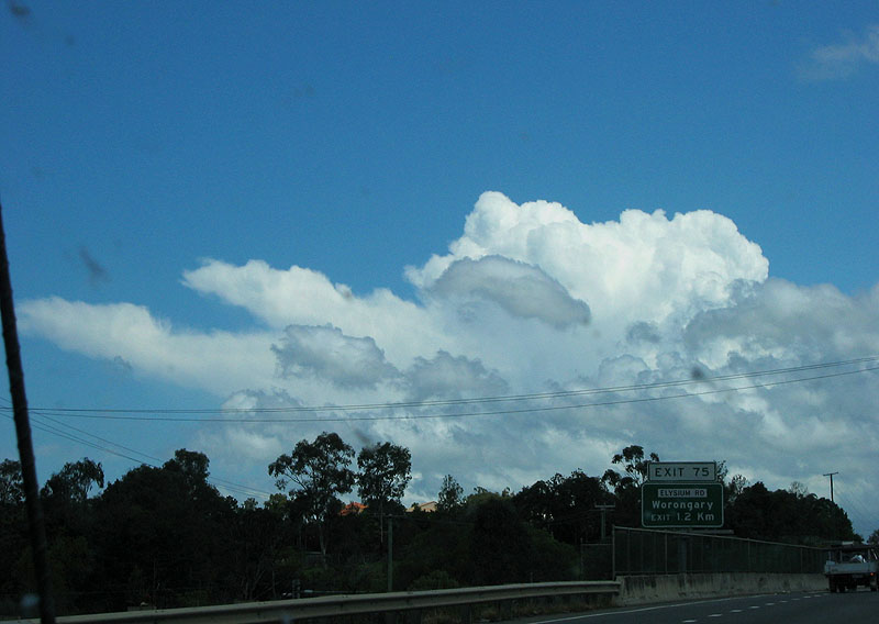
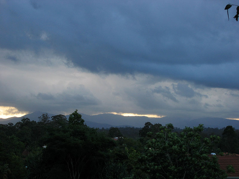
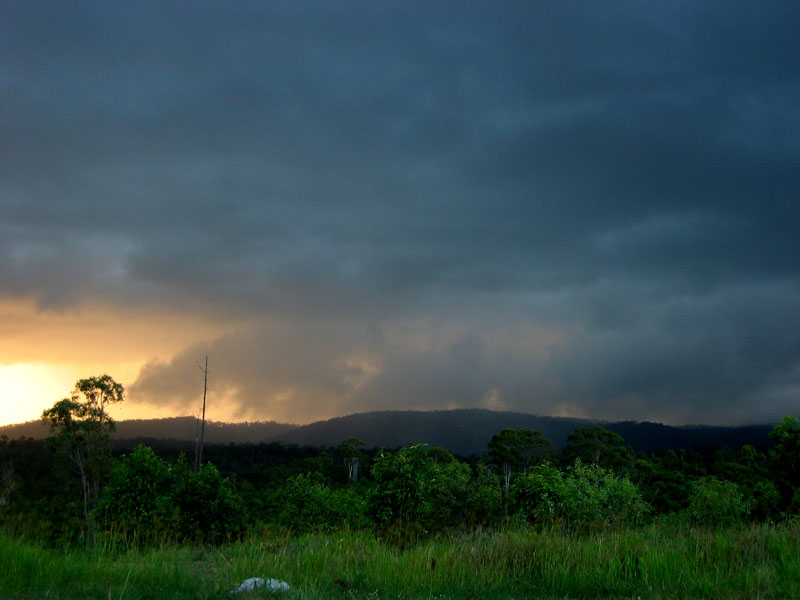
At this point we decided to look for some fuel - but all the service stations in the area weren't operating as the power was out! A 10km drive down the road yielded power and fuel. From the start of Pumicestone Rd we viewed the anvils of the storms as they moved out to sea, which provided a lovely sunset to cap off the day.
Why did I mention the 'chance of tornadoes' in the title? Not only did the wind shear suggest supercells, but there was enough low level shear for tornadoes! In the early afternoon Jonty Hall from the Bureau rang up Anthony's mobile and mentioned that he wouldn't be surprised if he saw a tornado or two in the coming hours! How right he was.
After staying the evening in Gympie and had a look at the models for the next few days, we parted ways with Bryan as he was to head home to the Gold Coast, and we were going to make our way up north towards the other TDU'ers above the Tropic of Capricorn. We weren't ruling out a drive to Townsville on Tuesday at this point!
We filled up with fuel and were leaving the service station when we started the discussion of going North again, with a completely different tone to our decision 20 mins earlier! Both of us suddenly felt very pessimistic on the decision to drive north, and the magic 'gut feeling' of forecasting kicked in - we decided to turn around and head back to Anthony's house for the night and see what the currently forecasted weak lifted indices in SE QLD would produce over the next few days.
After catching up again with Bryan, we had a sundae at the Big Pineapple in Nambour - and boy were they huge! Bryan and I went shares in a regular sized one, and Anthony couldn't finish a children's serving! One to note down if you ever want a sundae that is not only great value for money - but a meal in itself!
We arrived at Anthony's house west of Ipswich and were quietly looking through our photos from the previous days, when a glance at the radar loop showed a strong shower developing about 10-15km to our SE. It soon began to look like a storm on radar so I had a look outside and saw a couple of flashes in its updrafts, and returned to the house very contented with the knowledge that I had started TDU off nicely with four days of storms :)
The morning's model forecast for this day had improved markedly from the runs on the day before. There was just enough wind shear for supercells, and for once we had some good low level inflow from the N and NE. Late in the morning we headed down to Nerang to catch up with Bryan for the days chasing as we were likely to hang around SE QLD again. A discussion with Macca on the phone furthered our excitement for the day after hearing his thoughts, as well as discussing the Brisbane sounding when it was available at 11am. On the M1 we observed a couple of nice updrafts, as well as an early storm develop on the NE NSW coastline.
After meeting up with Bryan we decided to move back towards the Brisbane valley as there was already some storm development west of Ipswich. Soon after we saw a base emerge on the horizon, together with a very nice wall cloud! At times this appeared to be VERY close to the ground but we couldn't quite see what was going on as the motorway gave us fleeting views of the base. So we dove off into the Logan area to find a view.
The storm was heading towards us and a little to our north, so we decided to get ourselves to a good lookout and watch the situation continue to unfold.
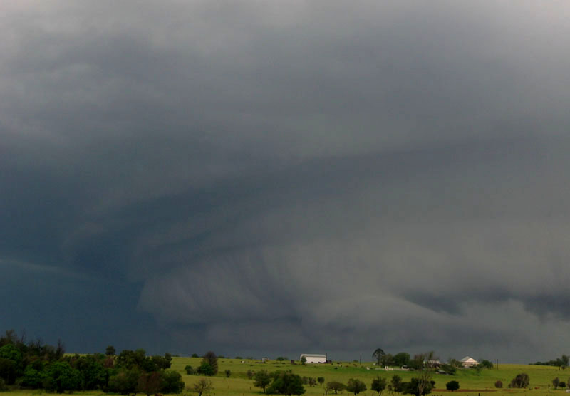
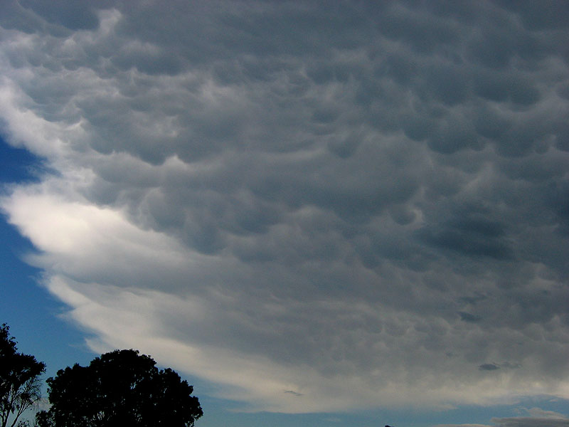
In Kingston Rd we found a lookout and took in the glorious view to the west! Naturally the wall cloud was the centre of attention, but the lack of other cloud unrelated to the storm allowed this supercell to really show off its structure! The updraft region was well defined and you could see strong new updrafts developing on its NW flank, even from our position to the east of the wall cloud and close to the 'exhaust' rain moving off to the SE. The anvil was full of lots of mammatus, of the shape and amount that I have seen on strong supercells in the past. The inflow from the ENE was clearly visible as it rushed straight into the large rotating updraft! We set up the camera on the tripod and started some timelapse of it all, the link is below.
Wall cloud and 'bowl of death' timelapse [1.41 mins - 4.92mb WMV]
The original wall cloud began to gust out and move further from the outflow (it could've perhaps been a new dominant updraft taking over), but soon after a new wall cloud developed behind the original one, and continued on the show! The video timelapse shows numerous funnels developing on this second wall cloud, though it was easier to see with the naked eye. At one point on the original video footage I jumped behind the camera and commented on the funnel(s) that I could see at that point!
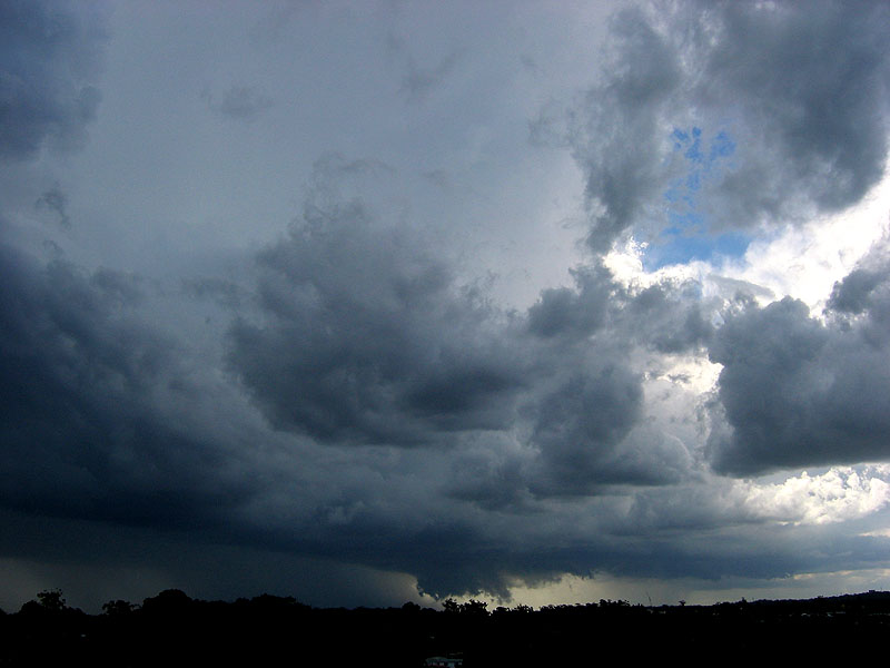
Eventually the wall cloud gusted out some more with a stronger outflow push, and was never as well developed from that point onwards. At this point the updraft really began to bloat itself with a lot more precipitation than it had before and soon enough, it let go in spectacular fashion! The "bowl of death", as was coined soon after was rather terrifying to watch as we were worried that it would've contained a barrage of large hail with destructive winds in excess of 100km/h - well it sure looked that way from our position and our assessment of the storms structure and visible outflow as it surged along the ground! Particularly obvious in the timelapse and the photos is how these outflow winds from the downburst raced forward to the NE.
The eastern side of the updraft base was now getting close to our position, and we decided it was time to hotfoot it to the M1 and probably head south in case it did the 'bowl of death' thing over us!
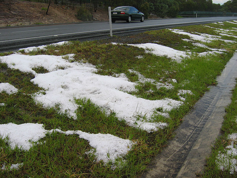
It soon occurred to us that we had little to worry about, as it quickly weakened as we drove, and we soon drove back along the Logan Motorway to look for signs of damage and hail. While we saw little damage, there was a fair amount of small hail around, approx 1cm. We also took some photos of the updrafts on the back end of the storm.
Meanwhile, a new storm had developed to the NW of Brisbane and was moving NE towards the Sunshine Coast. While there was another strong looking storm developing on radar where the first supercell had started, we decided that it would be best chasing the north one as the southern one would probably die when it encountered the cooler outflow of the first storm.
After a few photos at Rochedale of the new storm and some updrafts near the first storm to our east, we jumped on the Gateway and drove towards Caboolture.
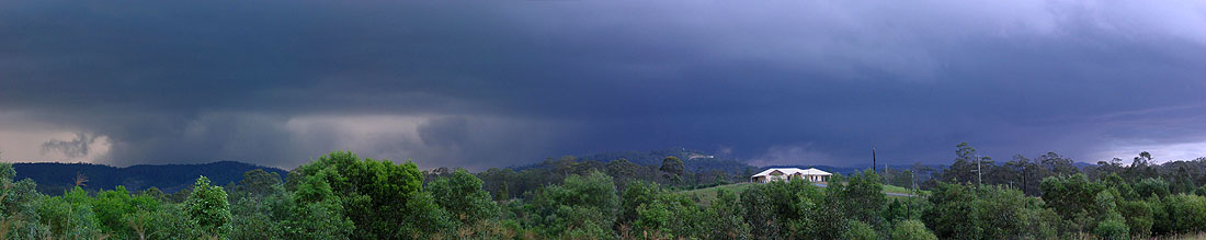
Upon rejoining the Bruce Hwy, we could see two strong storms now, both with wall clouds (though the one further away was hard to see)
We were looking for a place to view the storm, but it was very hard to get! Eventually (after 45 minutes of searching) we got a half decent view in a residential area in the southern part of Narangba, but after a few quick photos we decided to move on again, still looking for a good view to the W and SW.
We drove around for at least another 10 minutes, until finally we came across a great viewing spot on Oakey Flat Rd in Morayfield! So with some time to wait before the low cloud cleared and the storm to our west to come across the hills, we decided to set up some chairs, get out some food and cans of drink, and enjoy the wall cloud doing its thing to the SW of us!
Here also is some timelapse from someone (name withheld) on the SE side of this storm that we could see to the SW. They also were much closer to the storm! It shows the evolution of the wall cloud and its gusting out a couple of times - really worth the watch!
Wall cloud and gustfront timelapse [48 secs - 5.5mb WMV]
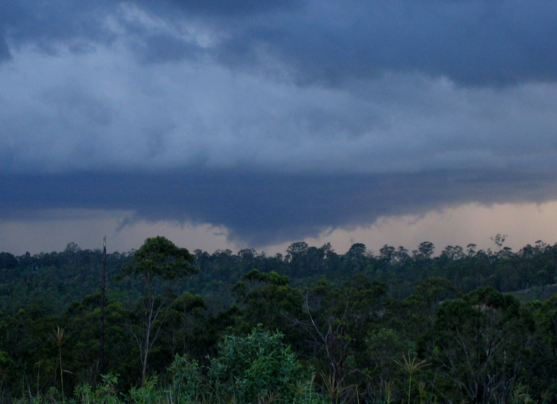
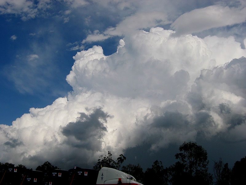
The wall cloud kept us entertained for a while (going by the photos, we watched it for 25 minutes!) until the low cloud cleared enough for the anvil of the storm to our west to become partly visible - and what a crisp anvil it was too!
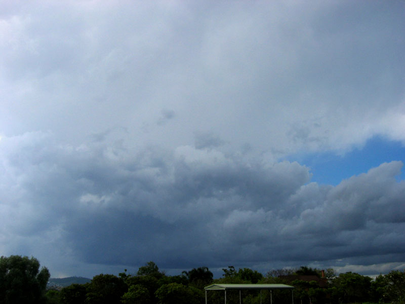
Twenty minutes after the anvil appeared, we began to see the gustfront come over the mountains. Although it wasn't the meanest looking thing we'd ever seen, we knew from looking at the updraft pulses and radar that it was far from a weakling!
At this point it was time to consider our options - retreat to the east and avoid the storm, or core punch it as it moved straight over us? Our decision was made for us quickly by a phone call from Ben Quinn! He was driving through the storm and was about 20km west of us, reporting a lot of heavy rain and strong winds, but only a bit of small hail. We were in and keen for the core punch!
After retreating to the car for a couple of minutes, the winds and then the rain started, performing a fairly 'garden variety core punch rating' for the first few minutes, soon after things picked up a few notches.
The constant strong westerly winds continued to increase and we were more concerned with these, until an incredible burst of rain and small hail hit the car front on (ie: from the North) which was exciting until it went bezerk - something like a truck dumping hundreds of litres of water on the car! There was a constant layer of water on the front windscreen, which the wipers could do nothing about! Being 'encased' in water like this was a rather claustrophobic experience - which you can see in our reactions during the 30 second video link below (please excuse the small amount of swearing).
While this intense 30 second burst of rain was going on (and we could NOT see out of the car at all), the winds had turned completely around and were now blowing strongly from the NE! We didn't notice this during the rain dump but we both did soon afterwards - quickly giving each other knowing looks as to what part of the storm we may have just passed under. The funny part of all of this is on Bryan's video footage the flag on his boot is flying in one direction at one point of the footage, and then soon after he looks at it again and its flying at nearly 180 degrees to what it had before!
Incredible core punch rain rates [38 secs - 3.53mb WMV]
When the rain and wind had nearly ceased, and we saw it continuing towards the Deception Bay/Redcliffe area, and we drove north to Caboolture. On the way, we observed weak tree/branch damage, probably due to winds around the 100km/h range. The winds appeared to be stronger here than where we were.
After some time mucking around north of the storm (I kinda forget why we were up there, perhaps there was another storm developing to the NW like the previous storms) we decided to drive back down to Deception Bay and perhaps down to Redcliffe to see the backend of the storm move out to sea, as it was producing occasional lightning in its updrafts and from its base.
We took the Deception Bay road exit off the Bruce Hwy and no sooner than a kilometre down the road we were greeted by the flashing lights of the emergency services, who were very quickly on the scene after the storm (5-10 minutes!) to cut and clear a number of large trees that had fallen down across the road. There were occasional crews clearing the trees for the next few kilometres as we approached Rothwell and Kippa-Ring (it was still lightly raining from the storm so full credit goes to the Fire Brigade and SES for getting there so quickly!).
We began to see some flash flooding on the sides of the road, which progressively got bigger as we kept driving along. As we drove up to a set of traffic lights with a few shops on the north side of the road, we came across some fairly large flash flooding on our side of the road, and while driving through it noticed that the gutter and footpath was completely submerged! We were focussed on this until Anthony exclaimed at what was on the other side of the road - there was a sedan half submerged in much deeper water, with a Commodore getting a run up to try and drive through the 40-50m of 50cm deep water! It didn't succeed, and while the lights were still red, we saw a Corolla attempt the crossing at a much slower speed, and succeeded!
Approaching the western part of Redcliffe we also noticed that everywhere north of the road was without power. Soon after we came across another section of water completely across the road, but only 20cm deep in the middle of the road. We made our way through and drove into Redcliffe. What an eventful drive!
After dinner at Sizzler in Redcliffe, and a few glances out to sea for the occasional flicker of lightning, we made our way back to Bryan's house in Nerang to put us in position for the next day in NE NSW!
|
Document: 200511-08.htm
Updated: 14th August 2006 |
[Australian Severe Weather index] [Copyright Notice] [Email Contacts] [Search This Site] |