and Chasing
[Index][Archives]
NSW North Coast Supercell Chase: Wednesday 5th January 2000
by Michael Bath
| Storm News and Chasing [Index][Archives] |
NSW North Coast Supercell Chase: Wednesday 5th January 2000 by Michael Bath |
TOP PRIORITY FOR IMMEDIATE BROADCAST

SEVERE THUNDERSTORM ADVICE
BUREAU OF METEOROLOGY
NEW SOUTH WALES REGIONAL OFFICE
Issued at 1341 on Wednesday the 5th of January 2000

This advice affects people in the following weather districts:

Northern Rivers

Thunderstorms are forecast within the advice area this afternoon.
Some of these are expected to be severe, bringing large hailstones,
destructive winds and very heavy rainfall.

The STATE EMERGENCY SERVICE advises that as storms approach people should:
 * put vehicles under cover
 * move indoors away from windows

During and after storms people should:
 * take extreme care when driving
 * beware of fallen trees and power lines
 * keep away from creeks and drains as you may be swept away
A cell's just
about to hit here in Ballina .......up to yellow on the radar...thunder almost
continuously here.
John
Just had a nice
storm go through here, had hail the size of $2 coins in town,an unconfirmed report
of golf ball size at East Ballina....had 22.6mm rain in 30 mins here. Some C/G's
VERY close to the house, was chatting to Jimmy on ICQ when the room lit up like
a Christmas tree & thunder at the same time, it was then I thought it would be
a good time to get off the 'puter............
Cheer's
John from Ballina
Thanks to John Woodbridge for the beautiful piece of reverse psycology on the weather - it worked well here!
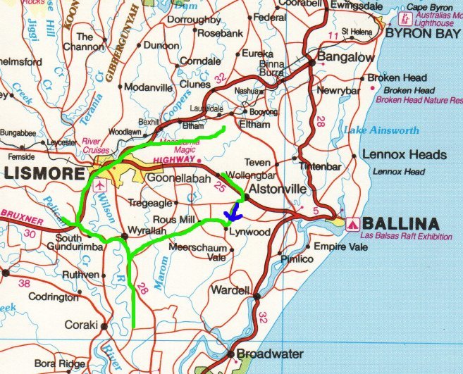
Signs this morning were not hopeful, with not a cloud in the sky and moderate W-SW winds blowing (I think?). Later, there were a few patches of altocumulus lenticularis but mostly towards the north. But very quickly late morning a field of cumulus developed and by 12.30pm congestus was developing W of Lismore.
 I
left my place at 1pm with a cell gathering strength SW of Lismore. It was very
slow in developing at first with a couple of turkey towers, and anvil rain or
virga spreading out in front towards the east. But updrafts kept persisting. By
2pm I was near Wyrallah, S of Lismore and in some rain from the developing cell
- there was no lightning observed at this stage. Either two cells got going very
close together or the one split into two - I'm not sure - but soon there was heavy
precipitation just to my N with its boiling updraft visible to my NW, then a gap
to the second one just to the W-SW. The W-SW one dominated for the moment but
as I moved further NW it weakened and probably collapsed after a while.
I
left my place at 1pm with a cell gathering strength SW of Lismore. It was very
slow in developing at first with a couple of turkey towers, and anvil rain or
virga spreading out in front towards the east. But updrafts kept persisting. By
2pm I was near Wyrallah, S of Lismore and in some rain from the developing cell
- there was no lightning observed at this stage. Either two cells got going very
close together or the one split into two - I'm not sure - but soon there was heavy
precipitation just to my N with its boiling updraft visible to my NW, then a gap
to the second one just to the W-SW. The W-SW one dominated for the moment but
as I moved further NW it weakened and probably collapsed after a while.
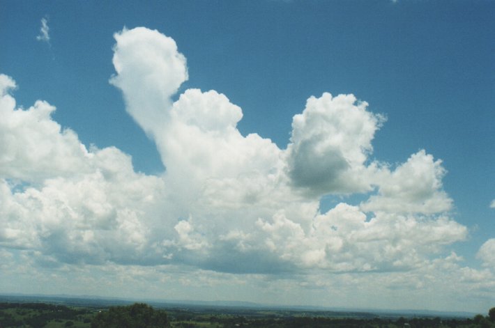
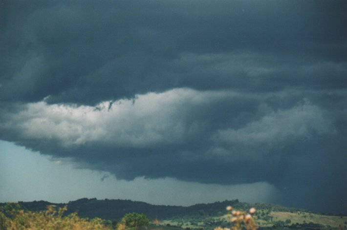
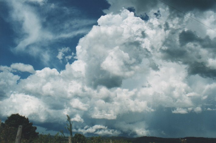
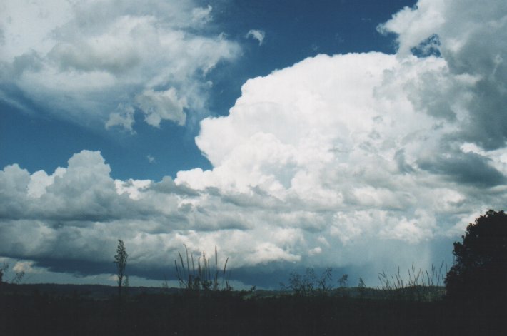
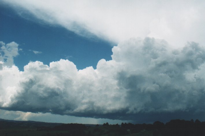
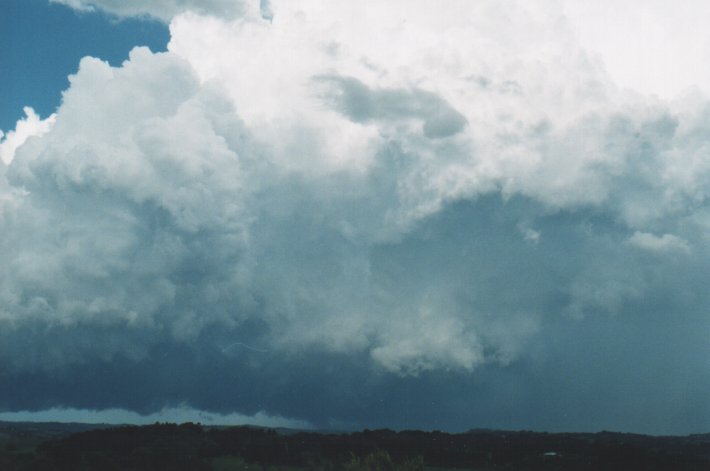
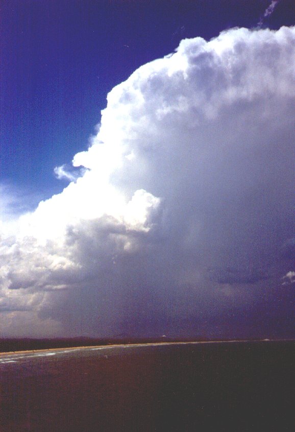
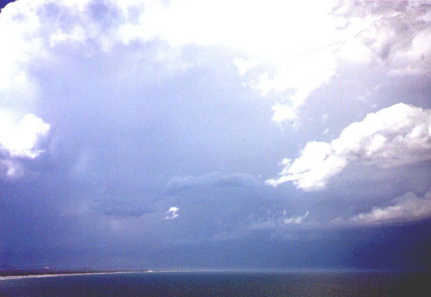
The north cell really took off at this stage (~2.20pm). As I was now W of the
cell, it became very high constrast and just beautiful to observe.
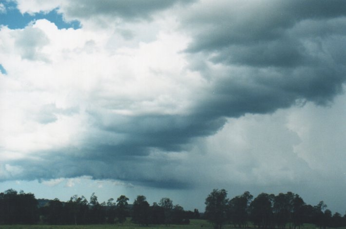
Towards the NE a shelf cloud or gust front was developing, while heavy precipiation
was developing at the rear (SW). Lightning was occurring regularly now with quite
a few CGs observed, some of which were close by to me from out the back of the
cell and along a line of congestus spreading further west. The storm moved slowly
NE and all the time base lowereings and scud were observed to the left with the
very heavy precipitation to the right (from my view looking eastward). Powerful
new updrafts kept forming on the NW flank. The whole storm structure did seem
to be rotating with quite a marked clear area in the middle. The more distant
cloud to the NE on the gust front was moving towards the left (north), while at
the back (NW and W) I could see it moving towards the right (south), and in the
middle a lighter area. This persisted for the whole time I watched the storm from
this time (~2.40pm). Needless to say it was an awesome sight ! With each new boiling
updraft spearing up the flank, there were more and more lowerings, prongs, and
scuds on or close to ground level.
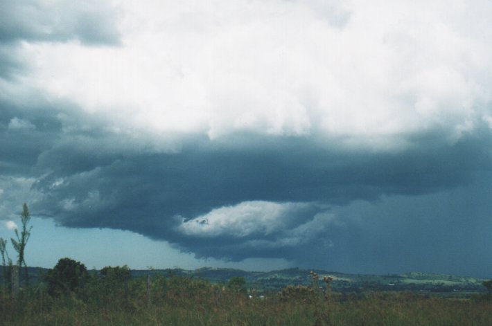
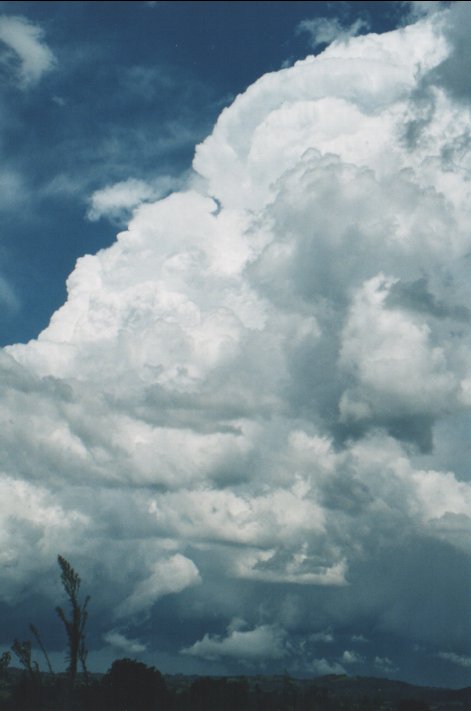
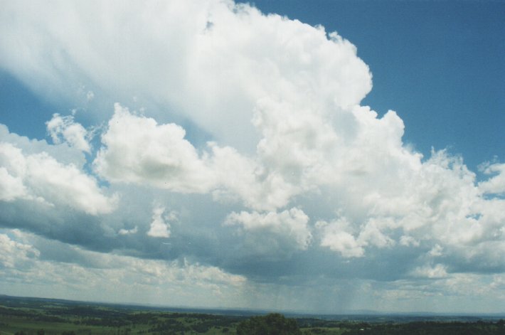
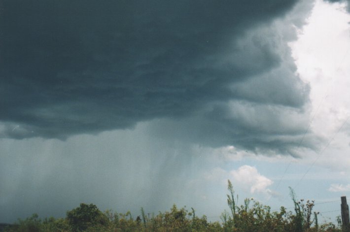
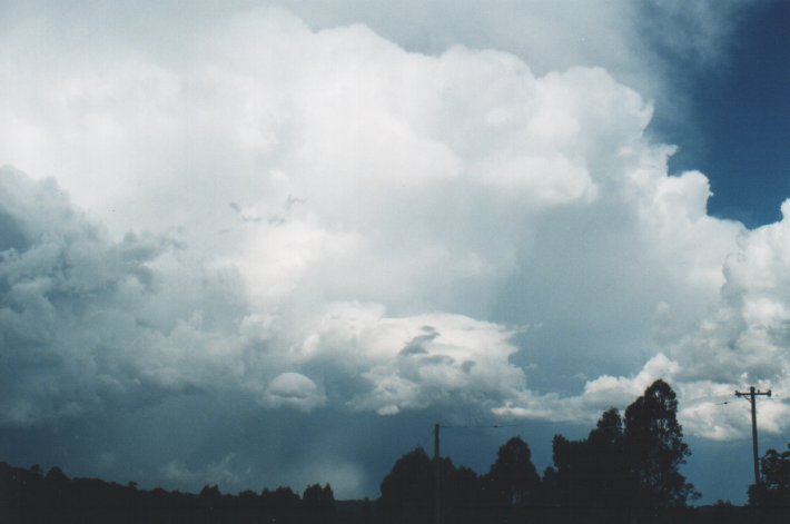
I left my location
SW of Lismore after 3pm trying to get closer and to watch the new cells develop
along a spectacular flanking line towards the NNW. Of course I got stuck by a
frigging Frigmobil semi trailer just leaving Lismore and going slow! AAARRGGH.
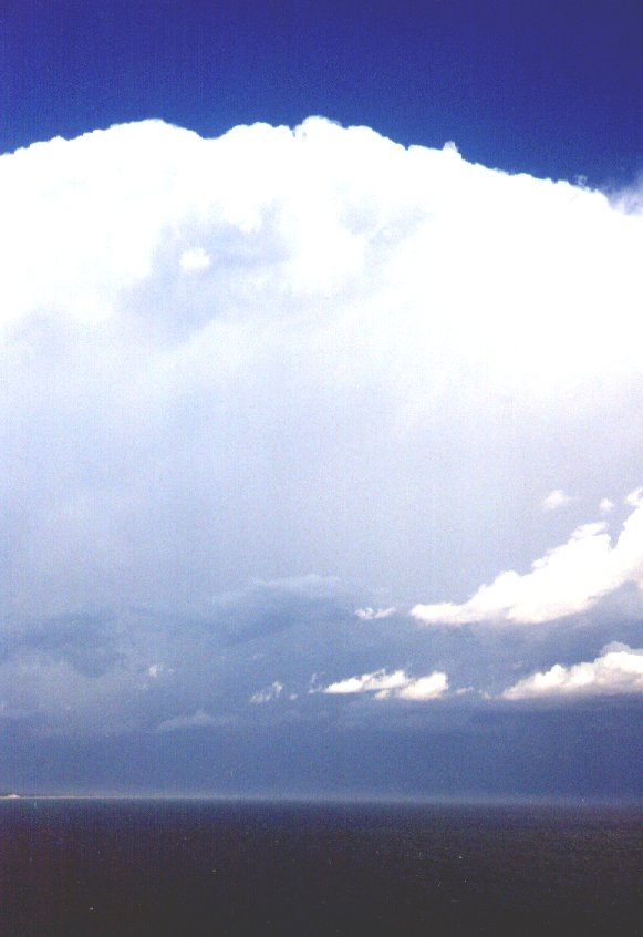
Anyway, I soon reached McLeans Ridges and watched the spectacle which was probably
over Cape Byron now (3.30pm). It was huge - clouds tops were over 15ks in height
or more from my guess, backshearing was eveident as each new updraft developed
and the persisting gust front was still visible out to the NE and the heavy precpitation
to the east (southern part of cell). CGs were occurring in this region also. And
still the whole structure appeared to have an overall rotation (anticlockwise
if viewed from above). Lowerings and all sorts of features teased on the developing
area, but no funnels or obvious wall clouds were evident.
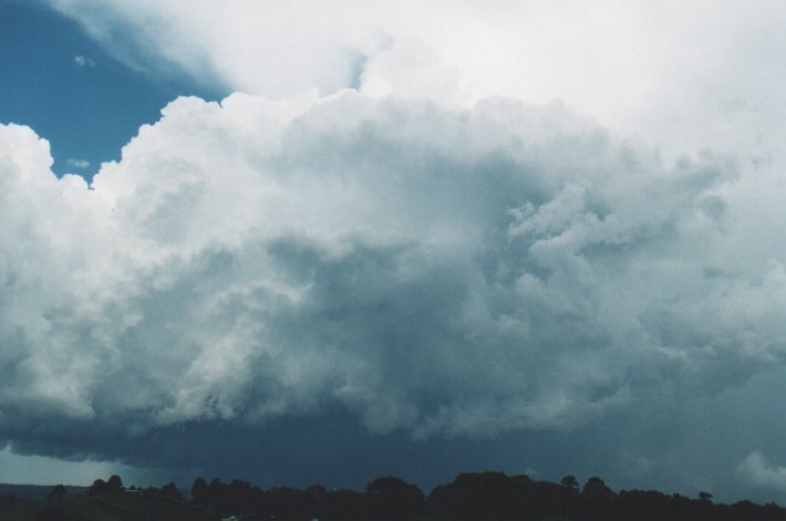
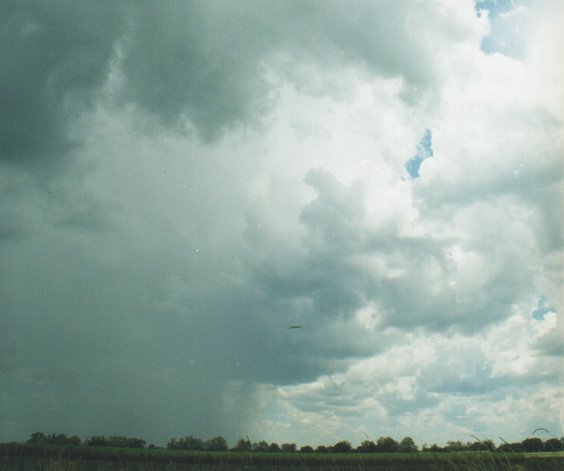
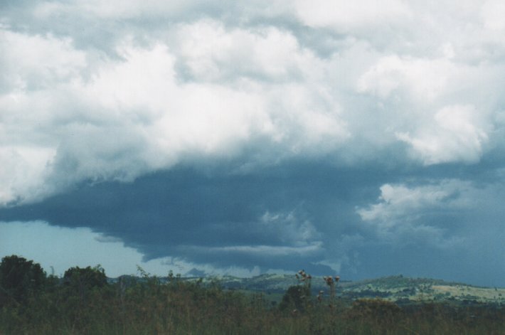
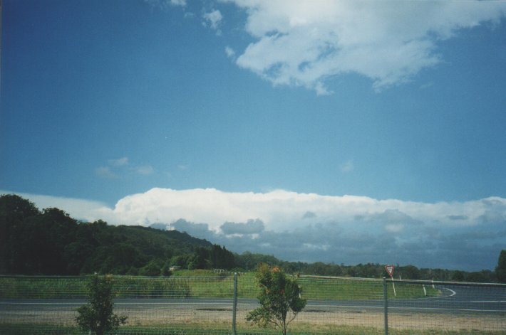
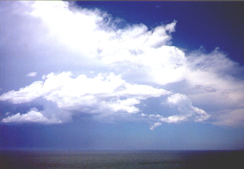
 The storm became obscured somewhat around 4pm and nothing more was developing
(apart from over the water, and to the north) so I decided to go home. I stopped
briefly to photograph a cell which had suddenly strengthened while passing over
the ranges north of Lismore. It had developed around 2pm near Kyogle but although
persisting, was weak for the 2 hours preceeding.
The storm became obscured somewhat around 4pm and nothing more was developing
(apart from over the water, and to the north) so I decided to go home. I stopped
briefly to photograph a cell which had suddenly strengthened while passing over
the ranges north of Lismore. It had developed around 2pm near Kyogle but although
persisting, was weak for the 2 hours preceeding.
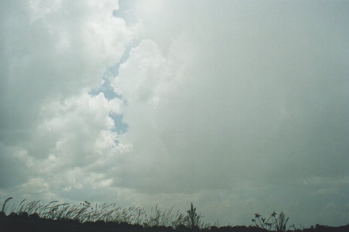
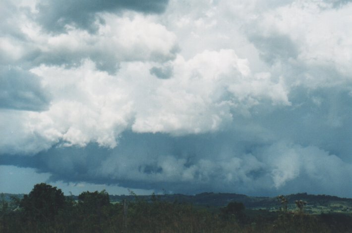
The main storm may have been a supercell - structurally it took on the right appearance, was rotating, developed around 1pm and possibly split with the right mover collapsing. The storm is still going strong off the coast noth of Byron Bay as I write this at 5pm.
The surface temperature in the Far North Coast region reached about 34 today, several degrees above forecast, as a SE change approached. The change was visible from early afternoon as a line of broken stratocumulus / roll cloud formation extending from just south of the storm and inland towards the WSW. It probably played a significant part in the strength of the storm.
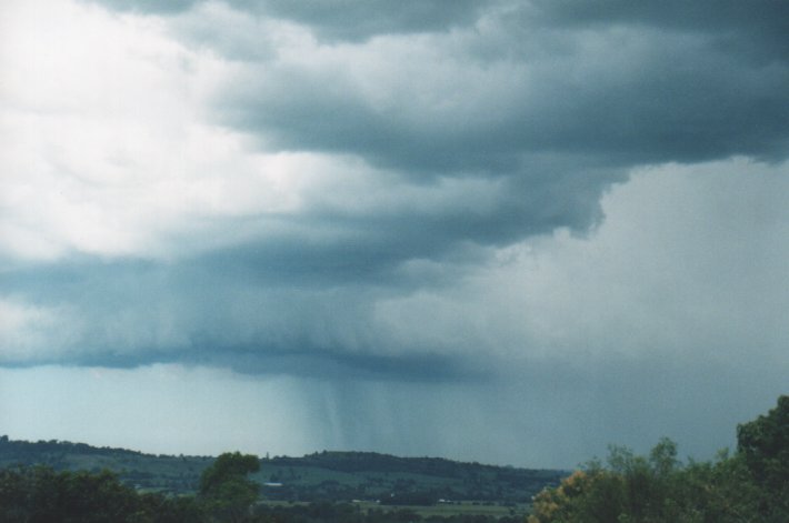
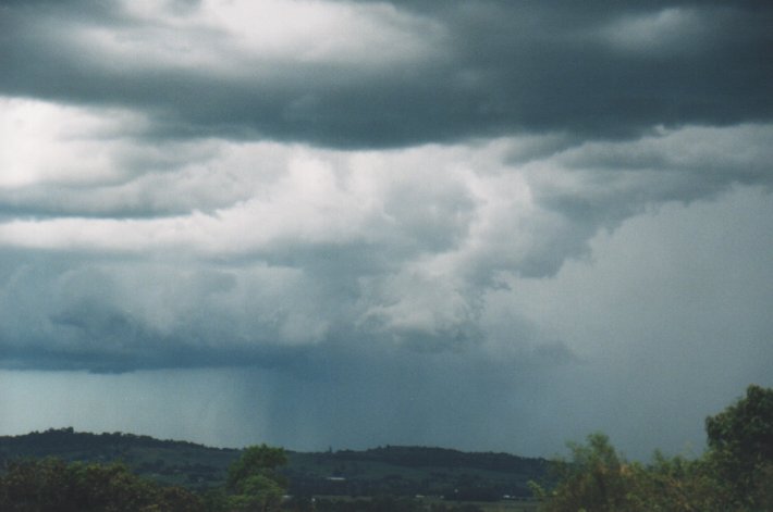
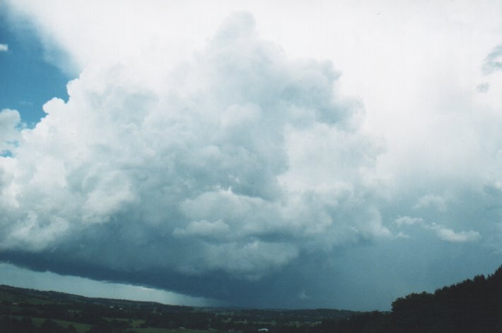
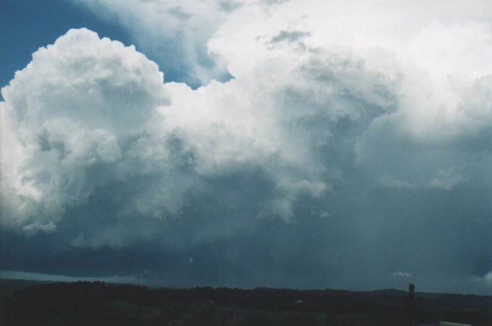
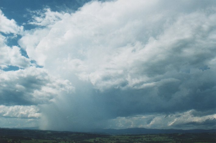
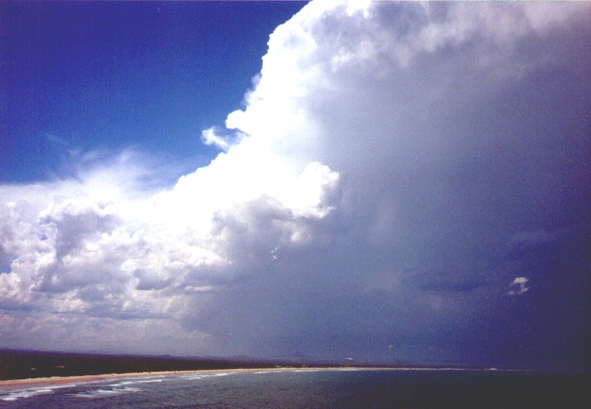
The following
two photos were taken from Maclean, 60km S of Lismore just after 3pm - note the
overshoot in photo 26 which can be seen in verticle photo 14 above also.
TOP PRIORITY FOR IMMEDIATE BROADCAST

SEVERE THUNDERSTORM ADVICE
BUREAU OF METEOROLOGY
NEW SOUTH WALES REGIONAL OFFICE
Issued at 1716 on Wednesday the 5th of January 2000

CANCELLATION

The Severe Thunderstorm Advice for the Northern Rivers valid this afternoon
has been cancelled as severe thunderstorms have now cleared out of the area.

Earlier this afternoon severe thunderstorms affected the Ballina, Lennox
Head and Byron Bay areas bringing large hail and very heavy rainfall.
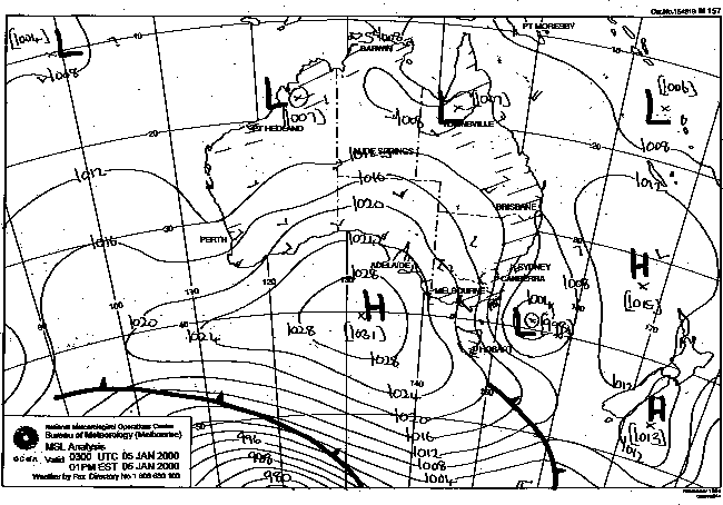
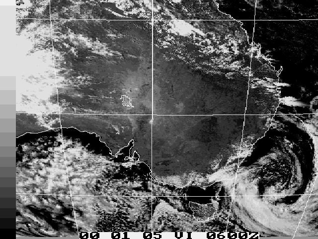
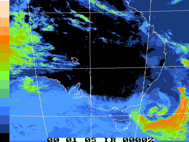
This image obtained
from Bureau of Meteorology.
2pm local 5th January 2000
|
Document: 0001-01.html
Updated: 2nd November, 2001 |
[Australian Severe Weather index] [Copyright Notice] [Email Contacts] [Search This Site] |