Hi,
Chase Report Putty Road and Jerrys Plains explosive severe storm January 10 2010All pictures from this day could be observed at the following link:
http://www.australiasevereweather.com/photography/photos/2010/jd20100110.htmlThanks for Michael being so quick in putting it up and for the assisting on this chase. Thanks for Kimberly for giving the go ahead for chasing!
Thanks Michael for the introduction to this unusually fascinating event! When storm tops go up and then rise another level with pileus on top of that you know you have a deep atmosphere! My concept of a successful and entertaining chase is to see updrafts and structure, the anvil and then to enter the core! This is what occurred today.
My intention yesterday was to let the family enjoy a day in Castle Hill Shopping Centre. We did and I just did some stuff on the internet - and of course I checked occasionally the weather. I saw the initial cells go up near Lithgow and Mudgee and just told Imelda there were storms. She said did I want to go - I said - "their probably not exciting - it's up to you". She got back to me to suggest that Kimberly gave the go ahead. I was packed in short time!
When I got out of the shopping centre, I was astonished to see a nice developing cell that would become the Putty cell.
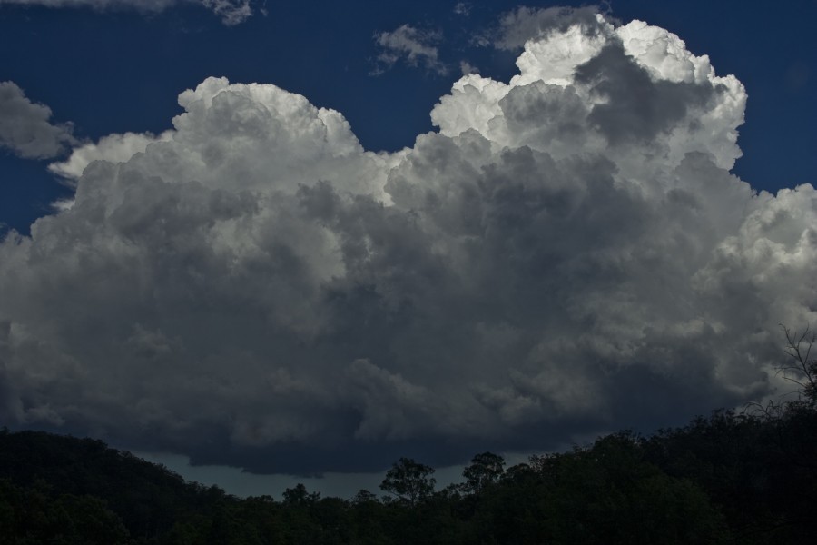
Pileus on top of the now very high anvil
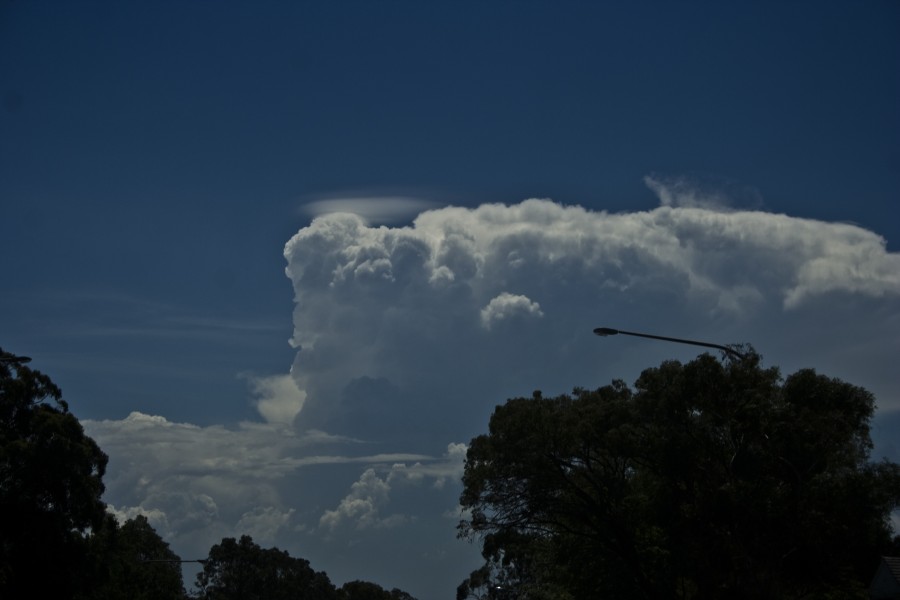
But the storm wanted to go up even further - take a look closely at the updraft shooting upwards
The more we looked at it, successive updrafts were forcing up. But surprisingly, this was not dying like pulse storms typically do, more updrafts would push and suport the anvil. By the time we got to near Windsor, another powerful updraft just shot straight through and produced an overshoot. At this stage, I was a danger to society with the rush of adrenalin! This storm would simply not die. We were headed to the Bells Line of Road! Err - that cell is closer than we think - what if it is closing in on Putty. A check from Michael Bath saved the day!
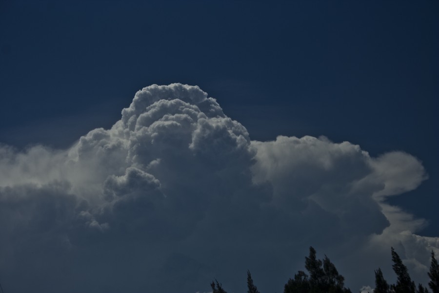
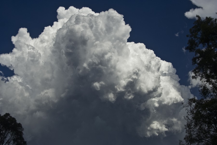
This was a magnificent pulse storm!
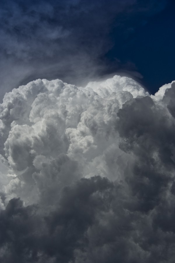
Even when the storm weakened, the anvil still was crisp
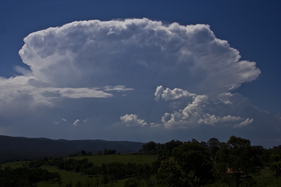
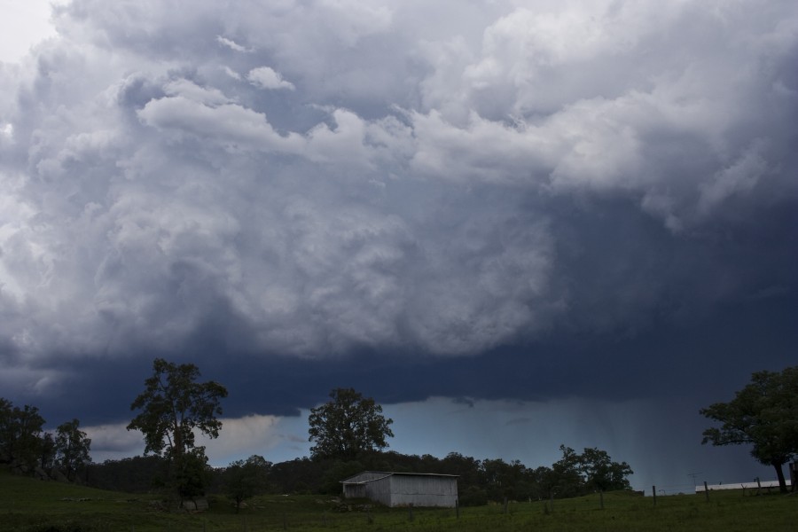
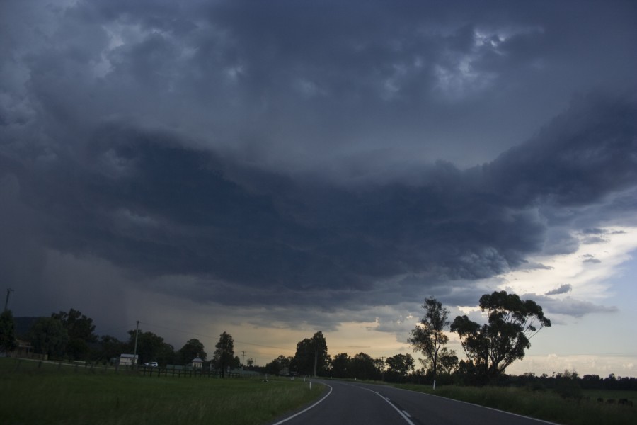
Heading up the Putty Road saw the anvil maintain for an hour though the cell was weakening. I was concerned with the anvil shield blocking the heat source but at the same time hoping that the cumulus to its east would develop - somehow. By the time we got near Putty, a line of large cumulus had developed in typical behaviour associated with outflow convergence. And as we drew near, this line literally exploded. Crisp towers just bulged overhead and just went higher.
Outflow from the weakening cell near Putty pushed these cells up
Explosively
And up even further
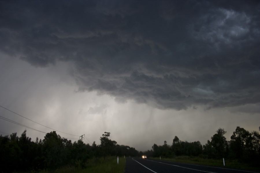
As soon as the first precipitation fell, the first bolt followed by another. I knew based on the structure and the slight green tinge in the updraft that hail was likely and of course the shear height of the updrafts. This was the most exciting time I have ever had on the infamous 16km of winding roads. Hailstones pecked at the car and aerial followed by rain and occasional hailstones. I was a little disappointed by the size but given the warm atmosphere, should not complain. Occasionaly cloud to ground lightning deafended the area.
Here is the base and lower updraft
As we exited the Putty Road near Bulga, I stopped despite the light rain still falling, the storm had organised in two cells - one west of Cessnock and another south of Jerrys Plains. The Cessnock cell was extremely active though not powerful bolts. I timelapsed this and saw lightning as frequent as you can get. The activity gradually decreased and I could see that outflow was dominating this cell and the Jerrys Plains cell was cranking up.
The cell west of Cessnock and one of the many frequent bolts though not powerful
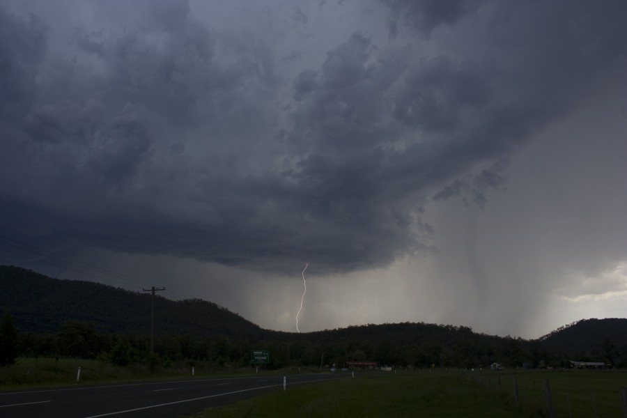
Cranking up was an understatement, as we neared the cell, I simply had to stop and film sucessive and sometimes multiple cloud to ground lightning piercing the ground in excellent contrast. A microburst with rain and hail was descending in the area and we entered the core. Cloud to ground lightning was hammering around us some in the adjacent field. As we neared Jerrys Plains I noticed we were outside a sharp zone of heavy preciptation to nothing. A u-turn was in order! It was not long when we were once again in the core and blasted by powerful straight line winds and hailstones perhaps up to 1.5cm (not measured). Pink cloud to ground lightning were still ripping around us. As the weather eased we headed back west into Jerrys Plains but the core had moved north. An eerie silence was in town. Lightning bolts were still descending from the anvil and quite powerful too but it was on a downhill trend. Still bolts occasionally would brighten up the sky behind us.
Jerrys Plains cell was not that exciting at first
Most of the action was caught on video of course.
Cell near Murrurundi
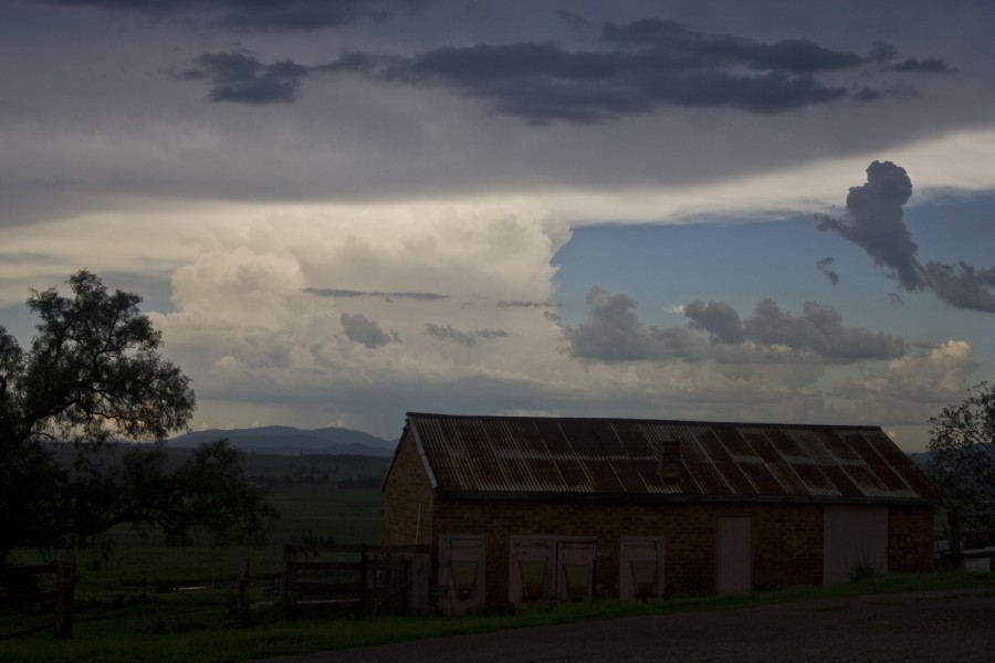
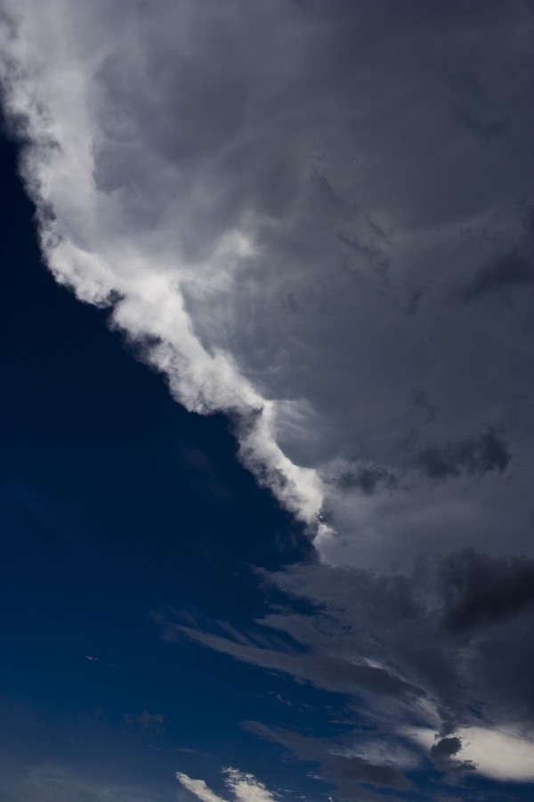
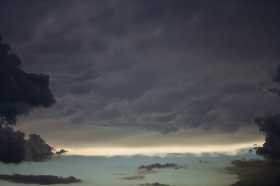
Mammatus
Cell near Murrurundi
I was so pumped with adrenalin that I had not realised I had skipped lunch! I was not even hungry - until we passed MacDonalds in Scone! We were in pursuit of another cell or two nearing Murrurundi and Tamworth. But as we closed in, it was evident that the massive anvil plume had cooled the atmosphere - not even outflow could encourage nearby updrafts. We stayed the night in Tamworth.
This has to be the most exciting core punch for us this season and perhaps for a year or two! And to think, we had virtually not planned to chase except locally say near Lithgow!
Regards,
Jimmy Deguara


