Author Topic: NSW/SE QLD Storms 14-16 September 2007  (Read 31453 times)

0 Members and 1 Guest are viewing this topic.

Offline Jimmy Deguara

  • Australian and Tornado Alley storm chaser
  • Administrator
  • Wedge tornado F5
  • *
  • Posts: 2,218
  • Gender: Male
  • Storm Chaser since 1993, Tornado Alley 2001
    • Australia Severe Weather
RE: NSW/SE QLD Storms 14-16 September 2007
« Reply #15 on: 16 September 2007, 09:34:08 AM »
Hi all,

(Michael here using Jimmy's login)

Some pics of the storms that moved through the area just south of Port Macqaurie Friday afternoon. The first cell after it had passed out to sea:


Then this storm rapidly moved over my sister's place at Lake Cathie. Plenty of CGs observed. After the moderate rain and outflow winds eased we went down to the beach about 1km away. The lightning was very frequent but moved away way too fast.


Michael
-------------------------------------
Australian Severe Weather
www.australiasevereweather.com

Australian Thunderbolt Tours
www.thunderbolttours.com

Phone  0408 020468  (International :  61  2  408 020468)

Offline Shaun Galman

  • Stove pipe F3
  • *
  • Posts: 441
  • Gender: Male
    • ridgelightning.com
RE: NSW/SE QLD Storms 14-16 September 2007
« Reply #16 on: 16 September 2007, 11:15:33 AM »
Hi Michael,
Well done capturing those elusive storms! ;) The structure looks amazing, particularly in the 4th shot from the top! I wish I could have been there to see it for myself!

I hope a few other storms went into the path of chasers (with cameras at the ready) and didn't slip by too quickly.

Cheers and take care.
Shauno
Chasing Region: Lightning Ridge. N.S.W.
Website: www.ridgelightning.com

Offline Dave Nelson

  • Elephant Trunk F2
  • *
  • Posts: 172
  • Gender: Male
    • Stormy Sydney
RE: NSW/SE QLD Storms 14-16 September 2007
« Reply #17 on: 16 September 2007, 12:20:55 PM »
Hi Gang  :)
 a copy of my storm diary for friday's events....

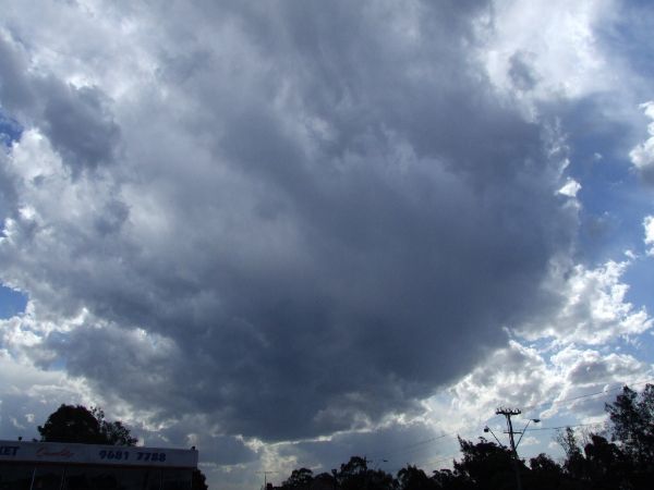
070914   1200 - 1500   Act- Maj   Saw the first anvil forming over Sydney’s inner west around 1200hrs whilst
    travelling down Mowbray Rd towards home for lunch.   Next 2 jobs were in Paramatta and after that
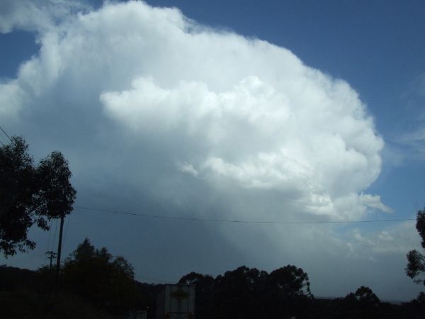
travelled to Menai for last job. On the way, stopped on Woodville Rd,    Guildford for first set of pix. There were 3
main cells present … one past to south of me over sthrn suburbs, another was following this one and growing. A
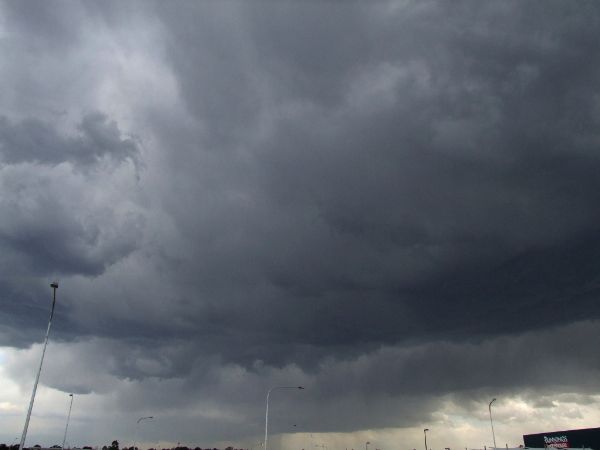
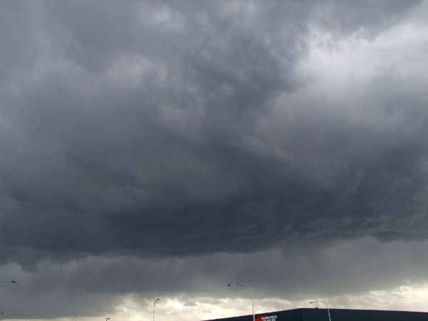
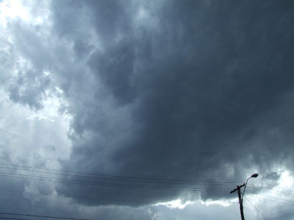
3rd cell was directly west    and was to pass over my location.   I travelled on to Bankstown and near the east
end of the runway by Bunnings.  I watched and photo’ed the 2nd cell as it grew rapidly and started producing
intra-cloud lightning and after ~ 15 min’s the CG’s started.  The core of this cell was south   of my location, looked
roughly to be the Menai area. Torrential rain could be seen falling. I wasn’t till I got to the Menai area I
discovered there had also been lots of hail. The hail got heavier as the storm moved over the Sutherland Shire
suburbs… with a couple of reports to me from felow radio operators.
  These were fast moving storms,  even surface winds were moderate-strong westerlies.
a good start to the new season,   will get some pics up when I can  :)

cheers
Dave Nelson

Edited to add pix

1)  from Mowbray/Epping Rd cnr


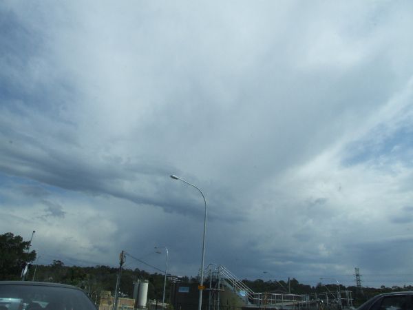
2)  from Woodville  Rd  cell 1 to south


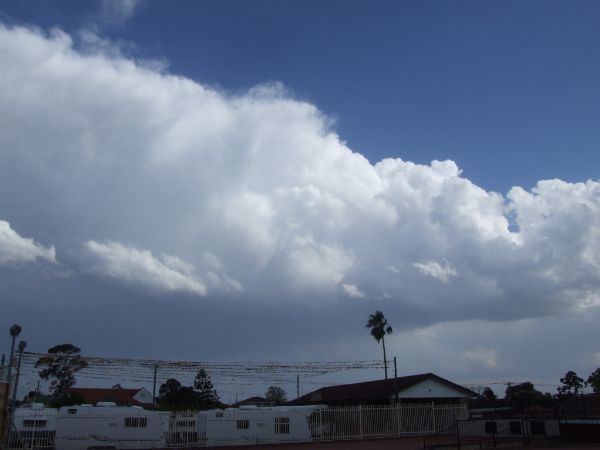
3)  from Woodville  Rd  cell 3 to west


4)  from Woodville  Rd  cell 3 to west, developing well


5)  from Woodville  Rd  tail of cell 1 to south


6 and 7) from Bankstown airport by Bunnings cell2 following cell 1


« Last Edit: 16 September 2007, 02:17:25 PM by Dave Nelson »

Offline Mike

  • Australian Severe Weather Moderators
  • Wedge tornado F5
  • *
  • Posts: 1,348
  • Gender: Male
  • Dry season here...boring!
    • http://StormscapesDarwin.com
RE: NSW/SE QLD Storms 14-16 September 2007
« Reply #18 on: 17 September 2007, 07:06:05 AM »
Good stuff fellas.  Nice CGs over the ocean there.  Particularly like that fourth shot also - very sinister.  Good to see some action at last for you all.  Hopefully won't be too long before our season kicks off.  Things getting stickier by the week!

Mike
Darwin, Northern Territory.
StormscapesDarwin.com
Lightning Research 2010/14

Offline Mike

  • Australian Severe Weather Moderators
  • Wedge tornado F5
  • *
  • Posts: 1,348
  • Gender: Male
  • Dry season here...boring!
    • http://StormscapesDarwin.com
RE: NSW/SE QLD Storms 14-16 September 2007
« Reply #19 on: 17 September 2007, 10:10:31 AM »
Any hail at all with that storm in photo # 5 shown?  Certainly a nice crisp anvil by the looks of the photo....?

Mike
Darwin, Northern Territory.
StormscapesDarwin.com
Lightning Research 2010/14

Offline Steven

  • Global Moderator
  • Stove pipe F3
  • *
  • Posts: 410
  • Gender: Male
RE: NSW/SE QLD Storms 14-16 September 2007
« Reply #20 on: 17 September 2007, 12:57:57 PM »
Heard some thunder early in the morning but that was it really, there wasn't any rain either. Yawn. I really wish I could move. Sunshine Coast never gets anything. Another lackluster storm for me, but I'm happy others got some good lightning pics. Although it probably goes on my list on days I heard thunder at least once, which the last time was on August 24 during the ECL. Wonder when our next chances are.

Offline Michael Bath

  • storm chaser
  • Administrator
  • Wedge tornado F5
  • *
  • Posts: 1,602
  • Gender: Male
    • Australian Severe Weather
RE: NSW/SE QLD Storms 14-16 September 2007
« Reply #21 on: 18 September 2007, 01:26:37 AM »
Had a report of hail (estimated 1.5cm diameter) from a storm which passed through parts of Ballina about 2am on Sunday. The same cell went over my place at McLeans Ridges but there was no hail.

MB
Location: Mcleans Ridges, NSW Northern Rivers
Australian Severe Weather:   http://australiasevereweather.com/
Lightning Photography:   http://www.lightningphotography.com/
Early Warning Network: http://www.ewn.com.au
Contact: Michael Bath

Offline Jimmy Deguara

  • Australian and Tornado Alley storm chaser
  • Administrator
  • Wedge tornado F5
  • *
  • Posts: 2,218
  • Gender: Male
  • Storm Chaser since 1993, Tornado Alley 2001
    • Australia Severe Weather
RE: NSW/SE QLD Storms 14-16 September 2007
« Reply #22 on: 18 September 2007, 01:56:45 AM »
It seems judging by the satellite imagery, the storm I chased further south near Bulahdelah and the one near where Michael was were the larger storms of the day on Saturday (both are in the photographs Michael showed earlier (I took very few pictures due to the chasing). They were certainly motoring along in excess of 80km/h.

One thing I note is the structure of the following picture I took on the go:


The upper levels can be seen to be organising in terms of a structured storm though of course the lower levels were simply organising and dropping dense hail shafts off the coast.

The storm near Port Macquarie was certainly the one that attempted to tap the surface moisture although still high based. I would estimate hail sizes were slightly larger in this storm but don't worry you would still require magnifying glasses haha. I estimated hail to about 5mm.

Regards,

Jimmy Deguara
-------------------------------------
Australian Severe Weather
www.australiasevereweather.com

Australian Thunderbolt Tours
www.thunderbolttours.com

Phone  0408 020468  (International :  61  2  408 020468)

Offline Mike

  • Australian Severe Weather Moderators
  • Wedge tornado F5
  • *
  • Posts: 1,348
  • Gender: Male
  • Dry season here...boring!
    • http://StormscapesDarwin.com
RE: NSW/SE QLD Storms 14-16 September 2007
« Reply #23 on: 18 September 2007, 05:29:49 AM »
Were the storms supercellular or severe pulse Jimmy?  I'm not familiar with the weather patterns in those parts !

Mike
Darwin, Northern Territory.
StormscapesDarwin.com
Lightning Research 2010/14

Offline Michael Bath

  • storm chaser
  • Administrator
  • Wedge tornado F5
  • *
  • Posts: 1,602
  • Gender: Male
    • Australian Severe Weather
RE: NSW/SE QLD Storms 14-16 September 2007
« Reply #24 on: 18 September 2007, 07:55:28 AM »
No supercells, just locally severe storms with strong straight line winds in the outflow.

All the pics taken by Jimmy are here:
http://australiasevereweather.com/photography/photos/2007/jd20070914.html

and mine:
http://australiasevereweather.com/photography/photos/2007/mb20070914.html

MB
Location: Mcleans Ridges, NSW Northern Rivers
Australian Severe Weather:   http://australiasevereweather.com/
Lightning Photography:   http://www.lightningphotography.com/
Early Warning Network: http://www.ewn.com.au
Contact: Michael Bath

Offline Jimmy Deguara

  • Australian and Tornado Alley storm chaser
  • Administrator
  • Wedge tornado F5
  • *
  • Posts: 2,218
  • Gender: Male
  • Storm Chaser since 1993, Tornado Alley 2001
    • Australia Severe Weather
RE: NSW/SE QLD Storms 14-16 September 2007
« Reply #25 on: 18 September 2007, 08:27:45 AM »
Hi Mike,

Definitely not supercellular though the tops were in the form of what I would like to see in a strongly sheared environment - nice fanned out anvils! Insufficient lower level support.

Regards,

Jimmy Deguara
-------------------------------------
Australian Severe Weather
www.australiasevereweather.com

Australian Thunderbolt Tours
www.thunderbolttours.com

Phone  0408 020468  (International :  61  2  408 020468)

Offline Mike

  • Australian Severe Weather Moderators
  • Wedge tornado F5
  • *
  • Posts: 1,348
  • Gender: Male
  • Dry season here...boring!
    • http://StormscapesDarwin.com
RE: NSW/SE QLD Storms 14-16 September 2007
« Reply #26 on: 18 September 2007, 11:00:53 AM »
Thank you for that.  Definitely large anvils compared to the rest of the storm's structure - hence my asking, they would have been excellent in the 'optimum' conditions!  good stuff.

Mike
Darwin, Northern Territory.
StormscapesDarwin.com
Lightning Research 2010/14

Offline Michael Bath

  • storm chaser
  • Administrator
  • Wedge tornado F5
  • *
  • Posts: 1,602
  • Gender: Male
    • Australian Severe Weather
RE: NSW/SE QLD Storms 14-16 September 2007
« Reply #27 on: 21 September 2007, 05:25:29 AM »
My sister Carolyn Sanderson just sent me these photos she took of the Lake Cathie storm which occurred last Friday when I was visiting. Very nice shots!


These two 1km VIS satpics show the cells which affected the Port Macquarie part of the Mid North Coast. The first is at 4pm showing the first storm just offshore, the second image at 5pm shows the earlier storm further out to sea with the new severe storm that Jimmy, Carolyn and I photographed at Lake Cathie.


MB
Location: Mcleans Ridges, NSW Northern Rivers
Australian Severe Weather:   http://australiasevereweather.com/
Lightning Photography:   http://www.lightningphotography.com/
Early Warning Network: http://www.ewn.com.au
Contact: Michael Bath