Author Topic: Dust Storms, Severe Thunderstorms, Wind, Rain & Snow over Southeast Australia: 19 - 27 Sep 2009  (Read 51780 times)

0 Members and 1 Guest are viewing this topic.

Offline nmoir

  • Elephant Trunk F2
  • *
  • Posts: 200
  • Gender: Male
  • "busting chases since 1999"
    • Oculi.com.au
heres a couple of pix from sydney cbd , quite an event and something i have only seen  a few times near mildura and broken hill

 apologies as there seems to be a issue at moment it can only post one image

EDIT: Nick - to get around the attachment error, attach one at a time, save, then modify post etc
« Last Edit: 26 September 2009, 03:43:03 AM by Michael Bath »
Nick Moir
Photographer
The Sydney Morning Herald
and www.oculi.com.au

Offline Shaun Galman

  • Stove pipe F3
  • *
  • Posts: 441
  • Gender: Male
    • ridgelightning.com
Hi all,

That is surely some pretty nice updraft structure on the Crookwell area storm!

It would be interesting to know the numbers, ie; the tonnage of dirt and dust that blew across the Eastern states over the two days.
The cleanup has begun here. Everyone is hosing houses and driveways down. The car washing duties are next on the list :)

Nice to actually have clear blue skies again!
Kindest regards,
Shauno
 
   
Chasing Region: Lightning Ridge. N.S.W.
Website: www.ridgelightning.com

Offline Colin Maitland

  • Barrel tornado F4
  • *
  • Posts: 614
  • Gender: Male
G'day Shauno and all,

This report might answer your question

It would be interesting to know the numbers, ie; the tonnage of dirt and dust that blew across the Eastern states over the two days.


The report by Geoff Chambers states:

The dirt shifted across NSW, north to the Gold Coast and as far afield as the southern alps in New Zealand.

CSIRO Marine and Atmospheric Research expert Dr Ross Mitchell said around 16 million tonnes of dust could have been whipped up by the dust storm.

He based that on detailed calcuations of a similar event in October 2003.

Dr Mitchell said the Birdsville weather station recorded its lowest visibility figure at the peak of the stormfront.

"The main source region is the Lake Eyre basin, where there has been quite a bit of deposition of fine material after the recent floods," said Dr Mitchell.

"That available material has been blown out. It's not uncommon to see a dust storm in that region but it is unusual to see it traverse the continent."

Monash University head of environmental science Professor Nigel Tapper said he would be interested to see whether the Heron Island weather station, run by his institution, recorded a dust level.

"It's a remarkable event, which started in the basin," said Prof Tapper.

"There were two storm fronts, one that pushed through Victoria and ended up in New Zealand, where the southern alps will be covered in dust and the other that moved east and north to the Gold Coast."

Both Dr Mitchell and Prof Tapper said climate change may have contributed to the freak weather event.

Griffith University DustWatch head Dr Craig Strong said the dust bomb had been building for 10 months on the back of floods, drought and strong winds.


From all reports I have read a great deal of the dirt has headed towards New Zealand. 


Cheers

Col


Offline Macca

  • Elephant Trunk F2
  • *
  • Posts: 171
The radar loops are impressive for the 22nd Sep. This first one is from Canberra and shows the cell passing over Murrumbateman at 4.50pm. There are reports of a "tornado" from there but probably straight line winds.

Hi Michael,

I heard/read a report from a Murrumbateman local that they had a storm in the late afternoon (the one you refer to above) which wasn't too bad but then at about 10pm another storm came through and sounded like a freight train, etc, etc.  I think they were saying that it was the later one which was the possible tornado producer.  

Macca

[EDIT] - Just loaded the radar for later that evening and there is quite an intense cell right near/on Murrumbateman at pretty close to 10pm.  It is a reasonable distance from radar and has a nice shape :).  Also just loaded the Wagga Wagga 256km radar and note that which doesn't show much due to the large storms near that radar site at the same time.  Appin radar (256km) shwos it up quite nicely for its distance from radar (although don't mistake it for the cell nearer to Young which is even more impressive on radar...makes you wonder how many tornadoes could've been produced on Tuesday night given the conditions...).


« Last Edit: 25 September 2009, 03:01:57 PM by Macca »

Offline Richary

  • Barrel tornado F4
  • *
  • Posts: 680
  • Gender: Male
Back to the dust storm, after posting my 2 photos from the backyard yesterday morning I had to drive to Newcastle. Visibility was about 500 metres most of the way and gradually decreased as I headed north, but probably more just to more dust arriving than the location.

Working on rooftops all day was interesting, eyes sore and very glad to find the motel and a shower at the end of it. Skin was feeling really dry and chapped, partly because of the gale force winds I suspect as well as the dust. Haven't had a chance to look at the photos I took driving up the F3 and at Newcastle, but will try to get to them in the next couple of days.

Offline nzstorm

  • Elephant Trunk F2
  • *
  • Posts: 115
  • Gender: Male
Some of your dust has made it to Auckland this morning.  Visibility about 5000m.
Steven Williams
Storm Chaser

Offline Jimmy Deguara

  • Australian and Tornado Alley storm chaser
  • Administrator
  • Wedge tornado F5
  • *
  • Posts: 2,218
  • Gender: Male
  • Storm Chaser since 1993, Tornado Alley 2001
    • Australia Severe Weather
Steve,

You need to ask the NZ authorities to give us back our soil!

Macca, were the cells in question long lived on the night? Yes some nice shaped cells but then they quickly merged with other cells, weakened or died out. The dynamics were incredible of course and tornadoes were certainly on the cards. Night time though is basically a no go zone.

Sorry for not getting back to all of this chase but it was not exciting news and I have also been busy on other items. I went out on the night (it was great to be simply amongst it) and was in those areas a little too late due to the time I was able to leave and distance I had to travel. Perhaps it would have been better to head down the Hume and head west. But my target was nearer the Cowra region, west and southwest based on earlier models I had access to. I was hoping at least one or two cells would left move along some sort of boundary but the shear itself was incredible.

My evening and night chasing was basically unsuccessful due to the time getting out there, the speed of the storms and the pathetic visibility of structure on the night due to low cloud and possibly dust! I have a couple of pictures on the run but you just watched storms disappear even from a distance. And then I thought that with tree lined roads and low visibility, being in the path of a core was simply not the best idea. Our road network is simply not ideal to deal with systems of this nature and you can easily lose your bearing. Getting to the storms without any specific organisation is simply too difficult to follow. I have chased very fast moving and violent episodes in Tornado Alley back in 2007 but that was more a day time situation. Better road network and also less trees.


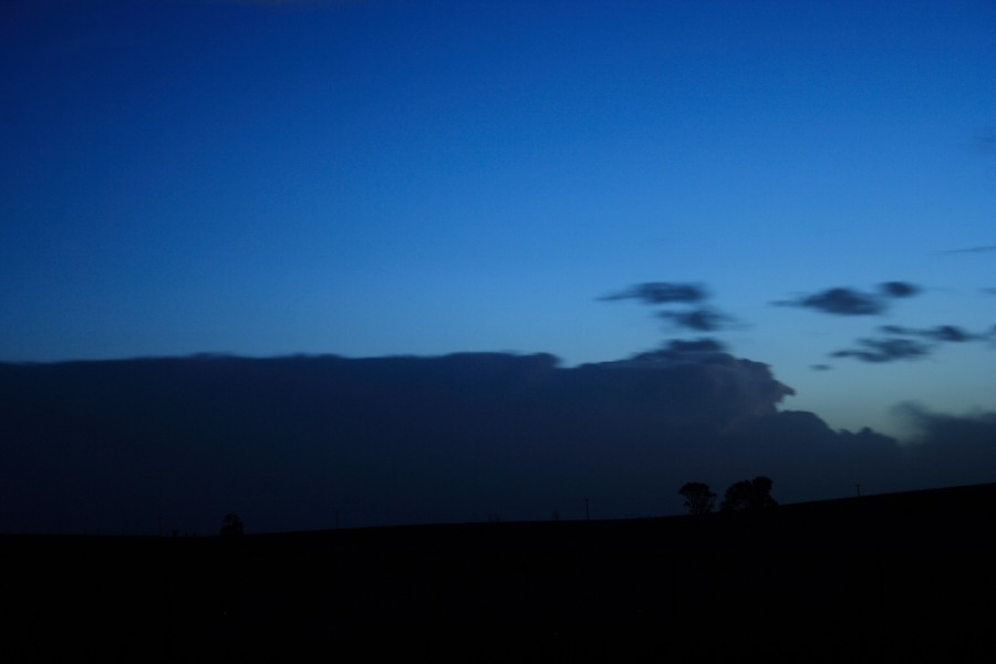
Evening storm near Young - likely a lower topped supercell. What I liked about this cell is despite the incredible shear, the storm updrafts bubbled upwards - observed at the back! I thought I would be able to intercept this cell - how silly to think that. I had my bearing wrong by a few degrees - I said goodbye to the storm!

I did make it to Young before the 9pm cells hit, but the storms were producing anvil crawlers - obviously some large drops indicating imminent hail but I was basically decided not to hang around in terms of a midnight return home and the reasons above. I felt it was a likely probability of accidently running into a cell on the way home rather than trying to chase in a fassion of a soccer goal keeper trying to catch multiple balls.

Regards,

Jimmy Deguara

-------------------------------------
Australian Severe Weather
www.australiasevereweather.com

Australian Thunderbolt Tours
www.thunderbolttours.com

Phone  0408 020468  (International :  61  2  408 020468)

Offline Antonio (stormboy)

  • Stove pipe F3
  • *
  • Posts: 481
  • Gender: Male
Well I don’t think that it is going to happen but Saturday has some strong winds forecast and there could be another chance of some raised dust but like I said hopefully not!

Areas include more of the northwest and northern tablelands as well as the northern rivers, Sydney, se QLD again and possibly Canberra. Today there was a reported dust storm over Bourke.

stormboy

Offline Peter J

  • Stove pipe F3
  • *
  • Posts: 419
  • Gender: Male
  • Lets go get em boys!
Gonna add some more to this posting, as it has been VERY heavy with rain here in the last couple of hours... 17mm in box hill in last 2 hrs, with a lot more on the way...

Big Pete

(Hope all is ok with those in NSW and QLD with the dust)
PJJ

Offline Chris.

  • Multi-vortex F1
  • *
  • Posts: 52
  • Gender: Male
Warwick Qld 23rd Sep 2009.

A few images that show the storm front associated with bringing the dust into Qld. Friends at Inglewood mentioned seeing the dust at 6.30 am and it rolled over Warwick at 7.15am. We had no rain and from what I can see it was mostly clear behind the front except for the dust! It was thick and concentrated over SE Qld.

Regards,
Chris.


« Last Edit: 26 September 2009, 03:34:42 PM by Chris. »

Offline Harley Pearman

  • Barrel tornado F4
  • *
  • Posts: 584
Downpour leaves muddy mark (Border Mail 24/9/09) - Some rainfalls for 23/9/2009

In addition to the dust storm, I was reading one report in the Border Mail titled "29 mm downpour leaves muddy mark" by Sarah Dean dated 24/9/2009 in which it is stated that the Border (Albury - Wodonga) was caked in brown mud after a heavy downpour that brought 28.8 mm of rain. It is stated that the twin cities were lashed by a thunderstorm creating a lighting spectacular but causing minimal damage between 12 midnight and 5 am.

However it appears some or much of that rain fell as mud in which orange dust / mud coated cars and washing hanging on clotheslines. Another report stated that an outdoor swim centre had to close as the swimming pools had mud in them following the event.

Also good rains on the 23/9/2009 brought much needed relief to some North West Victorian towns such as 40 mm at Ouyen. Urana in the Riverina scored 49 mm, Burrinjuck (South West Slopes) 30 mm, Coolamon 27 mm and Batlow 25 mm also saw relief from the dry.

While the good falls were patchy in nature, the system has delivered helpful rainfalls where needed.

Harley Pearman

Offline Antonio (stormboy)

  • Stove pipe F3
  • *
  • Posts: 481
  • Gender: Male
Well the infa red satellite is not the best but you can clearly see the new dust storm half way over NSW now and moving East. Looks like it is allot thinner so maybe it will be a haze and not a brown thick layer of dust.

stormboy - woo Dusty!

Offline nzstorm

  • Elephant Trunk F2
  • *
  • Posts: 115
  • Gender: Male
Quote
You need to ask the NZ authorities to give us back our soil!

LOL, 

 I noticed some traces of settlement on my car.  It was bright orange, incredible to think it came all the way from the Australian outback. The dust was reported widely over the north and west of the North Island.
Steven Williams
Storm Chaser

Offline Harley Pearman

  • Barrel tornado F4
  • *
  • Posts: 584
Morning Duststorm - Photos taken in Blacktown 26 September 2009

I was aware of the second dust storm across Western New South Wales and early morning 26/9/2009 it arrived into Sydney. Not as intense as the Wednesday morning one but still dramatic.

I took these photos at around 6.30 am off Bungarribee Road Blacktown looking east showing the event. Sunrise could not be seen and the dust is enough to curtail the suns strength.

Harley Pearman

Offline Kristy Norman

  • Elephant Trunk F2
  • *
  • Posts: 120
  • Gender: Female
We copped some of the dust storm last night, our roof was red this morning and the car didn't look too clean!
Some nice storms pushing up this afternoon.
In the first photo can someone let me know if it is a mid level funnel, I would love to know but it's not too easy to see.