Author Topic: Cold and Snow over Southeast Australia: 14 - 16 July 2009  (Read 70344 times)

0 Members and 1 Guest are viewing this topic.

Offline Jimmy Deguara

  • Australian and Tornado Alley storm chaser
  • Administrator
  • Wedge tornado F5
  • *
  • Posts: 2,218
  • Gender: Male
  • Storm Chaser since 1993, Tornado Alley 2001
    • Australia Severe Weather
Re: Cold and Snow over Southeast Australia: 14 - 16 July 2009
« Reply #15 on: 17 July 2009, 05:32:04 AM »
Hi,

I had to go to the Illawarra yesterday and was able to get a little closer to those cumulonimbus off the coast. Some of the other ones further east were not too bad for this time of the year. The one in my photo also produced a few lightning strikes.


A pleasant day with the family.

Regards,

Jimmy Deguara
-------------------------------------
Australian Severe Weather
www.australiasevereweather.com

Australian Thunderbolt Tours
www.thunderbolttours.com

Phone  0408 020468  (International :  61  2  408 020468)

Offline Michael Bath

  • storm chaser
  • Administrator
  • Wedge tornado F5
  • *
  • Posts: 1,602
  • Gender: Male
    • Australian Severe Weather
Re: Cold and Snow over Southeast Australia: 14 - 16 July 2009
« Reply #16 on: 18 July 2009, 04:11:45 AM »
Hi all,
Returned home from the Northern Tablelands trip about 3.30pm yesterday (16th) but was too tired to get photos ready.

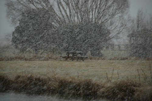
Got to Ben Lomond about 1.30pm Wed then chased some snowy looking clouds between there and Guyra. Headed a few ks out the Inverell Road where a better looking area of precip was interesting. Temp was 3-4 but soon after the rain started it dropped to 1 then big snowflakes started. I followed this back into Guyra where the snow persisted enough to cover everything white by 3.30pm


Apert from a few flurries no more snow fell until late afternoon. I went back to Ben Lomond where I was to meet Rodney and family later. A couple of cm of snow had fallen there.


Heavy snow started about 9pm. It was a real blizzard for a while. Martha from the Argus Newspaper was back from dinner so went to say hello and have a coffee in Guyra. The drive along the New England Highway was hazardous to say the least - no wonder police closed the road further north!  No pics of that but on video.

I headed back to Ben Lomond as Rodney Wallbridge and family had arrived and set up camp. I stayed in the car for the night which was cosy enough lol

Not much snow fell after about 11pm.

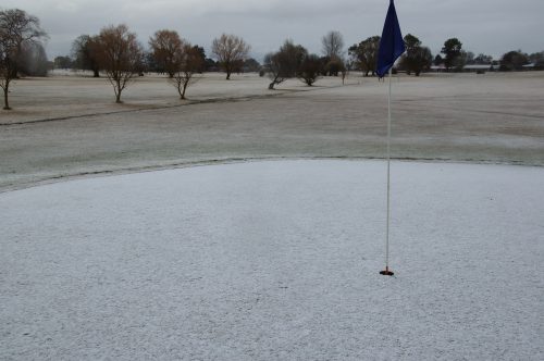
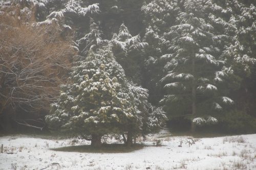
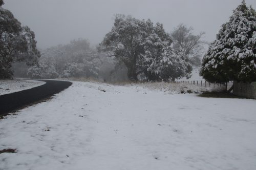
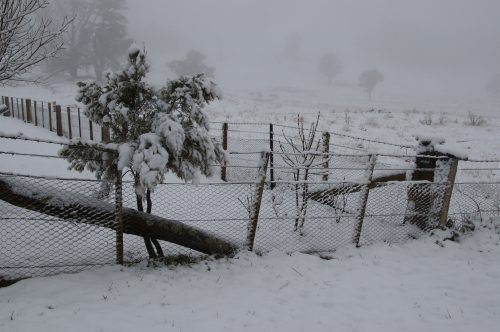
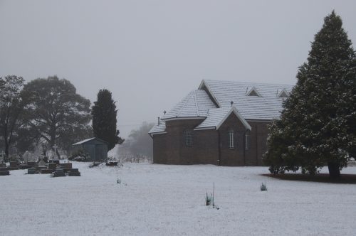
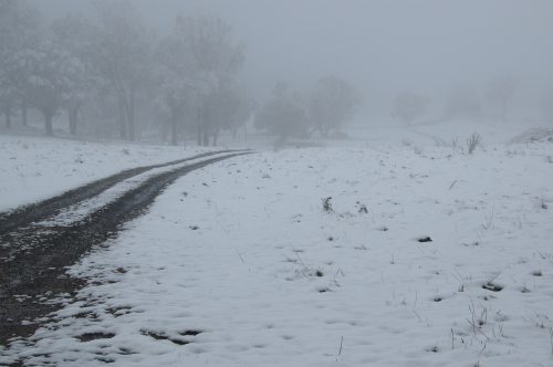
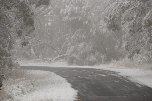
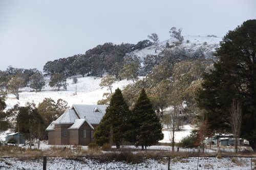
Morning finally allowed the extent of snow to be viewed. Some places had a really solid 5-6cm cover or perhaps more but most areas around Ben Lomond had about 4cm by the looks. I try to measure where it accumulates on posts etc.

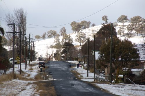
Along Inn Road and in town Ben Lomond:


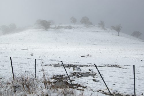
I met up with Sam Mac and his two brothers in Ben Lomond and we headed along the Maybole Road to the north for a look


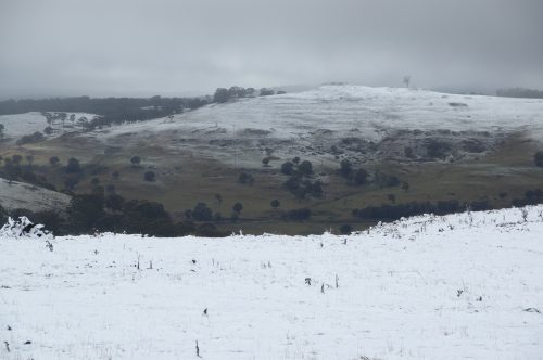
Back in Ben Lomond late morning with Rodney and family


Potentially there could have been a lot more snow cover but it was still a terrific event. Got to test out my new car too.


Location: Mcleans Ridges, NSW Northern Rivers
Australian Severe Weather:   http://australiasevereweather.com/
Lightning Photography:   http://www.lightningphotography.com/
Early Warning Network: http://www.ewn.com.au
Contact: Michael Bath

Offline enak_12

  • Elephant Trunk F2
  • *
  • Posts: 153
  • Gender: Male
Re: Cold and Snow over Southeast Australia: 14 - 16 July 2009
« Reply #17 on: 18 July 2009, 04:52:57 AM »
Couple of storms formed late yesterday afternoon just offshore..Love seeing sunset storms..Not much lightning however this time..


SnowMac

  • Guest
Re: Cold and Snow over Southeast Australia: 14 - 16 July 2009
« Reply #18 on: 18 July 2009, 10:03:47 AM »
Hey there Michael, Great pics, love the snowline photo also, certainly looked nice earlier on and later :). I love the Kaputar webcam David. Ive book marked it.

My brothers and I left about 3pm from home, approx 30 mins east of GlenInnes, saw some snow on the ground temp 1c.

About 10 mins out of town, before the old ben lomond road turnoff, the police had closed the highway, however 30 mins later we were able to preceed to Guyra (1c temps), with snowshowers along the way.

When we woke in the morning, was a patchy cover on the ground, by the time we left to meet Michael, Rodney and family, snow was almost gone in Guyra township.


Guyra 15th


Ben Lomond 16th


Offline Jimmy Deguara

  • Australian and Tornado Alley storm chaser
  • Administrator
  • Wedge tornado F5
  • *
  • Posts: 2,218
  • Gender: Male
  • Storm Chaser since 1993, Tornado Alley 2001
    • Australia Severe Weather
Re: Cold and Snow over Southeast Australia: 14 - 16 July 2009
« Reply #19 on: 18 July 2009, 04:20:00 PM »
Nice snowfalls up there on the Northern Tablelands. Great scenery shots also captured - looked like a lot of fun!

Photography July 16 2009

Kimberly and I headed down to the dam to get some reflection shots of the sunset. She did well for her first time shots. Mine are as follows:


Kimberly has a new website where she will post her new pictures including the spectacular sunset images:

http://www.photographic-art.com.au/photography/

Photography July 17 2009

Although storms were off the coast today from this morning, there was some rain and lightning in some areas around the Sydney and the Illawarra during the night.

Regards,

Jimmy Deguara
« Last Edit: 18 July 2009, 04:25:20 PM by Jimmy Deguara »
-------------------------------------
Australian Severe Weather
www.australiasevereweather.com

Australian Thunderbolt Tours
www.thunderbolttours.com

Phone  0408 020468  (International :  61  2  408 020468)

Offline Rodney Wallbridge

  • Multi-vortex F1
  • *
  • Posts: 71
  • Gender: Male
    • Red Bubble
Re: Cold and Snow over Southeast Australia: 14 - 16 July 2009
« Reply #20 on: 19 July 2009, 04:28:31 AM »
Gyday all, went a cool snow chase on weds arriving about 1030pm at Ben Lomond Range and camped at the intersection of Inn road and the New England highway. This was 1375mtrs  with a lovely blanket of snow around, but better just to the west a few kms a classic orographic signature of convective snowfall.
Enjoyed  several light Flurries of snow for a few hours before sleeping about 130am. Michael Bath met us there and we caught up on the latest news etc .Also bumped into Snowmac and fellas.
On thursday morning by the time we got moving into Ben Lomond township snow was allready melting fast due to sunny breaks and Temps around 3c at times then falling back to 1c under Stratu cu with occasional flurries.Had some awesome snowfights!!! (Sorry Jase Pato) and took a few pics around town.
GFS was pretty much on target with its progged snowline but also seems to not take into account cold uppers to lower the snow level under precip.
All in all had a great snow fix of Northern Tablelands snow!!!! Hopefully Victoria can provide an outbreak just prior to the AGM in August. Great pictures everyone who got amongst it! Here's a few of mine.


« Last Edit: 19 July 2009, 04:39:23 AM by Rodney Wallbridge »

SnowMac

  • Guest
Re: Cold and Snow over Southeast Australia: 14 - 16 July 2009
« Reply #21 on: 20 July 2009, 03:13:32 AM »
Great pics, nice sunset Jimmy :D Love the old wreck in the pic Roddy. Would be great for another  snowy event but chances are slim at this stage.

Offline Michael Bath

  • storm chaser
  • Administrator
  • Wedge tornado F5
  • *
  • Posts: 1,602
  • Gender: Male
    • Australian Severe Weather
Location: Mcleans Ridges, NSW Northern Rivers
Australian Severe Weather:   http://australiasevereweather.com/
Lightning Photography:   http://www.lightningphotography.com/
Early Warning Network: http://www.ewn.com.au
Contact: Michael Bath

Offline Shaun Galman

  • Stove pipe F3
  • *
  • Posts: 441
  • Gender: Male
    • ridgelightning.com
Re: Cold and Snow over Southeast Australia: 14 - 16 July 2009
« Reply #23 on: 20 July 2009, 06:10:55 AM »
Hi guys,
Absolutely stunning photos by all! Once again making me wish I could get over there and see some snow :)

Those storm photos are amazing also! We had some great structure here and there during this event. The Grawin Opal Fields received some small hail over 10mins from a rather large and ominous looking storm that impressed both Russ and I as we watched it push past town to the South, around 5:10pm on Wednesday the 15th July. We were working on the gallery so we couldn't get away to shoot it unfortunately? The updrafts on the storms were amazing and lead to substantially crisp anvils for this time of year! Most of the cells that formed here went on to become pretty active once they passed Collarenerbri and went on through the Moree area.

I was wondering what was causing such convective energy with this front as the temps were only in the very low teens? Cant recall ever seeing such nice structure like this before at this time of year?

Really great to see everyone getting out and about again! Roll on September! :D
Take care,
Shauno
Chasing Region: Lightning Ridge. N.S.W.
Website: www.ridgelightning.com

Offline Michael Bath

  • storm chaser
  • Administrator
  • Wedge tornado F5
  • *
  • Posts: 1,602
  • Gender: Male
    • Australian Severe Weather
Re: Cold and Snow over Southeast Australia: 14 - 16 July 2009
« Reply #24 on: 20 July 2009, 11:38:39 AM »
Hi Shauno,

The system produced a lot of instability across NSW during Wednesday due to the widespread cold upper temps: a rather large cold pool with -26 to -28 temps at 500hPa. Load up the Moree sounding for the day and you will see quite a nice profile - unstable all the way to 350hPa.

Not sure if you or others saw the 1km VIS - pretty impressive. Some of that ended up producing the snow - maybe even the same cells you saw.

MB
Location: Mcleans Ridges, NSW Northern Rivers
Australian Severe Weather:   http://australiasevereweather.com/
Lightning Photography:   http://www.lightningphotography.com/
Early Warning Network: http://www.ewn.com.au
Contact: Michael Bath

Offline Shaun Galman

  • Stove pipe F3
  • *
  • Posts: 441
  • Gender: Male
    • ridgelightning.com
Re: Cold and Snow over Southeast Australia: 14 - 16 July 2009
« Reply #25 on: 20 July 2009, 02:06:22 PM »
Thanks for posting that Michael!

I didn't get to see the VIS due to being busy (always at the worst times lol) They were the same cells by the looks of things. Russ' parents said as the cells came across Colly from here they picked up in activity and went on to Moree etc. as you can see in that great VIS image.

A nice looking profile indeed, really great to see this early! I'm hoping the little front forecast for Tuesday evening/Wednesday will hold up and produce a little something for us?

Those snow pics are pretty amazing! Bet it was fun out there :D
Take care,
Shauno
Chasing Region: Lightning Ridge. N.S.W.
Website: www.ridgelightning.com

Offline Michael Bath

  • storm chaser
  • Administrator
  • Wedge tornado F5
  • *
  • Posts: 1,602
  • Gender: Male
    • Australian Severe Weather
Re: Cold and Snow over Southeast Australia: 14 - 16 July 2009
« Reply #26 on: 24 July 2011, 07:03:23 AM »
Better late than never :-P

20090715
Location: Mcleans Ridges, NSW Northern Rivers
Australian Severe Weather:   http://australiasevereweather.com/
Lightning Photography:   http://www.lightningphotography.com/
Early Warning Network: http://www.ewn.com.au
Contact: Michael Bath