Author Topic: US trip 2006 - April 18 2006 Chillcothe tornadic supercell northwestern Missouri  (Read 8743 times)

0 Members and 1 Guest are viewing this topic.

Offline Jimmy Deguara

  • Australian and Tornado Alley storm chaser
  • Administrator
  • Wedge tornado F5
  • *
  • Posts: 2,218
  • Gender: Male
  • Storm Chaser since 1993, Tornado Alley 2001
    • Australia Severe Weather
Hi,

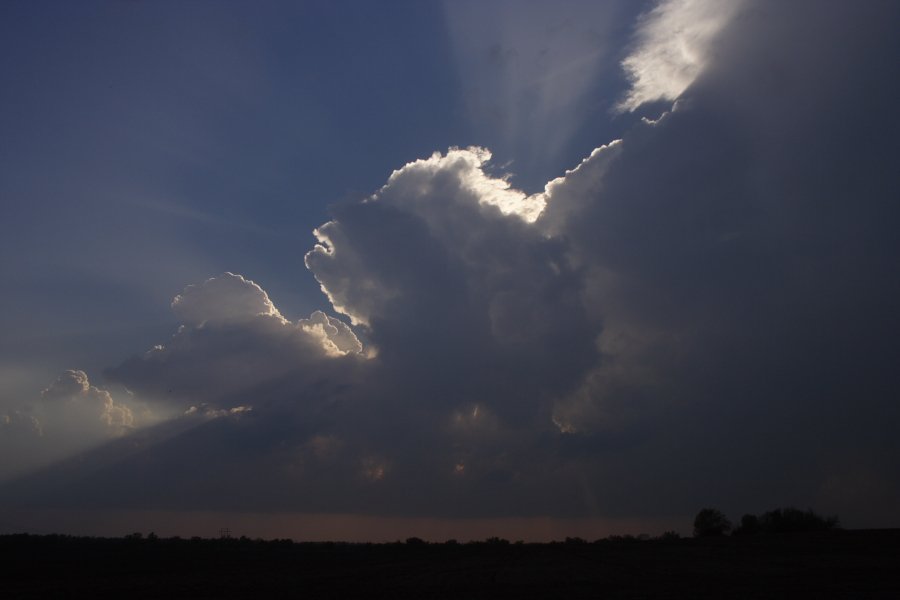
Just catching up on the storm news. This particular event in northwestern Missouri was quite a relaxed chase early. We targetted the region in the vicinity of the cold front/warm front and dryline intersection. The towers struggled all afternoon but finally an echo developed in NW Missouri. We made our way to cross the Missouri River so that it does not limit our chase opportunities.

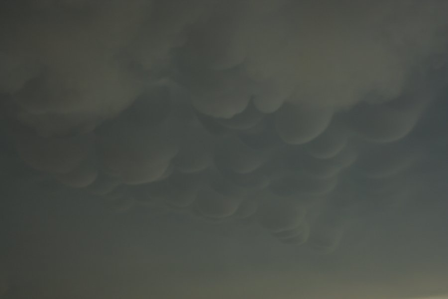
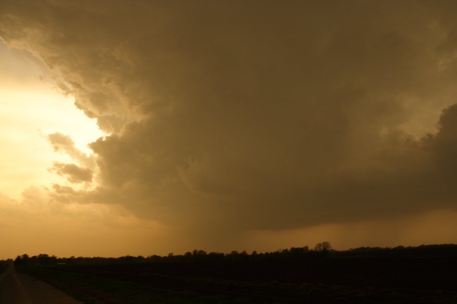
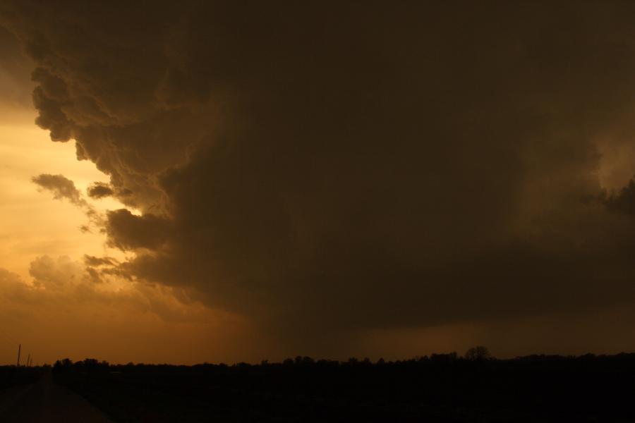
Soon another storm developed to is south and although the storm to the north (located east of St Joesphs) was severe, we liked the position and structure of the next storm south. It literally exploded with incredible mammatus under the forward anvil. This anvil was extremely active - with lightning zits and some cloud to ground lightning. The structures to the west reflected the warnings for large to giant hail (it was the first time that wallnut sized hail was noted on a warning). The two main storms though began to produce baseball sized hail with rapid intensification noted. A tornado warning was issued for this storm that approached Chillicothe - the structure complete with vault - incredible.

We were "unfortunately" playing it safe remaining further east of other storms though this storm had held further back. Reports of a funnel cloud and then debri crossing the road was noted on the NOAA radio warnings but it seems no photographs are available at this point.


Regards,

Jimmy Deguara
-------------------------------------
Australian Severe Weather
www.australiasevereweather.com

Australian Thunderbolt Tours
www.thunderbolttours.com

Phone  0408 020468  (International :  61  2  408 020468)

Offline nmoir

  • Elephant Trunk F2
  • *
  • Posts: 200
  • Gender: Male
  • "busting chases since 1999"
    • Oculi.com.au
wow , i am drooling in anticipations , awesome mammatus 
« Last Edit: 23 April 2006, 07:43:03 AM by Jimmy Deguara »
Nick Moir
Photographer
The Sydney Morning Herald
and www.oculi.com.au

Offline David C

  • Global Moderator
  • Barrel tornado F4
  • *
  • Posts: 643
  • Gender: Male
    • Thunderbolt Tours Storm Chasing Adventures
wow , i am drooling in anticipations , awesome mammatus 

...and if the latest GFS is destined to verify, you might want to chase from the 29th April Nick!
I had my eye on the area south of San Angelo yesterday (2oth) but had to fly out from LA so missed the action on computer. Nothing on storm track and SPC only has hail reports (eg 4 inch hail report from Hays County).

Sunday still looking interesting enough.
Storm Chaser,
Thunderbolt Tours - USA & Australia Storm Chase Tours
www.thunderbolttours.com