Recent Posts

Pages: 1 2 3 [4] 5 6 7 8 ... 10
31
Deadly floods hit Cambodia - ABC News (Australian Broadcasting Corporation)


http://www.abc.net.au/news/2011-10-17/deadly-floods-hit-cambodia/3575842
         
32
We can get rid of this rule and replace it with a rule on ensuring we properly name the title.

Regards,

Jimmy Deguara
33
Hi all,

All in all a good day up in QLD, have attached some of my video captures of mostly the same scenes as in Jimmy's pics above.

....so, some of the earlier GFS runs (eg on Weds and Thurs) indicated good directional shear from 500-850mb winds suggesting a favourable situation for supercell development on Saturday afternoon across NSW northern rivers and across into South east Queensland. There were at times hints of a surface low developing in response to the upper level trough, or otherwise generally good turning between the sfc and 850mb. This raised a few eyebrows, so Jimmy and I decided on a long haul chase up into northern NSW as a start.

It soon became evident with each progressive model run that there would be quite unidirectional shear between 500-850mb, so the expectation of significant severe weather was kind of diminished by Friday -- but we were already well on the road so there was nothing to loose!

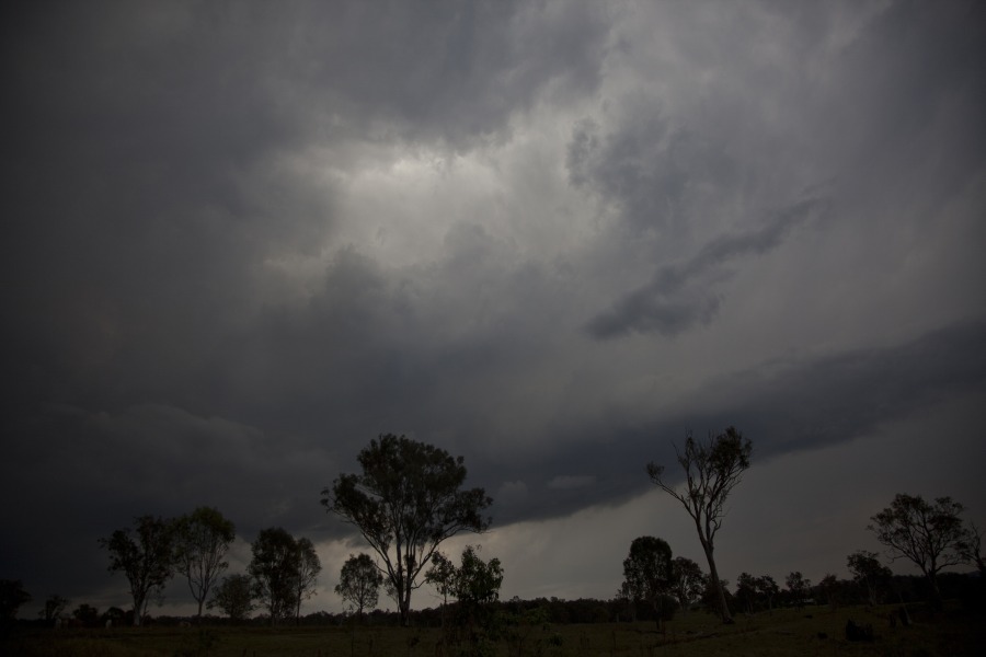
On chase day we sat at Boonah from the late morning. A line developed on radar out west of Texas (QLD) so we were hoping that isolated storms would initiate ahead of the line, which was advancing fairly quickly. A  brief period of NE winds were encouraging and eventually isolated storms did develop:


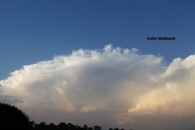
...and one of these initially intensified quite rapidly with an inflow band


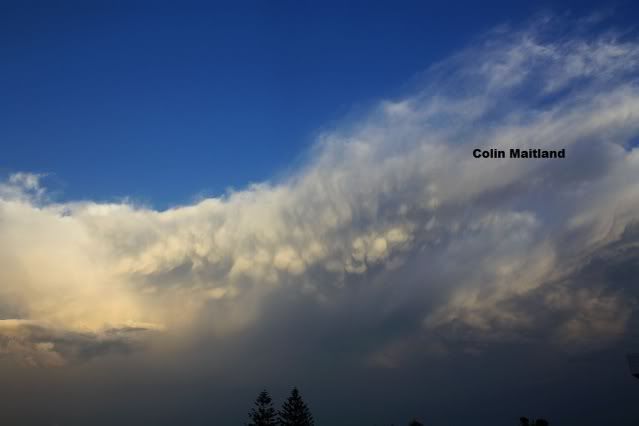
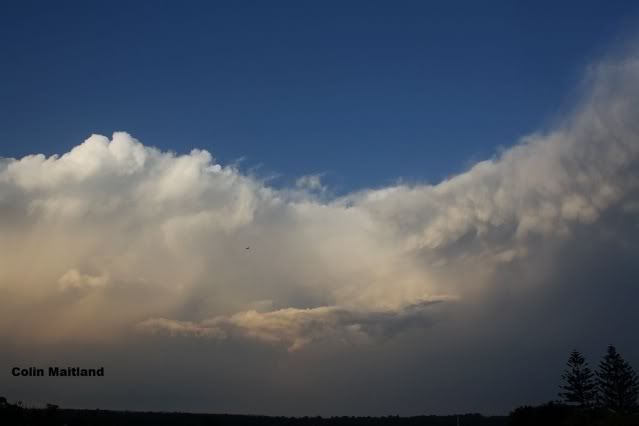
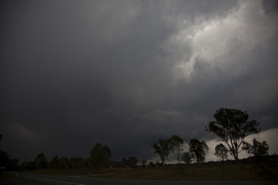
The problem was that the anvils were coming across, which suppressed what heating we had, and this conspired with the NW 850 winds to make these initially promising storms struggle. After giving up on these plan B was the northern end of the line that was now moving over the metro area.


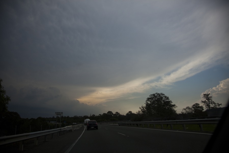
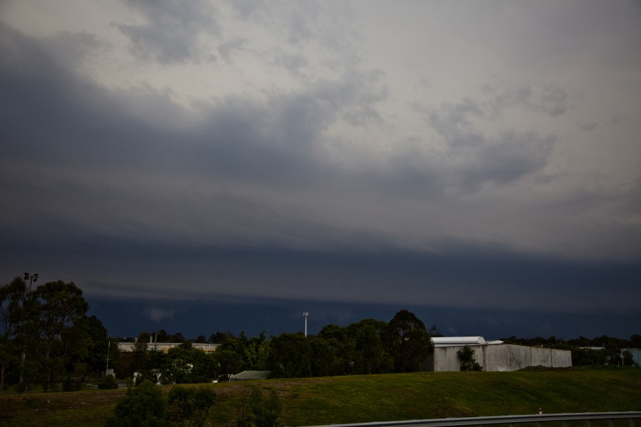
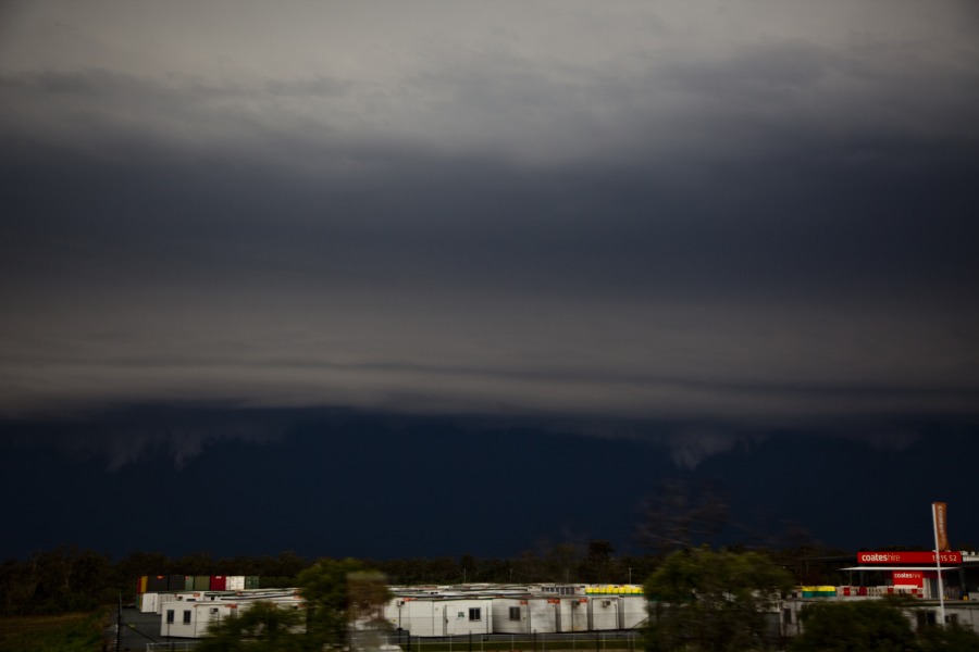
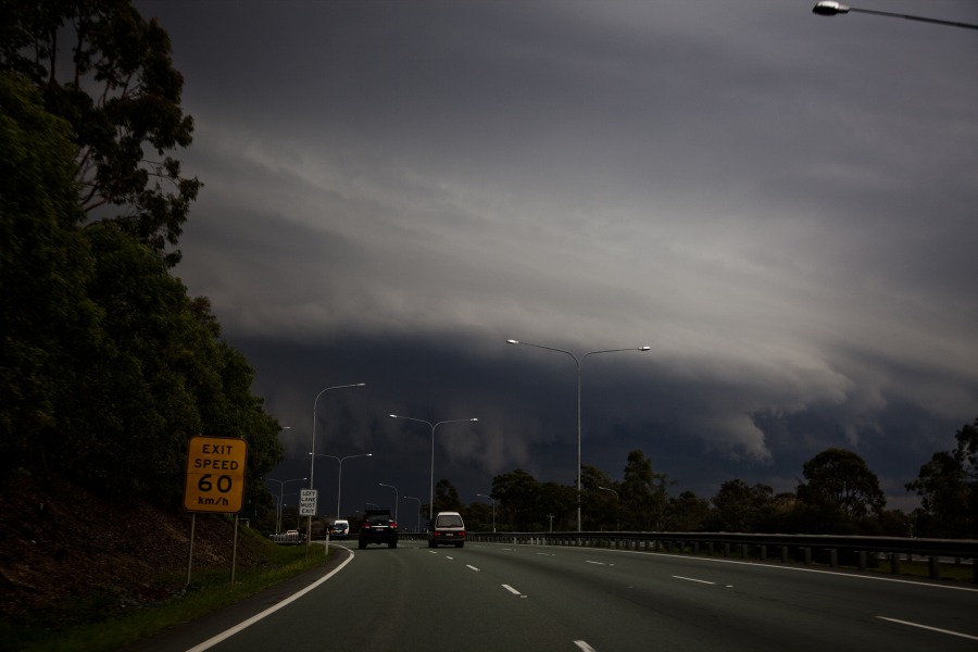
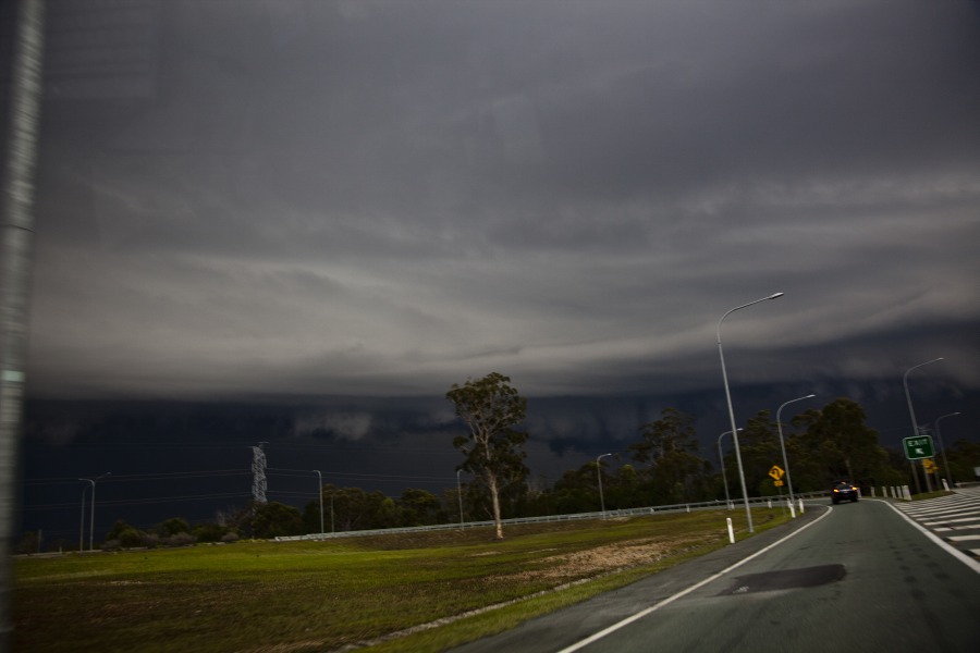
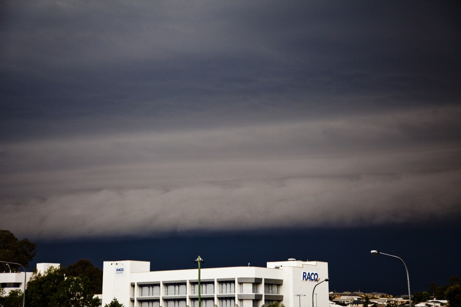
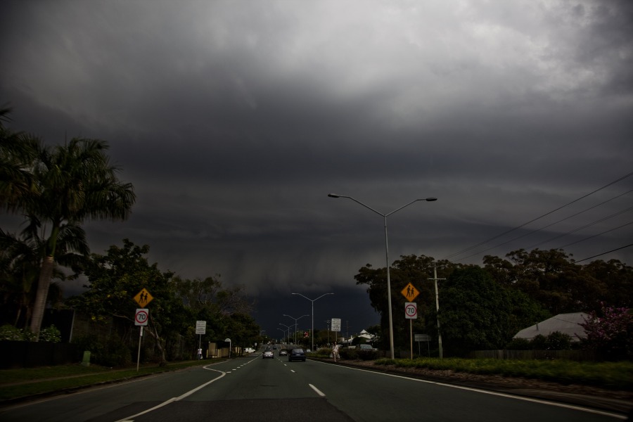
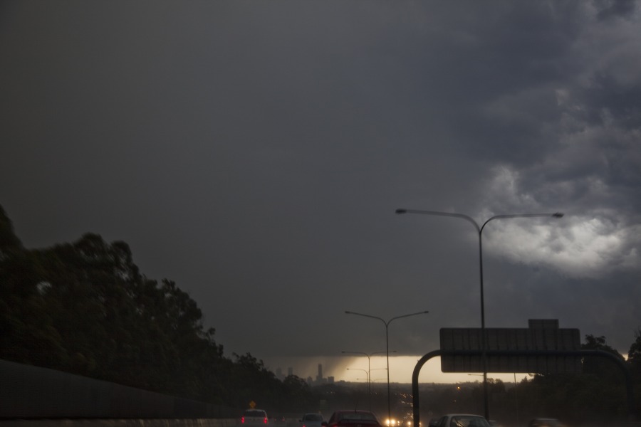
We navigated our way around the city and got some good footage of the approaching shelf and the base structure of the more isolated cells on the northern end that produced large hail.


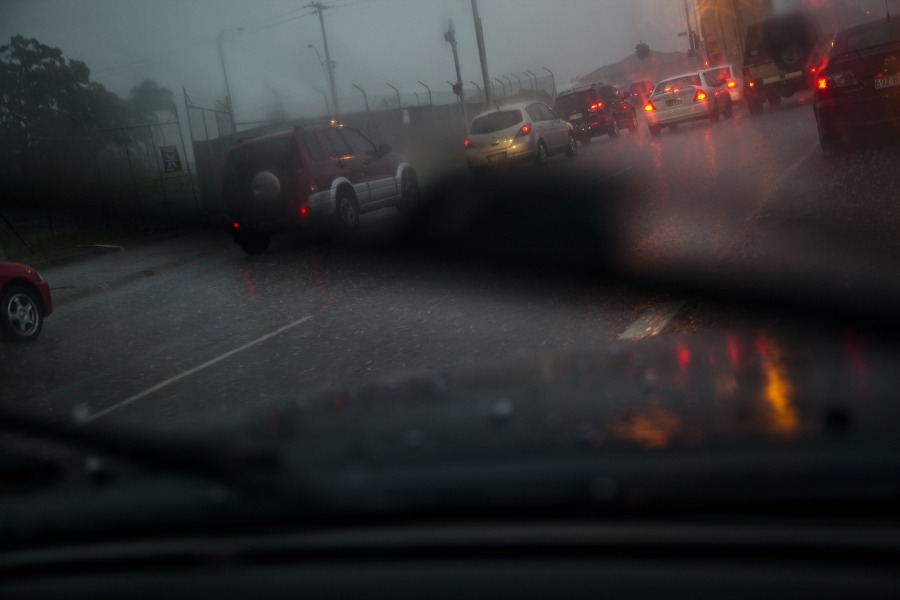
We missed our planned exit to head north to the airport and beyond and got caught in traffic as the line hit, with some small hail thrown in (1 to 1.5 cm) at Macgregor.
34
Hi Jimmy or Michael,

I seem to be having real issues trying to post images on the new website. It is no doubt something I am doing wrong, if you have any instructions or advice I would gladly appreciate it. I am downloading from photobucket.

Thanks

Colin
35
These are a few photos of the second cell on Saturday afternoon that formed to the north of Bracken Ridge and moved through approx 1/2 hour after the main system from the west had passed.


As darkness set in we were treated to an enjoyable light show.


Cheers

Col

36
Probe reveals floods funds fraud - ABC News (Australian Broadcasting Corporation)


The Federal Government says about 200 Victorians will have to repay relief money claimed from the

http://www.abc.net.au/news/2011-10-17/probe-reveals-floods-funds-fraud/3574672
         
37
Sea of vegetation after Murray flood - ABC News (Australian Broadcasting Corporation)


Water across the Overland Corner flood plain near Barmera earlier in the year has been replaced by a sea of new vegetation.
       

http://www.abc.net.au/news/2011-10-17/overland-corner-flood-plain-murray/3574442
         
38
We will have to gradually have to migrate to the new website for discussions http://www.extremestorms.com.au folks:)

David C and I initially made our way to Boonah and waited all afternoon. Weak cells did develop but the stronger initial cells occurred across the border in NSW. We watched as drier air entrainment cause base levels to evaporate and rise further it seemed. I feel this may have descreased the potential CAPE indicatd by the models. The latter models definitely indicated more of a squall line with perhaps the odd supercell with more of a linear mode from 850hPa and higher in the sounding. This is what occurred.

Cells developed almost overhead so we made our way to Beaudesert. Three cells intensified ahead of the squall line with the occasional bolt and reasonable structure observed. Unfortunately, the lack of direct heating with the encroaching squall line and its speed simply either saw a weakening and/or merge with the squall line.


After this attempt we made our position for the squall line particularly interested in the tail end charlie cell.


A very nice high contrast squall line in the end. The second last photograph shows the cell that went through the CBD which we could have intercepted had we taken the correct route - a blacked entry and traffic near long waiting at a traffic light wasted 10 to 15 minutes. This was suffucient time to intercept it from the road to the airport. Excellent road network in Brisbane!

Regards,

Jimmy Deguara
39
Local Sydney News Coverage - FreeNews / FreeNews Fire destroys abandoned homes in Redfern near “The Block”
« Last post by australiasevereweather on 18 October 2011, 01:00:12 AM »
Fire destroys abandoned homes in Redfern near “The Block”


READ MORE TO VIEW VIDEOAt around 4.00am NSW Fire & Rescue responded to numerous triple zero calls to a terrace home totally involved in fire.The blaze had taken hold of the house and was rapidly spreading to nearby properties.The roof of the terrace collapsed and fire crews forced entry to all the affected neighbouring properties to prevent further damage and fire spread.


http://www.freenews.com.au/eastern-suburbs/194-fire-destroys-abandoned-homes-in-redfern-near-the-block
         
40
Bangkok barriers hold but floods still menace - ABC News (Australian Broadcasting Corporation)


The Thai military has fortified flood barriers in northern Bangkok ahead of the arrival of billions of litres of floodwater from further north in the next day, with four major industrial estates already under water just outside the city.
       

http://www.abc.net.au/news/2011-10-16/bangkok-barriers-hold-but-floods-still-menace/3574048
         
Pages: 1 2 3 [4] 5 6 7 8 ... 10